
The second call forecast for Monday’s winter storm in Southern PA has been posted. Please view the article attached below.
Second Call Snowfall Forecast for Monday’s Southern PA Snowstorm
It has been a wild 24 hours on the weather models since we last updated you. We have gone from having a nice consensus to stark disagreements. Over the next 24 hours, we expect a consensus to be reached in dramatic fashion.
The European model has shifted well south, keeping heaviest snow in Virginia. Meanwhile, the American models have kept the bullseye over Southern PA and Northern Maryland. The Canadian model falls in between the two, with the bullseye just south of the Mason-Dixon line.
This not only makes it difficult for us to determine expected snowfall amounts, but the timing will also be different. If the Euro is correct, this will be light snow on Monday for those north of Route 30. If the American models are correct, moderate snow will reach well north of I-76.
All model guidance is at a standstill as well, with three consecutive runs of each model showing the same outcome. Below is what each model looks like as of early Friday evening.
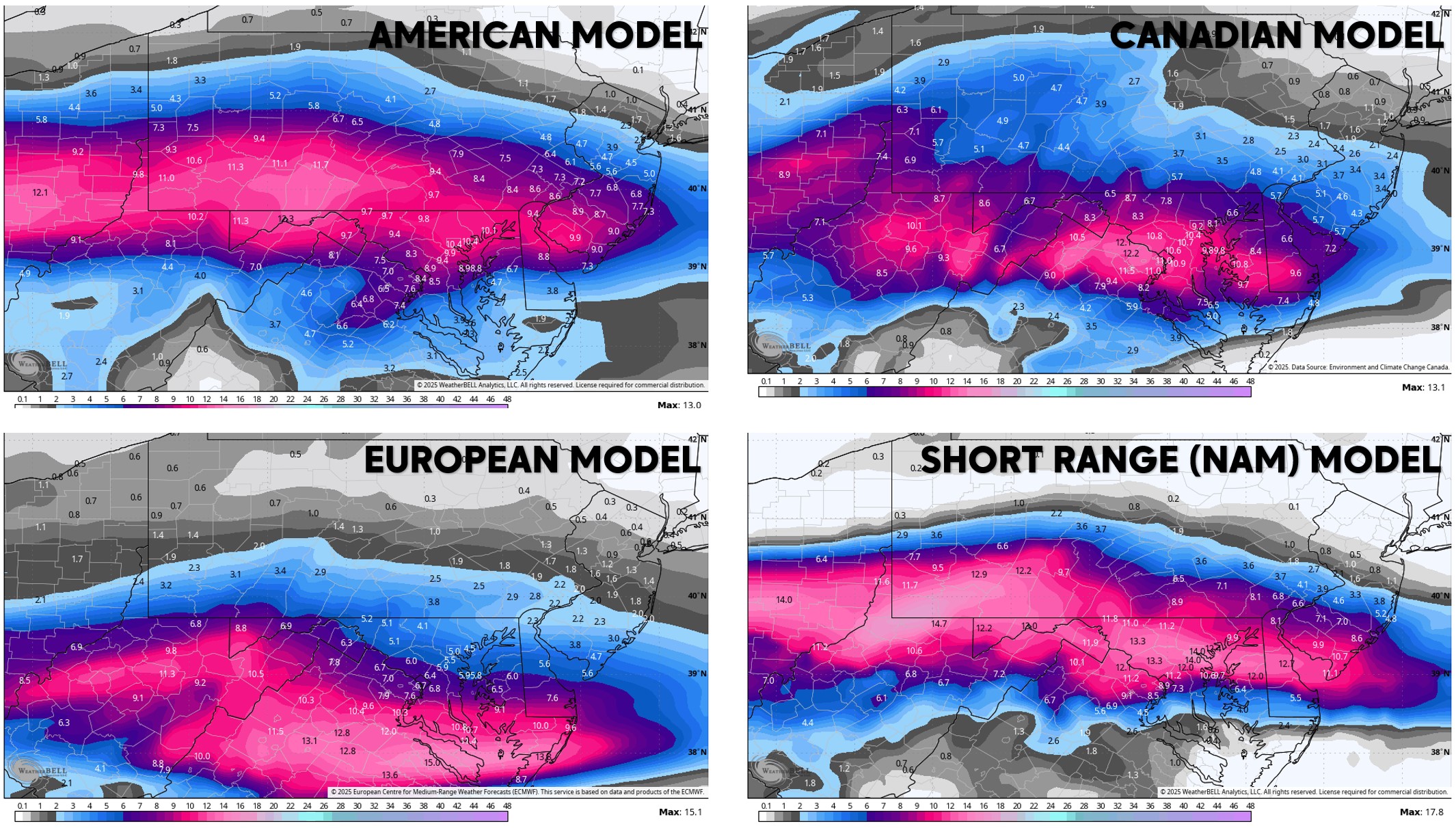
As you can imagine, this makes forecasting the storm problematic. The European model is statistically the most accurate model by a few percentage points. Meanwhile, this type of storm has a history of trending north in the final days beforehand.
Our forecast is a blend of all models, keep accuracy scores and trends in mind. What this all boils down to is the amount of room between this system and an upper level low in Eastern Canada.
We expect details to be much clearer by Saturday afternoon, as these things typically work themselves out 48-72 hours before impact.
FIRST CALL SNOWFALL FORECAST FOR MONDAY’S WINTER STORM
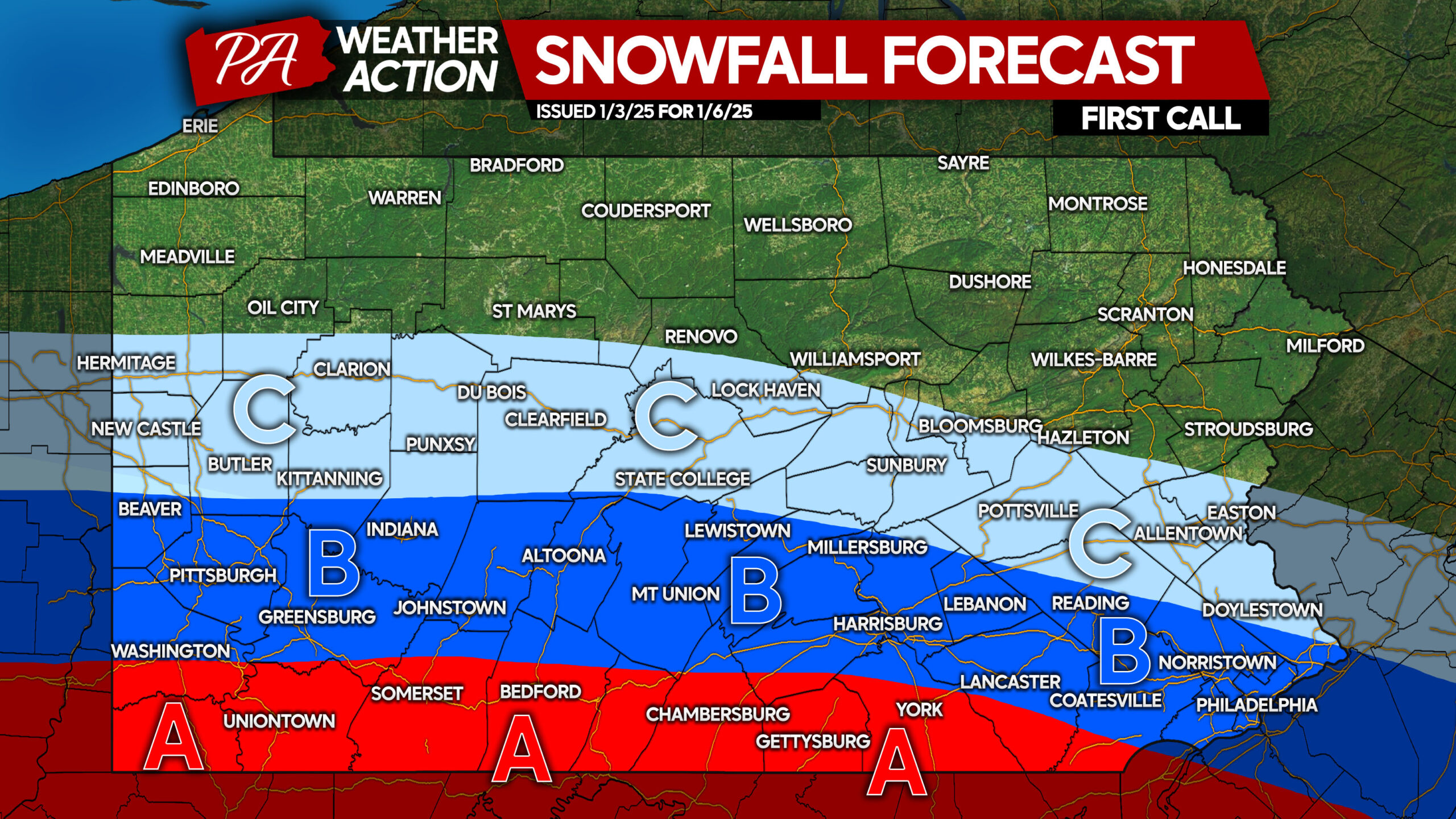
Confidence for this first call is medium due to remaining uncertainties.
Area A: Snowfall accumulation of 6 – 10″ expected. Significant travel impacts are likely, resulting in school and work closings.
Area B: Snowfall accumulation of 3 – 6″ anticipated. Moderate impacts to travel are probable, but travel may still be possible if snow is light.
Area C: Snowfall accumulation of 1 – 3″ expected. Minor travel impacts are possible.
Thank you for reading, and be sure to check back for Saturday’s update. We hope to have better clarity and will have a regional timing chart.
Don’t forget to share this forecast with friends and family. Have a good weekend!
You must be logged in to post a comment.