
This will be another storm that most locations do at least start as a brief period of snow before changing to sleet, freezing rain and plain rain in some cases. We expect precipitation to reach far western Pennsylvania by 7:00 AM Saturday. The precipitation will likely be in the form of snow initially. Taking a look at the GFS model valid for 10:00 AM Saturday, most areas are receiving light snow, but the transition line is already pushing into western Pennsylvania.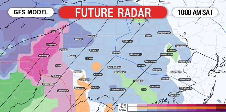 .The precipitation will start off light in the morning hours, but will quickly begin to fall at a moderate to heavy rate Saturday afternoon as the precipitation expands eastward. Below is a look at the GFS for 1:00 PM Saturday.
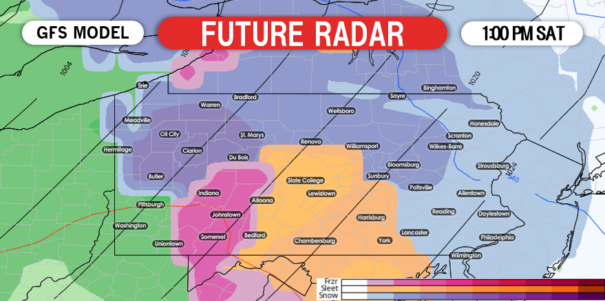
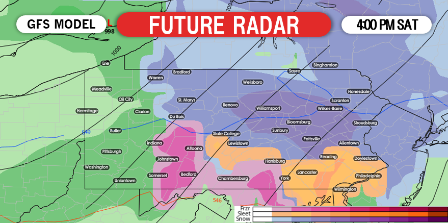
Significant travel impacts across much of the state will occur throughout the day Saturday, but we do anticipate the worst of the travel will be between 2:00 PM and 7:00 PM Saturday afternoon. Unlike previous events, most of the state will be in the 20s when wintry precipitation is falling. Please avoid traveling if you don’t need to. After 7:00 PM, precipitation will begin to wrap up and many areas will transition to freezing drizzle or plain rain by the time it is all set and done. 
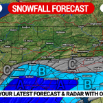
FIRST CALL SNOWFALL FORECAST FOR SATURDAY
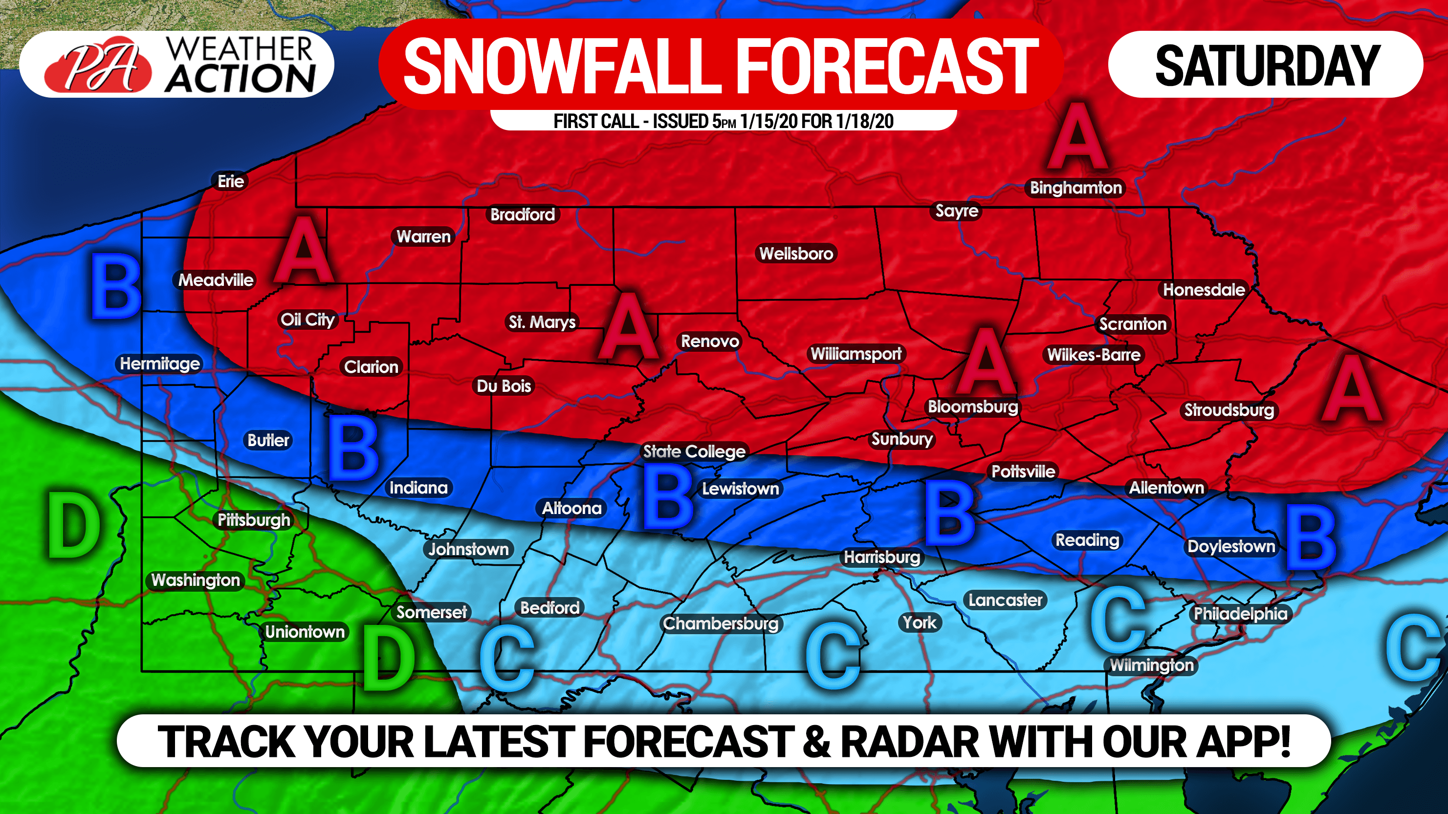
Area A: Snow and sleet accumulations of 4 – 6″ expected. Travel will be hazardous Saturday Afternoon and evening due to snow covered and icy roads.
Area B: Snow and sleet accumulations of 2 – 4″ anticipated. Travel will be difficult Saturday Afternoon and evening due to slushy roads.
Area C: Snow and sleet accumulations <1 – 2″ expected. Slippery travel possible Saturday Afternoon.
Area D: Mainly rain anticipated.
We will have an updated forecast for this event on Thursday and Friday evening, so be sure to view those for the latest timing and amounts.
Don’t forget to share this messy forecast with your friends and family in the area.
Another easy way to track the storm for your area is with our app. We send notifications as soon as important forecasts are released. Get our app by tapping the banner below!
You must be logged in to post a comment.