
This forecast is not for the weekend storm, but for a quick round of snow Thursday Night. Now that we got that out of the way, let’s get into the details.
A weak low pressure system will generate a quick round of snow Thursday evening into Friday morning. It could be a snowy commute Thursday evening in Southwest PA, and a potentially messy Friday morning commute in Eastern and Central PA.
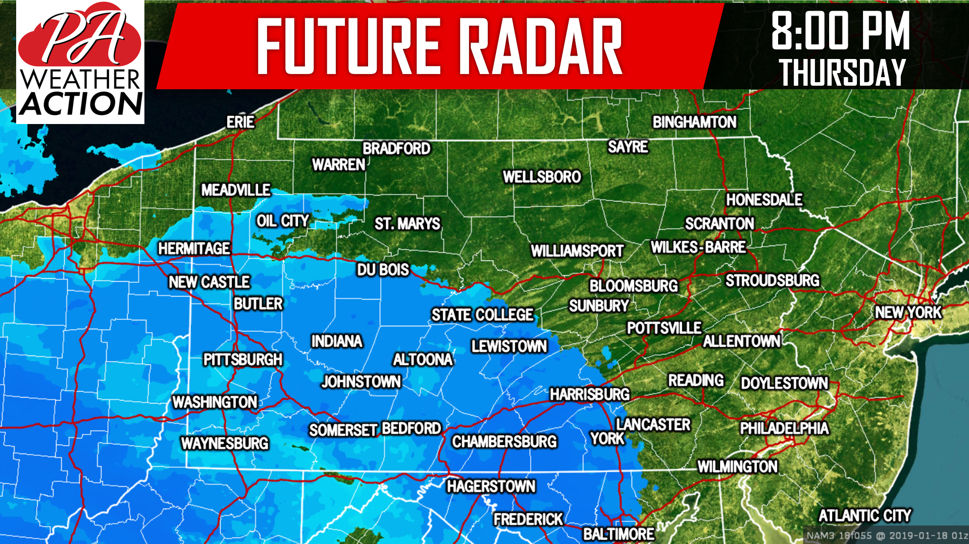
Snow will move in from southwest to northeast Thursday evening. Here is a look at future radar for 8 PM Thursday:
 By the early hours of Friday Morning, snow is likely to overspread Eastern PA. At the same time, it will already be wrapping up in Western PA. Below is future radar for 1 AM Friday:
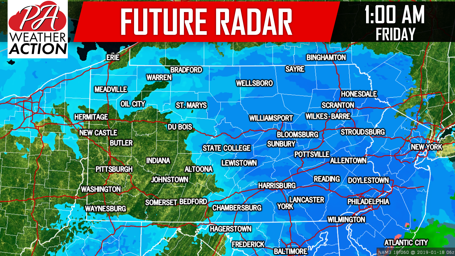
By the Friday morning commute, snow should be exiting through Northeast PA. Main roads should be plowed, but some secondary roads may be snow-covered.
SNOWFALL FORECAST MAP
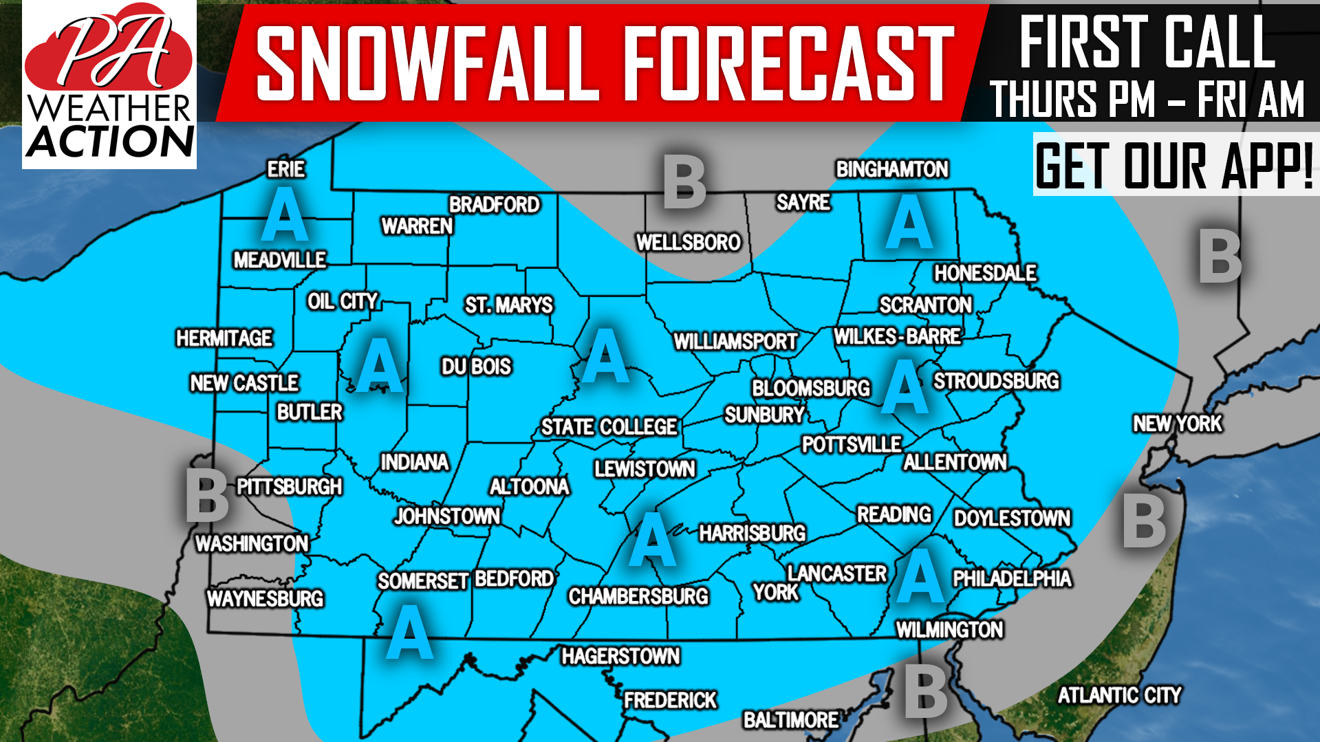 Area A: Snowfall accumulations of 1-3″ expected. Slippery travel likely Thursday Night into Friday Morning.
Area B: Snowfall accumulations of <1″ expected.
Receive updates on this forecast as well as this weekend’s storm by downloading our free app >>> PA Weather App Link
It’s looking like quite the mess for this weekend’s storm, but don’t ignore this little event either, as some school and traffic delays will be possible Friday Morning!
Share this update with your friends and family using the blue button below, stay tuned!
You must be logged in to post a comment.