
The second call snowfall forecast for Tuesday into Wednesday, along with details on the following storm have been posted. Please follow the linked article below.
Second Call Snowfall Forecast for Two Winter Weather Threats Midweek in Pennsylvania
We now move onto our next winter weather opportunity, and this one has the rare promise of being all snow. This was a potential that generated lots of talk on social media, and some thought it would be a big storm.
Back on Thursday, we said “Tuesday into Wednesday’s storm is looking weaker and south. That doesn’t mean no snow for us, but light to moderate accumulations possible instead of a big storm.” And that still remains on track.
Models currently agree that heaviest snowfall with this potential will be in Northern Virginia. There was a brief north trend yesterday, but things have stabilized for now. We wouldn’t be surprised to see trends in either direction in the coming day.
WINTER WEATHER TIMING
Light snow will move into Southern PA around dinnertime Tuesday, give or take a few hours. Temperatures will be below freezing, causing snow to begin accumulating immediately.
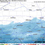
Below is the latest European model for 1:00 AM Wednesday, showing those darker blues south of I-76 and especially Route 30.
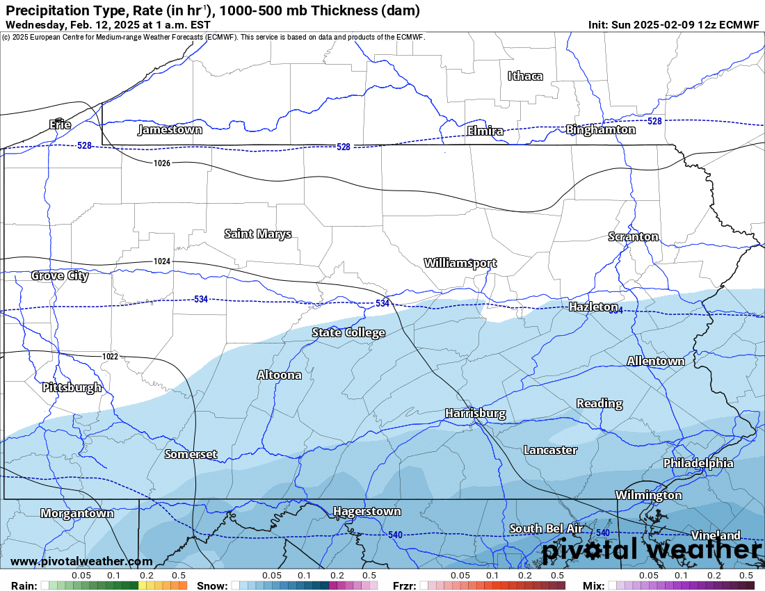
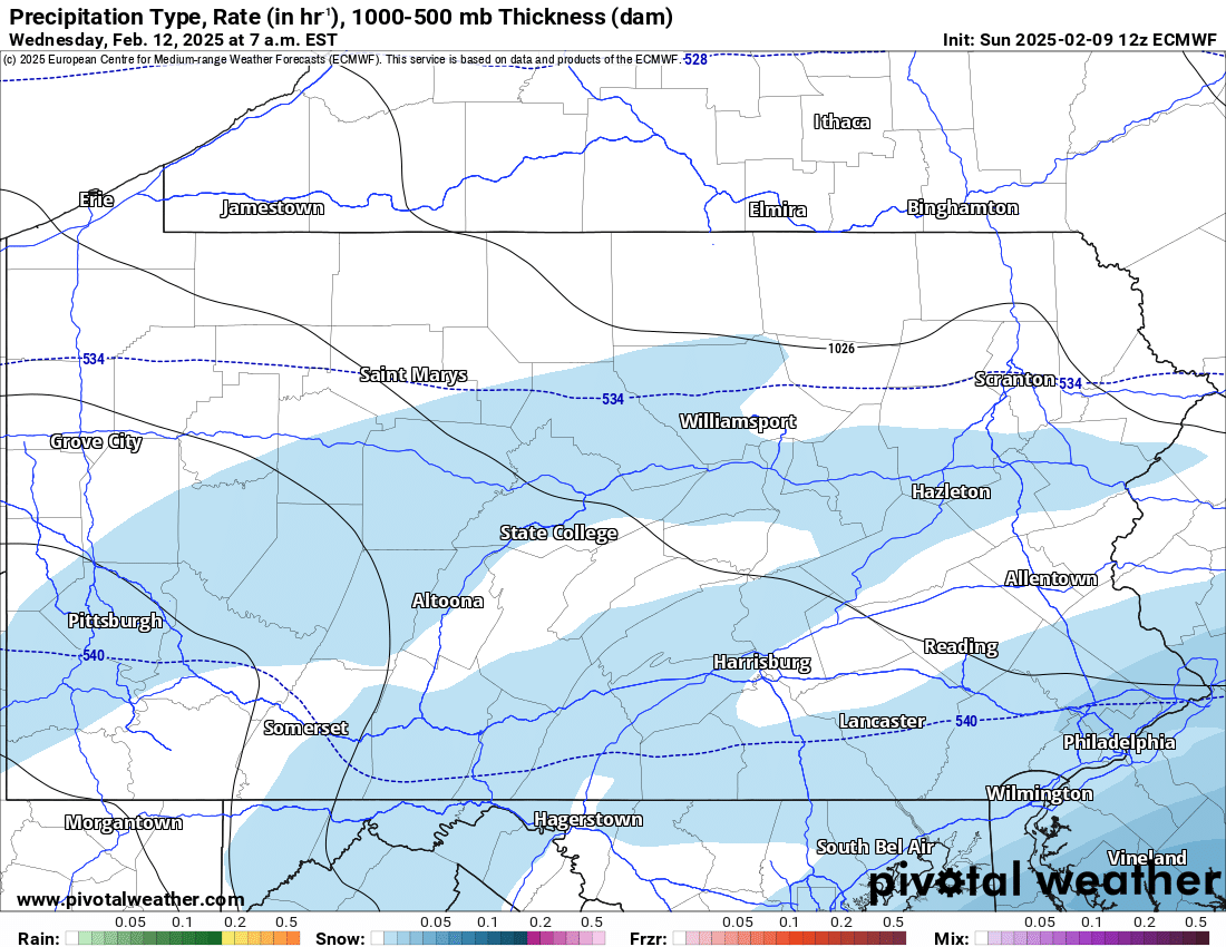
Light snow will continue overnight and into Wednesday morning. But as you can see, the Euro model is not enthused about this. By 7:00 AM Wednesday, light snow is likely around the Philadelphia area, with spotty snow showers in Southern PA.
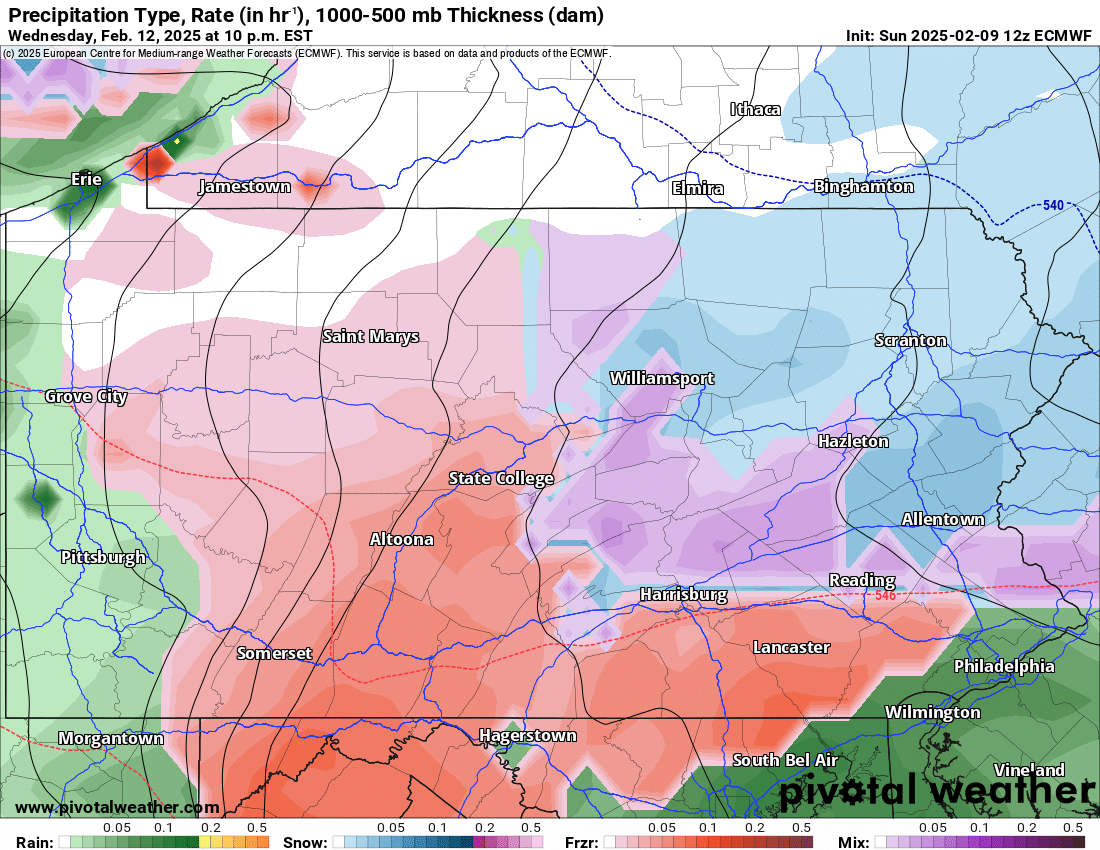
And in classic fashion with this active pattern, another system will move in late Wednesday. This system looks to be very reminiscent of the last two, with a bit of snow or sleet at the onset, below changing to freezing rain and ending as rain.
That system will move in after the Wednesday evening commute, continuing through early Thursday morning before temperatures warm above freezing by sunset. The I-79 corridor will be all rain, as usual with these systems.
Models are trying to drop a few inches of snow north of I-78 in Eastern PA before the changeover to sleet and freezing rain. Meanwhile, the main freezing rain (ice) threat will be near the I-99 corridor to the Laurel Highlands. Below is Euro model future radar for 10:00 PM Wednesday.
FIRST CALL SNOWFALL FORECAST FOR TUES PM – WED AM

This does not include impacts for the second system we discussed above, only the first one.
Area A: Snowfall accumulation of 3 – 5″ expected. Roads will become snow-covered Tuesday evening into Wednesday morning, possibly leading to delays Wednesday.
Area B: Snowfall accumulation of 1 – 3″ anticipated. Untreated roads will become snow-covered, possibly causing delays Wednesday AM.
Area C: Snowfall accumulation of less than 1″ expected.
Our Final Call Snowfall Forecast for this event will be posted at 5 PM Monday.
Don’t forget to share this forecast with friends and family in Southern PA!
You must be logged in to post a comment.