SECOND CALL POSTED AT 5:20 PM SUNDAY:
The first widespread winter storm of the season is coming Tuesday, which is a surprise given it’ll only be December 2nd. Snow during the holidays is always special, and doesn’t seem to happen as much these days. This December looks very cold and with an active storm track, this may well be the first of several holiday season snows.
Models remain in disagreement, with the European model very inconsistent. Meanwhile, the American and Canadian models have been relatively steady in their ideas. Our forecast is a mix of them all, while also factoring in early December climatology and a touch of personal intuition.
Terms like moderate and significant are subjective and their definitions vary just across PA. This storm will be fast-paced, as we don’t have blocking yet that will slow down storms. The ceiling is around 7 – 8″, which is borderline moderate versus significant. Trends have been to bring the storm in earlier on Tuesday, likely resulting in more cancellations instead of early dismissals.
FUTURE RADAR TIMING
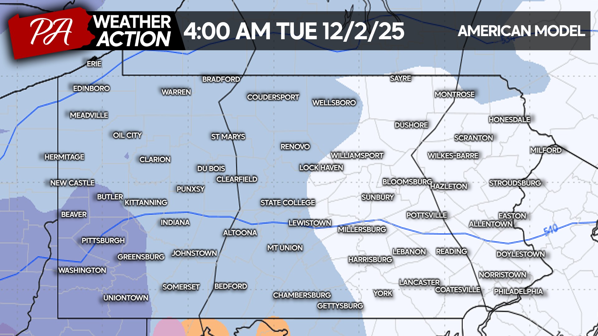
Light to moderate snow will begin to push into Western Pennsylvania by the pre-dawn hours of Tuesday. Temperatures will be in the upper 20s to just under freezing, make the snow a normal consistency. Not too wet or fluffy. Below is future radar from the GFS model for 4:00 AM Tuesday.
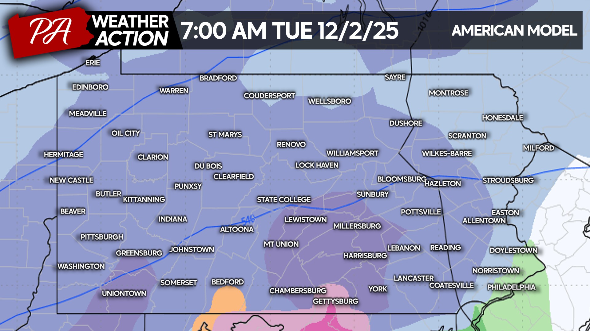
As the sun rises Tuesday, many of us will be greeted by accumulating snow. Travel will becoming increasingly difficult, making school cancellations more likely. Here is future radar for 7:00 AM Tuesday.
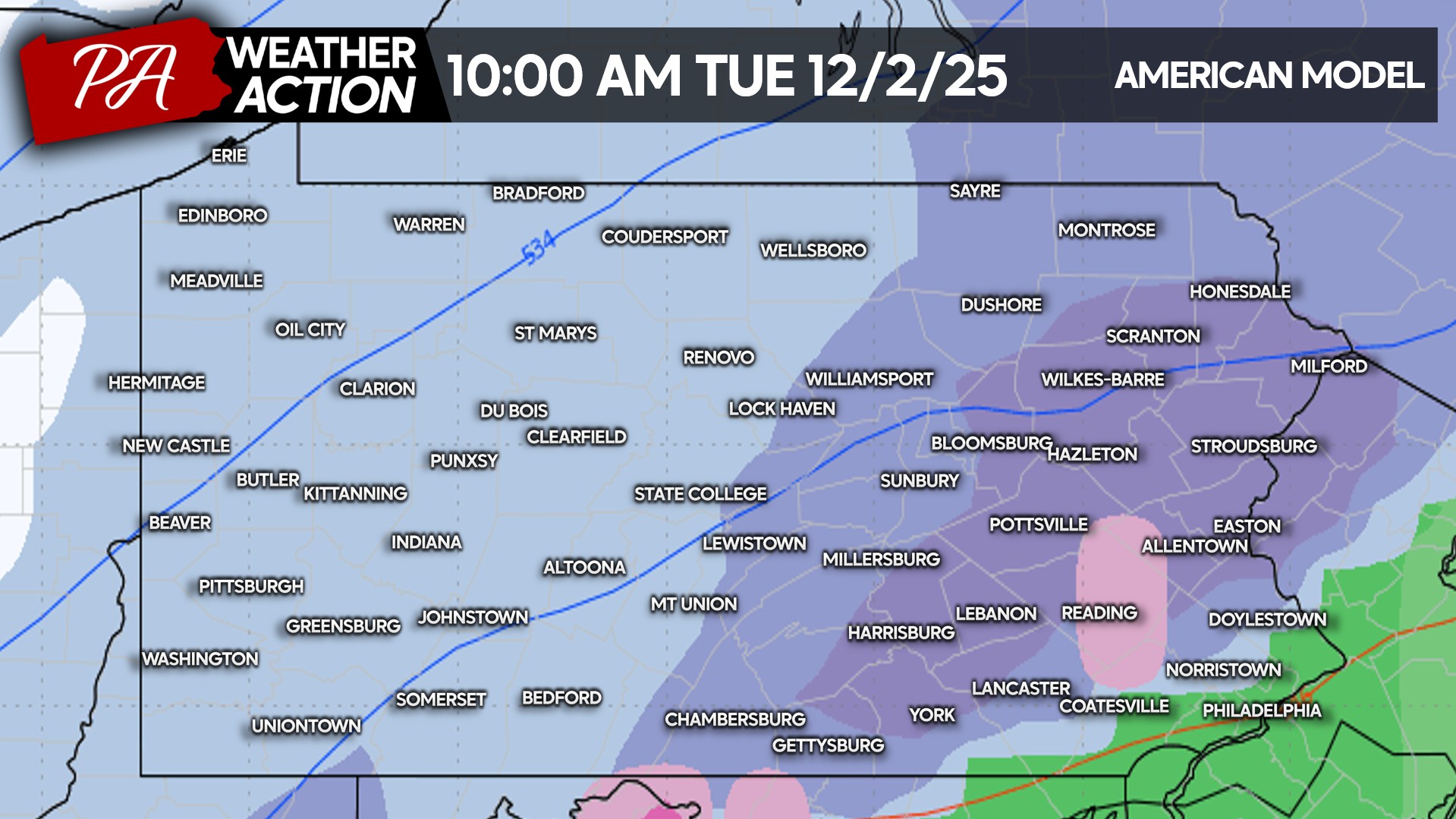
As mentioned, this will be a quick storm. Already by late Tuesday morning, moderate snow will likely dwindle to lighter snow in Western PA. Meanwhile in the eastern half of the state, moderate to locally heavy snow should be falling as the coastal storm gets going. Below is future radar from the GFS model for 10:00 AM Tuesday.
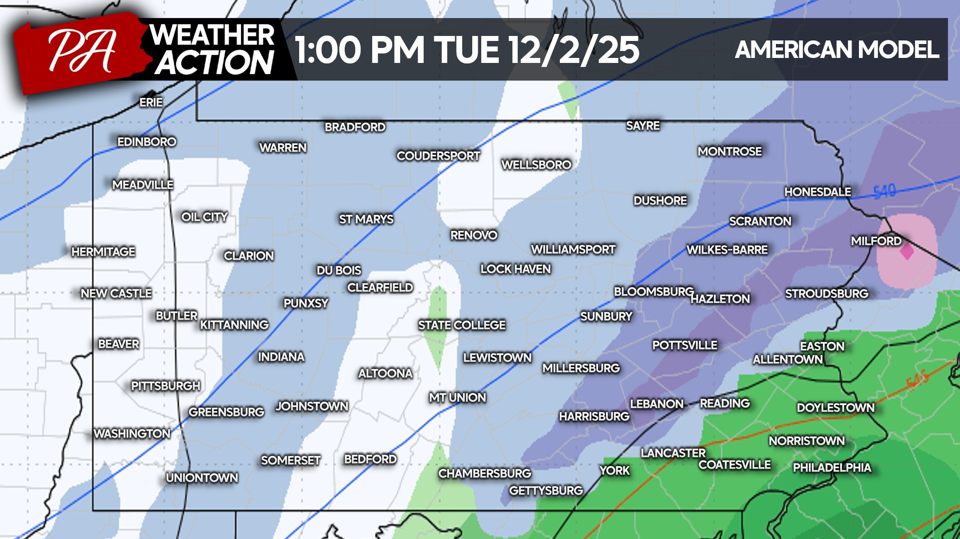
The debate is certainly where the rain/snow line will set up in Southeast PA and if there will be any sleet or freezing rain in between. The rain/snow line looks to nudge north in SEPA early Tuesday afternoon as the storm is pulling away. Areas as far north as the Lehigh Valley may mix with rain. Here is future radar for 1:00 PM Tuesday.
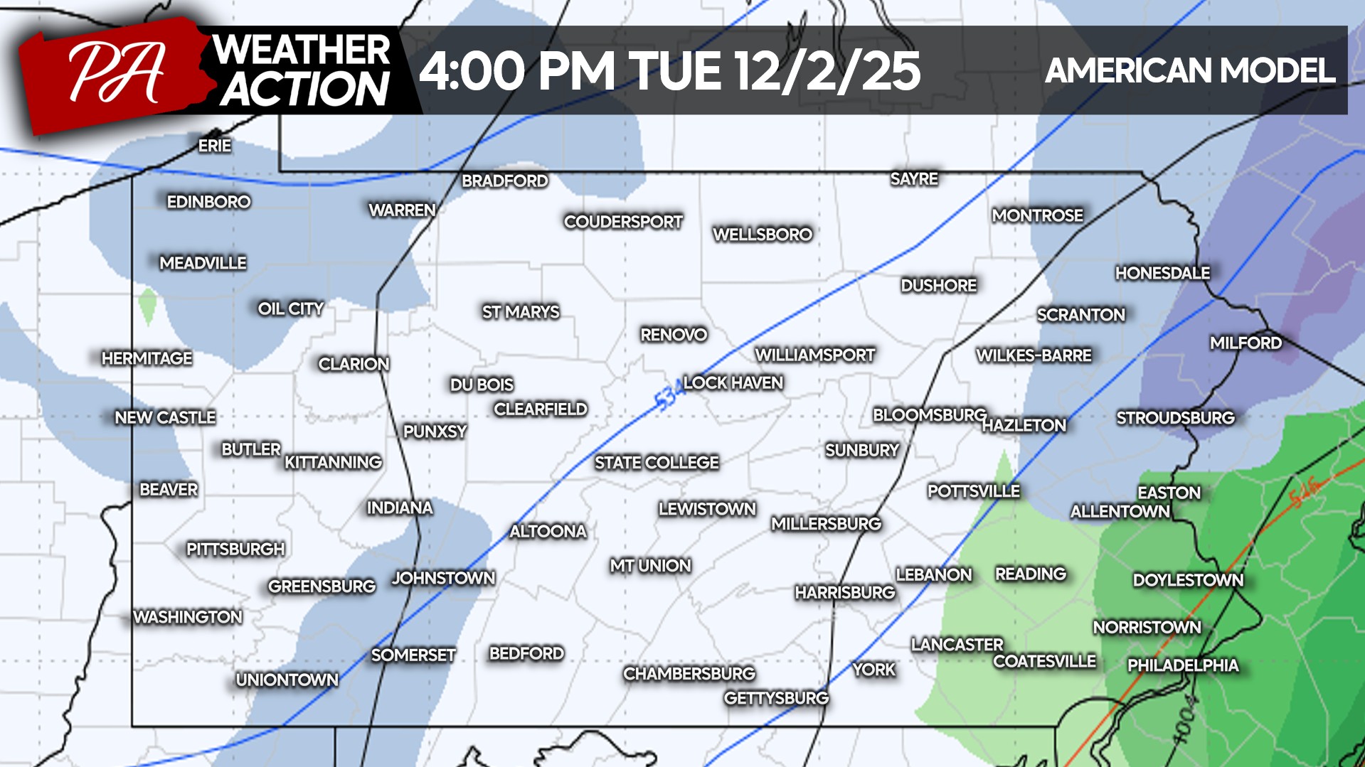
And finally, but not after long, the storm is expected to wind down late Tuesday afternoon in Eastern PA with the rain/snow line probably in the proximity of I-78. Below is future radar for 4:00 PM Tuesday.
FIRST CALL SNOWFALL FORECAST FOR TUESDAY’S WINTER STORM
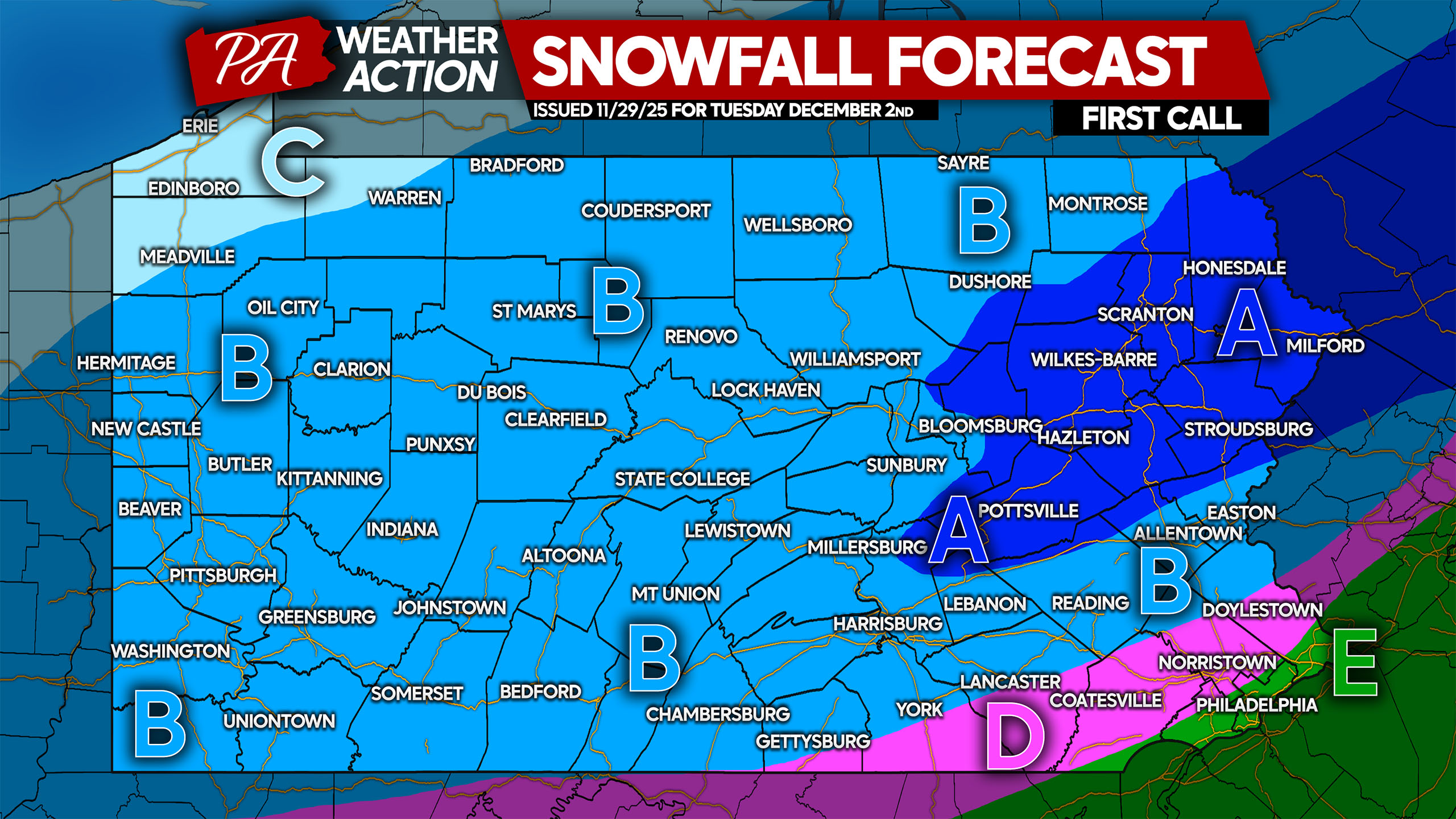
Area A: Snowfall accumulation of 4 – 7″ expected. Roadways will likely become snow-covered, leading to work and school disruptions and cancellations.
Area B: Snowfall accumulation of 2 – 5″ anticipated. Some mixing with rain and sleet may occur near the pink area (D). Roadways will likely be slushy and slippery, leading to work and school disruptions or cancellations.
Area C: Snowfall accumulation of 1 – 2″ expected. Minimal impacts on daily life likely.
Area D: Snowfall accumulation of 1 – 2″ anticipated. This region will likely start as snow, but may changeover to sleet and rain. This is the area of highest uncertainty. Travel disruptions still probable.
Area E: Plain rain expected.
Our next forecast update will be posted 5:00 PM Sunday.
Don’t forget to share this forecast with friends and family!

You must be logged in to post a comment.