
OUR FINAL CALL SNOWFALL FORECAST HAS BEEN POSTED. VIEW IT BELOW.
Final Call Snowfall Forecast for Tuesday’s Western PA Snowstorm
A strong system will move over Pennsylvania on Monday, bringing a wind-driven rain and even a marginal severe weather risk in eastern PA. The storm will then cutoff just to our north, meaning it will be stuck in place, as a cold front blows in from the west. This will cause rain to change to snow in western Pennsylvania, which is expected to continue for nearly a day. The snow will be light in most areas, except for locations in lake-effect belts where enhancement will occur.
STORM TIMING
Light snow will move into western PA from Ohio early Tuesday morning. Temperatures are expectedly to steadily fall as Tuesday morning progresses. Below is Hi-Res NAM future radar for 2:00 AM Tuesday.

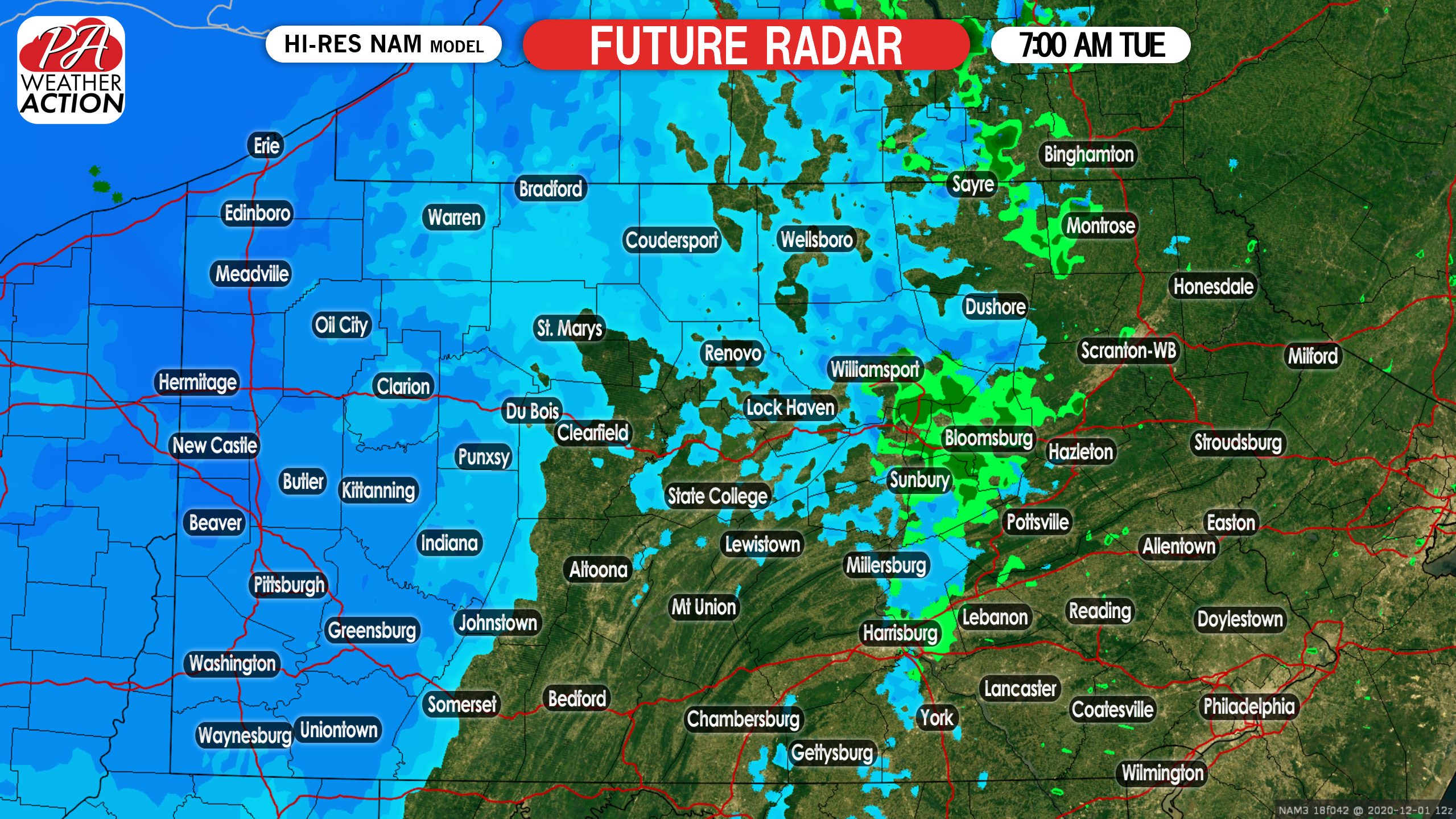
The light snow will continue to flow into western PA, but note that it will not be advancing into the Laurel Highlands much yet. Here is future radar for 7:00 AM Tuesday.
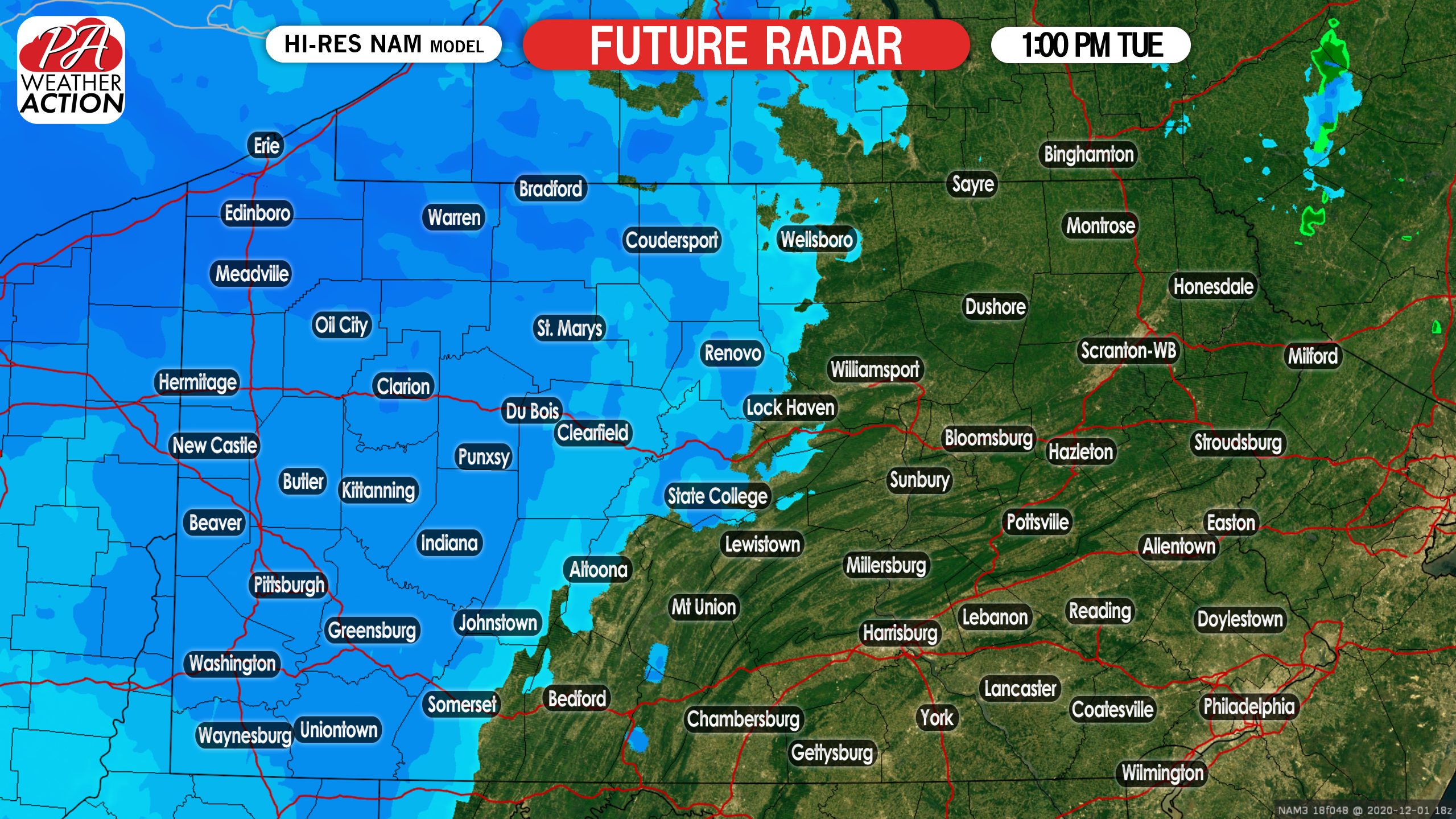
By early Tuesday afternoon, the eastern edge of the snow is likely to push into the Laurel Highlands and as far east as Coudersport in northern PA. Also, lake-effect will enhance the snowfall in northwest PA. Below is future radar for 1:00 PM Tuesday.
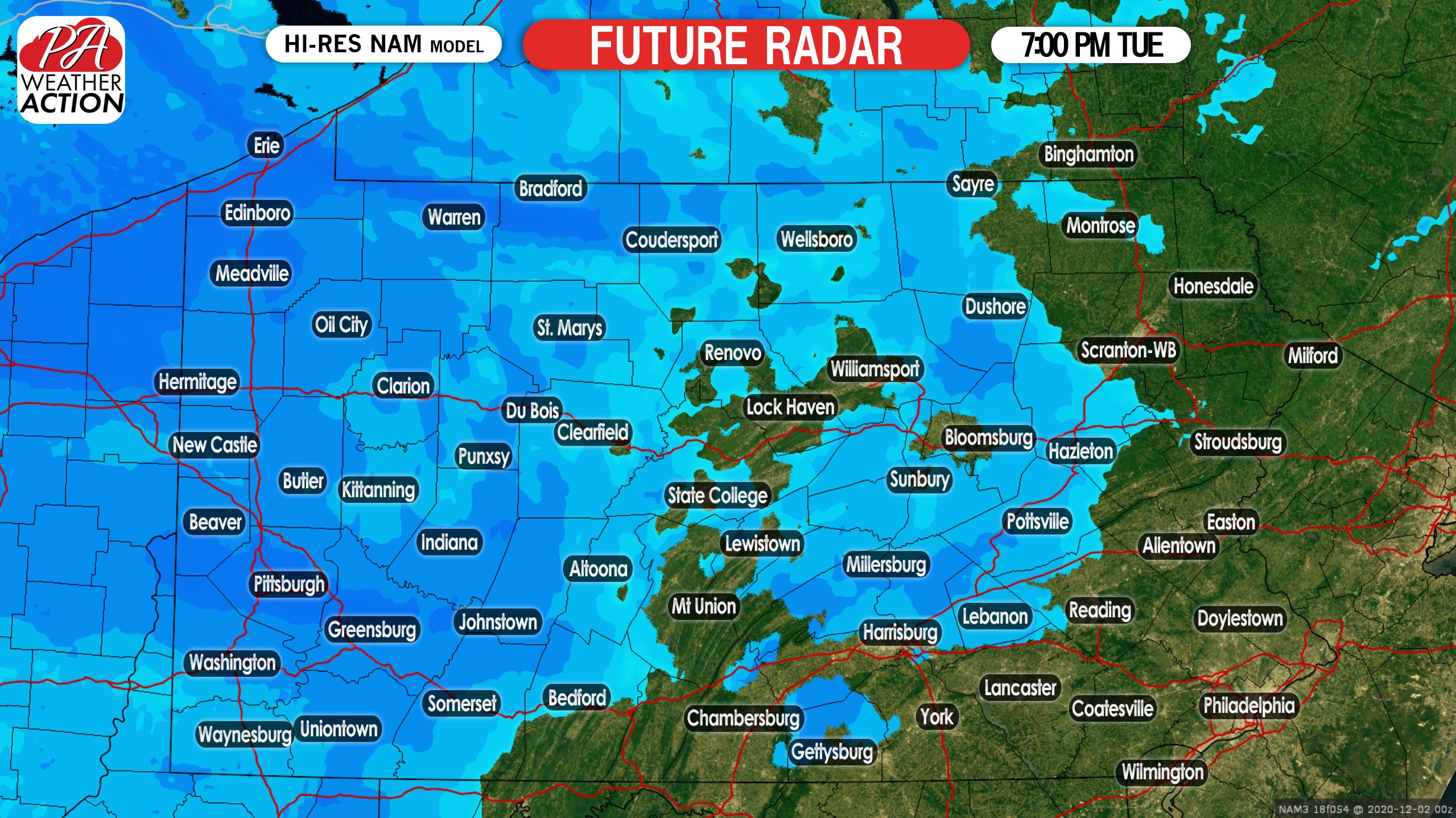
As we head into the Tuesday evening commute, the snow is likely to persist, but begin to weaken in most of western PA shortly after. Below is future radar for 7:00 PM Tuesday.
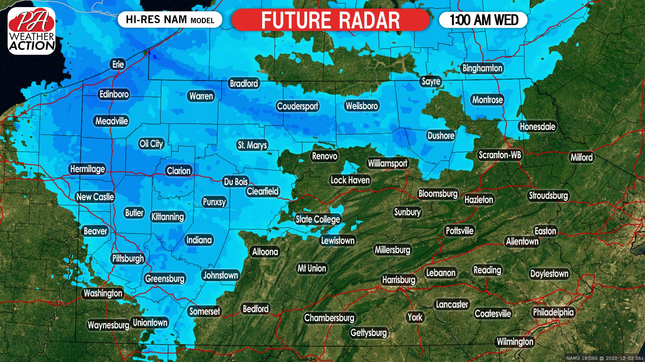
Finally, by early Wednesday morning the snow will end in most areas outside of lake effect belts, where streamers may continue to come in from the lake. Here is future radar for 1:00 AM Wednesday.
FIRST CALL SNOWFALL FORECAST FOR TUESDAY
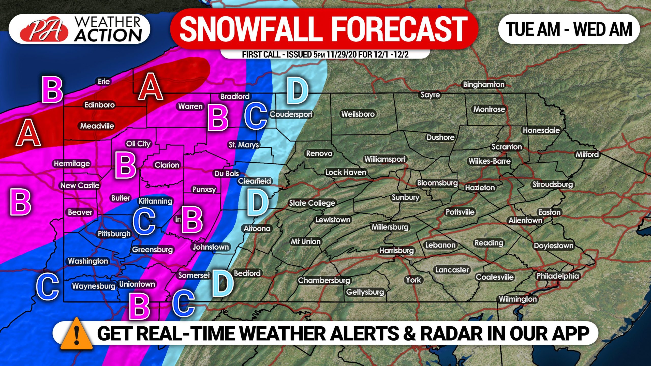
Area A: Light to moderate snow is expected to consistently fall from early Tuesday morning to early Wednesday morning. Snowfall accumulation of 6 – 10″ expected. Delays and closings likely Tuesday due to snow-covered roads.
Area B: Light snow is likely, starting early Tuesday morning through the late evening. Occasional moderate snow expected. Snowfall accumulation of 4 – 6″ anticipated. Delays and closings possible Tuesday due to snow-covered roads.
Area C: Light snow is anticipated from early Tuesday morning until late evening. Snowfall accumulation of 2 – 4″ expected. Travel may be difficult Tuesday.
Area D: Light snow is likely, starting Tuesday afternoon through late evening. Snowfall accumulation of 1 – 2″ expected.
Don’t forget to share this forecast with friends and family who will be impacted using the blue button below!
Stay tuned for our final call forecast on Monday. You can do that and so much more with our free iOS & Android app! Get it here >>> Weather Action App

You must be logged in to post a comment.