
FINAL CALL POSTED:
A storm pushing through the Upper Midwest and Great Lakes will bring a wintry mix to Pennsylvania on Wednesday. Snow will be mainly confined to the higher elevations on Wednesday, with lake effect snow following the storm.
After such a dry end of summer and fall, parts of the state have returned to moderate drought conditions. This system won’t help that much, with the rest of December likely drier and colder than normal. All while Chicago is off to their snowiest start since 1978. Maybe it will be our turn soon.
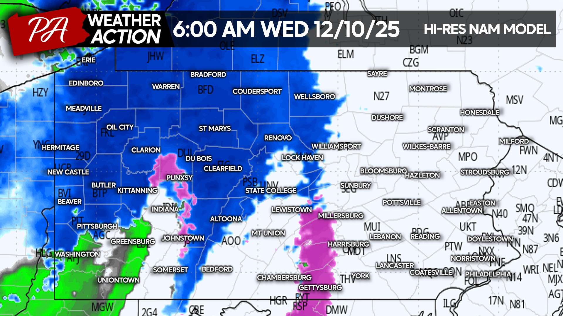
Moderate snow will push into the northwest quarter of Pennsylvania in the pre-dawn hours of Wednesday. A brief freezing drizzle is possible in South Central PA before temperatures warm above 32. Below is the Hi-Res NAM model for 6 AM Wednesday,
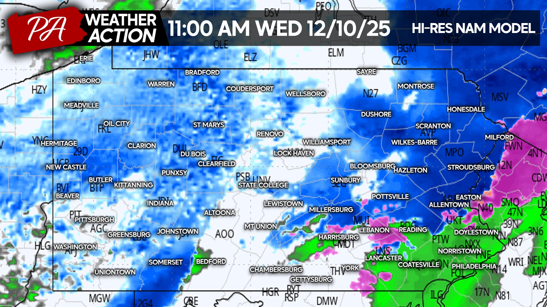
Snow will push east through Wednesday morning, reaching Northeast PA by around lunchtime. Due to marginal temperatures on either side of 32, accumulations will mainly be outside the valleys in higher elevations. Here is future radar for 11 AM Wednesday.
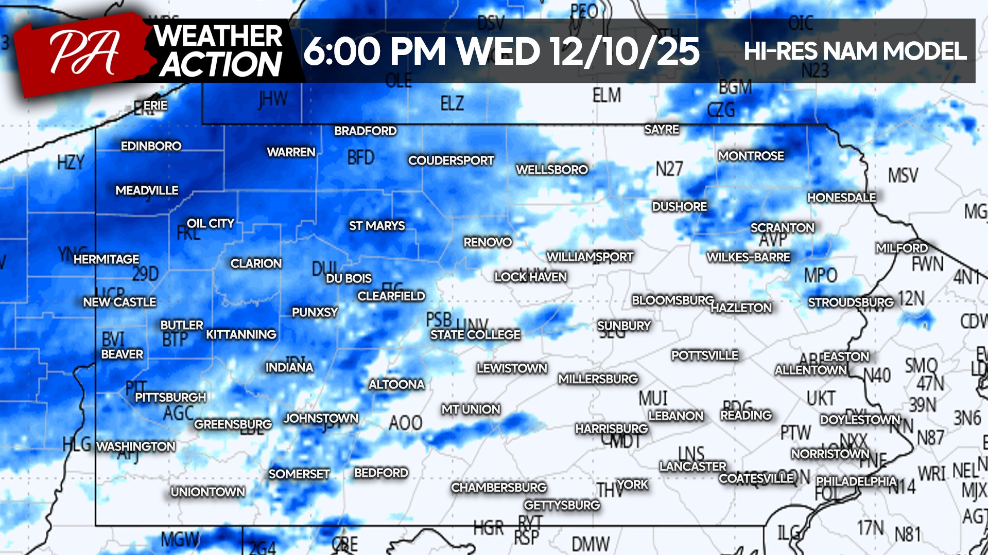
Lake effect snow showers will develop across Western and Northern PA Wednesday evening. They will continue Thursday in the northern tier along Route 6. Edinboro to Coudersport and places in between will see additional snow accumulation.
FIRST CALL SNOWFALL FORECAST FOR WEDNESDAY – THURSDAY
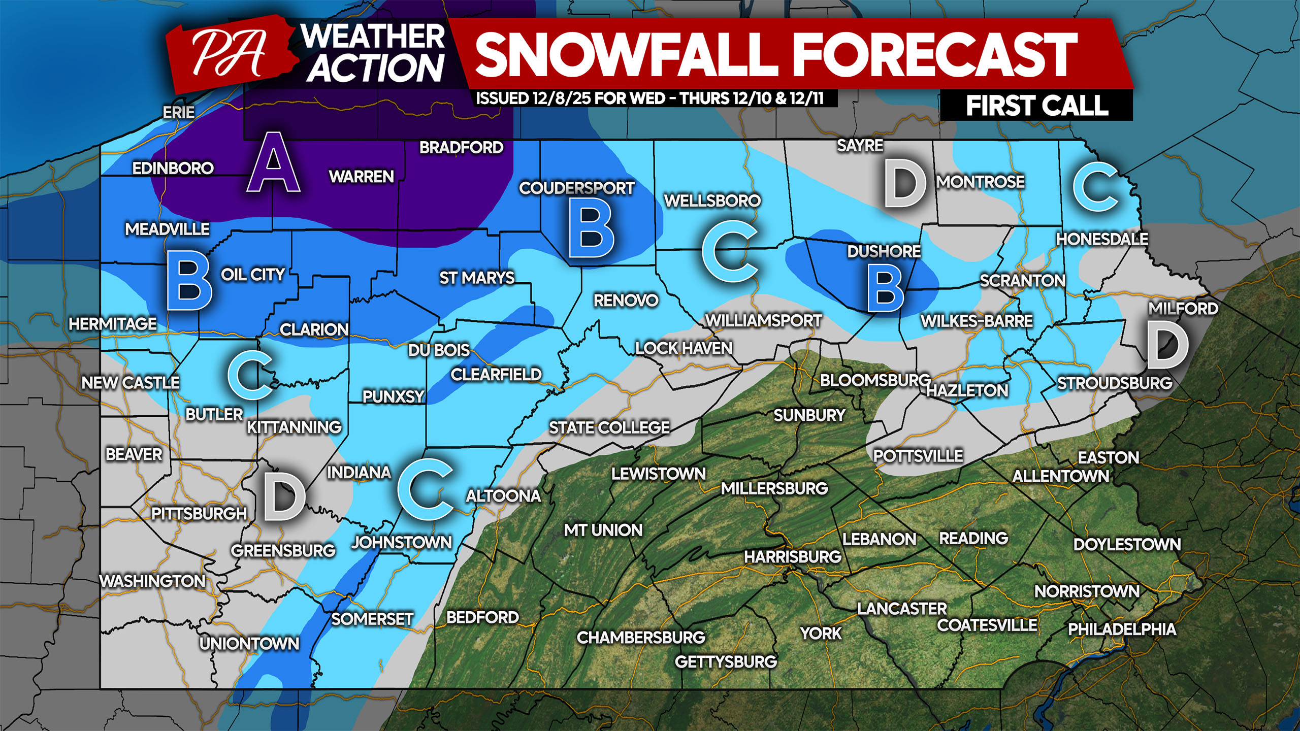
Area A: Snowfall accumulation of 5 – 8″ expected between the clipper and subsequent lake effect snow. Snow-covered roads likely throughout most of the period.
Area B: Snowfall accumulation of 3 – 5″ anticipated between the clipper and scattered lake effect snow showers that will follow. Slick travel is likely.
Area C: Snowfall accumulation of 1 – 3″ expected. Roads may be slick during times of snow.
Area D: Snowfall accumulation of less than 1″ anticipated from the clipper in eastern areas, and the lake effect in Western PA.
The rest of us not included in any of these areas will see a few rain showers before the cold air returns Thursday ahead of a cold blast this weekend.
Be sure to share this new forecast with friends and family in affected areas below!
You must be logged in to post a comment.