
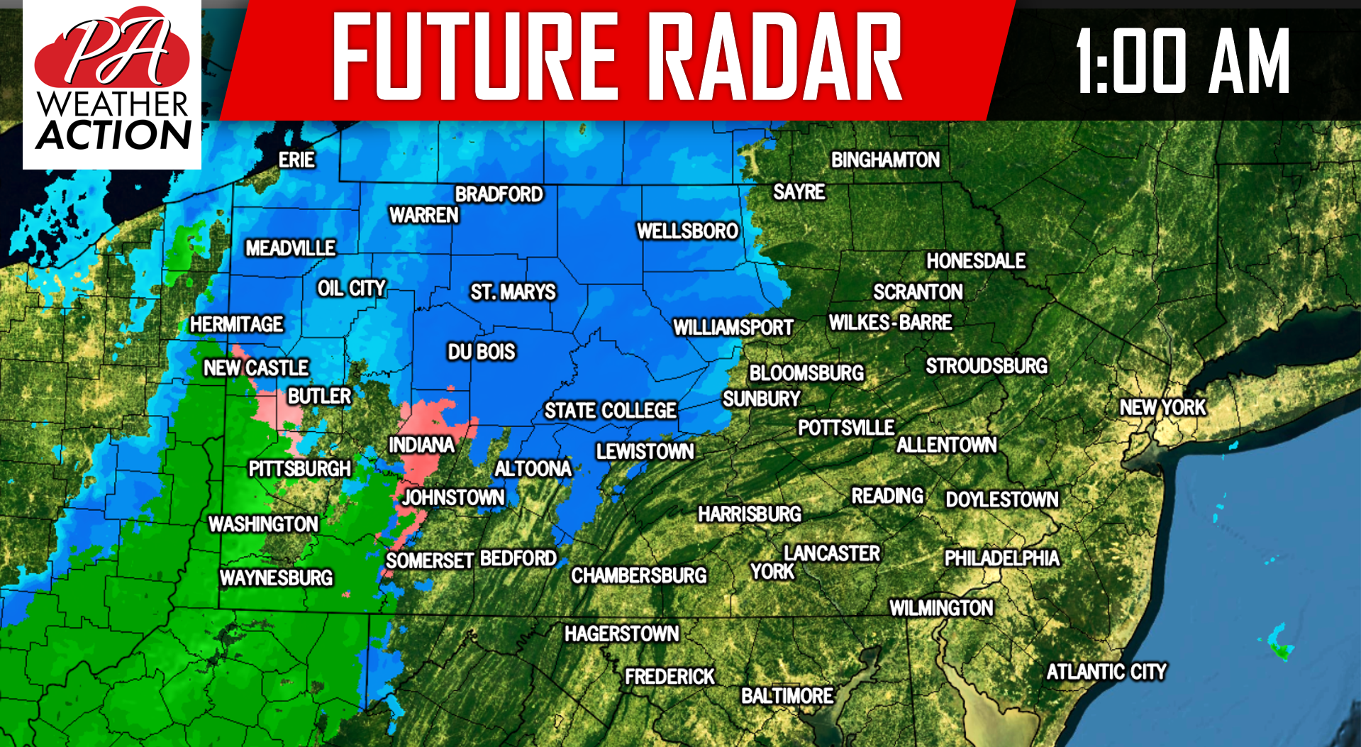
Guidance over the last 24 hours has trended a bit snowier overall, but still favors the interior parts of the state for this winter storm. An arctic front will be passing through the state starting early Tuesday morning in our western counties and by the late afternoon for our eastern counties. The arctic front itself will produce a period of snow and/or a wintry mix before a low pressure forms along the front by the mid-morning hours Tuesday. This will allow for precipitation to be enhanced, especially across Eastern Pennsylvania.
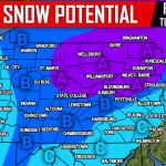
Temperatures will be marginal ahead of the front, meaning most areas will be around 32 degrees. This will allow for some areas to start off as a wintry mix before changing over to all snow. For the snow lovers across Southwest PA, this will once again not be your storm. Plain rain to brief snow is expected across those areas. Below is a look at our future radar for 1:00 AM Tuesday morning:
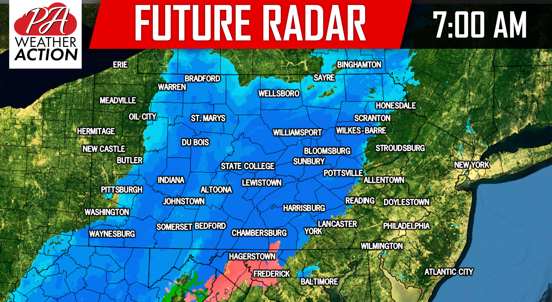
 This area of precipitation will continue to push east as we progress into the mid-morning hours. Below is a look at 7:00 AM Tuesday morning:
FIRST CALL SNOWFALL FORECAST FOR TUESDAY’S STORM
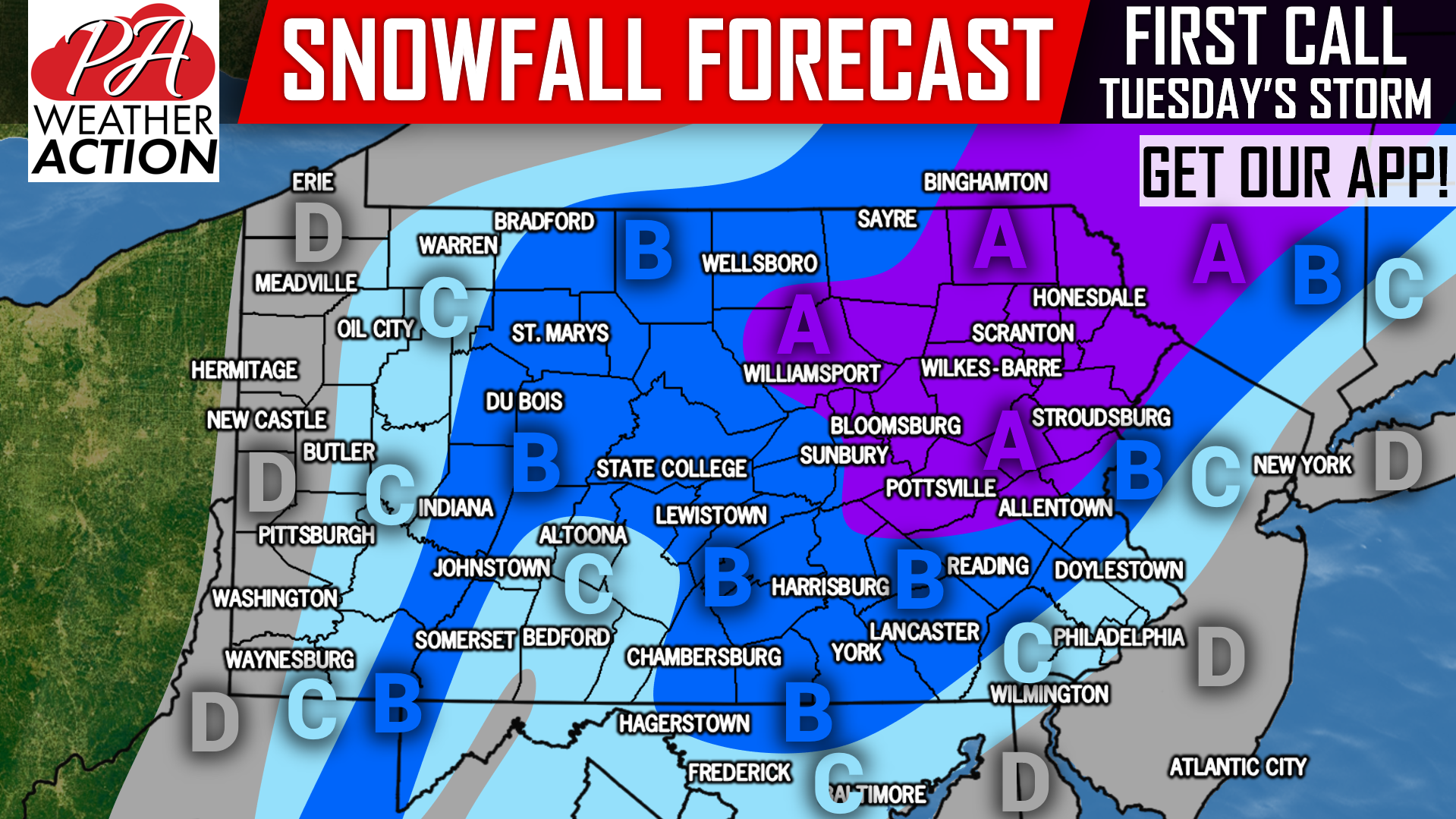
Area A: Snowfall accumulations of 4 – 7″ expected. Hazardous travel likely Tuesday.
Area B: Snowfall accumulations of 2 – 4″ expected, with isolated amounts up to 6″ possible. Hazardous travel anticipated Tuesday.
Area C: Snowfall accumulations of 1 – 2″ expected, with isolated amounts up to 3″ possible. Untreated surfaces will become slushy Tuesday.
Area D: Snowfall accumulations of <1″ expected.
We will be fine-tuning the forecast in the next 24 hours. Receive Monday’s Final Call Forecast along with your latest hourly and daily forecast & radar with our free app >>> PA Weather App Link
We will have frequent updates on our facebook page as well, be sure to like us if you haven’t already >>> PA Weather Action Facebook Page
Be sure to share this snowfall forecast with your friends and family using the button below!
You must be logged in to post a comment.