
A major winter storm continues to be on track to impact the area this weekend with heavy snow, sleet, freezing rain and plain rain. Over the last 12 hours, there has been a warming trend in the model guidance. This will only cut back on snow and ice totals in Southwest PA and Southeast PA. Everyone else will likely see a significant to major snow and ice totals from this winter storm. If the warming trend continues, we will make adjustments during tomorrow’s forecast. This could just as easily trend back to being a little colder as well.
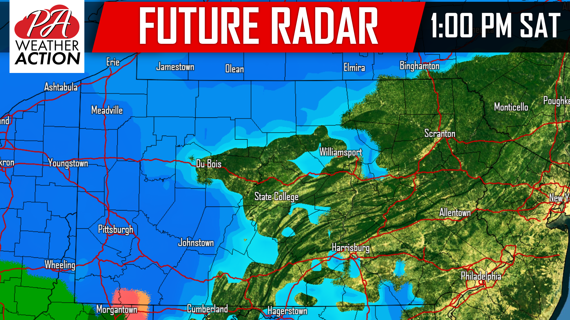
We still expect most areas will at least start off a period of moderate to heavy snow Saturday afternoon overspreading the area from west to east. Below is a look at 1:00 PM Saturday:
 Most areas will see at least a few hours of snow. The farther north you live in the state, the longer the duration of snow will be. Moving our future radar to 4:00 PM Saturday afternoon, just about everyone is seeing steady and heavy snow except for far Eastern PA and extreme Southwest PA:

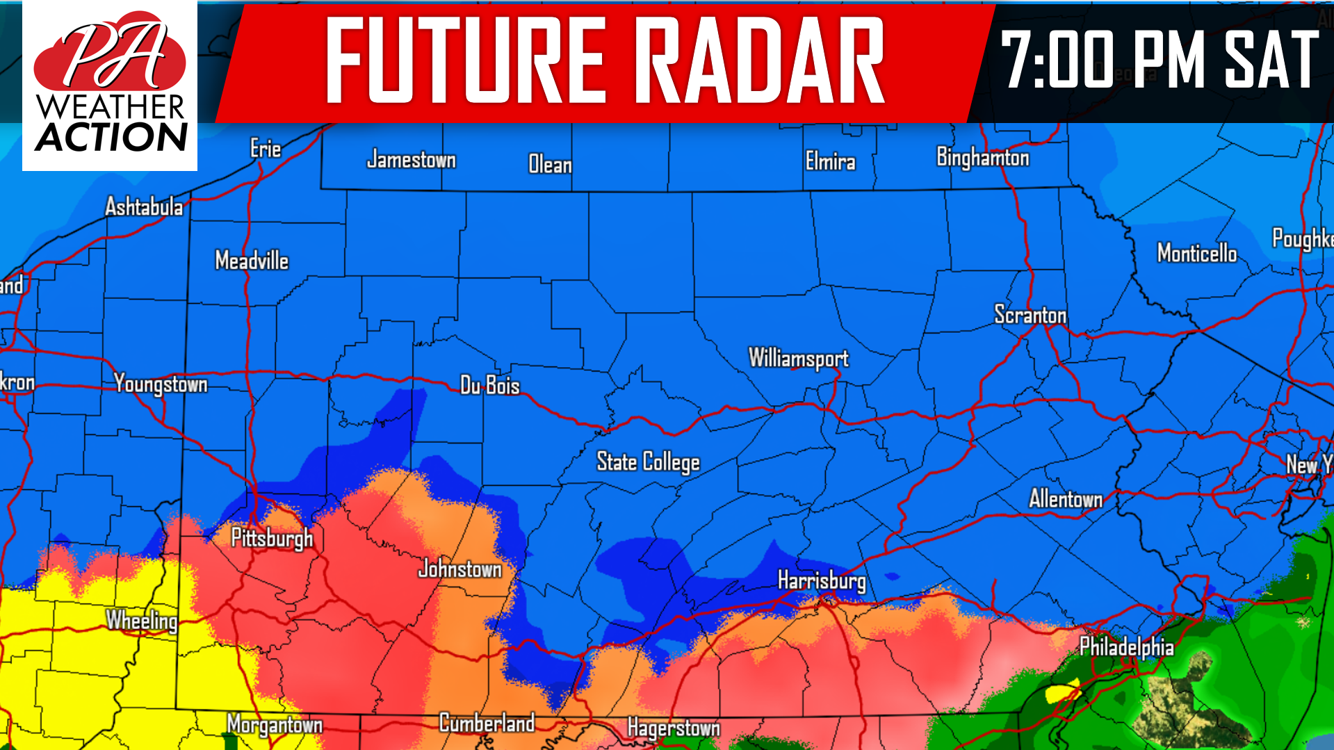 As we continue to head into the nighttime hours, the freezing rain and even plain rain will push well into PA, approaching Interstate 80. We are fairly confident to say areas North of Interstate 80 and West of Interstate 81 will see mainly snow out of this storm despite what our future radar shows. Take a look at 1:00 AM Saturday evening:
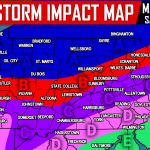
 Precipitation will begin to wrap up during the morning hours Sunday and everyone should clear out by noontime Sunday. We will not lie. This is one of our toughest forecast in quite sometime. Some our most populated towns/cities including Pittsburgh, State College, Harrisburg, and Allentown to name a few, are right on the line of a major snow/ice storm vs less snow/ice and more rain. It is a VERY close call. A swing 25 miles in either direction can make the difference between an inch of snow and over a foot of snow. With that being said, we took a blend of model guidance (factoring in the warming trend), plus current observations.
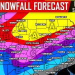
We will start with ice accumulations, and below that will be snowfall accumulations.
FIRST CALL ICE ACCUMULATION FORECAST
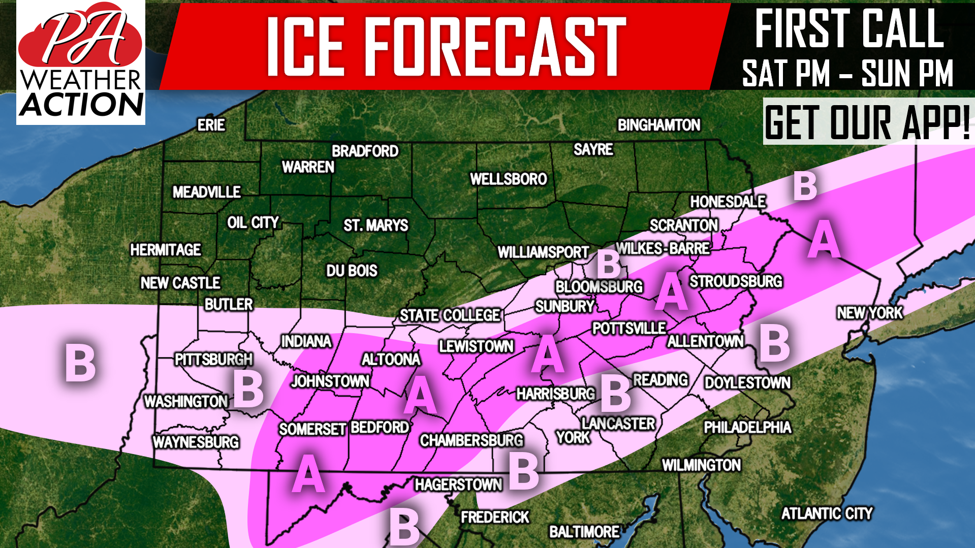 Area A: Ice accumulation of .10 – .25″ expected. Scattered power outages possible as a result of icy, and windy conditions.
Area B: Ice accumulation of .01 – .10″ expected. Isolated power outages possible as a result of icy, and windy conditions.
All ice will occur directly after the initial period of snow switches to freezing rain.
FIRST CALL SNOWFALL FORECAST
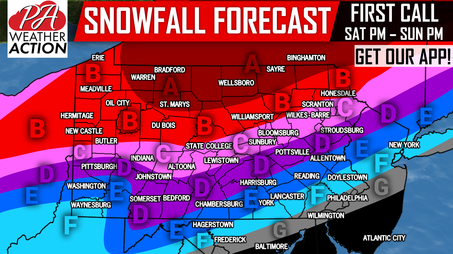 Area A: Snowfall accumulations of 15″+ expected. Travel will be near-impossible Saturday Evening into Sunday.
Area B: Snowfall accumulations of 10 – 15″ anticipated. Travel will be near-impossible Saturday Evening into Sunday.
Area C: Snowfall accumulations of 6 – 10″ expected. A period of sleet and freezing rain is likely, which is why totals are slightly less. Still, travel will be dangerous Saturday Evening into Sunday.
Area D: Snowfall accumulations of 4 – 6″ anticipated, before turning to sleet and freezing rain, and possibly plain rain for a period. Travel will be hazardous Saturday Evening into Sunday Morning.
Area E: Snowfall accumulations of 2 – 4″ expected, before turning to sleet and freezing rain, then rain.
Area F: Snowfall accumulations of 1 – 2″ anticipated, before briefly turning to sleet and freezing rain, then rain.
Area G: Snowfall accumulations of <1″ expected, before turning to rain.
This forecast is by no means locked in, as model guidance continues to fluctuate between warmer and colder solutions for the state. Receive Friday’s Final Call Forecast and updates through the storm with our free app >>> PA Weather App Link
We also post frequent updates on our facebook page. Be sure to like us if you haven’t already >>> PA Weather Action Facebook Page
Don’t forget to share this important forecast with your friends and family using the button below!
You must be logged in to post a comment.