
UPDATED 5:00 PM THURSDAY, VIEW ARTICLE LINKED BELOW.
For many in Eastern and Western PA, this winter season has been off to a surprisingly normal to even active start. But in the middle, a snow hole. Some areas of Central PA have failed to even pick up 6″ of snow so far this winter. But it’s safe to say, the narrative about this winter is about to change for everyone.
When we think of wintertime childhood memories, we think of the biggest snowstorms we experienced growing up here in Pennsylvania. And for many, this upcoming storm will be one remembered for a long time to come. While we aren’t looking at a historic event, it will be a memorable one nonetheless.
Many times models struggle to agree on the little events that often give forecasters a bad reputation. But the reason we speak with so much confidence now is because the few times when all models agree this far out have always been ahead of major winter storms.
Could we see a north trend that brings mixing issues into Southern PA? Sure, but given it’s late January and we have a very strong high pressure in the perfect place, it’s unlikely that Southern PA sees totals greatly reduced by sleet/freezing rain. And along with that north trend, it’s also important to note that timing has sped up as well.
WINTER STORM TIMING
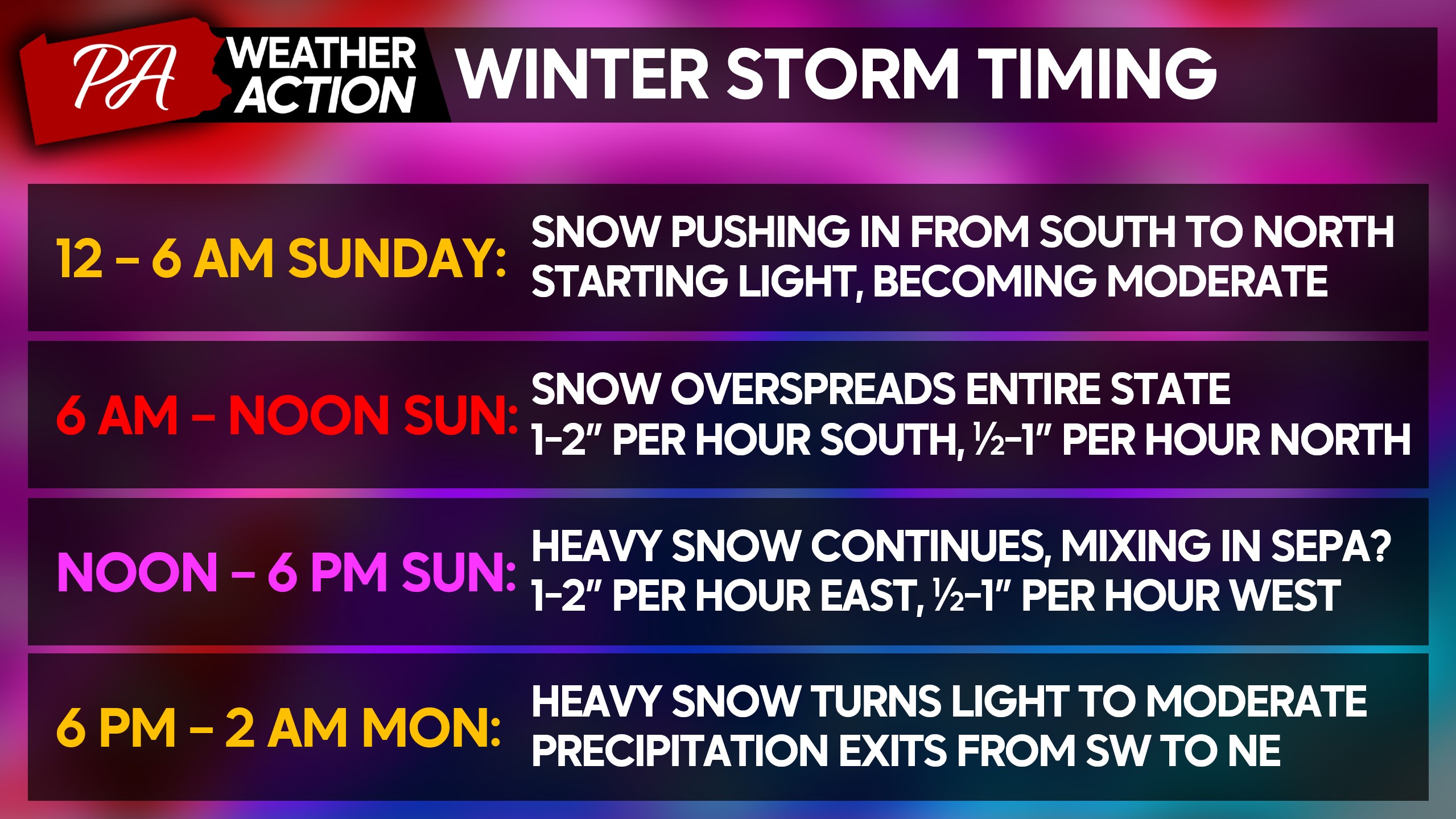
The European model, along with others, is now bringing the storm in a good bit earlier. And given these storms tend to arrive sooner than most models show, we feel comfortable using the earliest solution.
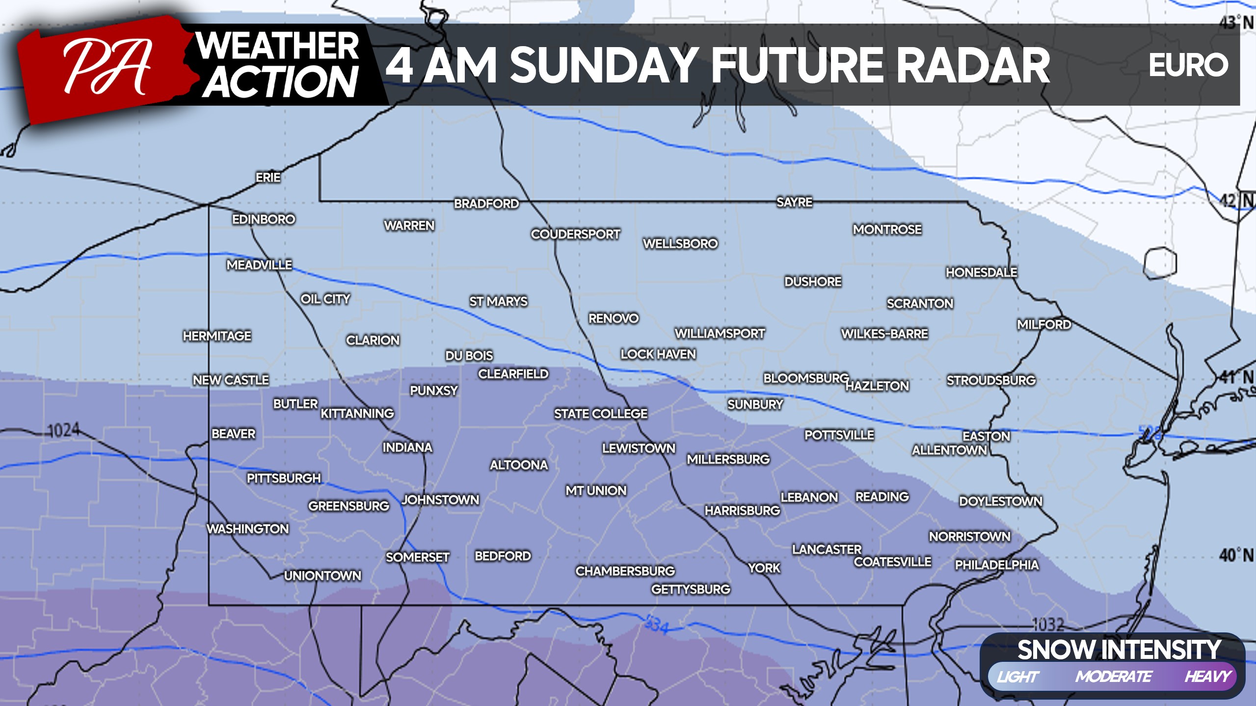
As snow arrives before sunrise Sunday, temperatures will be in the single digits and low teens. It will be a very fluffy snow and accumulate rapidly. Even pretreated surfaces will certainly become snow-covered Sunday morning. Below is the European model simulation for 4:00 AM Sunday.
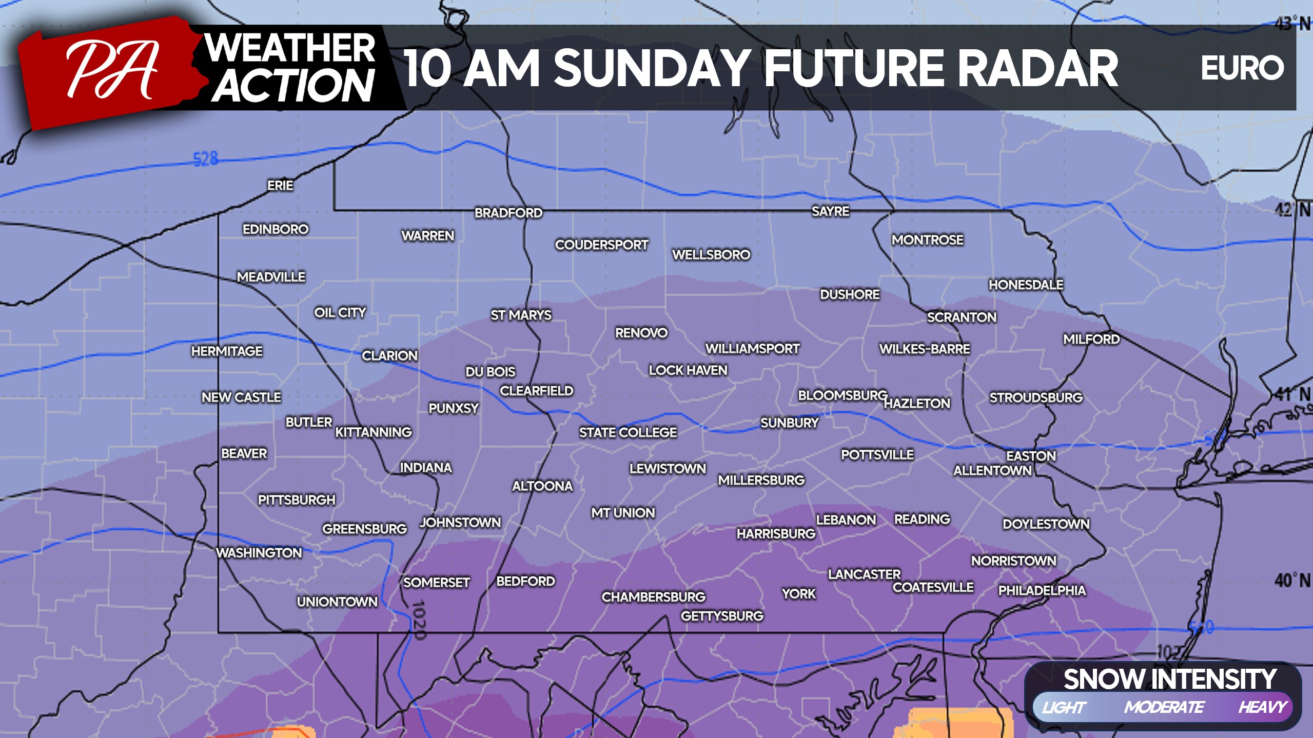
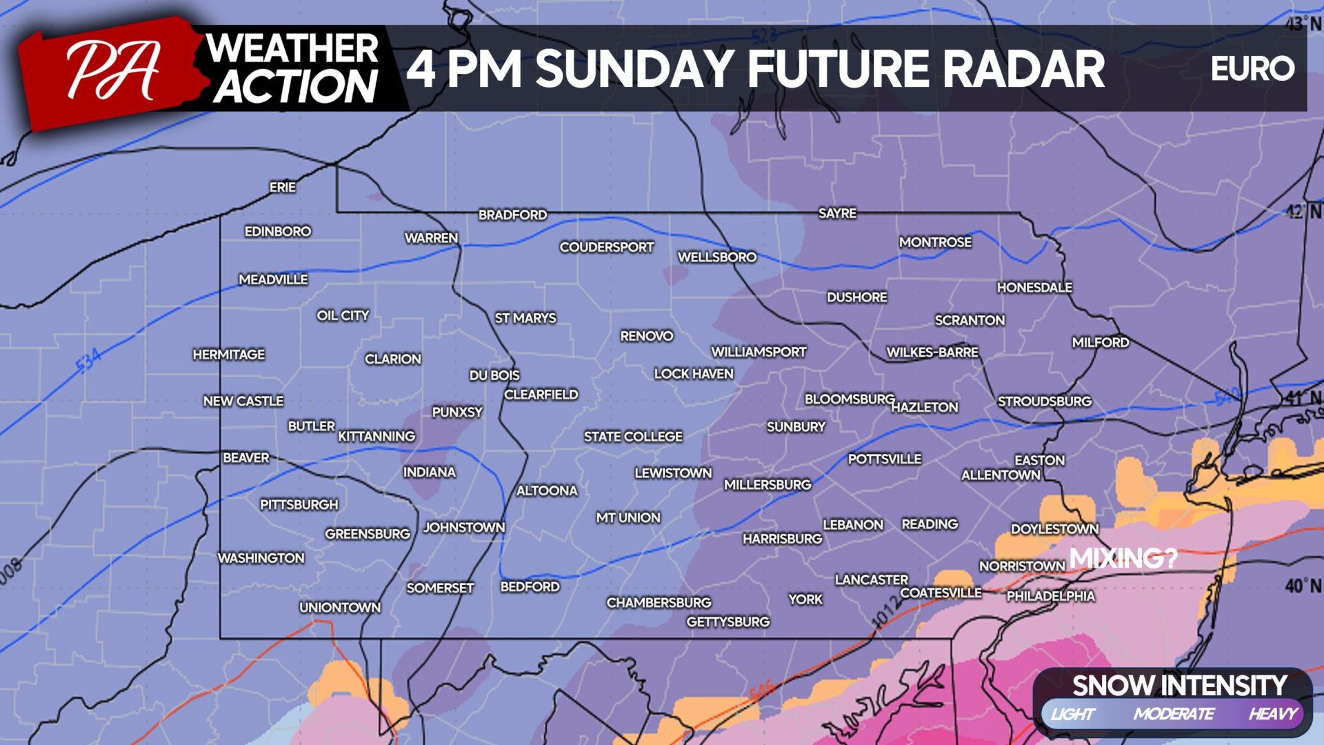
As Sunday morning progresses, snow will become very heavy and accumulate at 1-2″ per hour in nearly the entire state. All Sunday morning activities should be canceled/postponed, as travel will be dangerous. Here is the Euro model for 10:00 AM Sunday.
Now this is when things get perhaps a bit complex in Southeast PA. Some guidance is beginning to show mixing issues near I-95 as upper levels temperatures rise just above 32. But with surface temperatures below freezing, this could introduce a layer of ice on top of the snow near Philadelphia.
If this north trend continues with a stronger coastal, more of Southeast PA could see a period of wintry mix. But as mentioned, I don’t think this is a December 2020 storm scenario in which most of the eastern half of the state changes over to sleet. Different climatology this time of year, different setup.
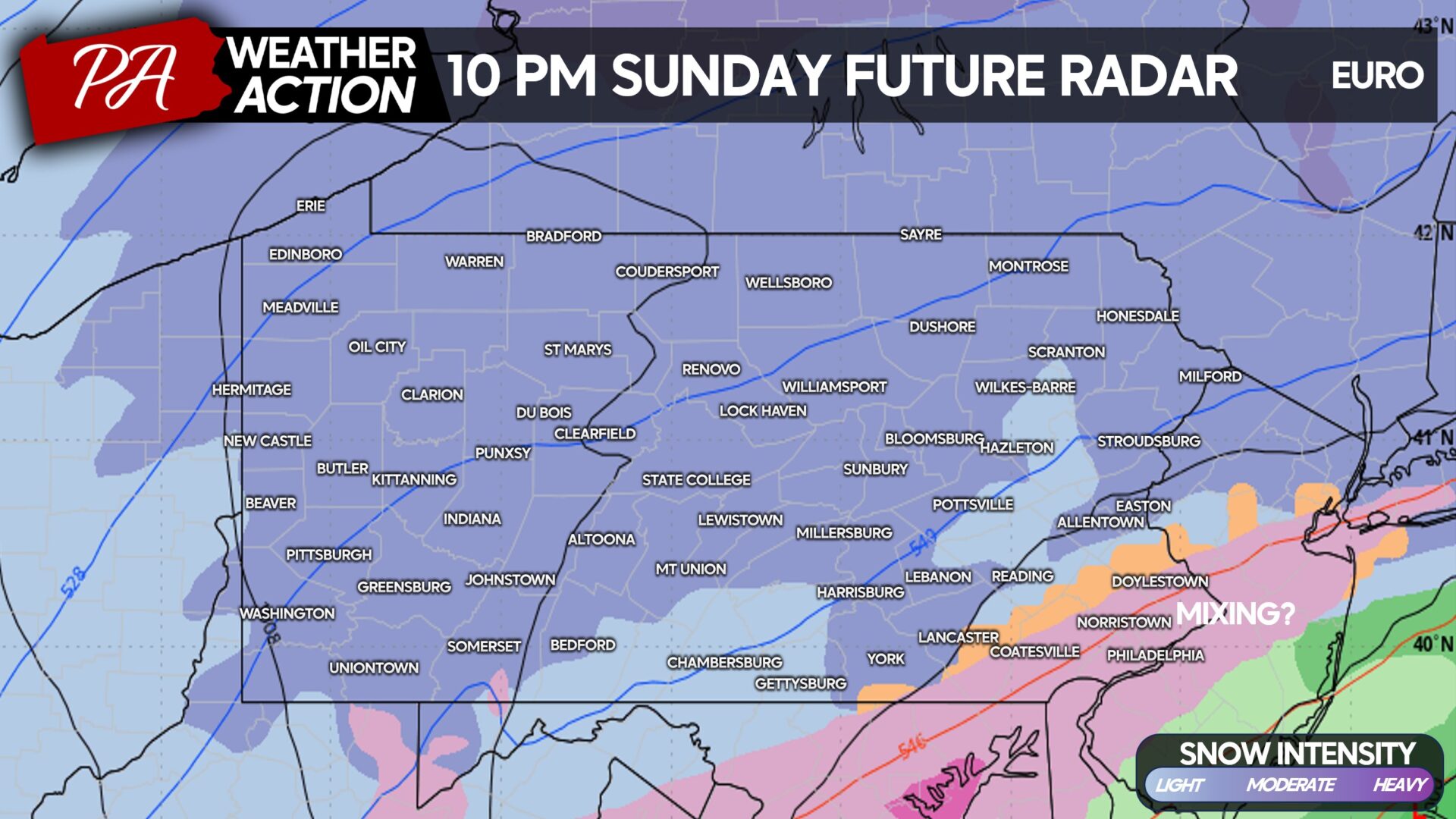
As we head into late Sunday evening, the storm should begin exiting the area from south to north. Areas north of I-80 will likely see snow lingering into the early morning hours of Monday.
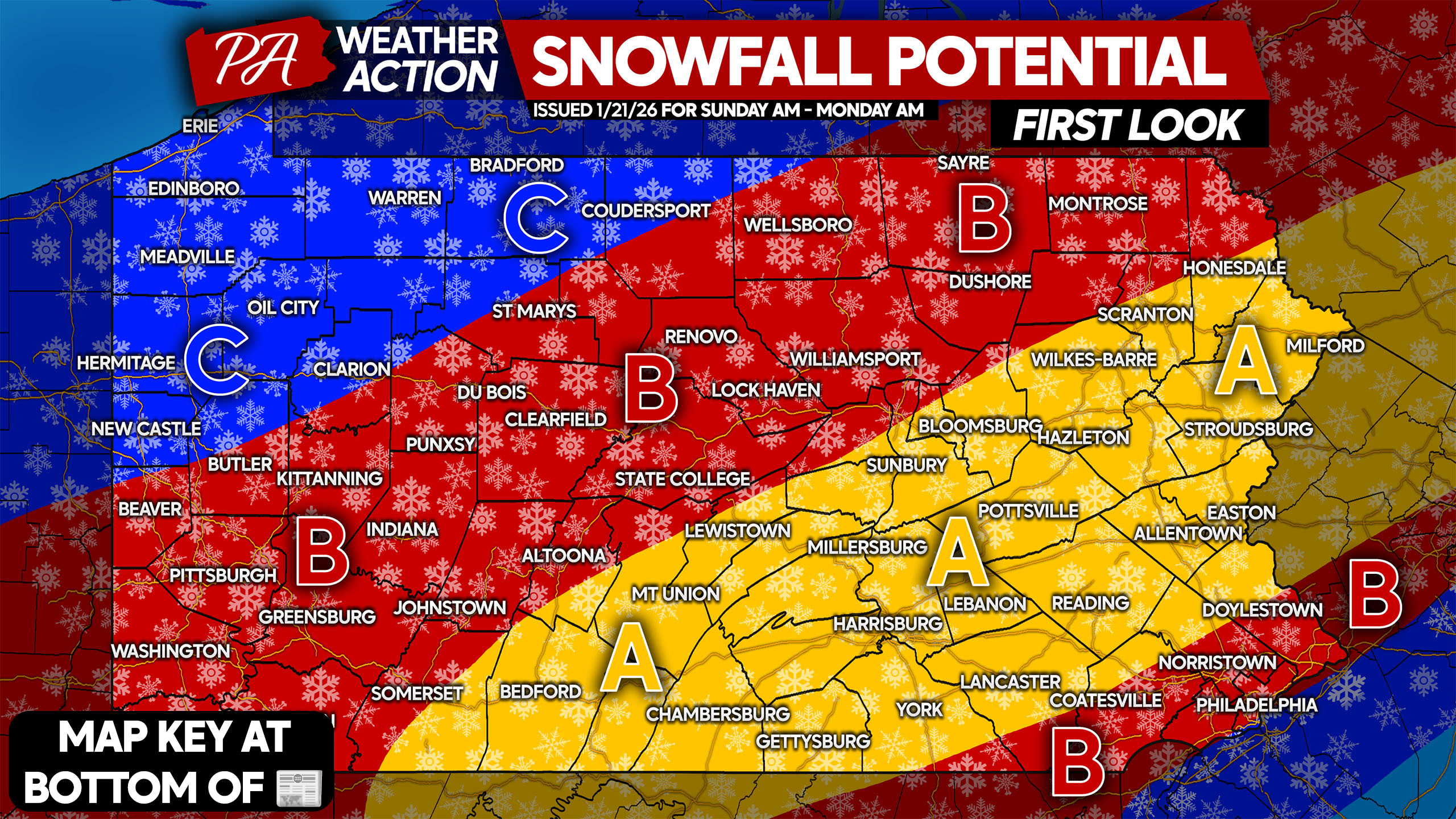
FIRST LOOK AT POTENTIAL SNOWFALL FOR SUNDAY’S MAJOR STORM

Please note, this is not an official forecast. Our First Call Snowfall Forecast will be issued at 5:00 PM Thursday.
Area A: Snowfall potential of 12 – 18″. Travel will likely be impossible Sunday, with closings spilling into Monday and perhaps Tuesday. Prepare soon.
Area B: Snowfall potential of 10 – 15″. Mixing possible in Southeast PA. Travel will likely be impossible Sunday, with closings also likely Monday and even Tuesday. Prepare soon.
Area C: Snowfall potential of 8 – 12″. Travel will be very difficult to impossible Sunday. Closings likely Monday and possibly Tuesday. Prepare soon.
Share this important information with friends and family below! Stay tuned.
You must be logged in to post a comment.