
FIRST CALL POSTED:
After a very cold first half of December, temperatures have moderated a bit lately with very few people in Pennsylvania on track to see a white Christmas. But we will have a mess on our hands Friday into Saturday morning.
What once looked to be all rain event has now trended significantly our direction, as a result of features in the jet stream over Atlantic Canada. The cold air will be locked in much farther south, keeping most of Pennsylvania frozen through the storm.
While surface temperatures will be below 32° in most areas, the upper levels a few thousand feet above our head won’t cooperate as much. This will result in widespread sleet and/or freezing rain (ice) in Central and Northwest PA. Only Northeast PA has above a 50% chance of staying all snow.
WINTER STORM TIMING
The storm will push in early Friday afternoon from west to east. This will be a cold air damming situation, meaning the mountains and areas east will hang onto freezing temperatures. Southwest PA usually warms above 32° quickly, meaning plain rain for them. Here is a look at 4 PM Friday on the European model.

Friday evening travel looks to be a no-go in most of the state, with icy and snow-covered roads creating very hazardous conditions. You may notice Central PA and even Southeast PA didn’t get much snow on this model run, which may very well be the case. A bit of sleet is likely at the onset before changing over to freezing rain.
Below is the European model for 10 PM Friday evening.

Freezing rain will continue through the night in most of Central and Eastern PA overnight into Saturday morning, with areas closest to the Southern PA border perhaps warming above 32°. But along and north of the turnpike, treacherous road conditions will persist into the hours around sunrise Saturday.
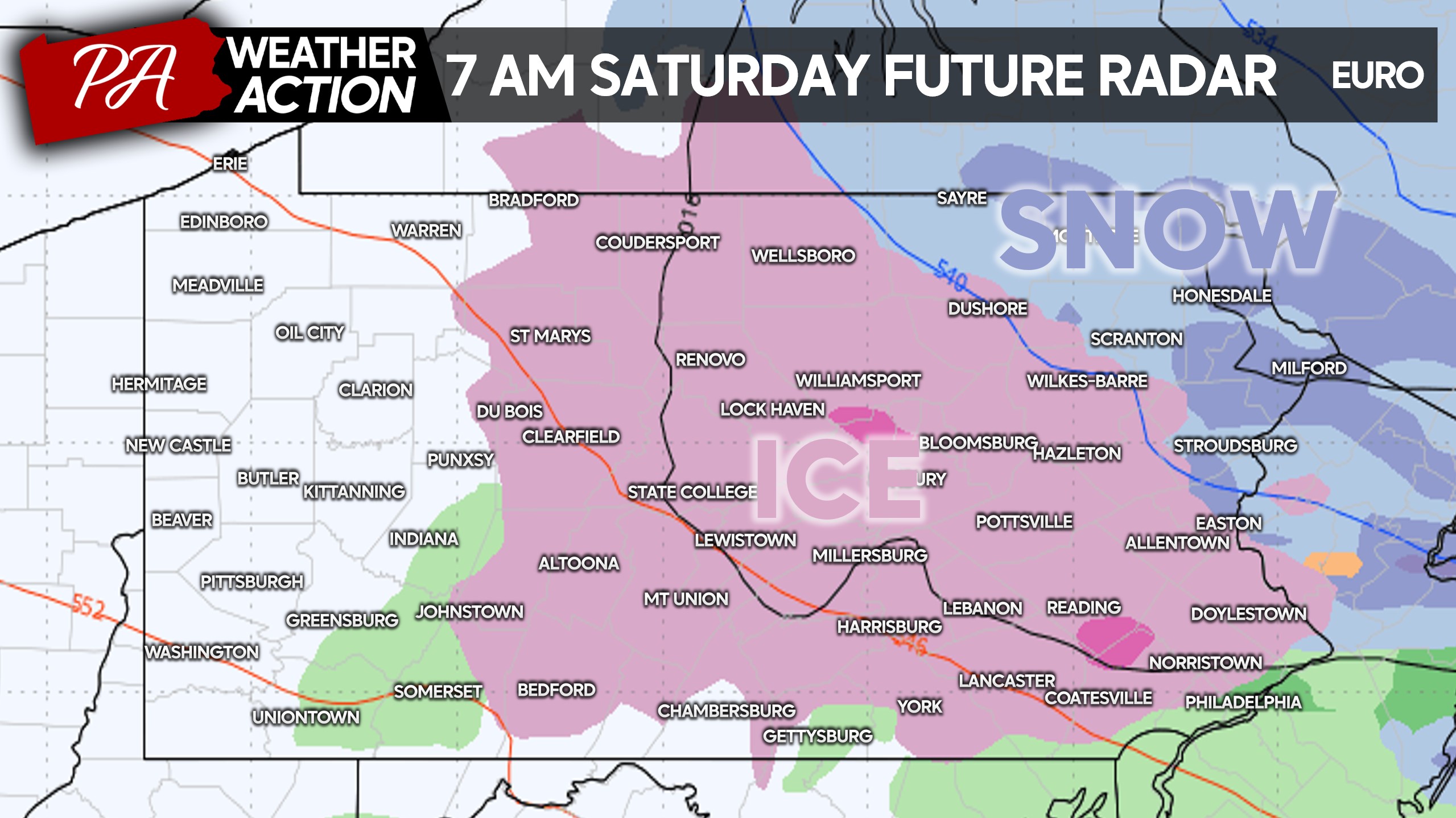
The storm will be out of here by mid-Saturday morning. However in the eastern half of Pennsylvania north of I-76, temperatures are likely to stay below freezing all day with ice not melting until late Sunday.
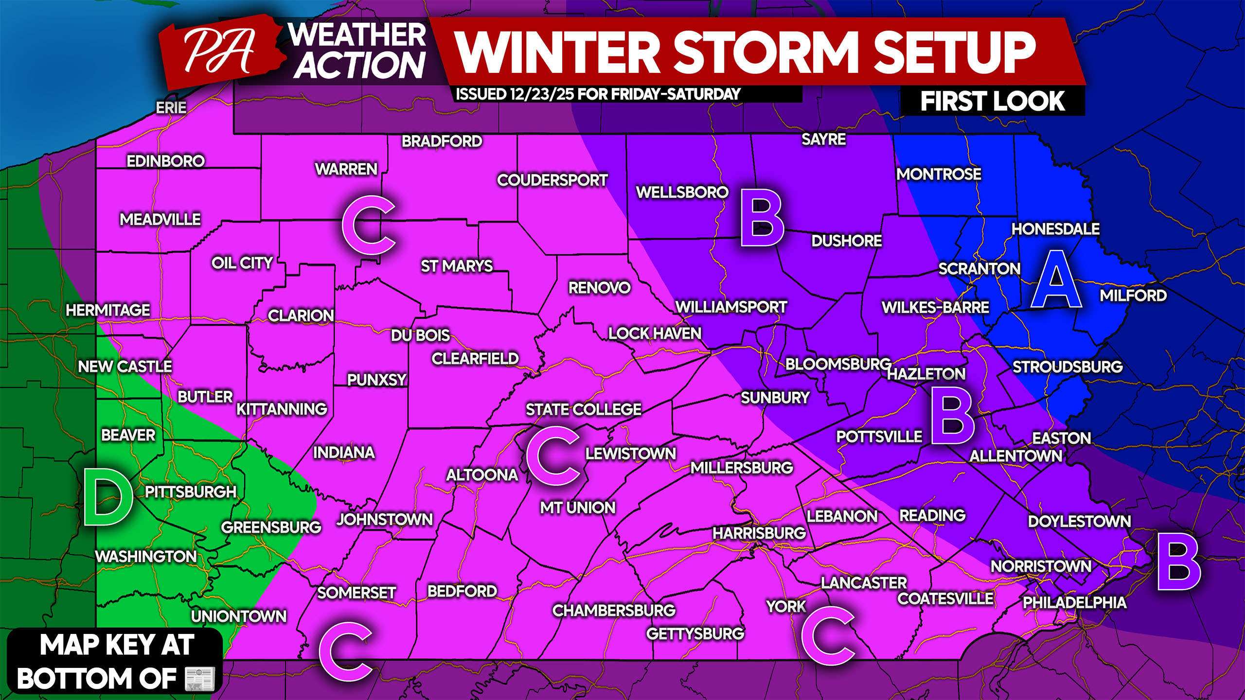
FIRST LOOK AT WINTER STORM SETUP
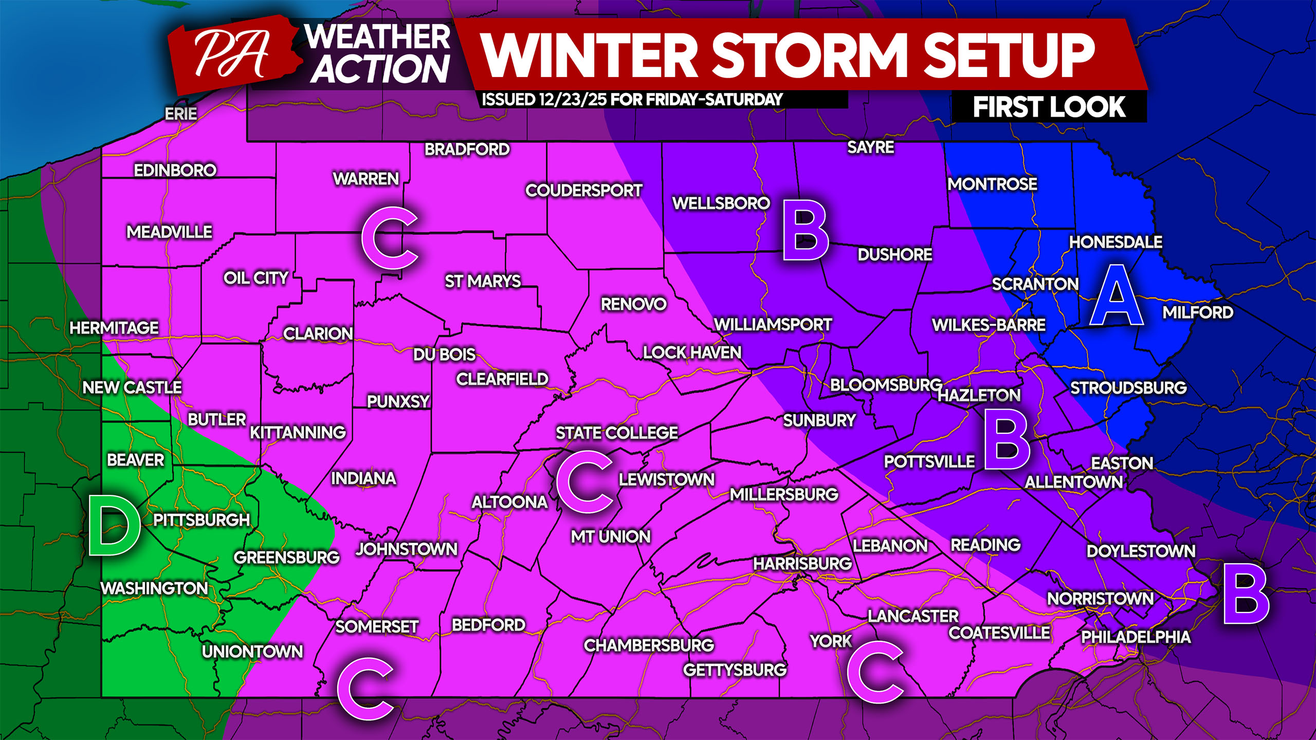
Area A: All snow is currently favored, with the potential for moderate to significant snowfall accumulation. Plan on significant impacts.
Area B: A period of snow, followed by sleet and freezing rain. Light to moderate snowfall accumulation is possible, followed by moderate ice accrual.
Area C: A very brief period of snow followed by sleet and freezing rain. Light snow, but more so sleet accumulation is possible, followed by moderate to significant ice accrual.
Area D: Plain rain is expected due to a lack of cold air damming.
Share this forecast with friends and family who may be traveling in affected areas!
You must be logged in to post a comment.