
This winter’s pattern has constantly benefited the interior when it comes to snowfall, unlike what we typically expect out of El Niño. And once again, this storm looks to follow that pattern. A weak area of low pressure is likely to develop Tuesday at the base of a deep trough that will bring us major cold late next week. The system will then track northeast across the eastern gulf coast states, Carolinas, and up over the Del-Mar-Va.
Being three days out, there of course is some uncertainty. When and where the low pressure develops and how fast is strengthens will determine its impacts on Pennsylvania. For now, here is how the storm looks to play out based on latest model data:
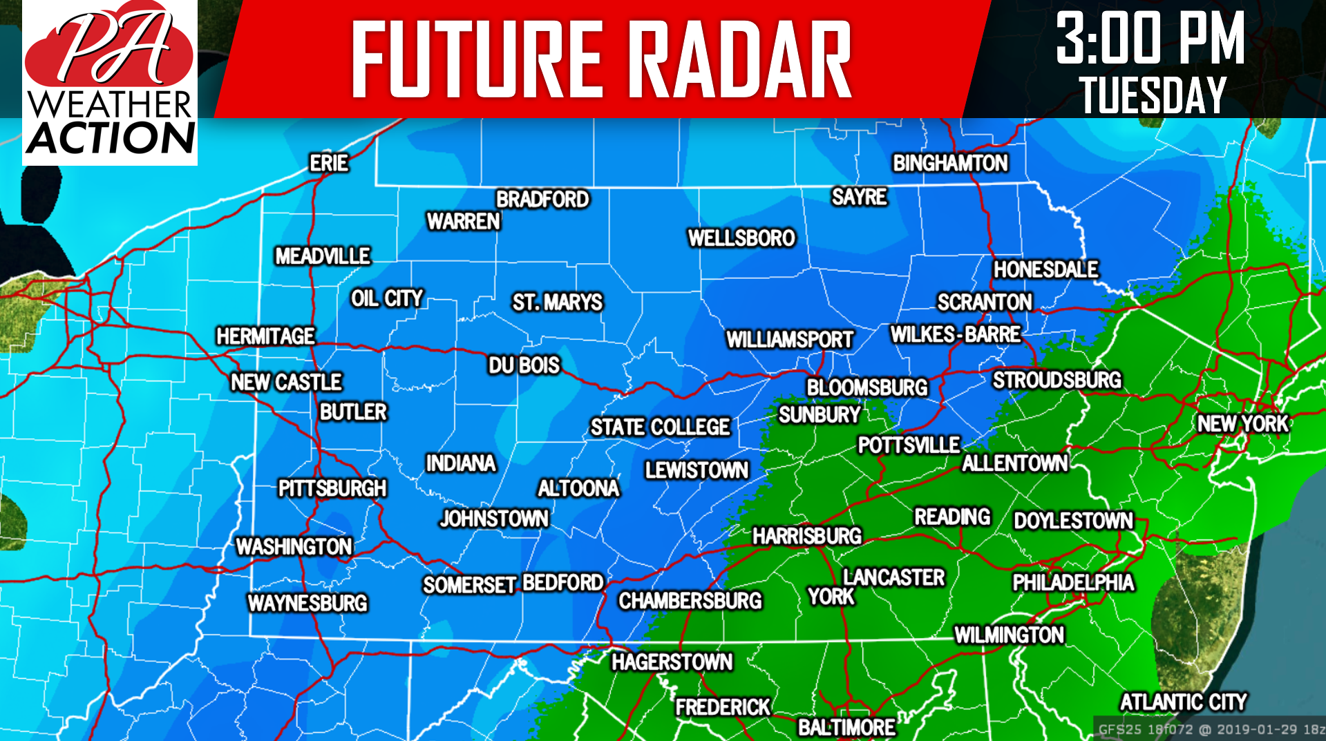
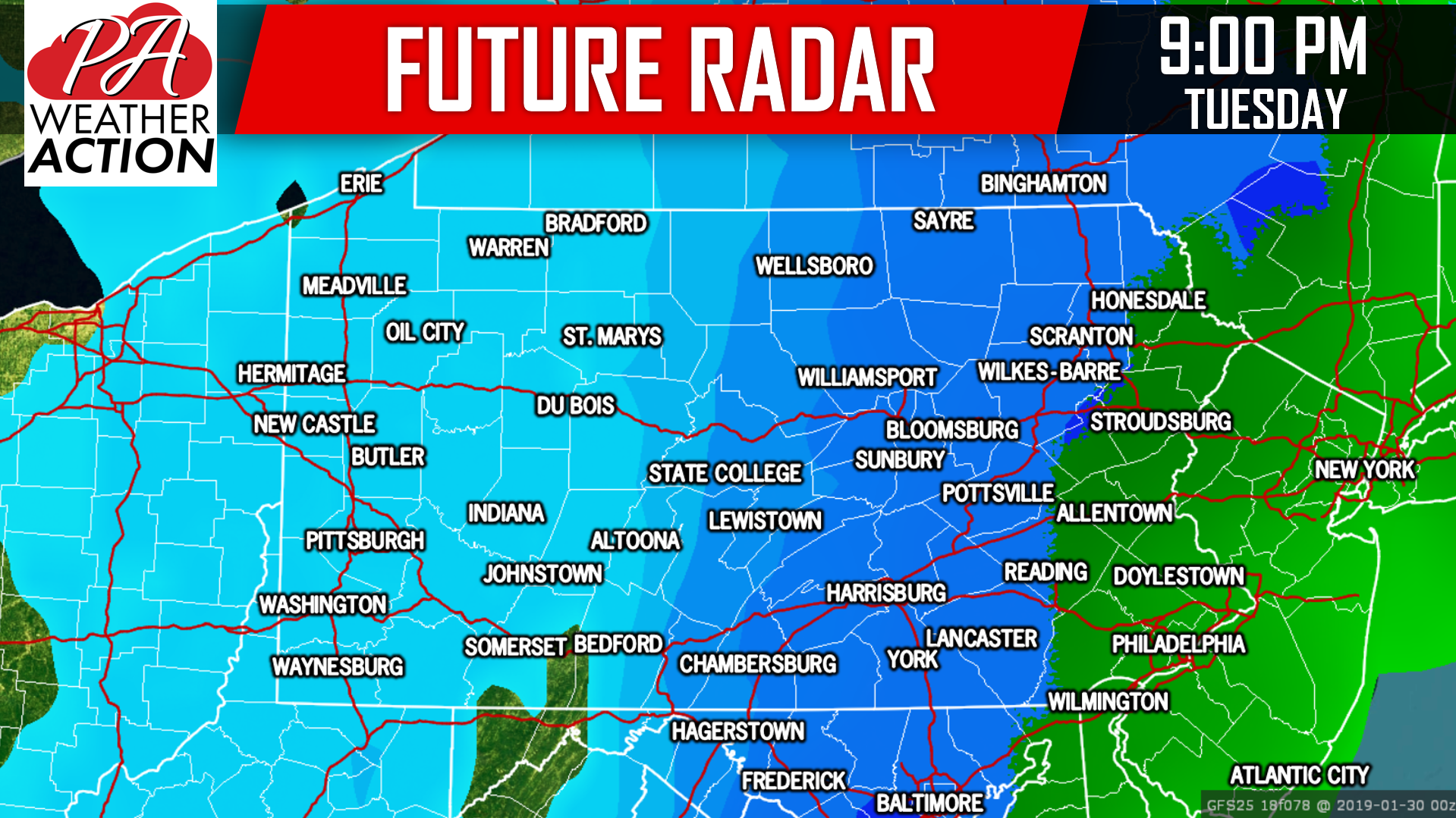
Light snow will develop in Western PA Tuesday Morning, before pivoting east into central and eastern PA Tuesday Afternoon. Precipitation may start in the form of rain in Eastern PA, eventually changing to snow from west to east. Snow will exit Western PA Tuesday Evening, while continuing in central and eastern parts of the state. All precipitation will wrap in Eastern PA early Wednesday Morning.
Parts of Central PA and up into the Poconos will likely stay all snow through the duration of the storm, resulting in highest potential snowfall amounts. On the opposite end of the spectrum looks to be Southeast PA, where an extended period of rain may significantly cut down on snowfall amounts.
This can be illustrated by looking at future radar for 3:00 PM Tuesday:
For now, we are going to look at snowfall potential with this storm. We will release our first call Sunday Evening.
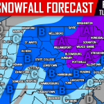
SNOWFALL POTENTIAL FOR TUESDAY’S WINTER STORM
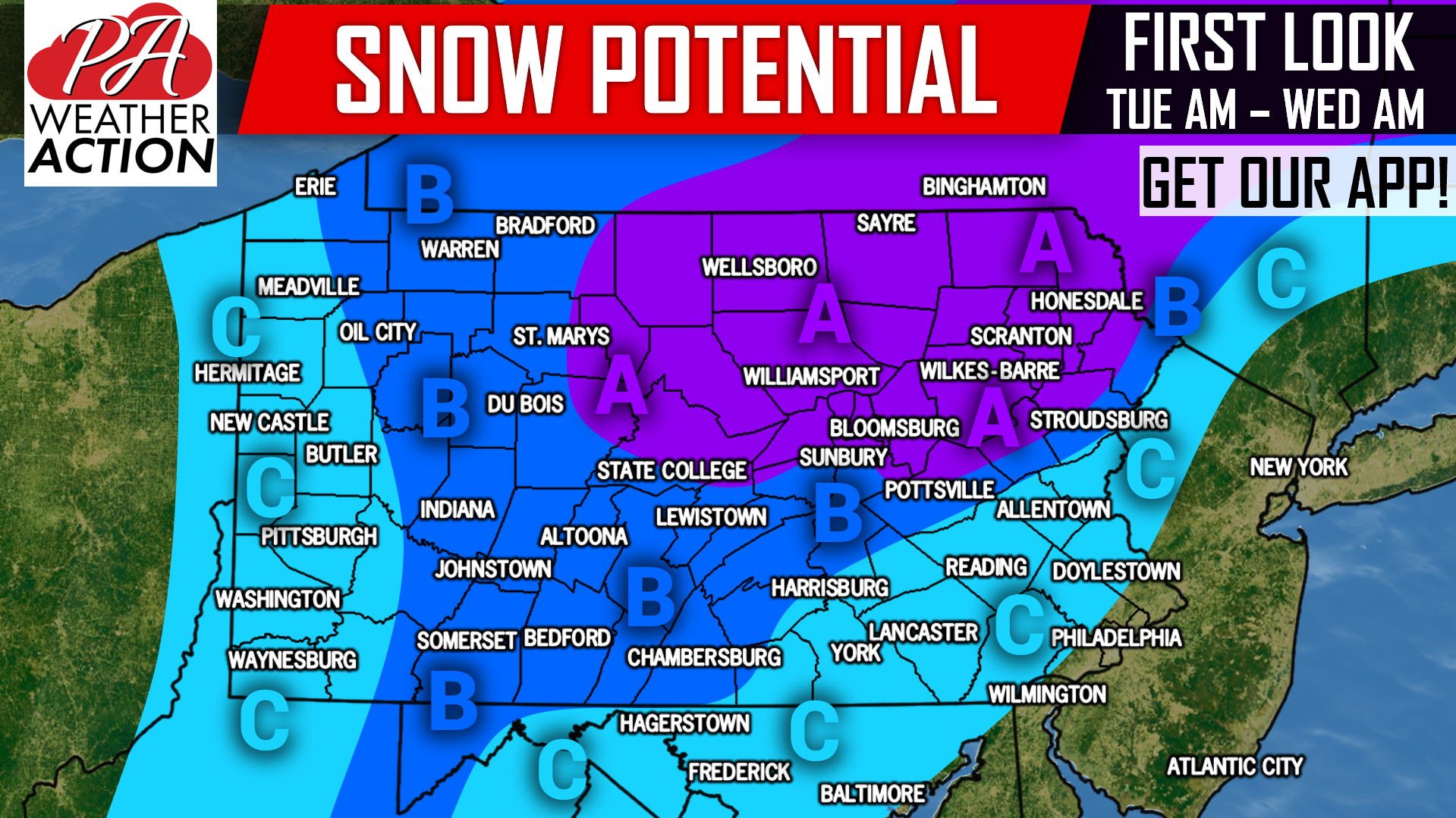
Area A: This region has a 60% chance of seeing 5″ of snow or more. Travel impacts possible Tuesday into early Wednesday Morning.
Area B: Locations in this region have a 60% chance of seeing 3″ of snow or more. Travel impacts possible Tuesday Afternoon into early Wednesday Morning.
Area C: A 60% chance of seeing 1″ of snow or more exists in this region. Travel impacts possible on untreated surfaces Tuesday Night (Eastern PA).
Some changes to the forecast are certainly possible in the coming days! Receive Sunday’s First Call Forecast along with your latest hourly and daily forecast & radar with our free app >>> PA Weather App Link
We will have frequent updates on our facebook page as well, be sure to like us if you haven’t already >>> PA Weather Action Facebook Page
Don’t forget to share this new update with your friends and family using the button below!
You must be logged in to post a comment.