
After nearly a week of tracking, Isaias is finally nearing landfall. The storm is expected to make landfall this evening as a category one hurricane near Wilmington, NC, and move north-northeast toward us shortly after. Flash Flood Watches have been issued for much of the eastern half of the state, and Tropical Storm Watches are in effect for the Philadelphia Area.
After the heavy, in some cases flooding rain places like the Lehigh Valley have experienced lately, more flash flooding is almost certain to result from Tuesday’s deluge. Rainfall rates of 1-1.5″ an hour are expected for several hours Tuesday afternoon in much of the eastern half of the state.
ISAIAS TIMING
Showers and thunderstorms are likely this evening in south-central PA. They are not directly associated with Isaias, but they will impact potential flooding tomorrow due to close time proximity. Below is the HRRR model future radar for 8:00 PM this evening.

Light rain will overspread nearly the entire eastern half of the state by very early Tuesday morning. This will be well ahead of Isaias, and we do not expect any flooding by the Tuesday morning commute. Here is Hi-Res NAM future radar for 4:00 AM Tuesday.

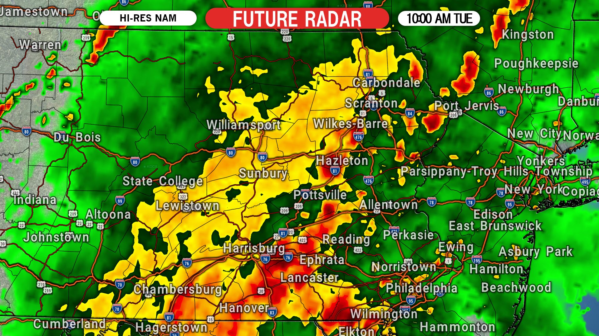
Heavy rain will enter southeast PA after about 8 AM Tuesday, and will continue to spread north-northeastward as the late morning progresses. By 10 AM, we anticipate most of the eastern half of the state will be seeing moderate to heavy rain. Below is future radar for 10:00 AM Tuesday.
After lunchtime Tuesday is when we predict the worst conditions to occur. Heavy rain bands near the center of Isaias will move into eastern Pennsylvania, and rain rates of 1″ or more per hour are expected. The early afternoon is when the highest flash flooding risk will begin. Here is future radar for 2:00 PM Tuesday.

Winds will also be on the increase Tuesday afternoon. Wind gusts of 40-60 MPH are expected in southeast Pennsylvania by mid-afternoon. Highest gusts will be near the Philadelphia area. Below are projected wind gusts for 2:00 PM Tuesday.

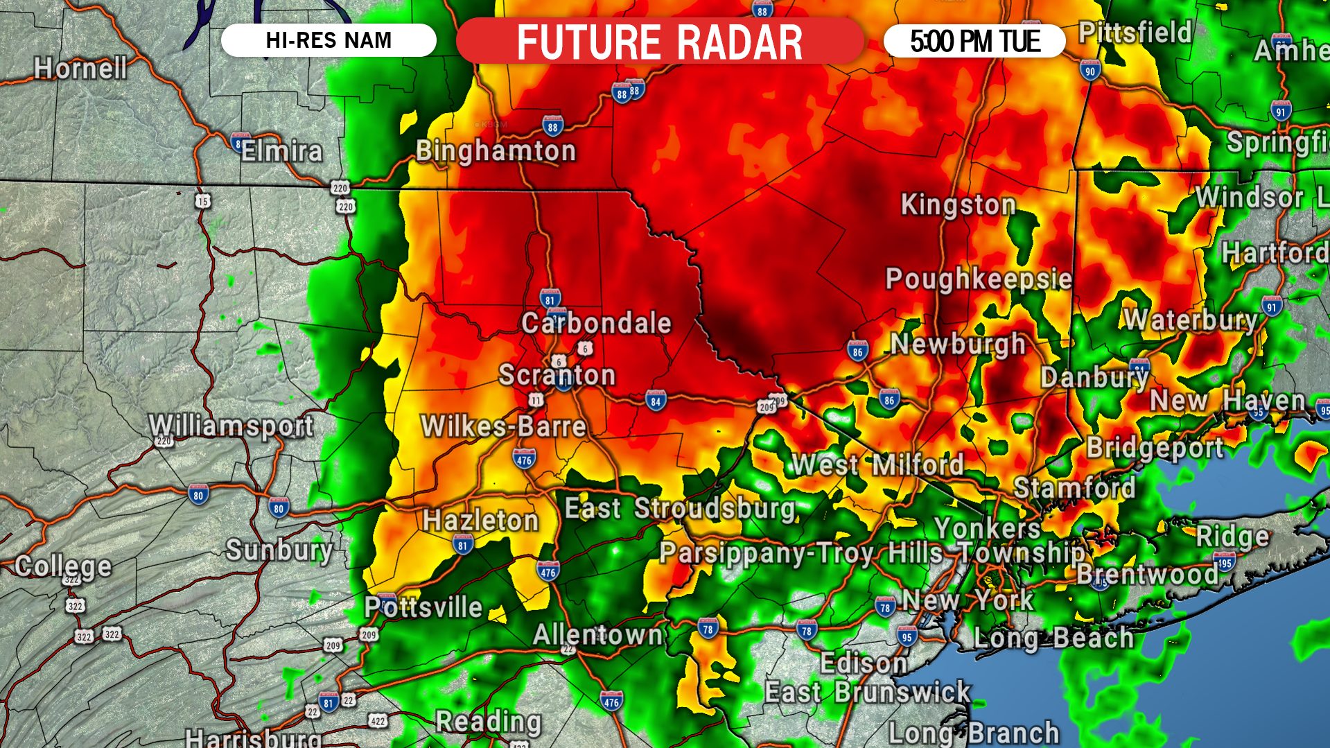
The worst of Isaias will move through Tuesday afternoon. By early evening, the heavy rain will likely be exiting northeast PA. The flash flood threat will begin to go down after dinnertime, but unfortunately we foresee many water rescues occurring during the Tuesday evening commute. Here is future radar for 5:00 PM.
ISAIAS FINAL CALL RAINFALL FORECAST MAP

Area A: Rainfall amounts of 3 – 5″+ expected, with the majority falling late Tuesday morning through the afternoon. Flash flooding is expected in areas with poor drainage. Wind gusts of 40 – 60 MPH likely.
Area B: Rainfall amounts of 2 – 3″ anticipated, mostly falling late Tuesday morning and afternoon. Flash flooding is possible in areas with poor drainage. Wind gusts of 20 – 40 MPH likely on the west side of this zone, and 40 – 60 MPH on the east side.
Area C: Rainfall amounts of 1 – 2″ expected. Isolated flash flooding is possible in areas with poor drainage.
Area D: Rainfall amounts of 1/2 – 1″ anticipated.
Turn around, don’t drown. Remember these facts from the NWS when considering driving through flooded roadways:
* Six inches of water will reach the bottom of most passenger cars causing loss of control and possible stalling.
* A foot of water will float many vehicles.
* Two feet of rushing water can carry away most vehicles including sport utility vehicles (SUV’s) and pick-ups.
Share this forecast and important advice with family and friends using the blue button.


You must be logged in to post a comment.