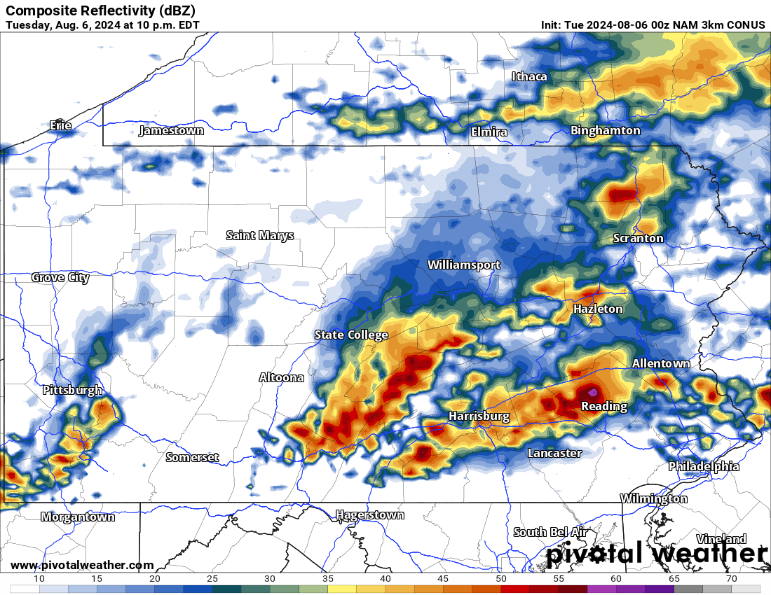
Today offers a real threat for flash flooding, especially during the evening and overnight hours tonight. Below is a look at the current radar:
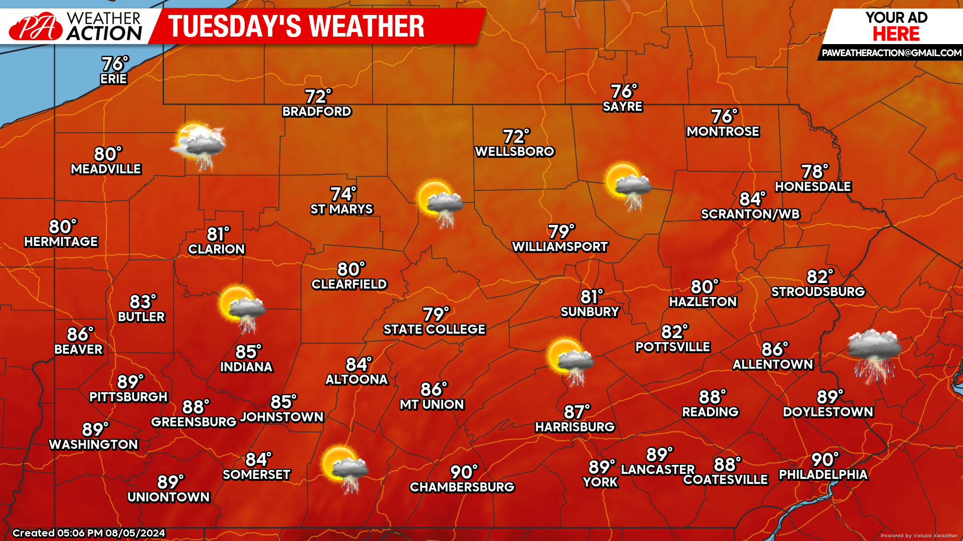
Today’s Weather Forecast: 6/10
A slow moving front will cause showers and thunderstorms to “train” over the same areas today, especially during the evening and overnight hours. Flash flooding will be a significant problem for locations hit by today’s thunderstorms. The biggest risk area for flash flooding will be across the southeastern counties.
Wednesday’s Forecast: 7/10
Most of Wednesday’s shower and thunderstorm activity will occur in the early morning hours, however isolated showers and thunderstorm will still be possible throughout the day. The biggest difference will be the temperatures which are not expected to get out of the 70s!
Hi-Res NAM Future Radar Valid Through 8:00 PM Wednesday:
Below is a look at the project Hi-Res NAM future radar illustrating the potential for thunderstorms capable of producing significant flash flooding as we head into the evening and overnight hours tonight. Use the top left of the graphic below for time reference:
Hi-Res NAM Rainfall Projections Through Thursday AM:
Please note that this is not a forecast and is simply a model projection. However, this does give us an idea on the potential for how much rain could fall in a short period of time. Where exactly the “jackpot” for rain develops is still something that we will have to nowcast heading this evening.
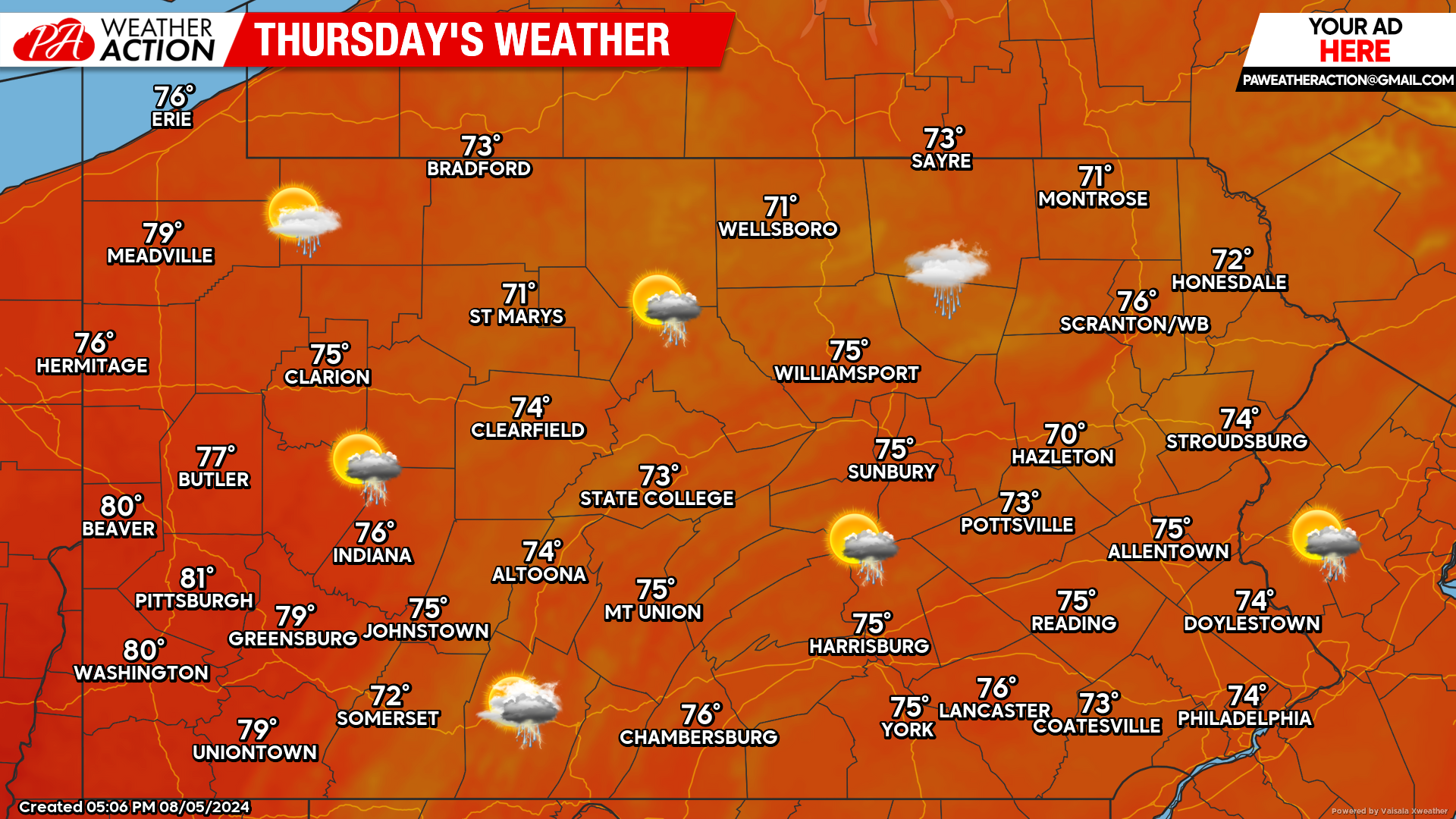
Thursday’s Weather Forecast: 8/10
Isolated showers and thunderstorms are possible Thursday, but not likely. Temperatures will range from the 70s to lower 80s.
Tropical Storm Debby Update:
First and foremost, all the rain mentioned above has nothing to do with Tropical Storm Debby. Debby is currently producing devasting rainfall across the southeast this morning. Although the exact track remains a question mark, odds are increasing that Debby’s remnants will make an impact to our area during the Friday-Saturday time period. Specific details will be ironed out over the next couple days. Stay tuned!


You must be logged in to post a comment.