
This summer has quickly turned into the summer of flash floods, and it dates back to May, when many PA climate sites recorded their wettest May on record.
However, we didn’t see much flash flooding back in May. But after such a rainy month, the saturated ground couldn’t absorb the torrential downpours of summer thunderstorms that followed.
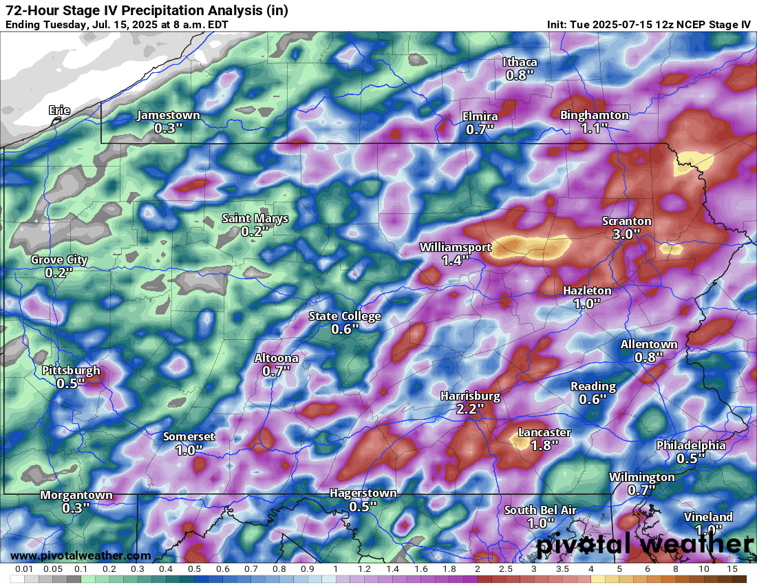
Here is a look at how much rain fell just in the last three days.
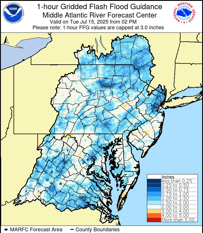
And if you wonder what that results in, here’s a look. Below is a map displaying how much rain would need to fall in one hour to result in flash flooding. In areas like Scranton/W-B, it would only take a 0.50″ of rain in an hour to cause flash flooding.
In Philadelphia, Harrisburg, York, and Lancaster, only about an inch of rain per hour would cause flash flooding.
Wednesday’s Flash Flooding Risk Forecast
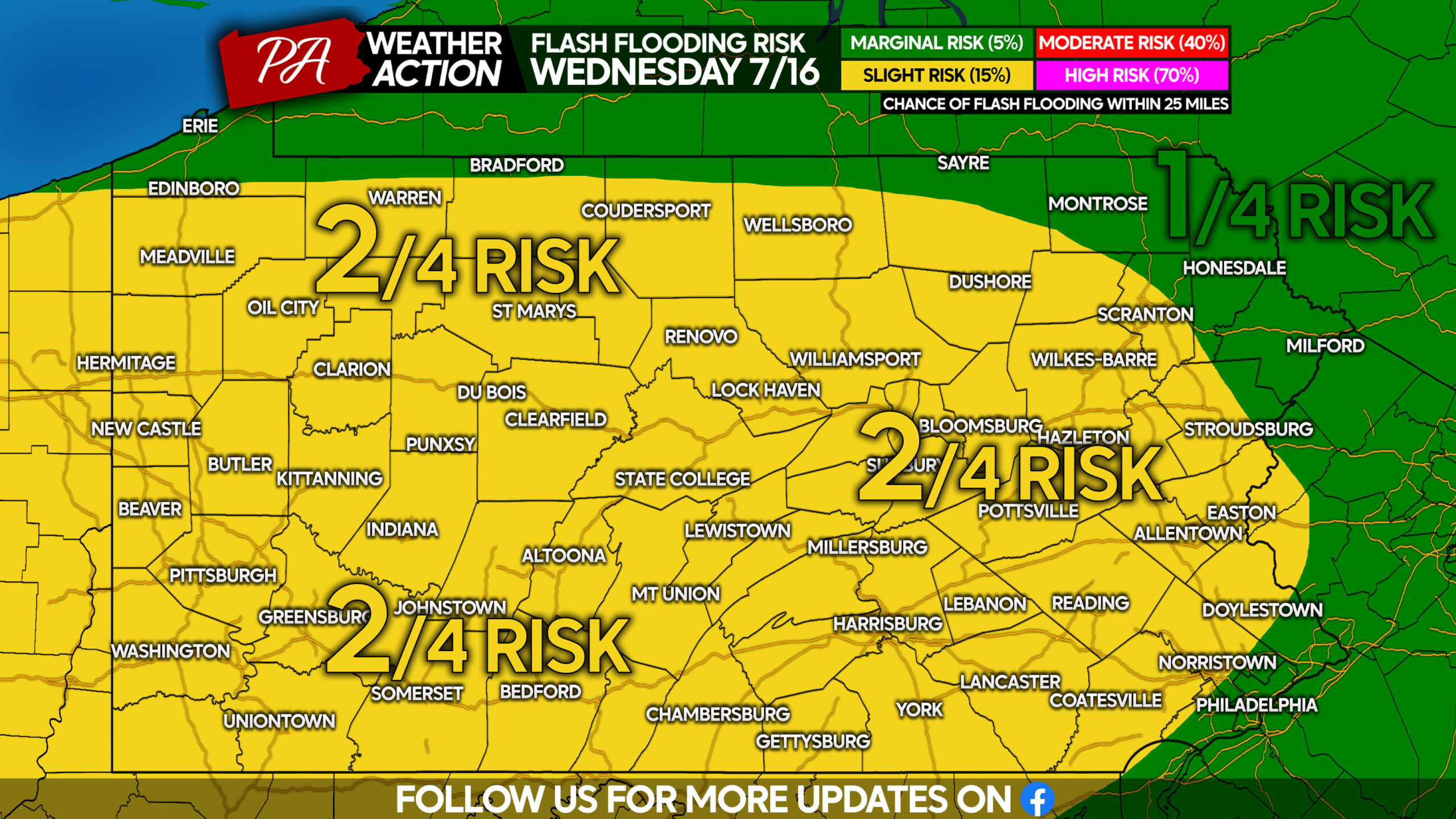
Almost all of the state is in a level 2 out of 4 risk, so not quite as high as Monday’s 3/4 in Southeast PA. We still expect it to be an active day with urban flash flooding especially. Areas that have recently experienced flash flooding are at greatest risk.
Rapid rises of small streams and creeks may also result in flooding roadways nearby. River levels are likely to be elevated going into the weekend.
Scattered storms will break out by mid to late Wednesday afternoon, especially in Western PA. These storms will be moving at a decent pace to the northeast.
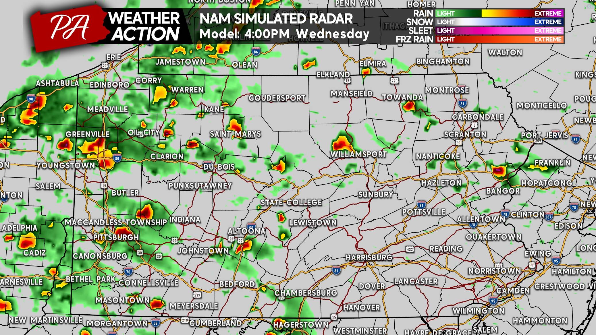
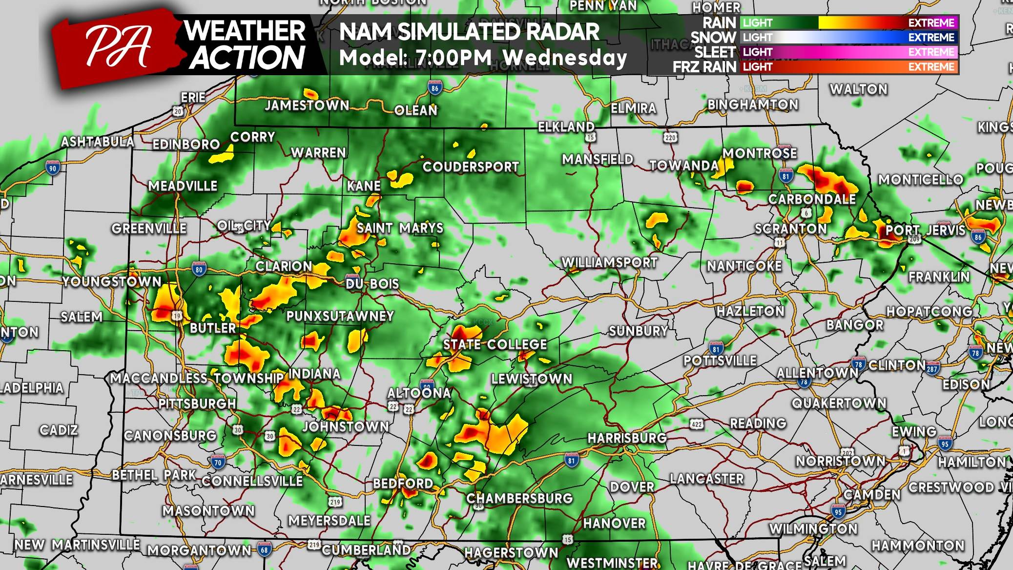
By 7:00 PM Wednesday, the Alleghenies will be the focal point of the heavy rainfall, with some scattered storms possible elsewhere.
Wednesday’s Severe Thunderstorm Risk Forecast
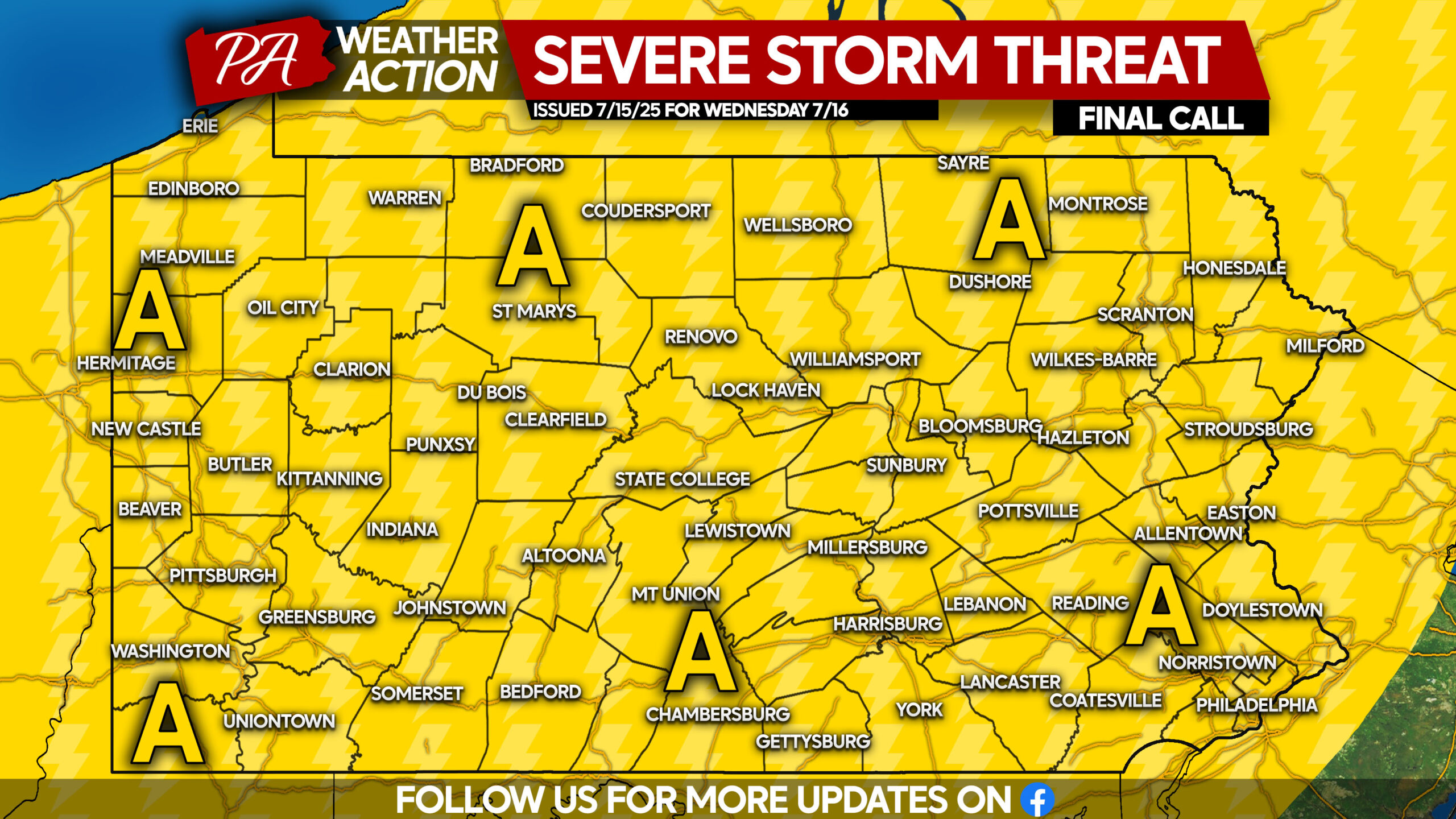
Area A: Scattered thunderstorms are expected, with a few containing gusty winds up to 60mph. Most storms will have more garden variety winds of 20-40mph. Frequent lightning and flash flooding are concerns as well.
The pattern looks to stay active in the coming weeks, so definitely try to take advantage of the dry days!
Don’t forget to share this forecast with family and friends below.
You must be logged in to post a comment.