


This is a very tough system to forecast, as there are three parts to it. It may still have a few more tricks up its sleeve, but here is how things stand now. Recent model trends in the past 12 – 18 hours have brought the incoming snow farther south and west in Pennsylvania. As a result, much more of the state is expected to get in on heavier accumulations. Widespread cancellations are likely Monday across all of the eastern half of the state. Let’s time it out below.
LATEST STORM TIMING
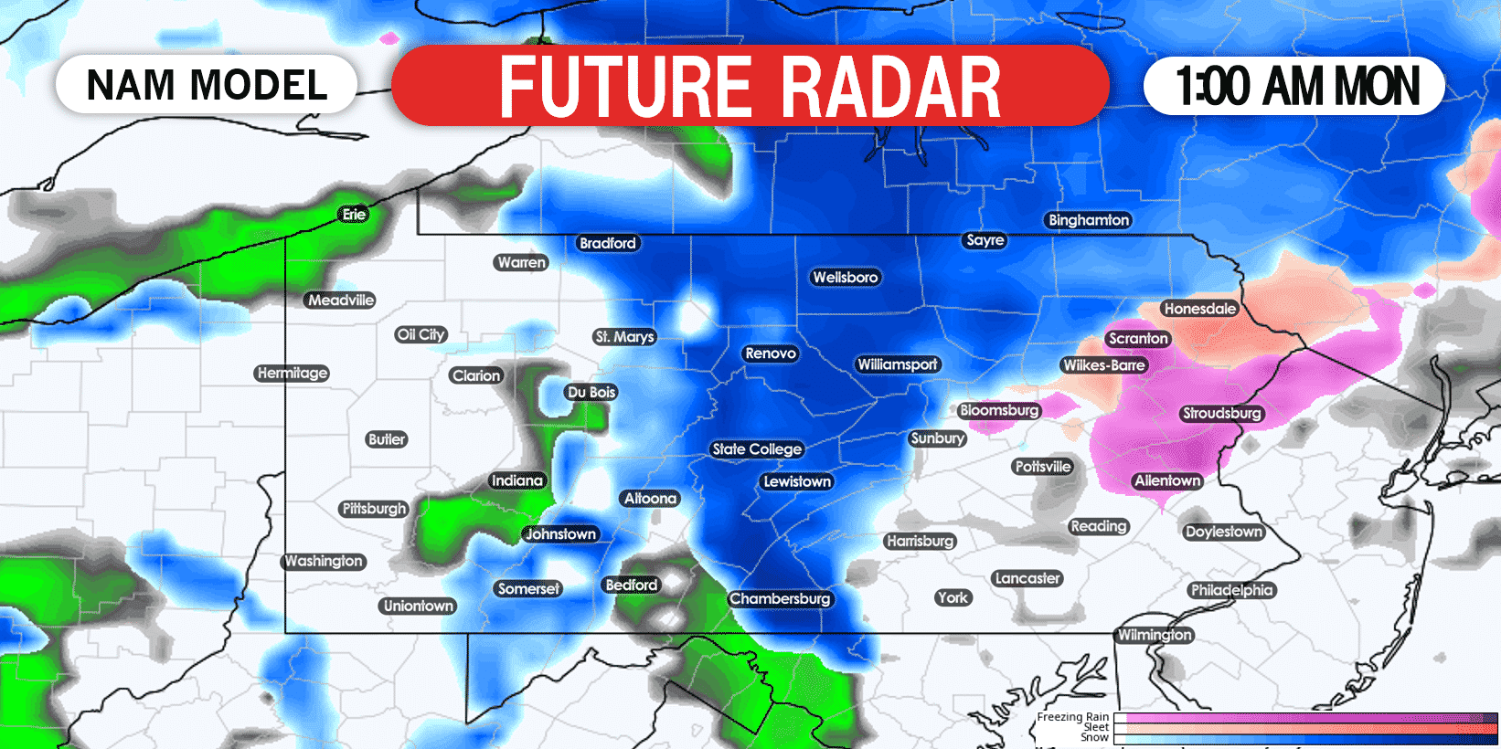
Snow is expected to begin in parts of central and northern PA by early Monday morning. Below is NAM future radar for 1:00 AM Monday.
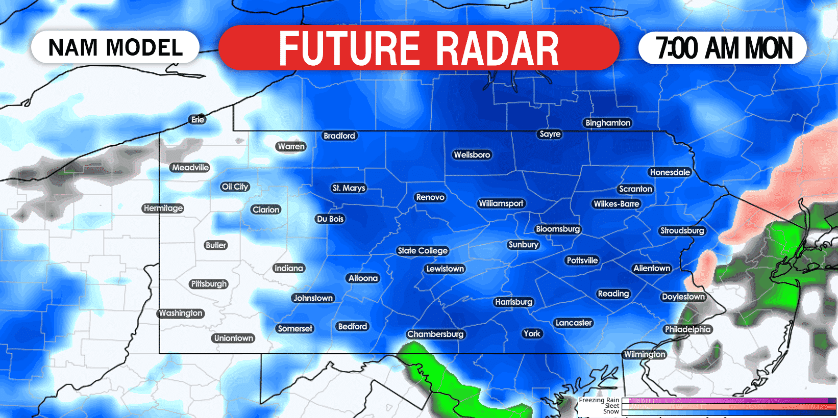
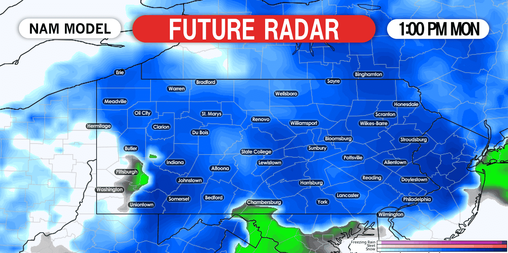
Temperatures Monday will be in the upper 20s in northern PA, and the low 30s in southern PA. It may have a tough time sticking to the roads in parts of the Lower Susquehanna Valley, unless heavier bands occur. Elsewhere in the state though, we expect snow-covered roads. Snow will continue all of Monday morning and into the afternoon in most of Pennsylvania. Below is future radar for 1:00 PM Monday.
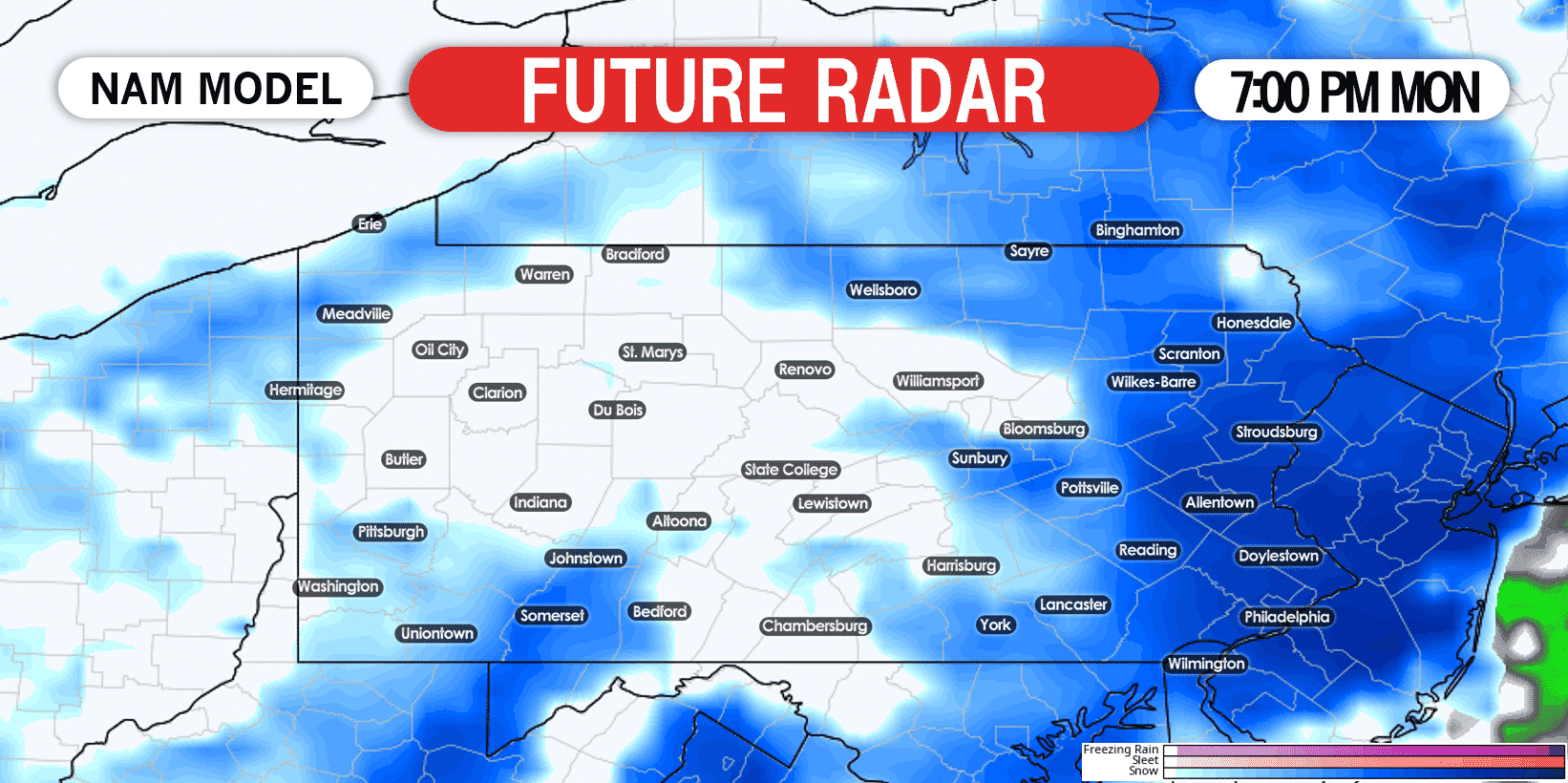
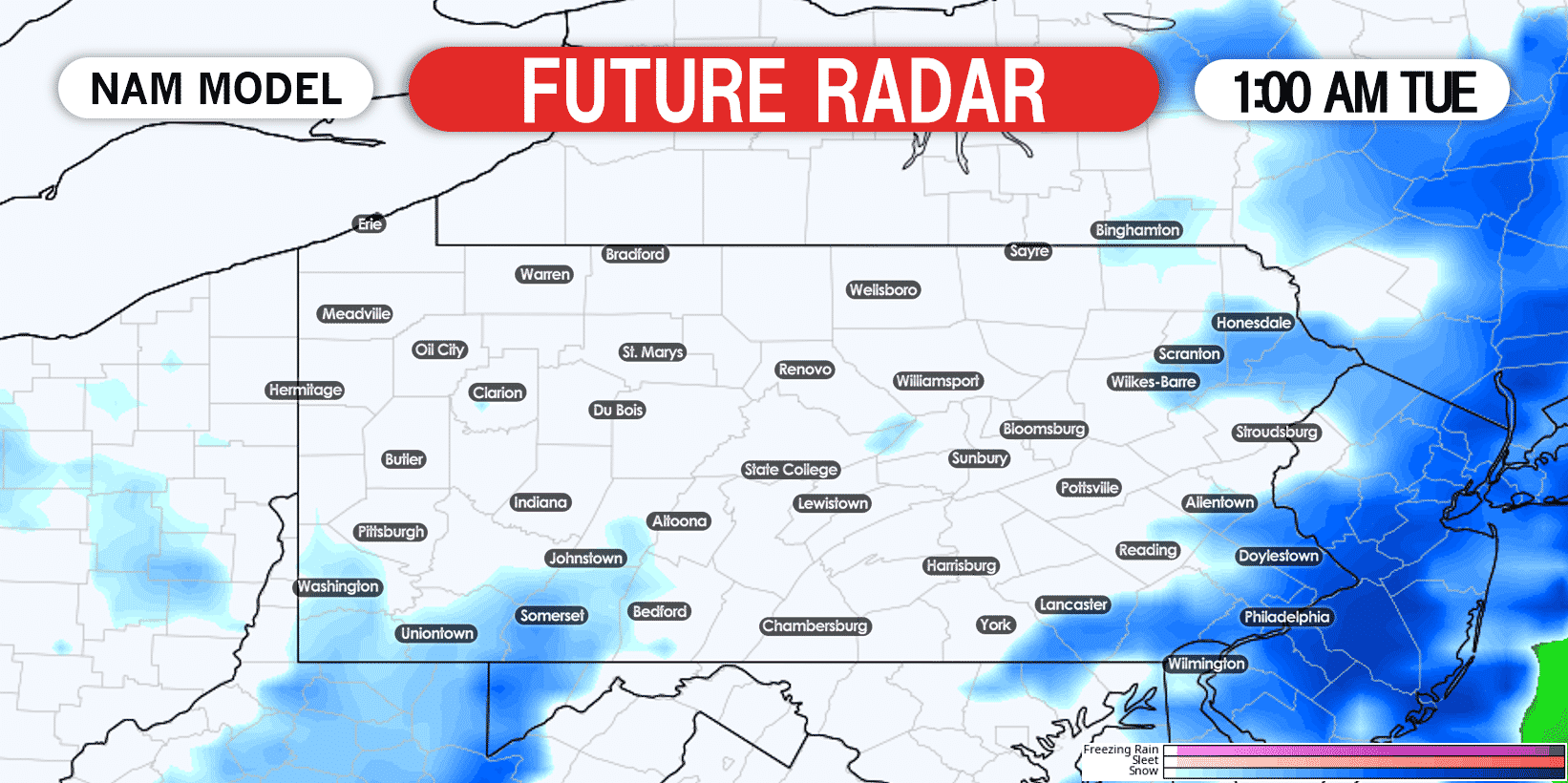
Finally by late Monday evening, snow will come to an end in most of eastern PA. Here is future radar for 1:00 AM Tuesday.
FINAL CALL SNOWFALL FORECAST FOR NOW – TUESDAY AM
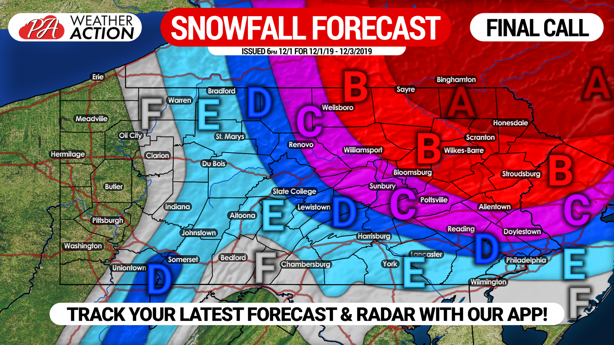
Area A: Snow accumulation of 10 – 14″ expected. Snow-packed roads likely Monday, causing closings.
Area B: Snow accumulation of 6 – 10″ anticipated. Snow-packed roads likely Monday, causing closings.
Area C: Snow accumulation of 4 – 6″ expected. Slushy and snow-covered roads may cause delays/closings Monday.
Area D: Snow accumulation of 2 – 4″ anticipated. Untreated roads will become slushy.
Area E: Snow accumulation of 1 – 2″ expected.
Area F: Snow accumulation of <1″ expected on grassy surfaces.
Be sure to share this new forecast with your friends and family in the area! You can track updates to this forecast, as well as your local hourly & daily forecast, radar, and more with our free app >>> Weather Action App
You must be logged in to post a comment.