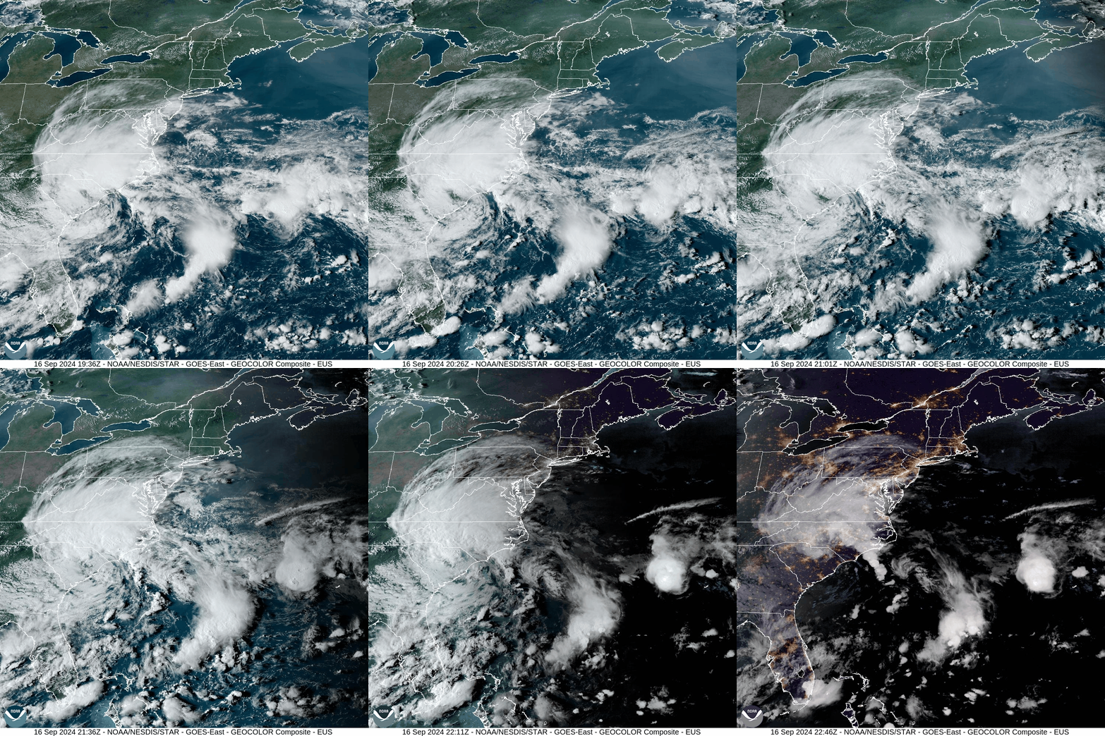
Our stretch of blazing sunshine will yield to tropical system over the Carolinas that will crawl northward over the next few days. Tropical downpours will also crawl northward with the system over the next couple of days but they should remain south of our area. Some high clouds were visible in our skies this afternoon, evident by the visible satellite loop.
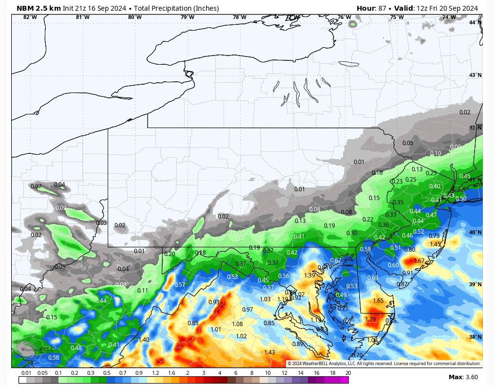
Anticipated rainfall through Friday morning:
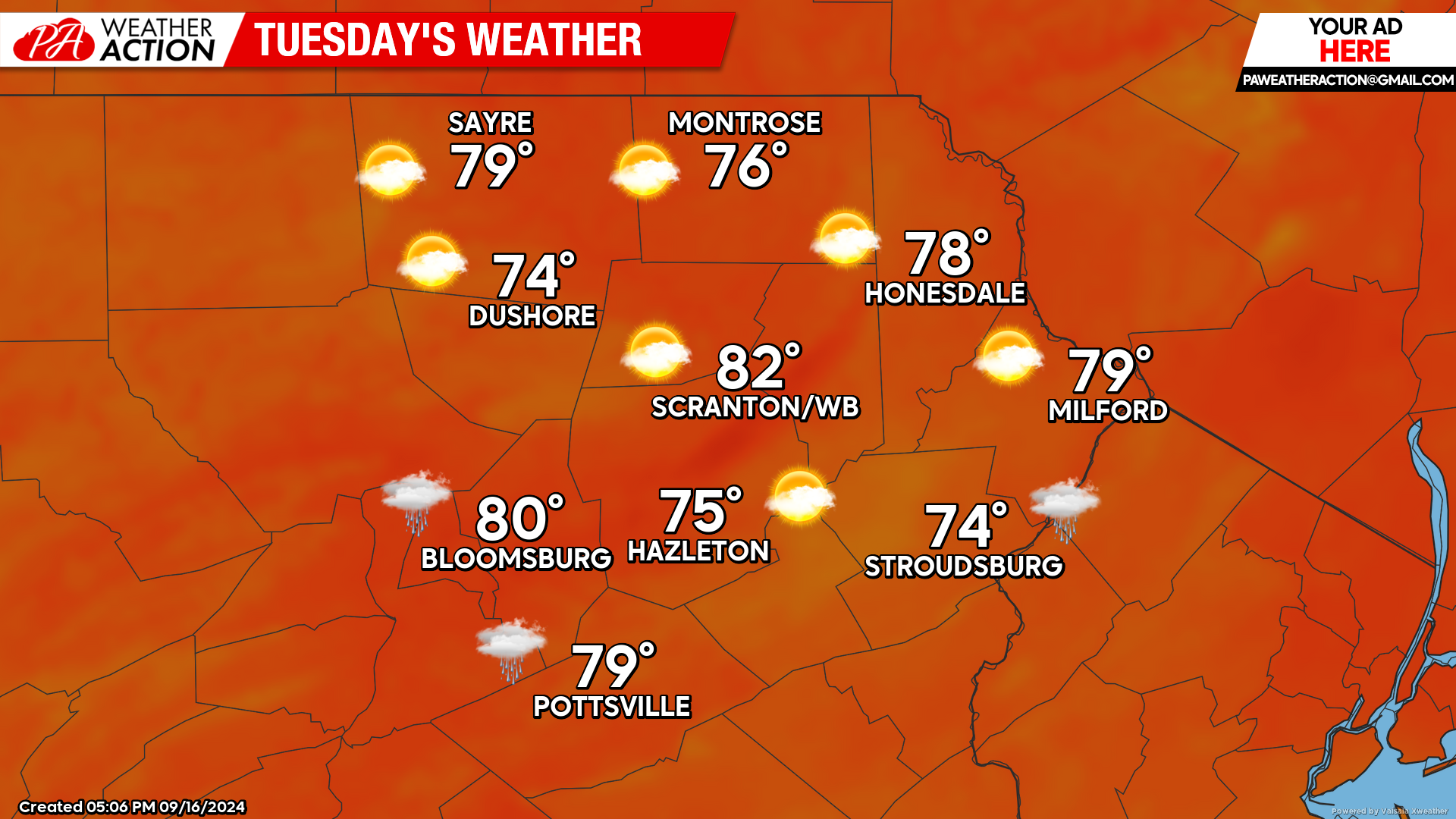
TUESDAY
The system to our south will induce a gentle wind from the east. Temperatures will be slightly above-normal, and humidity will increase somewhat as the system circulates air off the warm Atlantic.
Clouds will spiral into our area, likely obscuring the partial lunar eclipse in the overnight hours across our southern counties. Some showers could work into our area as well, especially during the afternoon and overnight hours, but the heavy tropical downpours should remain to our south.
However, it remains possible places in the northern half of our area could remain clear-enough to observe the partial lunar eclipse of the Harvest Supermoon. For those who want to watch, the moon will start to be covered by the Earth’s full shadow by 10:13 PM. The peak of the eclipse will be at 10:44 PM with only 8 percent of the Moon covered. The Moon will finish exiting the full shadow at 11:16 PM.
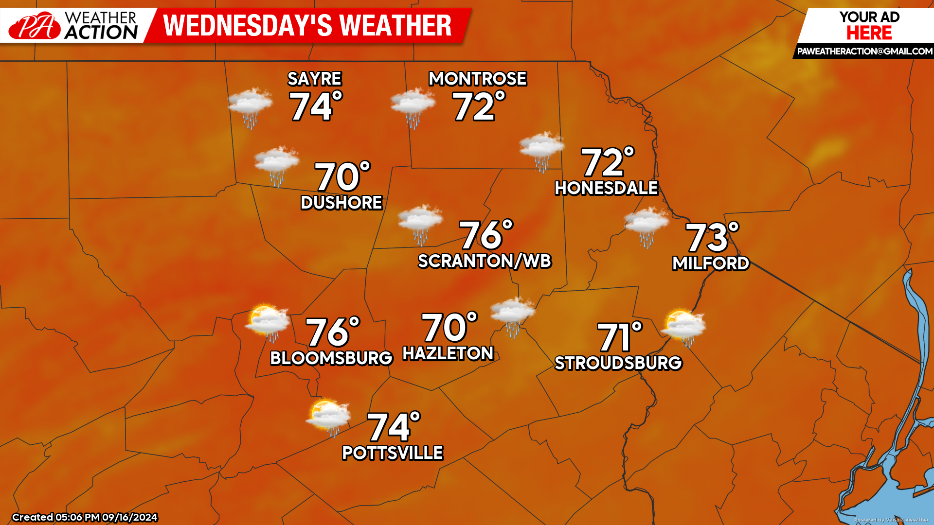
WEDNESDAY
Clouds and potential showers will continue to work into our area, along a breeze off the Atlantic. Precipitation amounts should unfortunately be light, as we are in an extended dry spell. Temperatures will remain above normal with summery humidity. This humidity will also help keep nighttime temperatures mild, with overnight lows barely falling into the 50s this week.
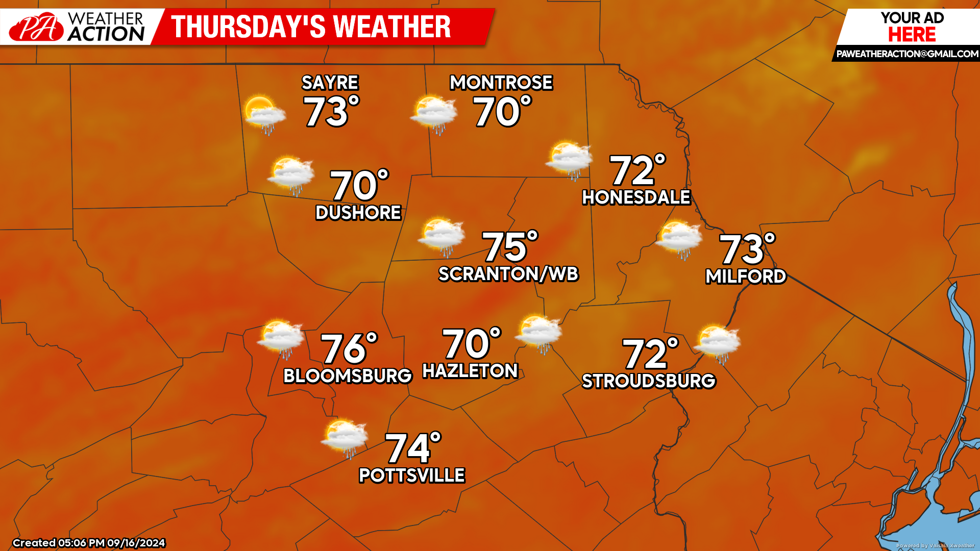
THURSDAY
Thursday will be another day of clouds and potential showers, although at this time rainfall amounts still look to be light. A breeze off the Atlantic along with above-normal temperatures and slightly summery humidity will continue.

You must be logged in to post a comment.