
Good afternoon! It is surely a wonderful afternoon across the region with temperatures sitting in the 70s under mostly sunny skies. I hope you have had the opportunity to enjoy the warm and sunny conditions over the last few days because significant changes will be coming to the forecast over the next 36-48 hours, ushering in fall-like air into the region.
FRIDAY:
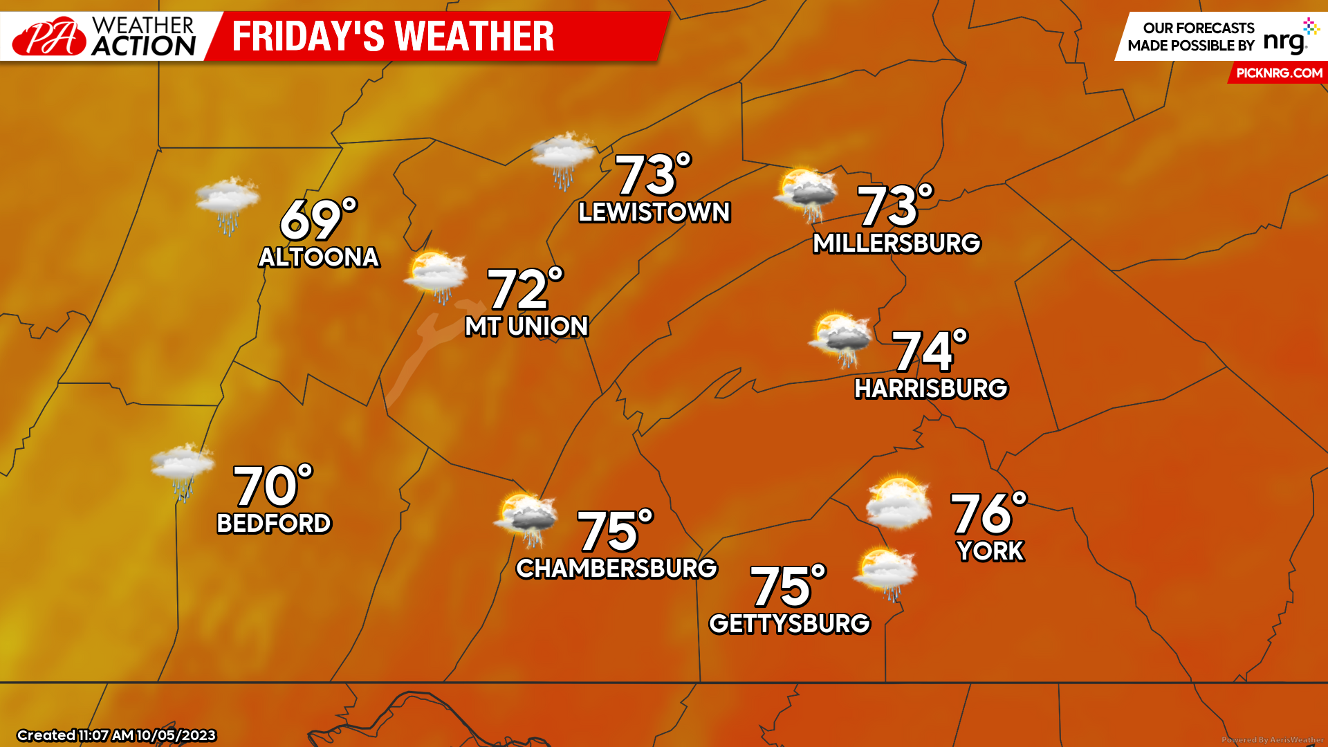
Friday will feature the last day of widespread warmth as temperatures rise into the upper-6os to mid-70s. Unfortunately, the warmth will be aided in the threat for showers and thunderstorms, especially during the latter half of the afternoon and evening hours. Keep in mind, not every single location will experience showers and/or thunderstorms tomorrow due to the overall scattered nature. Expect a southerly wind of 5-10 MPH during the afternoon hours.
FUTURE RADAR:
A few showers will begin to move into the western portions of the region by the mid-afternoon hours, primarily along the I-99 corridor. 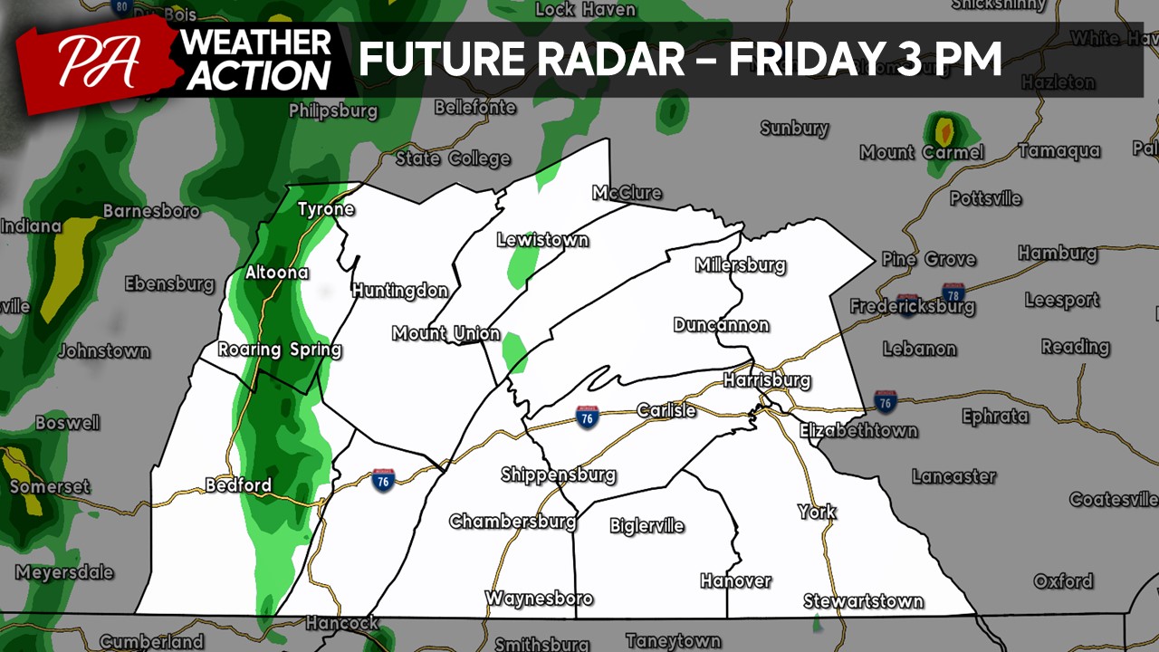
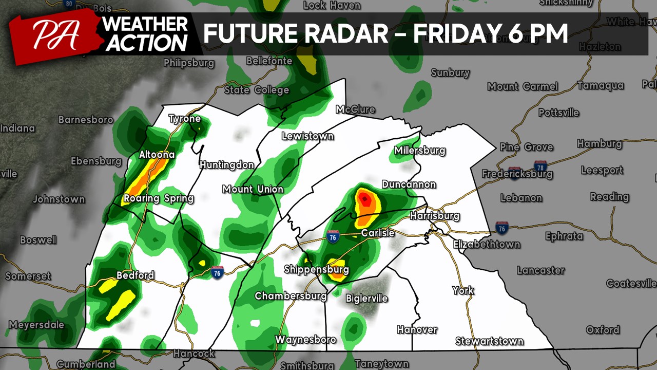
By the dinner hour, we will see a scattered amount of showers and potentially a few thunderstorms (denoted by the warmer colors). Severe weather is NOT currently anticipated, however, a few stronger thunderstorms may produce gusty winds, torrential downpours, and lightning. Remember to head indoors if you hear thunder in the vicinity!
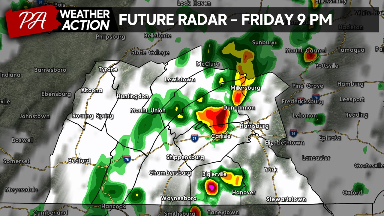
By the 9 PM hour, the majority of the precipitation will continue to move eastward, impacting much of the Harrisburg area with scattered showers and thunderstorms.
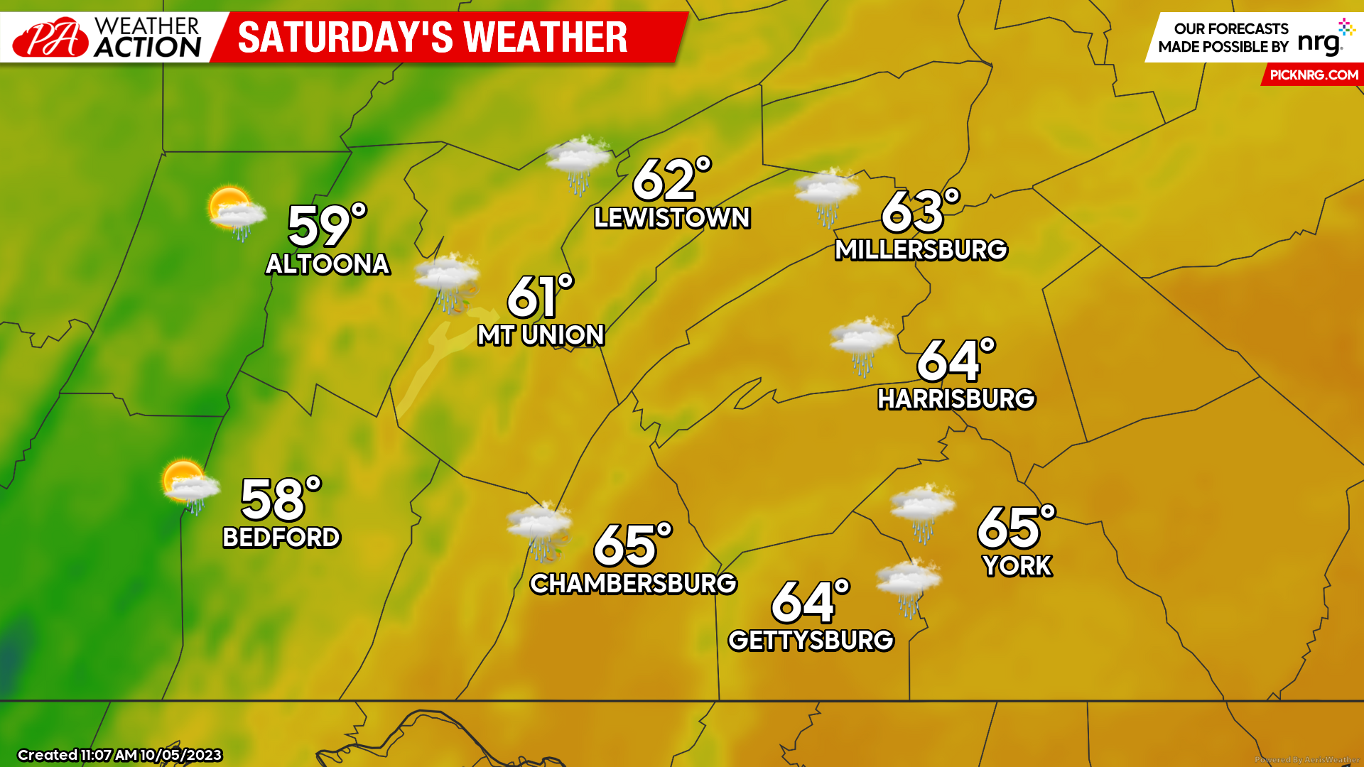
SATURDAY:
As the cold front moves through the region, Saturday we will see a step down in the high temperatures with many areas ranging from the upper-5os to mid-60s with rain showers expected, primarily before 3 PM across the area. On top of the cooler conditions, we will have a westerly wind of 10-20 MPH with gusts potentially reaching 25-30 MPH, making for an uncomfortable afternoon.
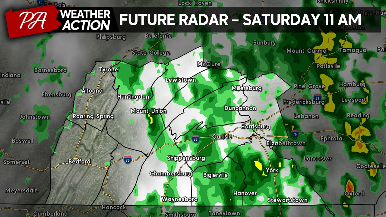
FUTURE RADAR:
Scattered showers will be impacting much of the central and eastern portions of the region by late Saturday morning. If you are planning to head out for lunch, make sure to bring the umbrella and rain gear!
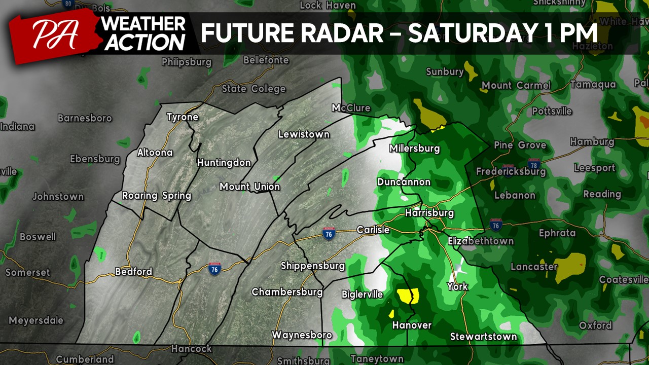
The precipitation will continue to track further east by 1PM, with much of the western and central zones beginning to dry out and will see a mix of sun and clouds as drier air begins to move into the area.
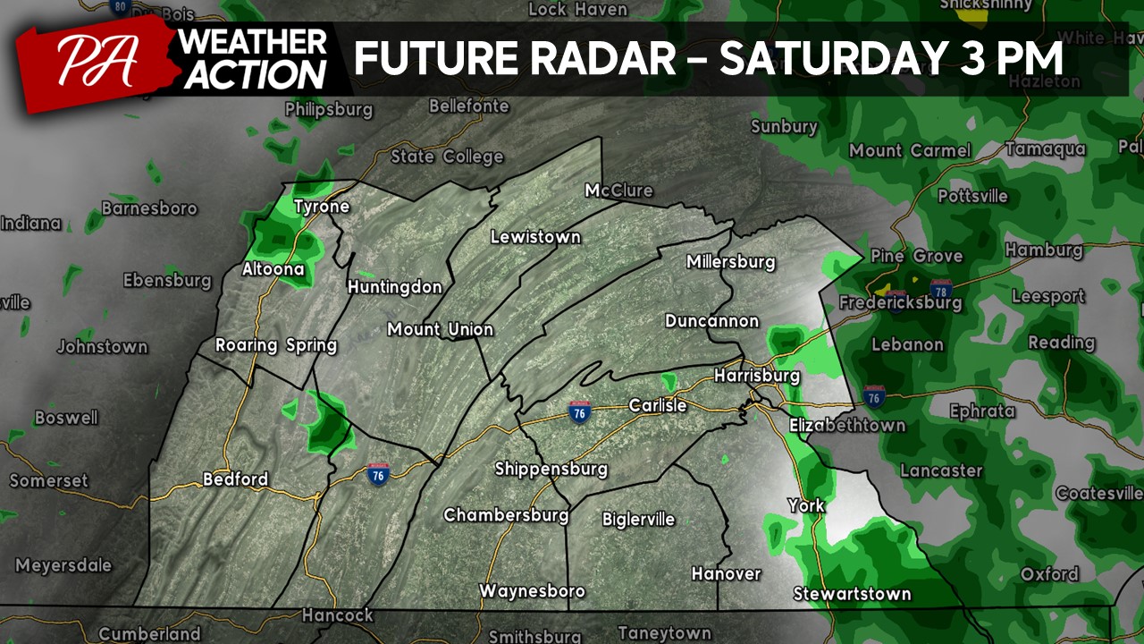
By the mid-afternoon hours, the majority of the precipitation will have moved out with a mix of sun and clouds across the region. A few showers cannot be ruled out during the remainder of the day.
SUNDAY:
Sunday will feature some of the coolest conditions yet this year. Expect high temperatures to range from the lower-50s to upper-50s, with a few of the highest elevations barely reaching to hit 50-degrees. Expect sustained winds of 15-20 MPH out of the northwest with gusts 30-35 MPH at times, making for quite a windy afternoon and it may feel a lot cooler at times! It will be mostly dry with a mix of sun and clouds, although portions of western Blair and Bedford Counties may see a few showers during the afternoon hours.
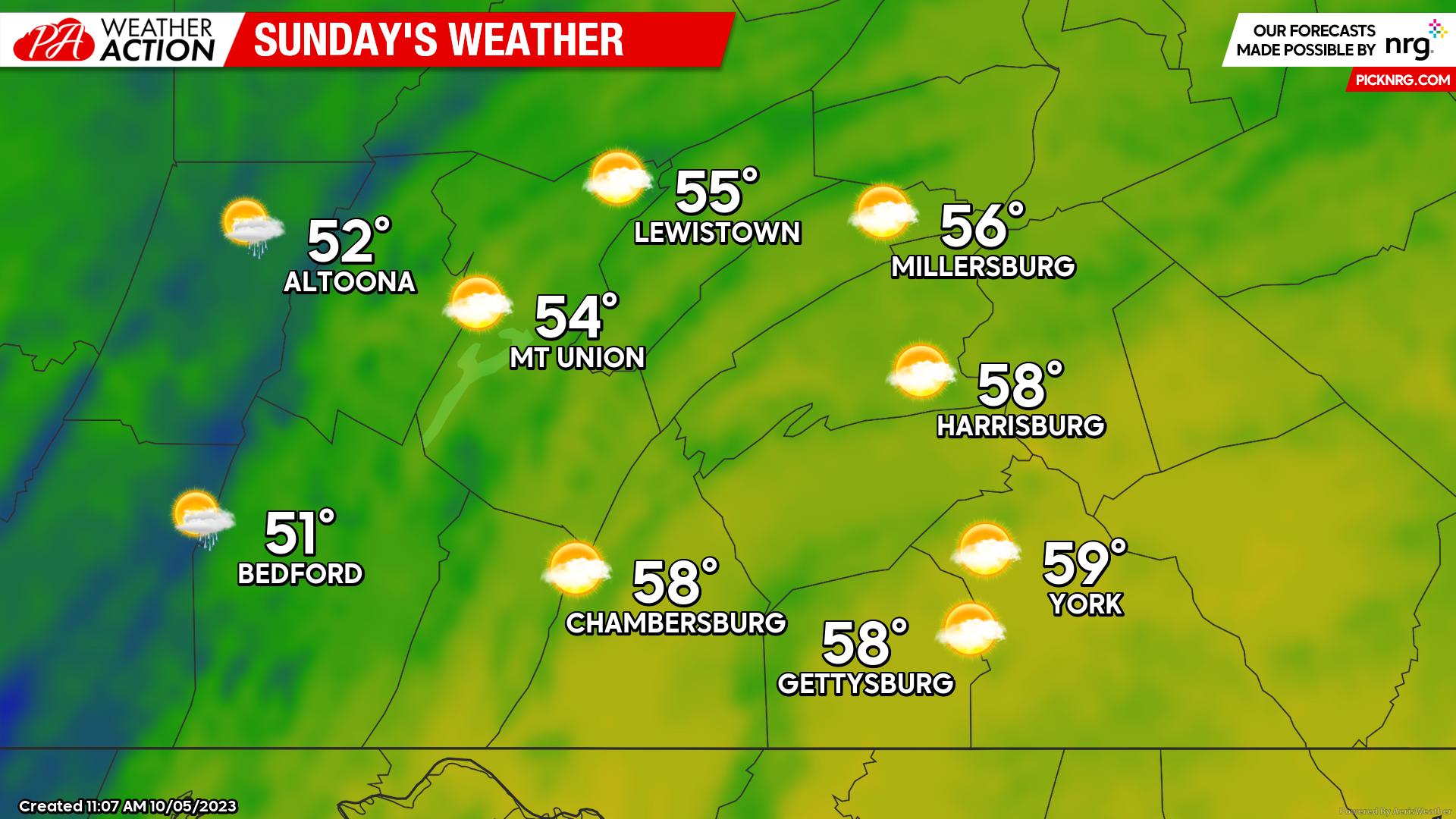
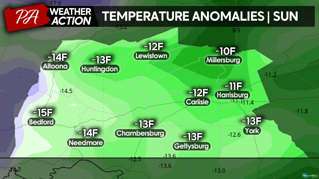
High temperatures Sunday afternoon will range from -10 to -15 degrees below average, a complete 180 reversal from temperatures that were recorded earlier this week! Make sure to bring out the hoodies and pants if you have not done so yet as Sunday will be quite chilly!
Moving past this weekend, we will be going into a more October-like pattern with cooler days and multiple rain events possible throughout next week. It is also quite possible, depending on the sky cover each night, there may be the potential for the first frost of the season early next week (more details coming soon…). Anyway, have a great weekend and feel free to reach out with any questions or concerns. Download the PA Weather Action app for more updates!
Denys
You must be logged in to post a comment.