
Hurricane Florence has brought historic amounts of rainfall to North Carolina over the last several days and close to record breaking rainfall amounts in surrounding areas. Now that Hurricane Florence remnants are officially pushing north, we can expect a rainy Monday as moderate to heavy rainfall is expected state-wide. The rainfall may linger into Tuesday, but Tuesday’s rain will be more scattered.
Initially, it did appear that our area would be impacted Tuesday into Wednesday by Florence’s remnants. However, the time-frame has been pushed forward roughly 24 hours. What has not changed, is the track. The good news is, the expected rainfall amounts have DECREASED over the last couple of days. With that being said, we still expect a wash-out for many areas tomorrow and a dreary Tuesday.
Below is a look at the future radar valid for 8:00 AM tomorrow morning: 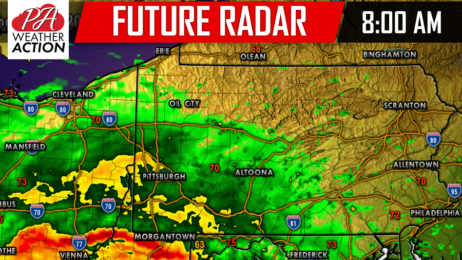
The rain will begin to push into our southwestern counties in the mid-morning hours and will steadily push northeastward as we head into lunchtime. Below is a look at 12:00 PM tomorrow afternoon: 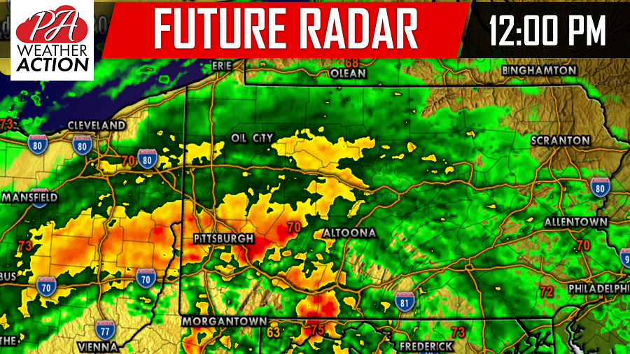
There will be bands of heavy rain tomorrow that could put down over an inch of rain in an hour alone in some locations. Especially under these red and yellow bands you see on our future radar.
Taking the future radar forward to 4:00 PM tomorrow afternoon, you can see the rain has overspread the whole state with a dry slot forming over our southwestern counties: 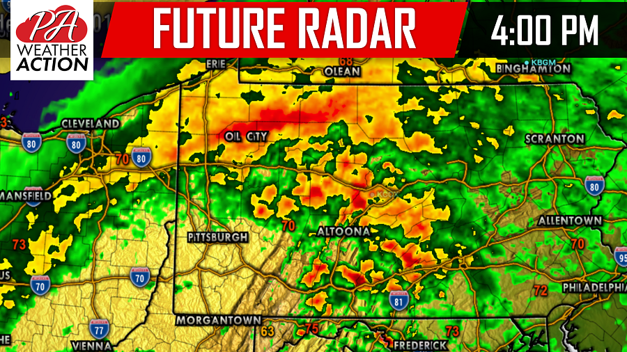
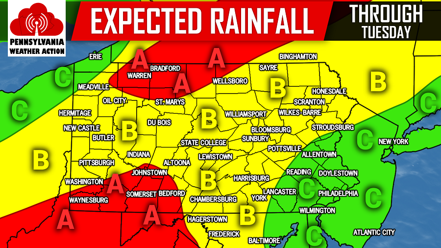
EXPECTED RAINFALL AMOUNTS THROUGH TUESDAY:
Area A: 1 to 2 inches of rainfall, with isolated locations receiving 3 or more inches of rainfall. Flooding is a concern for the local areas that do receive upwards of 2-3″+.
Area B: 0.5 to 1 inch of rainfall is expected with isolated locations receiving 2 or more inches of rainfall. Flooding is less of a concern for these areas, but still possible for the local areas that receive more than 2 inches of rainfall.
Area C: Up to 0.5 inches of rainfall is expected with isolated locations receiving more than 1 inch of rain. Any flood threat should be limited in these areas.
For more updates on the rain from Hurricane Florence and much more, like us on Facebook by clicking here>>>Pennsylvania Weather Action’s Facebook page
Download our free app to today to stay ahead of Florence’s remnants with the latest weather alerts and traffic conditions, click here>>>Pennsylvania Weather Action’s App
Share this article with your family and friends using our icon below!
You must be logged in to post a comment.