
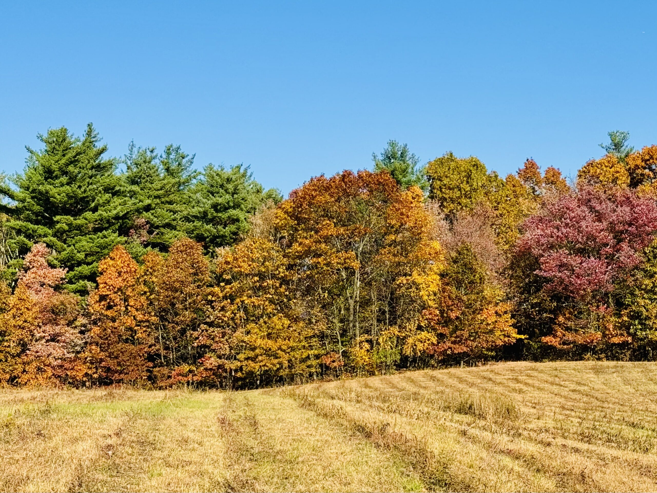
After starting the day in the 30s, strong sunshine on the dry ground and half-barren forests drove temperatures into the 80s in the southern valleys today! Southwest winds also delivered higher humidity today. This will result in a much-milder evening than last night. Meanwhile, Tsuchinshan–ATLAS remains visible in the western sky for a couple hours after sunset. It is moving away from Earth and is now quite a bit dimmer than it was last week. It is still a great sight when viewed through binoculars or a small telescope!
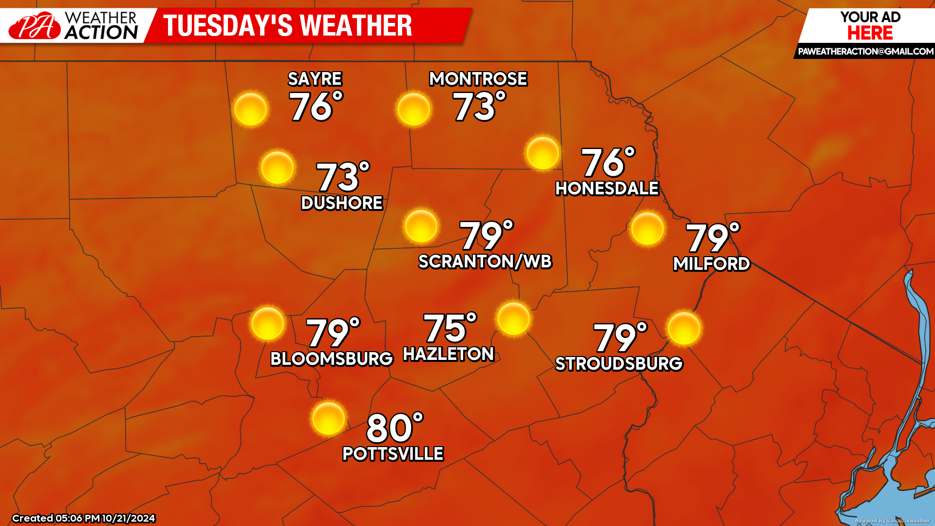
TUESDAY
Tuesday will be extremely warm for this time of year. Morning temperatures will start in the 40sm and afternoon temperatures will soar to 80 in the warmer valleys under blazing sunshine!
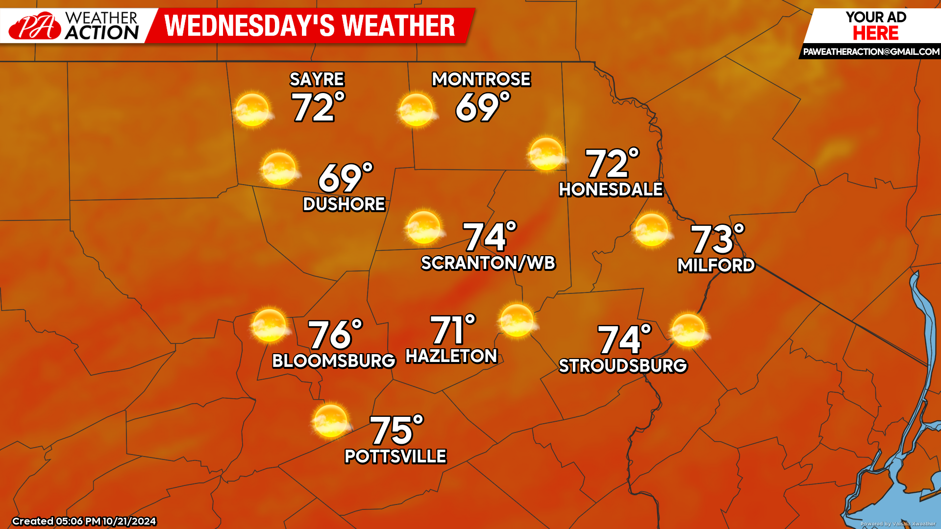
WEDNESDAY
Wednesday will be another very-warm day, with a mild start and temperatures climbing well into the 70s for much of the area. It will also feature gusty southwest wind ahead of an approaching cold front which will cross the area after sunset. There could be some dying showers with that cold front, but not much precipitation is expected. It will, however, end our autumn heat wave.
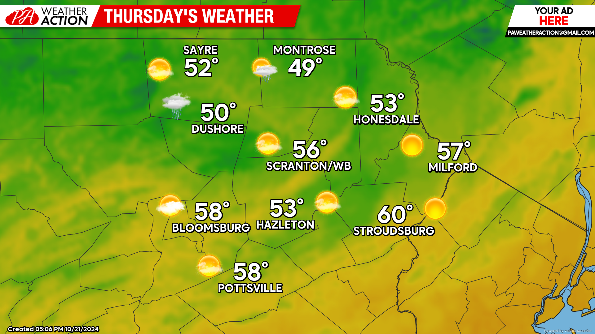
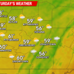
THURSDAY
Gusty winds from the northwest will drive colder air into our region. Morning temperatures will be near 40 in most locations, and low 40s in the southern valleys. Afternoon temperatures will only reach into the 50s for most locations (which is slightly above-normal for this time of year). There could be some showers surviving into the northern counties although most locations will be dry with partly sunny skies. For those of you hoping for perhaps another warm day, there is an opportunity early next week…

You must be logged in to post a comment.