
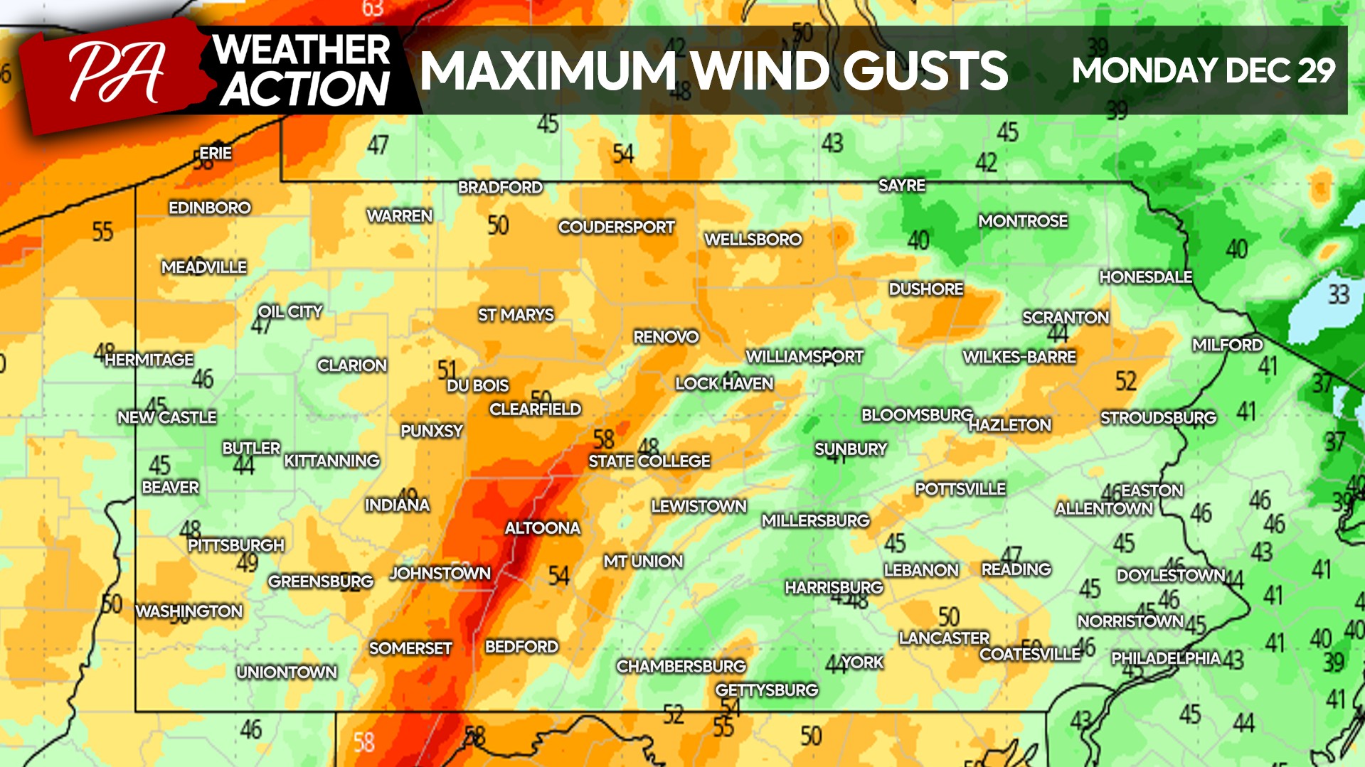
After a brief warmup, cold air will rush in Monday accompanied by wind gusts of 40-55mph. And as you’d expect in late December, lake effect snow will fly in Western and Northern PA. High wind alerts are up across the entire state, so be sure to secure Christmas decorations!
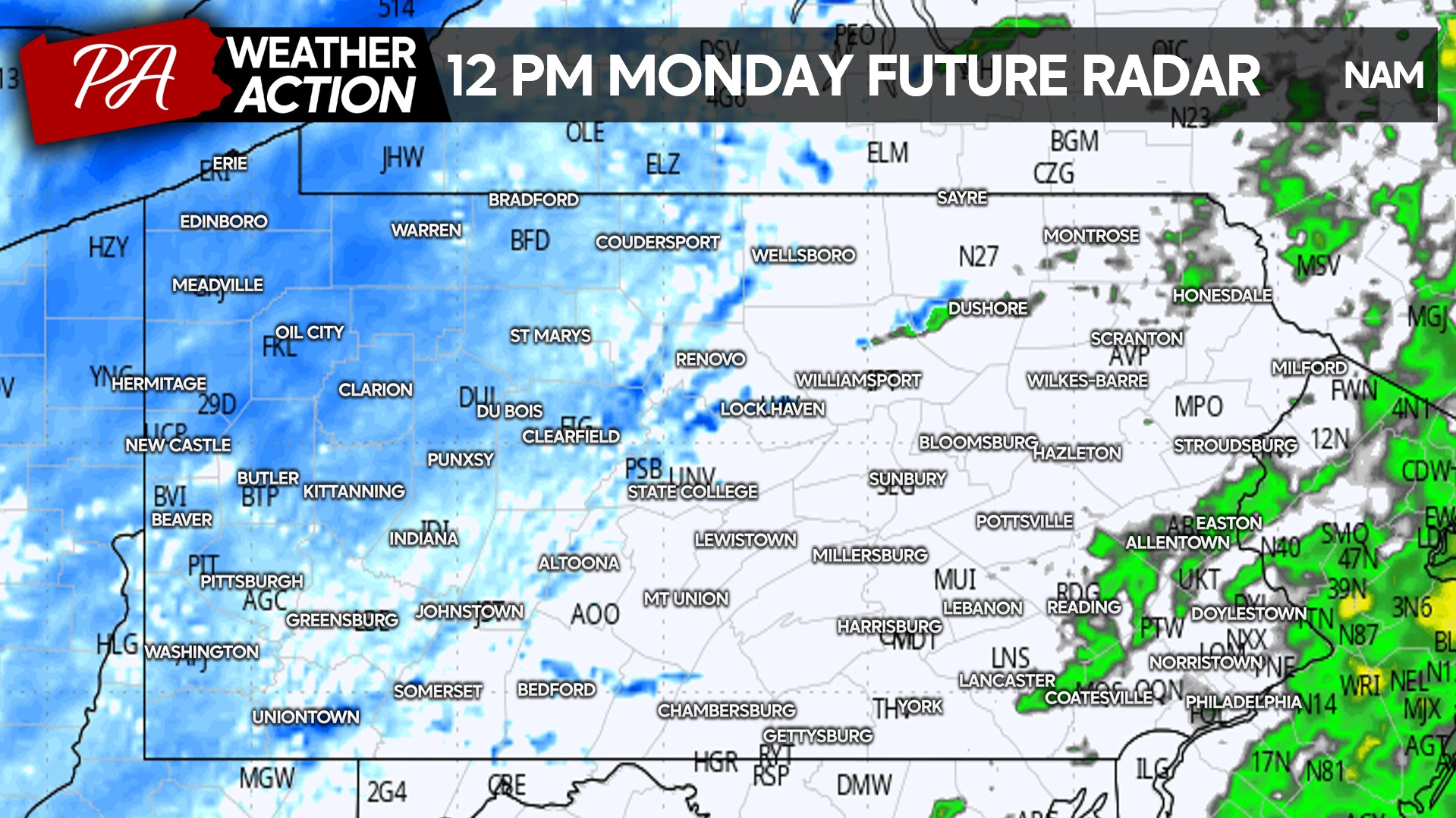
Lake effect snow showers will begin late Monday morning, with mainly light snow in Western PA. Temperatures in the 20s will promote immediate accumulation. Here is the Hi-Res NAM model for 12:00 PM Monday.
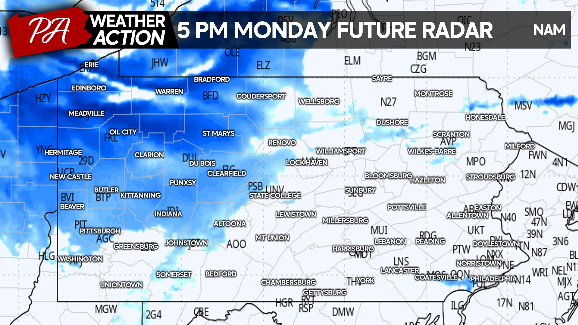
Snow squalls will quickly ramp up in Northwest PA as we head into Monday evening with occasional low visibility amidst whiteout conditions. This is future radar for 5:00 PM Monday.
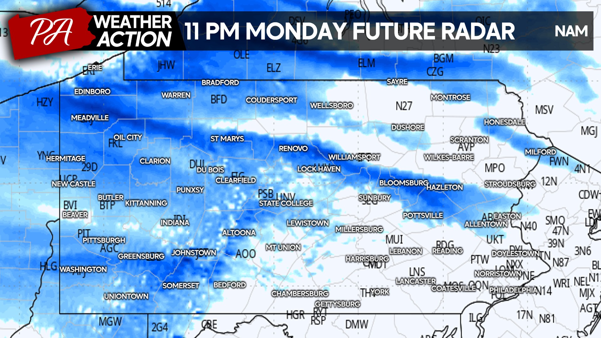
Travel will be treacherous late Monday evening on I-79 in Northwest PA, along with parts of I-80 and Route 15. This period is when snow squalls will push farther into the Appalachians, while squalls to continue across NW PA.
Lake effect snow will begin to wind down Tuesday, but this will be a brief intermission before another round of snow hits midweek. Below is the Hi-Res NAM for 11:00 AM Tuesday.

FINAL CALL SNOWFALL FORECAST FOR MONDAY – TUESDAY IN PA
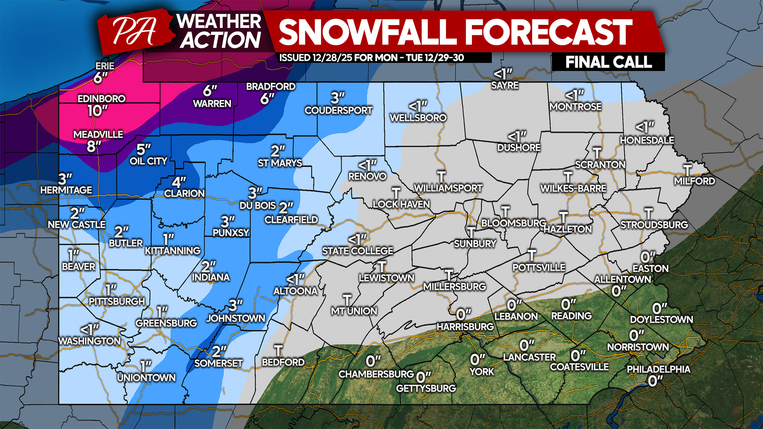
Heaviest accumulations will be across the Northwest PA lake effect belts where 8-12″ of snow are expected. As you push into the Alleghenies of NW PA, snow squalls become a bit less concentrated and amounts drop to 5-8″.
The Laurel Highlands are looking at 2-4″ with highest accumulations near Seven Springs, with similar totals up the spine of the Alleghenies. Southwest PA should land on either side of 1″, along with places like Altoona and State College. Trace amounts of snow are possible in scattered snow showers Monday evening east of the mountains.
Don’t forget to share this forecast with family and friends who may be traveling home for the holidays during this time!
You must be logged in to post a comment.