Good afternoon, Wednesday ended up being a long night of loud thunder, destructive hail, flooding and strong damaging winds as the cold front moved through Oklahoma and Kansas. Now we set our eyes to Texas and Louisiana for Thursday for another big system pushing through.
Thursday’s enhanced threat across Texas and parts of Louisiana.
A large weather system will move through the Southern Plains and the Gulf Coast States on Thursday bringing tornadoes, very large hail, strong damaging winds and lots of heavy rains into Central, South and East Texas this afternoon and evening, then into Louisiana overnight. Please see the SPC risk map below. 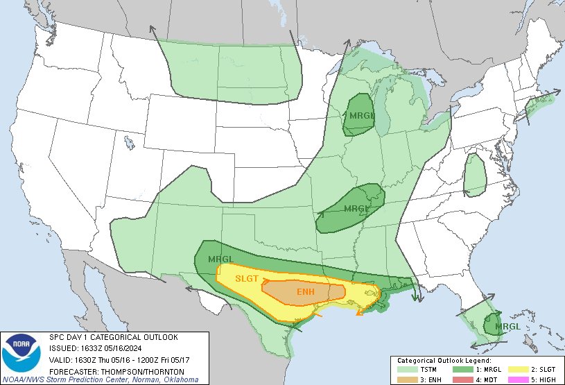
An elevated tornado concern for East Texas today and tonight.
The latest HRRR Significant Tornado Parameter highlights an increasing concern for East Texas later today and into tonight. The greatest concern for tornadoes and very large hail looks like Central Texas into East Texas with Houston Metro being in the middle of it. Check out the map for details. 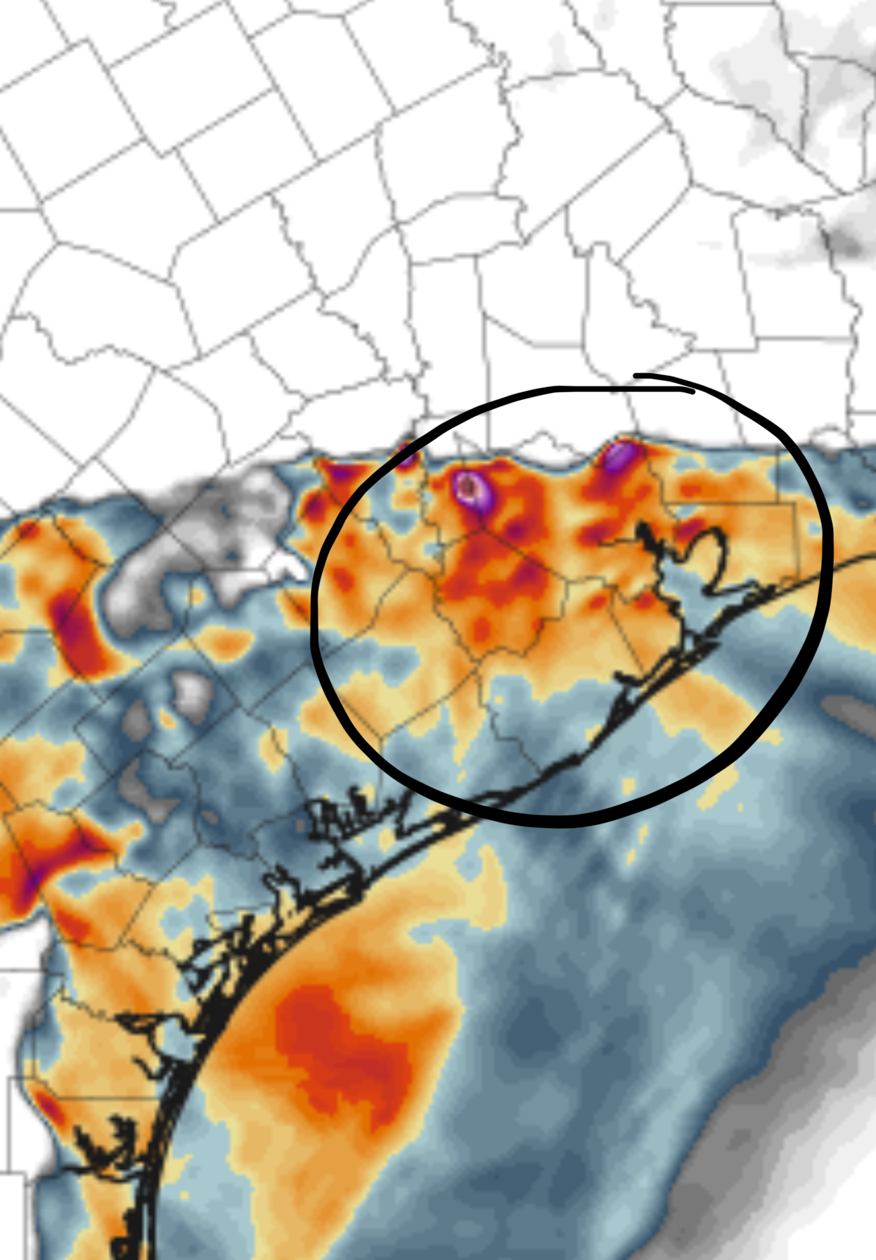
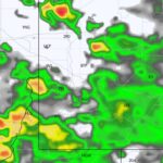
Here is the HRRR future radar for Thursday.
The future radar shows multiple convective system with supercells tonight with very large hail, tornadoes, strong damaging winds and heavy rains which could lead to flooding for Central, South and Eastern Texas. Then into Louisiana overnight. 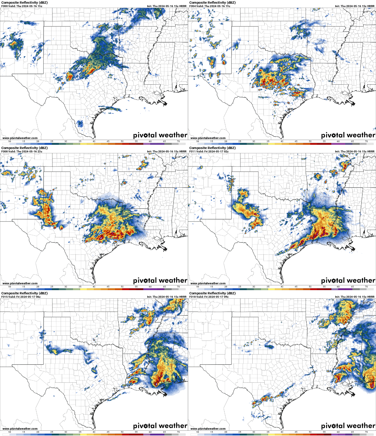
The Nadocast tornado risk for Thursday.
Nadocast tornado risk map shows a swath of a tornado potential from Central Texas to Houston Metro and over into Louisiana. 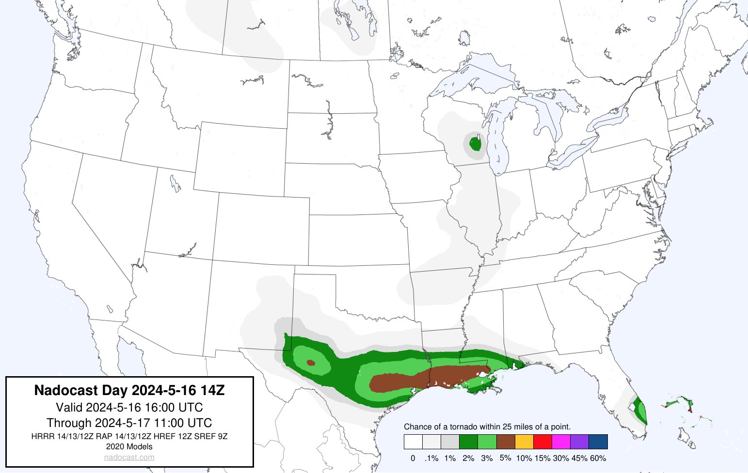
HRRR Helicity tracks for Thursday.
Swaths of damaging winds, very large hail and tornadoes are highlighted on the helicity tracks for West, Central, South and East Texas towards Houston Metro then into Louisiana overnight. 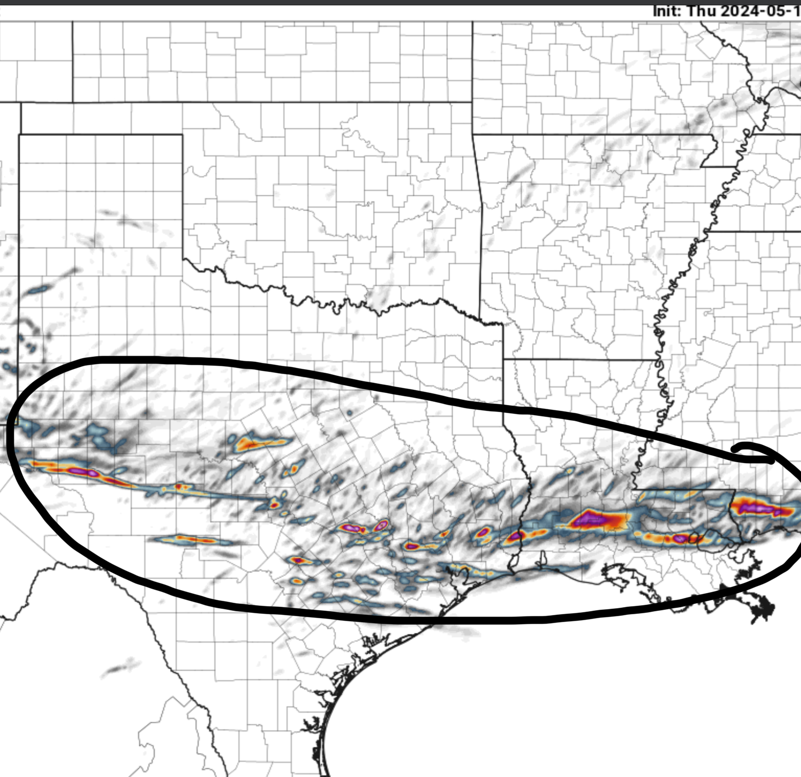
A slight risk of severe weather on Friday for the Gulf Coast States.
Large hail, tornadoes, damaging winds and heavy rains with flooding for the Gulf Coast States from East Texas to Florida Panhandle on Friday. Please see the SPC risk map below. 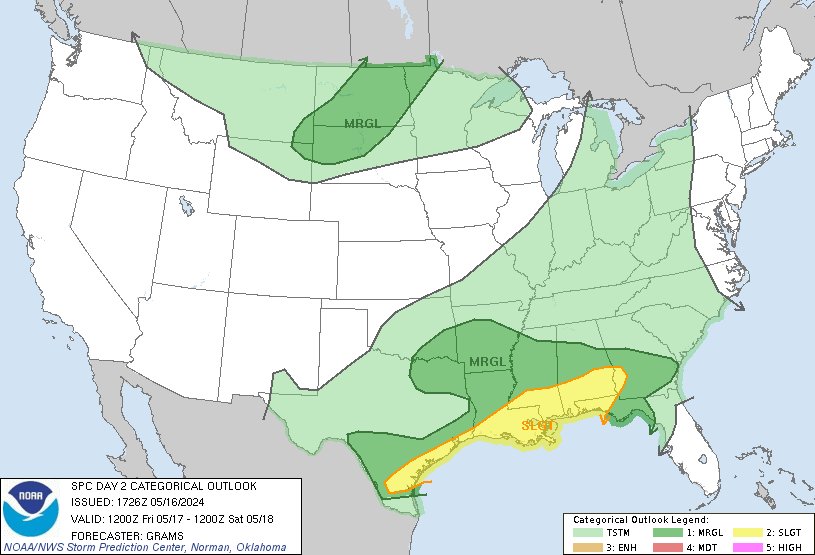
HRRR future radar for Friday
As energy dives Southeast from Canada and meets up with the sub tropical jet stream and moisture from the Gulf of Mexico, this will cause another round of severe weather on Friday and a major flooding problem from East Texas to Florida.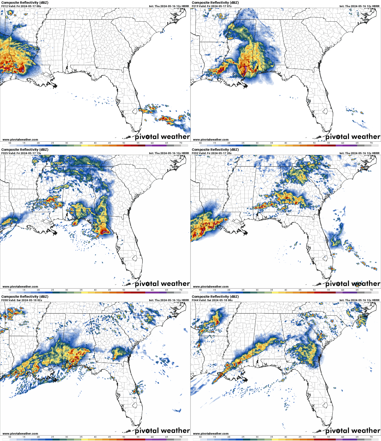
A marginal risk for severe weather on Saturday for the Southeast US.
A threat for more severe weather on Saturday for the Southeast US from Mississippi to the Carolinas. Please see the SPC threat map. 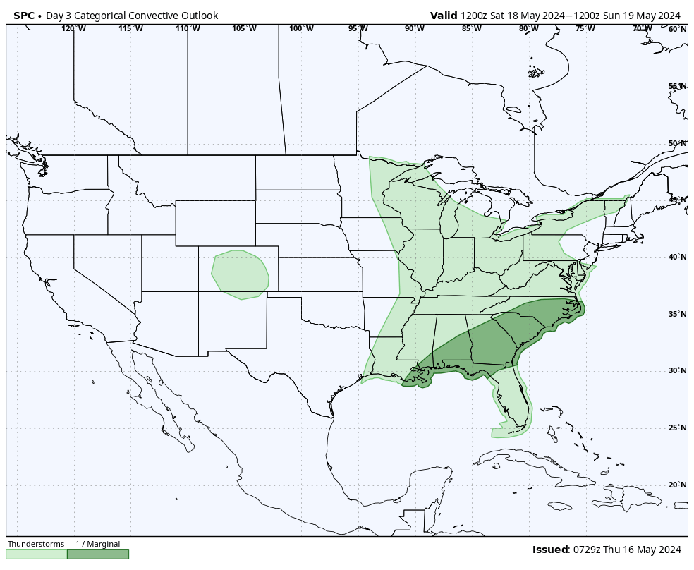

You must be logged in to post a comment.