
Good afternoon, after a busy weekend of severe weather, we start all over again for this week as we move into that Summer storm pattern.
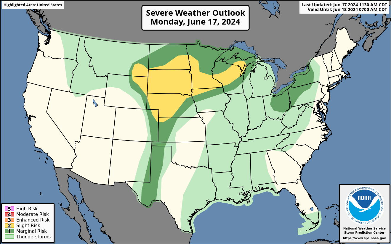
Severe Weather Outlook for Monday
A slight risk of severe weather today for the Northern/Central Plains and Upper Mississippi Valley.
A low pressure system will move into the Plains this afternoon and evening with a cold front. The cold front will bring severe damaging winds/large hail, a chance for a couple of tornadoes. The front will then push East towards Upper Mississippi Valley. SPC risk map below.
HRRR Future Radar Loop for Monday
As the cold front moves through, we could see scattered strong to severe thunderstorms in the Plains and Upper Mississippi Valley. This will bring severe damaging winds and large hail and a couple of tornadoes. 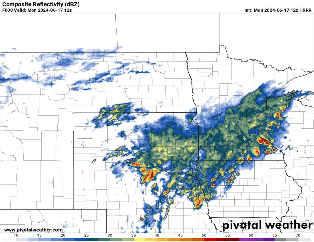
HRRR Helicity Tracks for Monday
A swatch of damaging winds and large hail with a couple of tornadoes are shown on the model. A line of storms to form in front of the low pressure in the Upper Mississippi Valley. Large hail and damaging winds are the main threat.
Another line will form later this evening in the Plains, this line of storms will bring large hail, severe winds and a couple of tornadoes to the Plains. 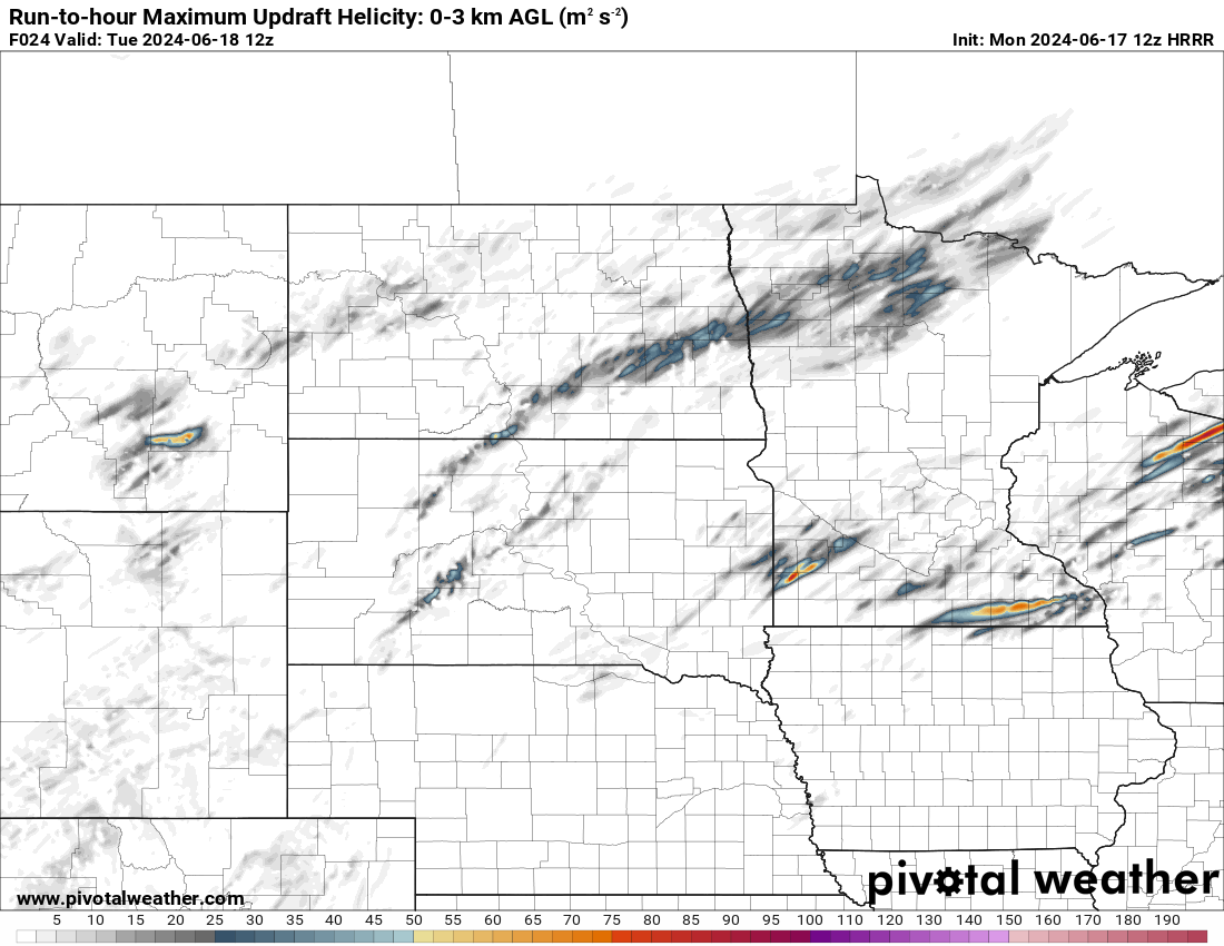
Severe Weather Outlook for Tuesday
A slight risk of severe weather on Tuesday as a cold front moves through.
Large hail and severe winds are the main concern on Tuesday with a low chance of tornadoes as another round of severe storms will move through the Central/Northern Plains and Upper Mississippi Valley.
Scattered strong to severe thunderstorms will move through parts of Nebraska and Kansas tomorrow, then move East towards the Upper Mississippi Valley. SPC Risk map below. 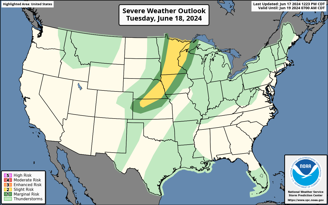
Tropical Weather Outlook for this Week
A low pressure system near the Yucatán Peninsula is expected to move towards the SW Gulf of Mexico today and will start to strengthen. There is a high chance of it becoming Alberto tomorrow or Wednesday. The tropical system will move towards Mexico and this will cause tropical moisture to rise up towards SE Texas and Louisiana where heavy tropical rains could fall on the Gulf States.
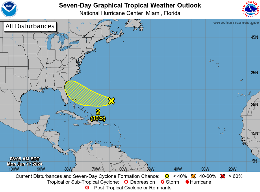
There is another tropical area the NHC is watching off the East Coast of Florida. This has a slight chance of forming into a named storm. This tropical wave will bring more tropical rains to Florida by the middle of the week.
The Euro model is showing another low forming behind the potential Alberto, the low is showing to move towards the Northern Gulf of Mexico next week and possibly affect the Gulf States. 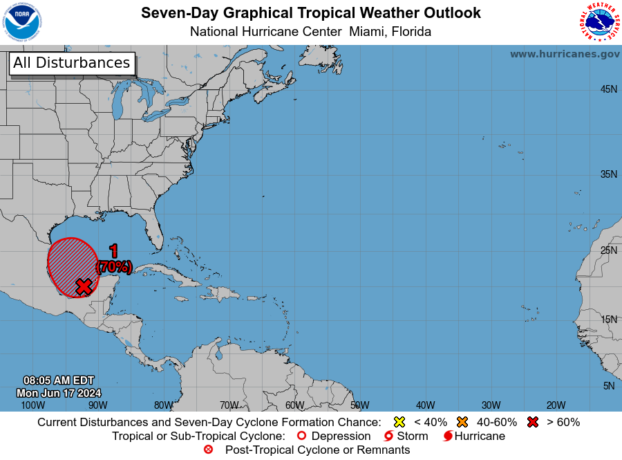
I will keep you updated on any new severe weather threats or tropical weather threats.

You must be logged in to post a comment.