Good morning everyone, as we are in June now, we will start seeing more severe weather spread out in different parts of the US as we approach Summer.
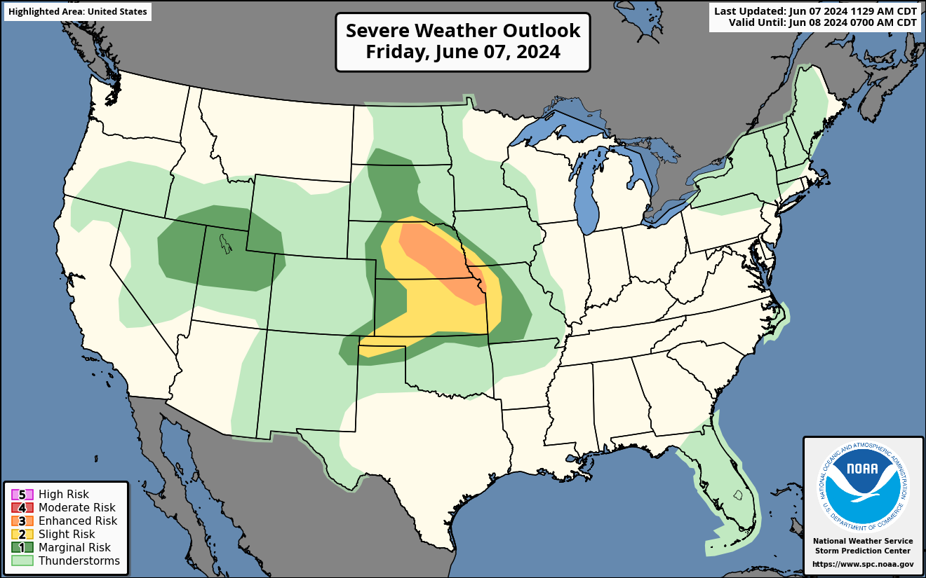
Friday’s Severe Weather Outlook
An enhanced risk of severe weather today for the Central Plains. Significant damaging winds and large hail will be the main threat. There is a chance for a couple of tornadoes in the Central Plains.
Severe thunderstorms are expected this afternoon and evening in the Central Plains. A marginal risk of severe weather is also possible in the Western states in UT,ID,NV, WY and CO. Large hail and damaging winds are the main threat.
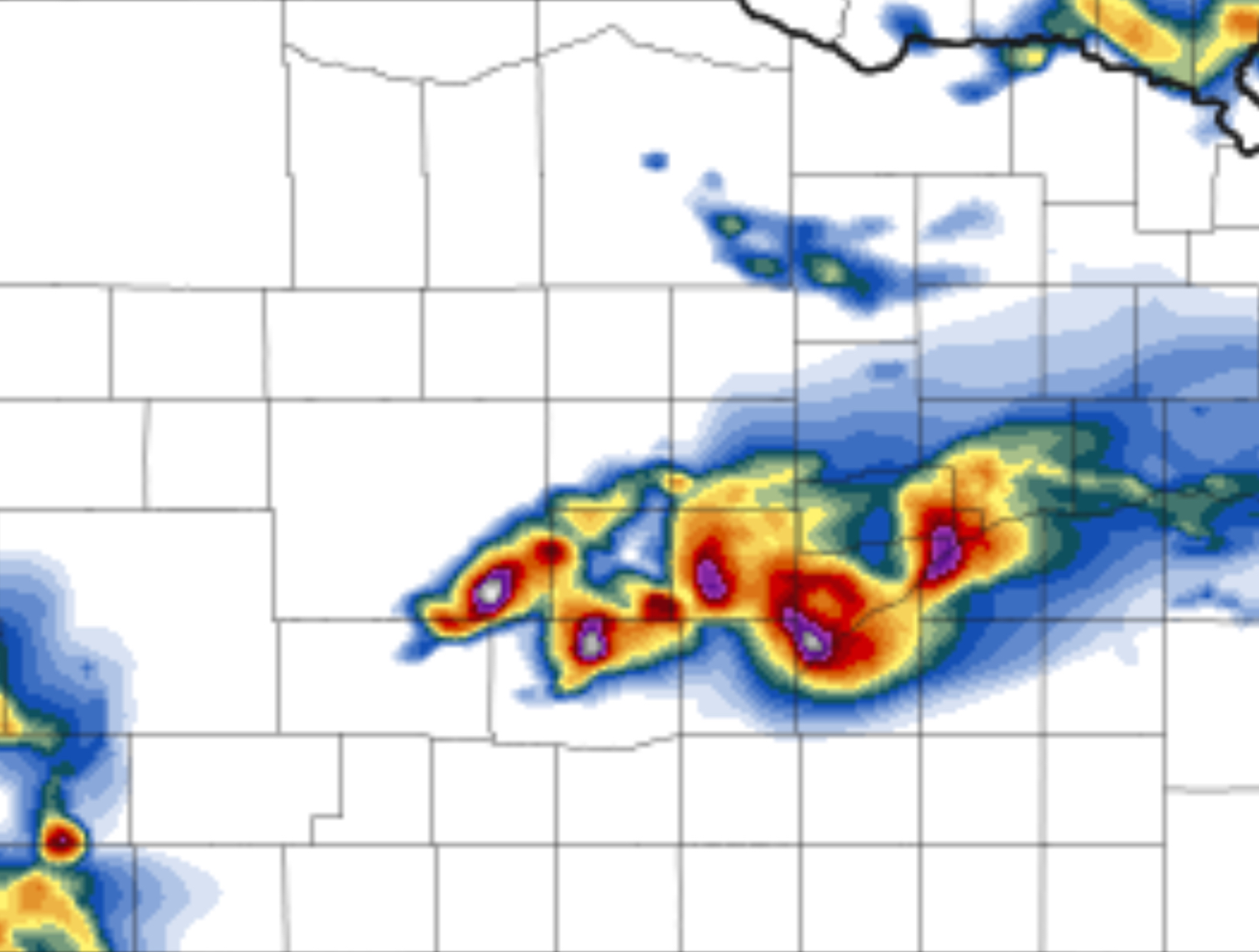
HRRR Future Radar Loop for Friday
Discrete supercells will start to form in the Central Plains this afternoon with a threat of a couple of tornadoes, significant hail and significant winds. These storms are expected to start in Nebraska and move South and East towards Missouri as they form into a linear line of severe storms later tonight. 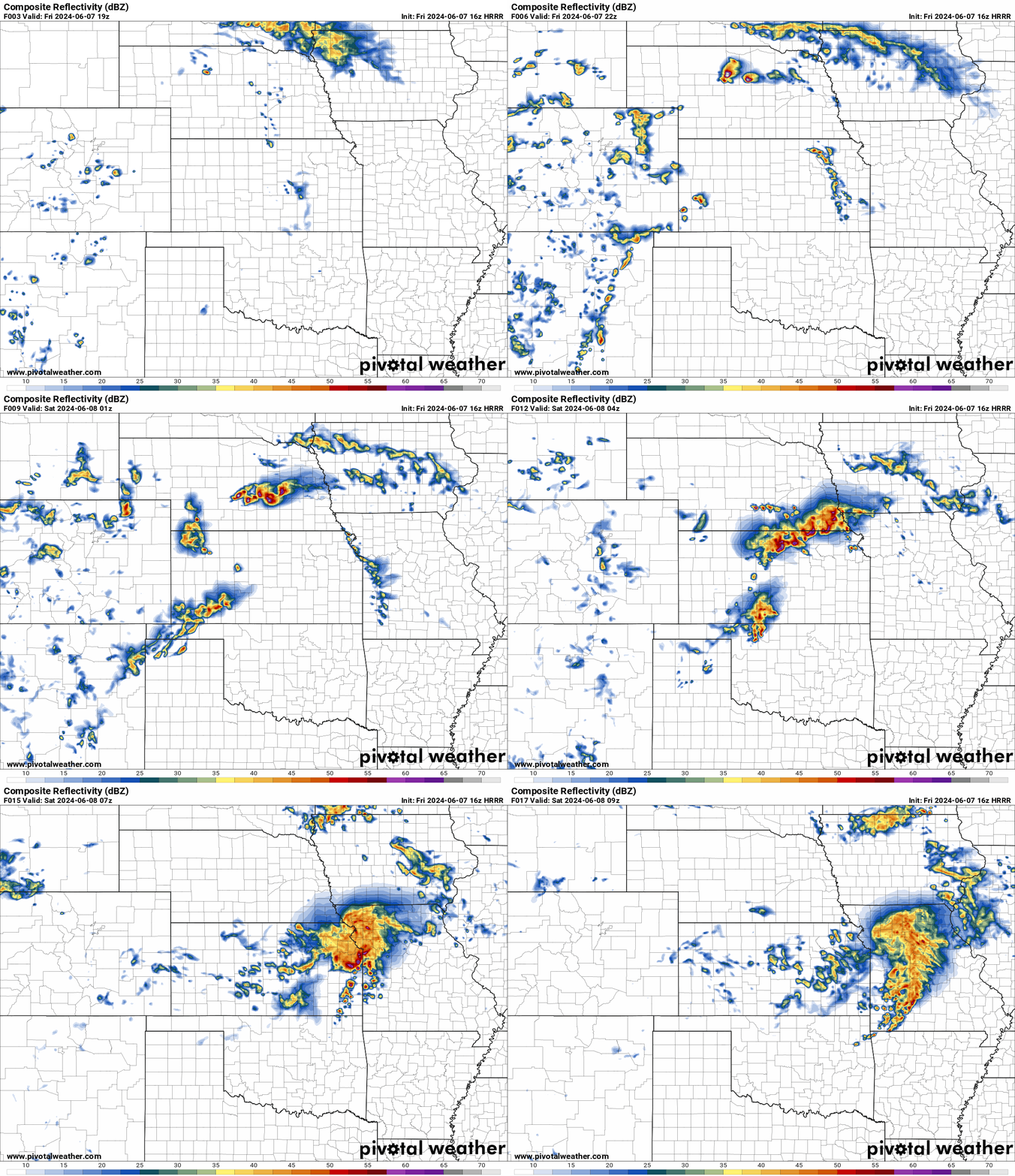
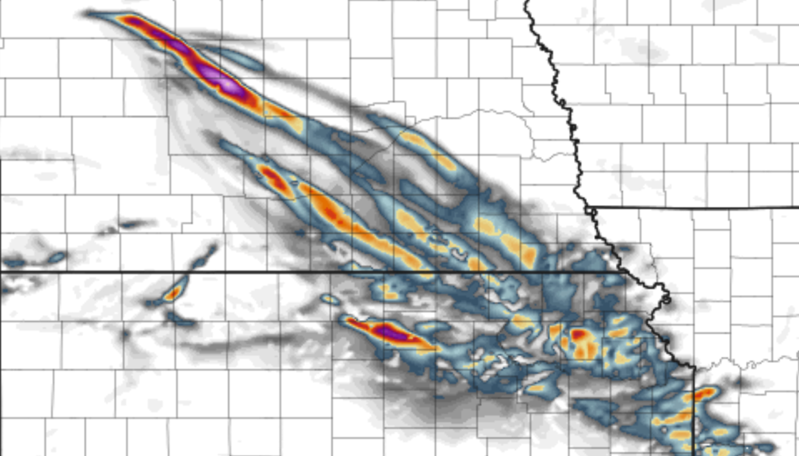
Helicity Tracks for Friday
A swath of significant damaging winds, large hail and a couple of tornadoes are shown on the helicity tracks starting after 3 pm today in Nebraska and moving SE towards Missouri later tonight. These severe storms will impact NE, KS, MO with severe weather.
Severe Weather Outlook for Saturday
A slight risk of severe weather on Saturday in the Plains with large hail, damaging winds and possible tornadoes. There is also a chance of severe weather in Missouri and Mississippi Valley with possible chances of tornadoes, hail and damaging winds. Please see SPC risk map.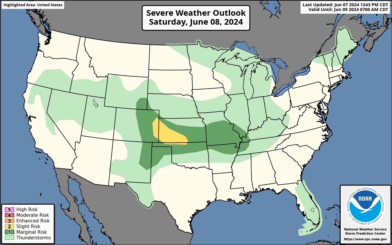
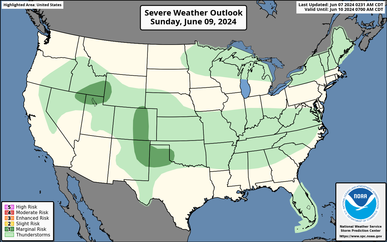
Severe Weather Outlook for Sunday
A marginal risk of severe weather for Western states in ID,NV,WY and UT on Sunday. Main threat will be damaging winds and hail. There will also be a severe weather threat of marginal risk for CO,NM,TX/OK Panhandle with damaging winds and hail.
Please stay tuned for any updates on any other severe weather next week.

You must be logged in to post a comment.