Good morning, It was a very long weekend of severe weather with destruction all over the South and Midwest. Very large hail, destructive winds and strong tornadoes wreaked havoc over the weekend. Another round of severe weather this week as we approach the last week of May.
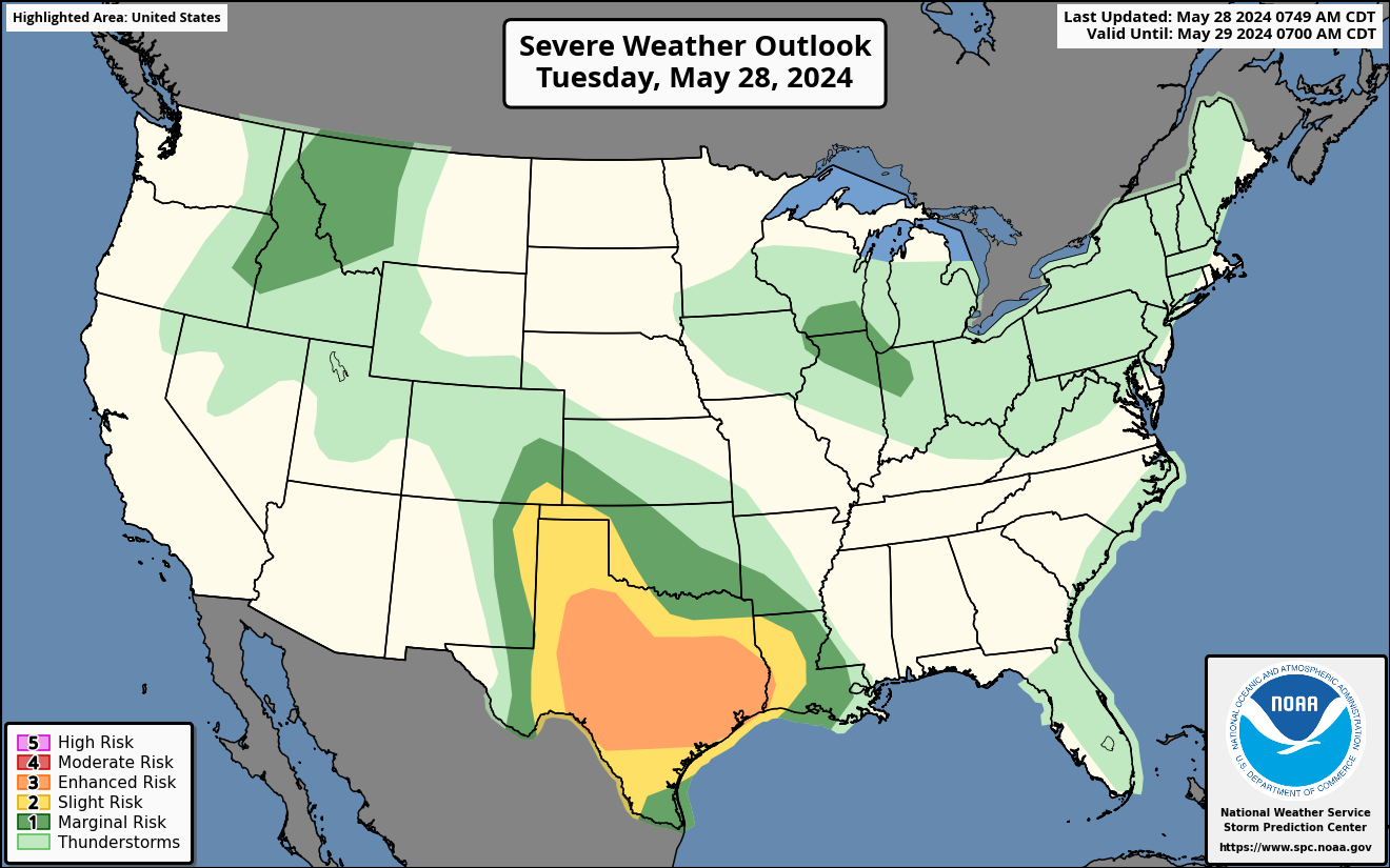
Severe Weather Outlook for Tuesday
An enhanced risk of severe weather on Tuesday for parts of East, Central and North Texas. Very large hail, significant winds with a chance of tornadoes possible.
There is a sight risk for parts of OK, CO, TX, NM and LA today for large hail and damaging winds.
A marginal risk for parts of ID, MT, WA, WI, IL, IA and IN for some isolated storms. See SPC risk map.
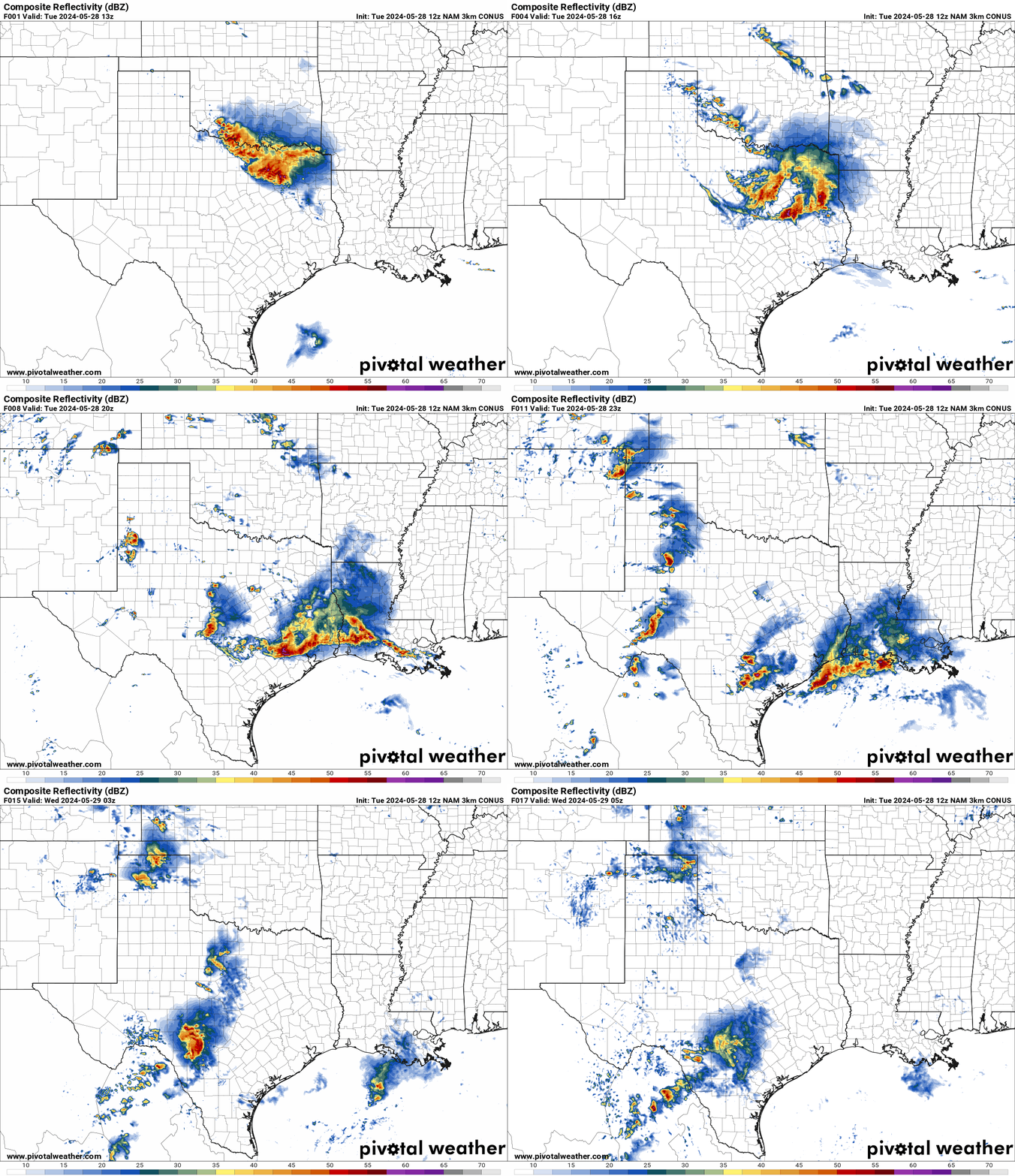
 NAM Future Radar Loop for Tuesday
A cold front will move through the Southern Plains today bringing severe weather to parts of TX, OK,CO, NM, AR and LA. Very large hail, significant winds and possible tornadoes.
An increasing concern for a MCS developing in North Texas and moving SE towards the Houston Metro for another line of damaging winds later today. This would also bring more large hail.
HRRR Helicity Tracks for Tuesday
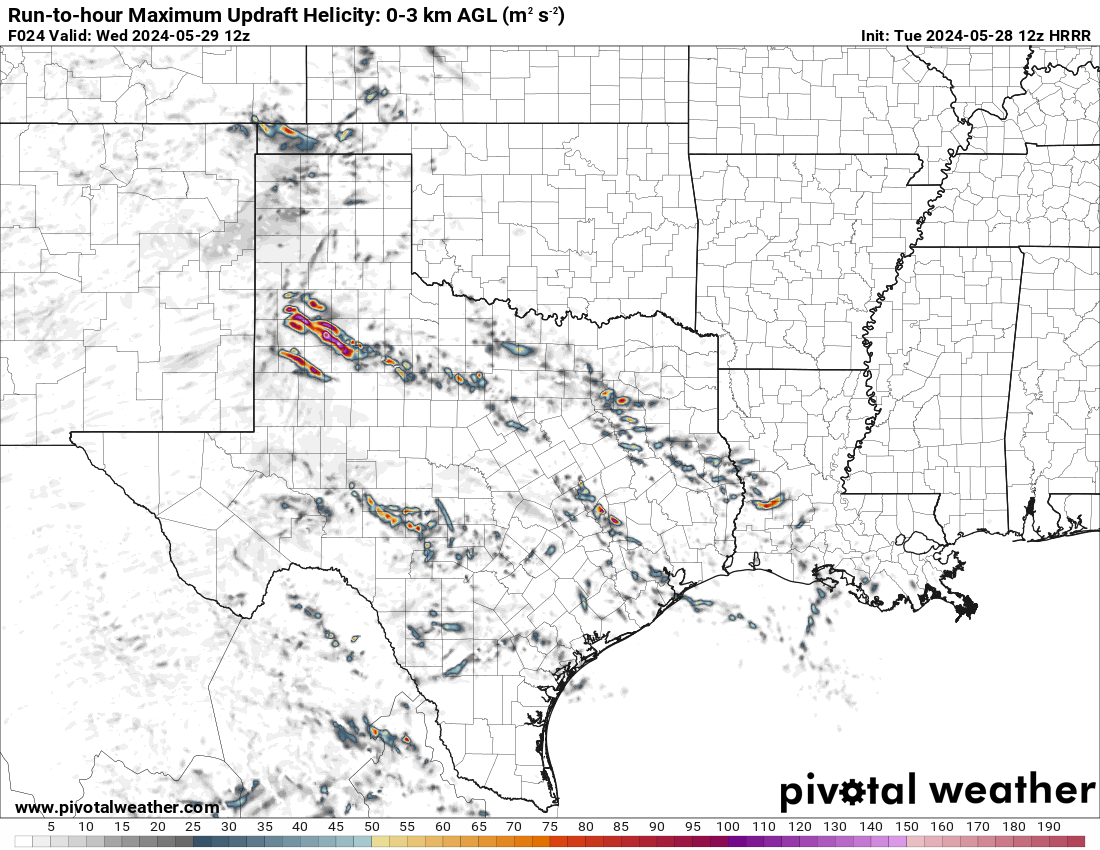
A swath of very large hail and significant damaging winds are shown on the helicity map for Tuesday. As the cold front moves through the area the risk of severe weather increases later today and tonight for parts of Texas.
The chances of very large hail will increase out in West Texas later today and tonight.
Severe Weather Outlook for Wednesday
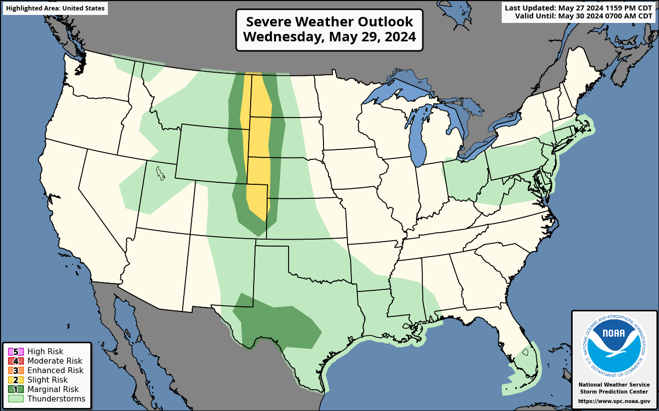
A slight risk of severe weather for the Northern and Central Plains on Wednesday evening.
A cold front moves towards the Plains on Wednesday bringing large hail and damaging winds to parts of MT,WY, CO, ND,SD, NE, and KS. See SPC risk map below.
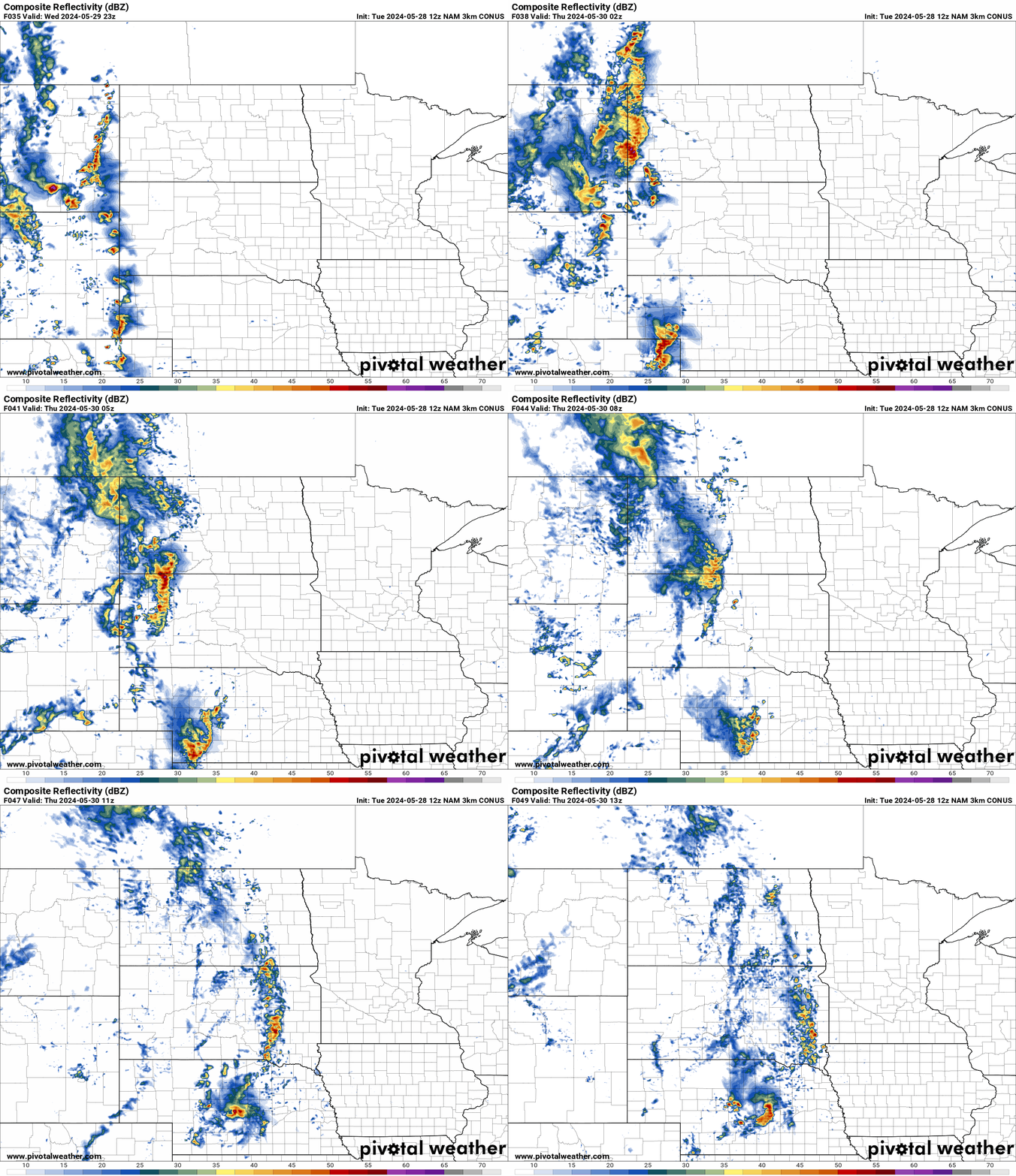
NAM Future Radar Loop for Wednesday
A cold front moves through the Plains on Wednesday bring very large hail and damaging winds.
A line of thunderstorms will become severe during the late afternoon and evening in the Northern and Central Plains.
Severe Weather Outlook for Thursday
A slight risk of severe thunderstorms for parts of OK,TX, and CO on Thursday.
As a system moves in on Wednesday it will bring damaging winds and large hail to the Plains. See SPC risk map below. 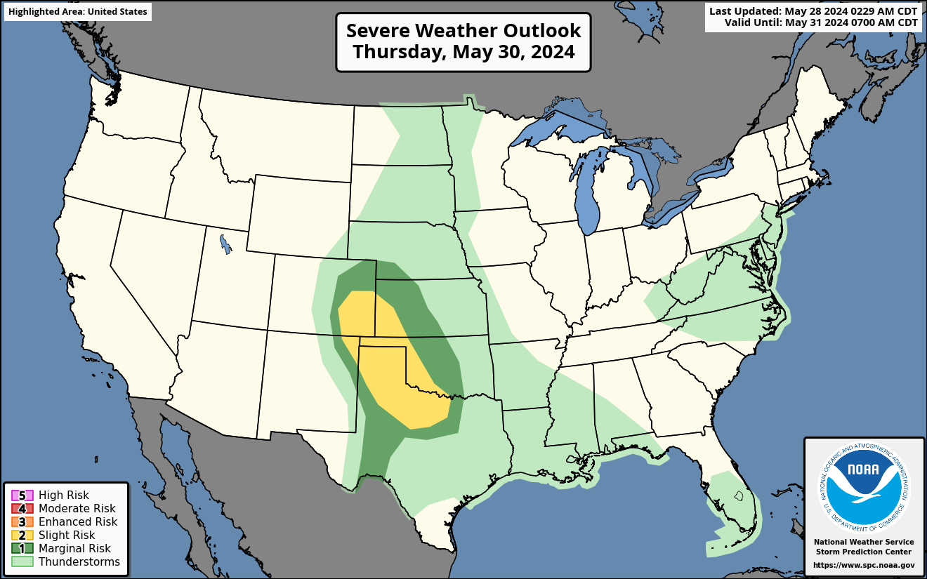
Please stay tuned for any updates for the rest of the week for any severe weather.


You must be logged in to post a comment.