
Rarely do we have an overnight severe thunderstorm threat here in Pennsylvania, as usually there is little instability after the sun goes down. However, the Storm Prediction Center has placed northwest PA in a Slight Risk for storms that will roll through late tonight and into early Saturday morning.
Damaging winds are the main risk threat associated with these storms expected tonight. Most of the activity is not likely to move into NWPA until after midnight.
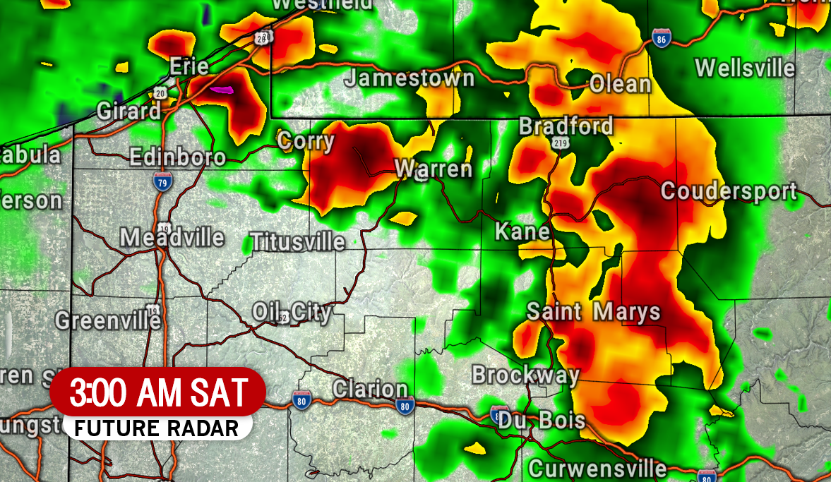
We expect a line of storms to move into Erie County by around midnight. Below is HRRR future radar for 1:00 AM Saturday, showing those strong storms near Erie.


As the early morning progresses, we predict the storms will go from lines to mostly heavy rain with embedded lightning. Looking at 5:00 AM Saturday, we see the storms are likely to be in the Susquehanna Valley, north of State College and Sunbury.
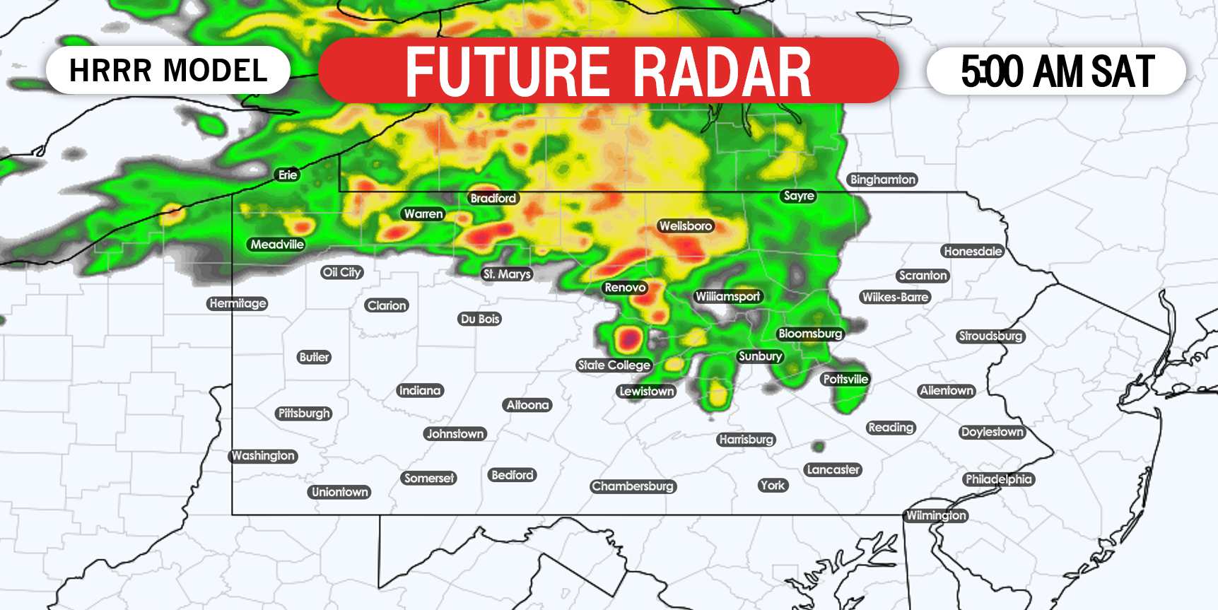
The heavy rain will move into the Poconos and Lehigh Valley around sunrise, but we don’t see anything to worry about. However, there is another Slight Risk for nearly the entire state on Saturday we will have details for later this evening.
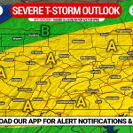
SEVERE THUNDERSTORM OUTLOOK FOR EARLY SATURDAY
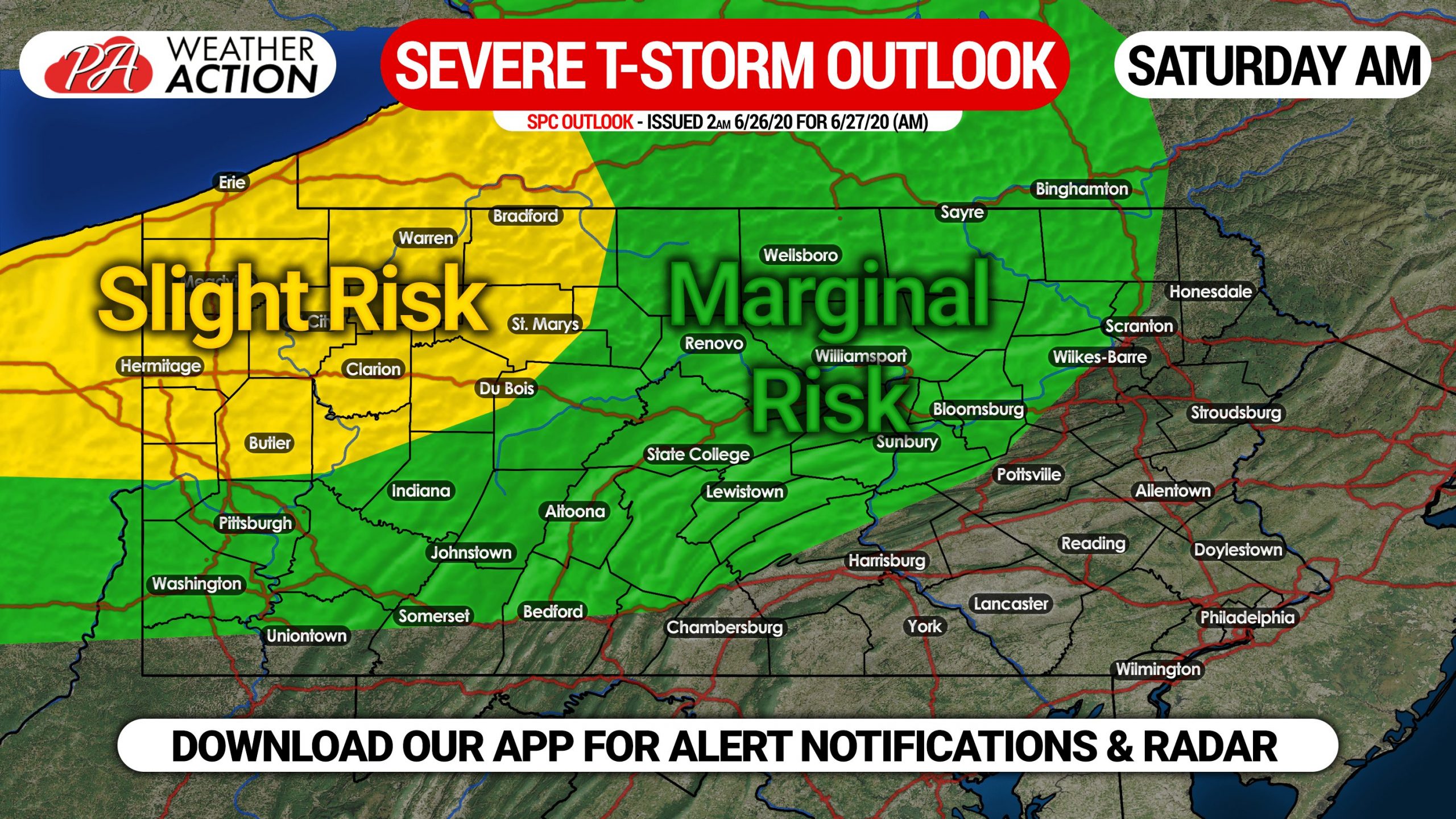
The areas that need to prepare for the potential for damaging winds are all locations north of Butler, north of State College, and west of Coudersport. Essentially all of northwest PA. Short range model guidance has most of the activity north of the Pittsburgh Metro.
We will have future radar and other details for Saturday PM’s severe threat this evening, stay tuned for that.
Don’t forget to share this forecast with friends and family in affected areas.
You must be logged in to post a comment.