
Click Here to Skip to the Heat Index Forecast
For weeks now, we have been wondering where early summer weather is. A gloomy spring has carried into June, with many days bringing rain and cloudy skies. And forget about weekends, they’ve always been wet.
Well that all will change in a big way starting this weekend, as sunny skies prevail and temperatures rise past the “hot enough to swim” threshold. You will very soon be wishing it wasn’t so hot.
The culprit of this sudden shift is a massive ridge that will develop over the Eastern United States, with the epicenter of it parked directly over Pennsylvania as you see below.
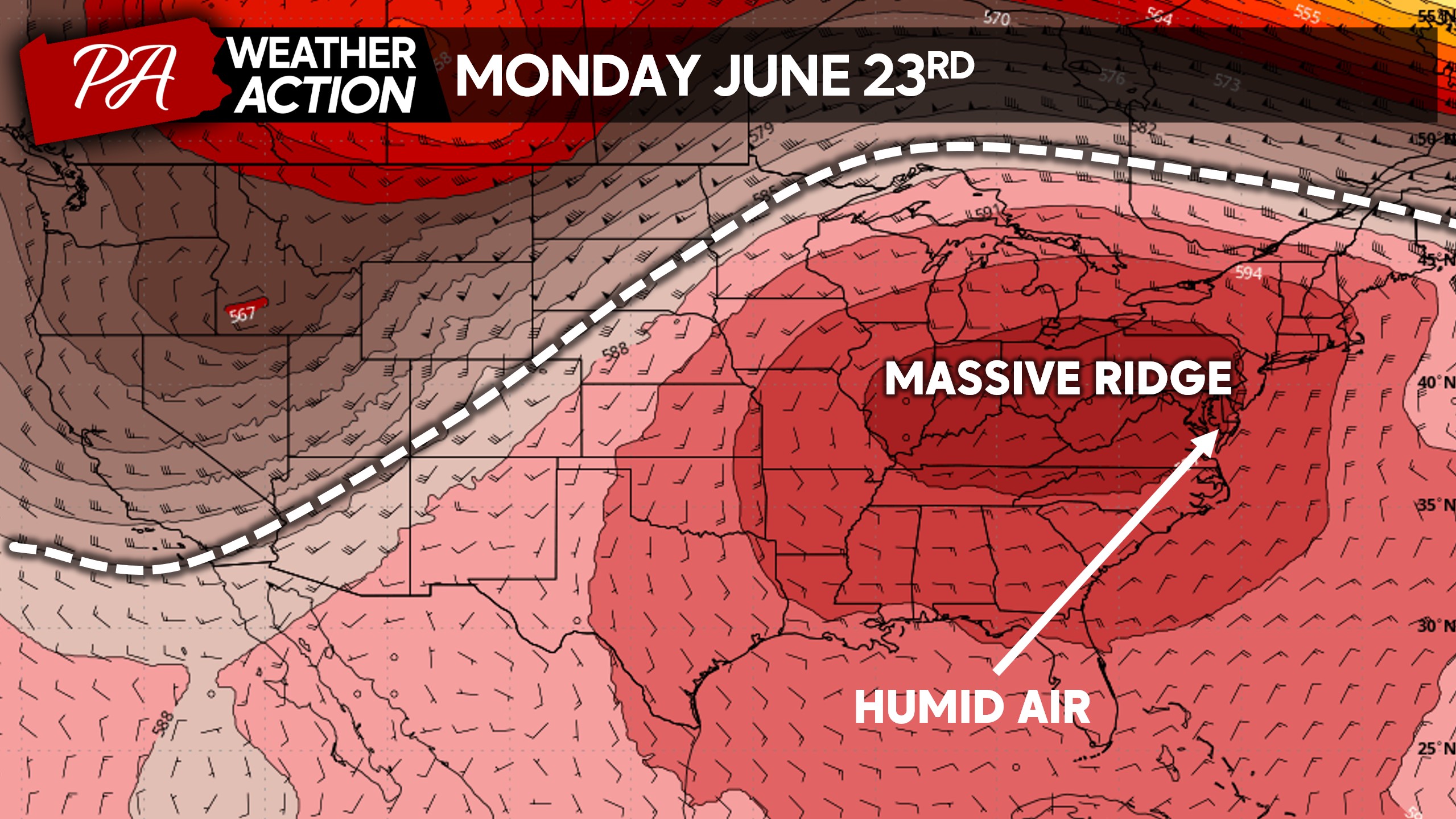
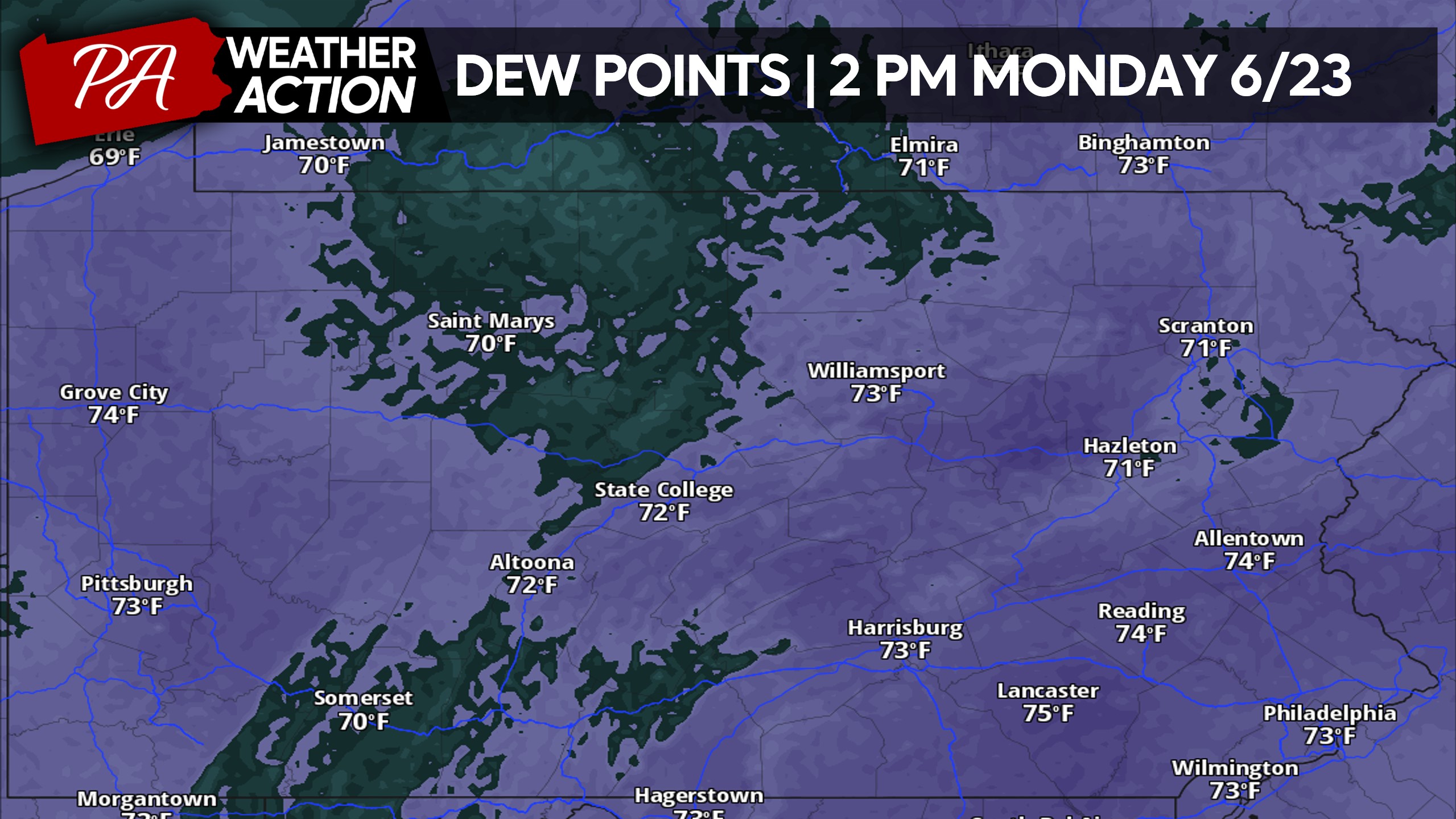
Humid air from the Atlantic will also be a major factor, with dew points well into the 70s. In classic East Coast fashion, this will not be a dry heat whatsoever.
But rather a heat that is exhausting to be outside in, even just for a short period of time. Here are this upcoming Monday’s dew points.
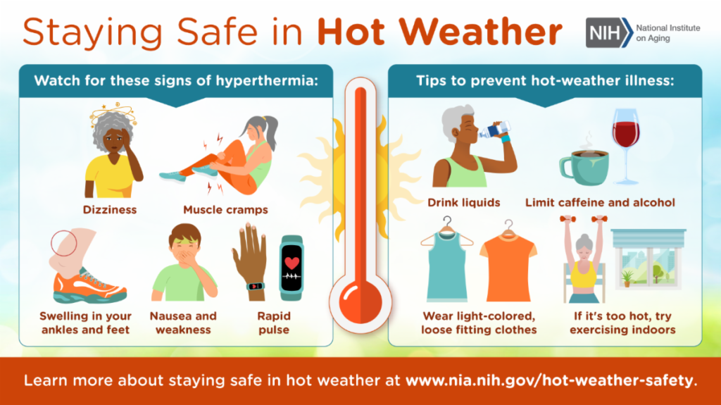
Below are safety tips for the upcoming significant heatwave. Despite peaking Monday to Wednesday, the heatwave will begin Sunday and continue for 7 days.
The best thing you can do is stay indoors during peak heat. Although the elderly and young children are most impacted by excessive heat, nobody is immune.
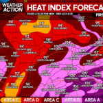
MAXIMUM HEAT INDEX FORECAST: MON – WED 6/23-6/25
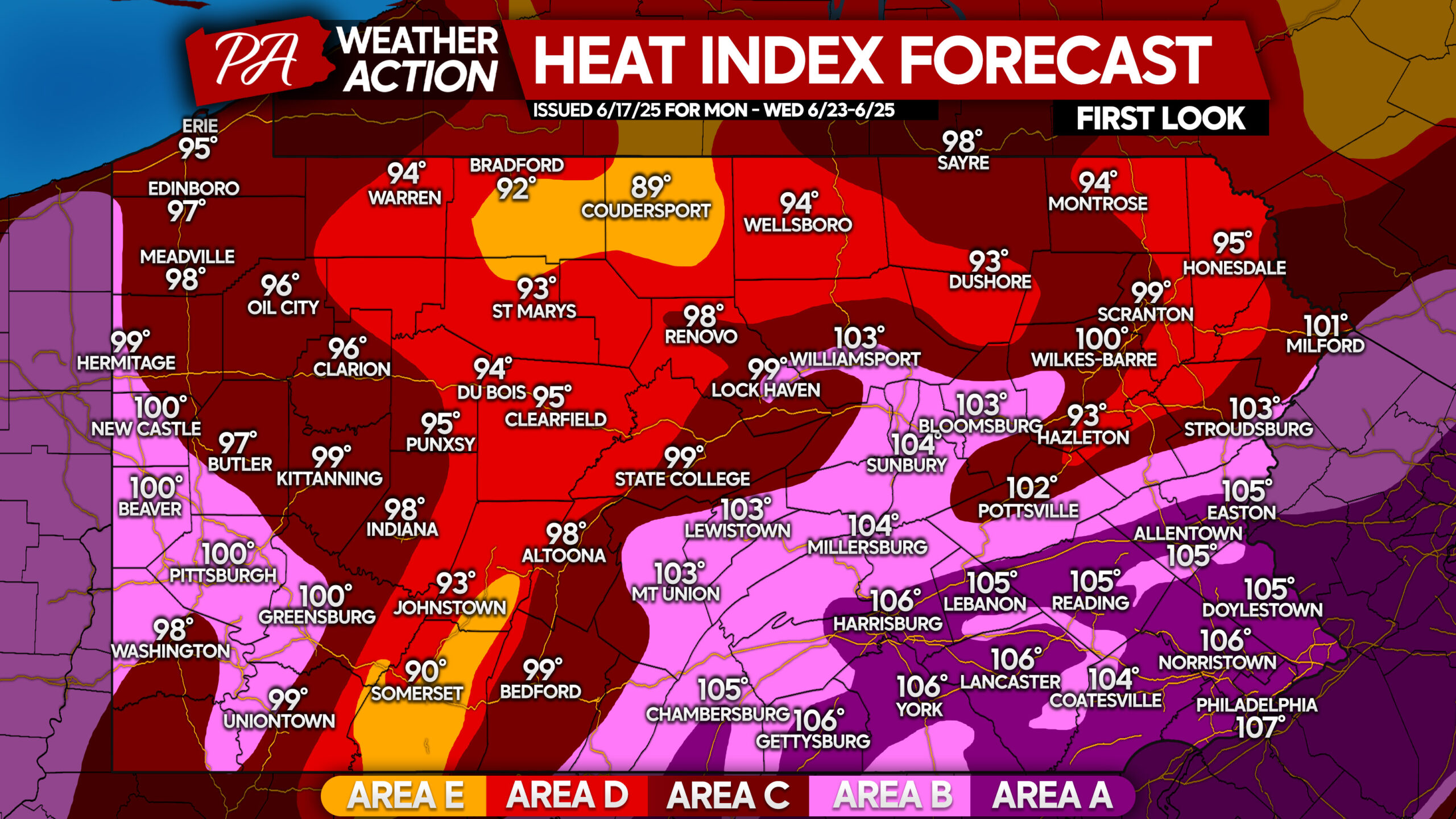
Area A: Temperatures of 97 – 102° combined with high dew points will make it feel like 105-110° during the afternoons of Monday, Tuesday, and Wednesday. Heat cramps or heat exhaustion likely, and heat stroke possible with prolonged exposure and/or physical activity.
Area B: Temperatures of 93 – 97° along with high dew points will make it feel like 100-105° during the afternoons of Monday, Tuesday, and Wednesday. Heat cramps or heat exhaustion likely, and heat stroke possible with prolonged exposure and/or physical activity.
Area C: Temperatures of 90 – 93° and high dew points will make it feel like 95-100° during the afternoons of Monday, Tuesday, and Wednesday. Heat stroke, heat cramps, or heat exhaustion possible with prolonged exposure and/or physical activity.
Area D: Temperatures of 87 – 90° combined with high dew points will make it feel like 90-95° during the afternoons of Monday, Tuesday, and Wednesday. Heat stroke, heat cramps, or heat exhaustion possible with prolonged exposure and/or physical activity.
Area E: Temperatures of 85-87° and high dew points may cause fatigue after prolonged exposure. These high elevations will avoid the worst of the heat.
Don’t forget to share this important forecast & information with family and friends.

You must be logged in to post a comment.