
Today felt like spring in comparison to what we’ve experienced recently! Melting snow has resulted in poor air quality and overnight fog. And just as it seemed like we were about to leave the worst of winter in the rear view, a winter storm looms possible for Sunday into Monday.
In today’s era of weather forecasting, there is always a race to be first. So let’s establish a few things now.
Weather apps will change every model run and shouldn’t be used. There is no point of highlighting areas or making any maps this early. I would not cancel or reschedule plans at this point. I would not look for anyone who believes that are confident enough to tell you one way other another, because it would be baseless.
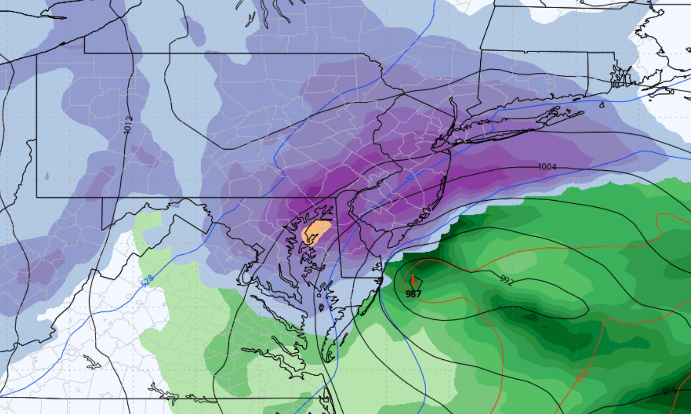
With all that in mind, let’s take a look at where models stand as of Tuesday evening. We have the Canadian and UKMET (UK) models in one corner projecting a major blizzard in the Upper Mid-Atlantic with a strong low pressure situated right off the coast. Statistically, a one-in-twenty year event like this has a very slim probability (2-4%) of occurring.
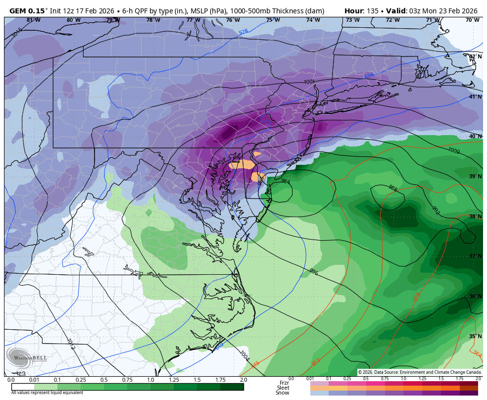
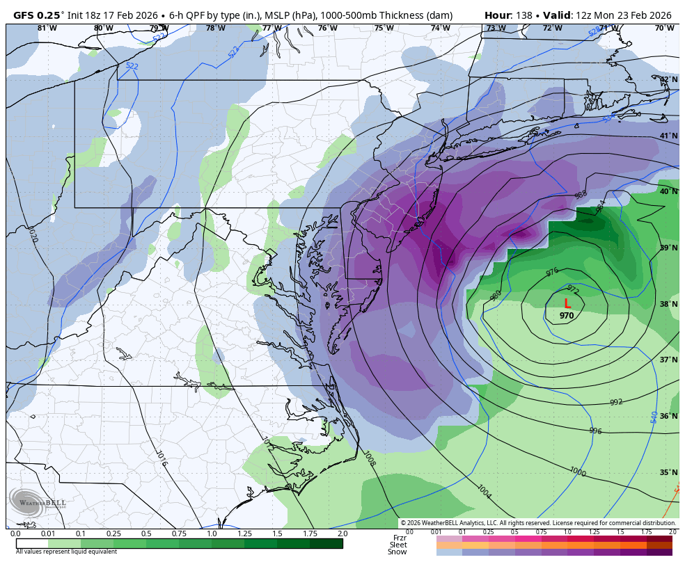
As we work our way down the ladder of impact to the American and German models, the “major blizzard” is now centered fairly far offshore with the coast taking the brunt of the storm.
With this type of outcome that includes less breathing room for energy to dig and amplify on the coast, we would still see light snow in all of Southern PA with heavier snow in Southeast PA.
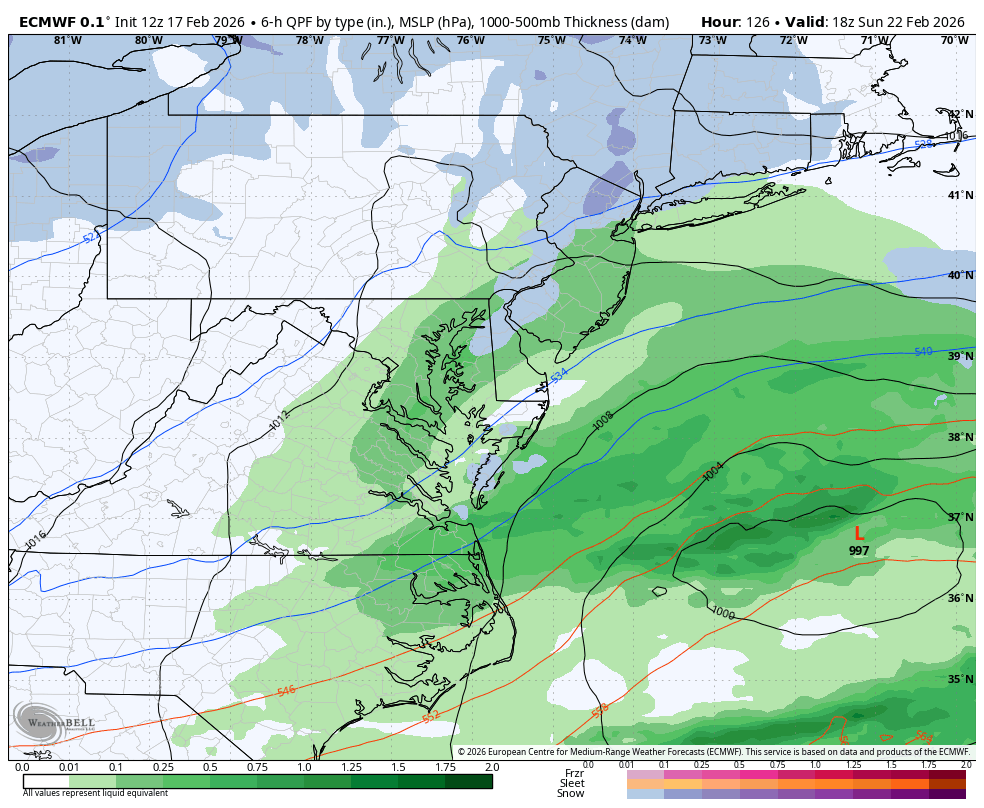
And finally, the biggest red flag for this potential event. The European model is not interested because the energy responsible for producing this event drops into the Great Plains too far east and doesn’t dig as far south before rounding the trough axis and coming up the coast.
If that all sounds confusing, the summary is that the European model, which is statistically the most accurate model, is keeping the storm flat and weak and well offshore.
And that’s where we stand. All meteorologists and forecasts use these models, and realistically nothing else, to base their forecasts on. You have now seen it for yourself. There is lots of uncertainty of if there will even be a storm, and if there is, how significant it will be.
The hype is there because the ceiling is very high. But it’s a waiting game and that’s all any of us forecasters can do. We will see what happens in the next 24 hours and see if scenario maps are possible to post on Wednesday!
For now, keep plans for the weekend and have a watchful eye!
You must be logged in to post a comment.