An update including the First Call Snowfall Forecast has been posted. Please tap the article link below.
First Call Snowfall Forecast for Monday’s Winter Storm in Pennsylvania
After an up and down December, January has quickly turned wintry. Last Saturday, we published an article that mentioned frigid temperatures and snowfall opportunities for January. And less than a week later, we are discussing two separate snow events.
The first will be a sneaky snow event on Friday that will lay down mainly light accumulations, and the next is of course Monday’s snowstorm potential. Notice we left out Sunday, as that storm is now modeled to move in very late Sunday evening in Western PA.
Friday’s Sneaky Snow
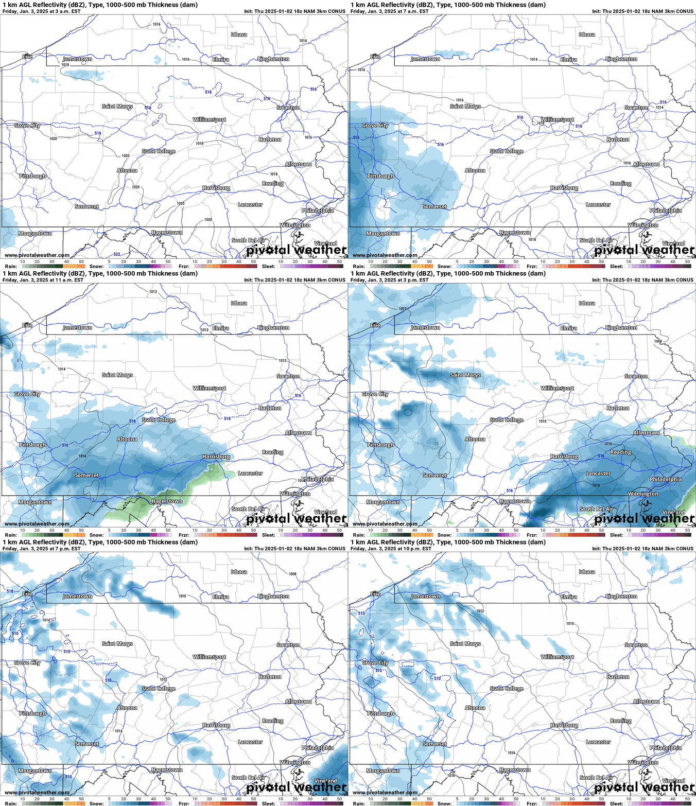
A weak system will move through Southern PA Friday. Start time in the Pittsburgh Metro will be around 7 AM Friday, followed by the Laurel Highlands at 9 AM. Then a start time of lunchtime in the Lower Susquehanna Valley, and 3 PM in the Philadelphia Metro.
Snow will start light, before turning moderate for a few hours, then turning light and departing. Total snow duration looks to be around 3-4 hours. Western PA is likely to see scattered lake effect snow squalls into the Friday PM hours.
Below is Hi-Res NAM Future Radar for Friday’s snow event.
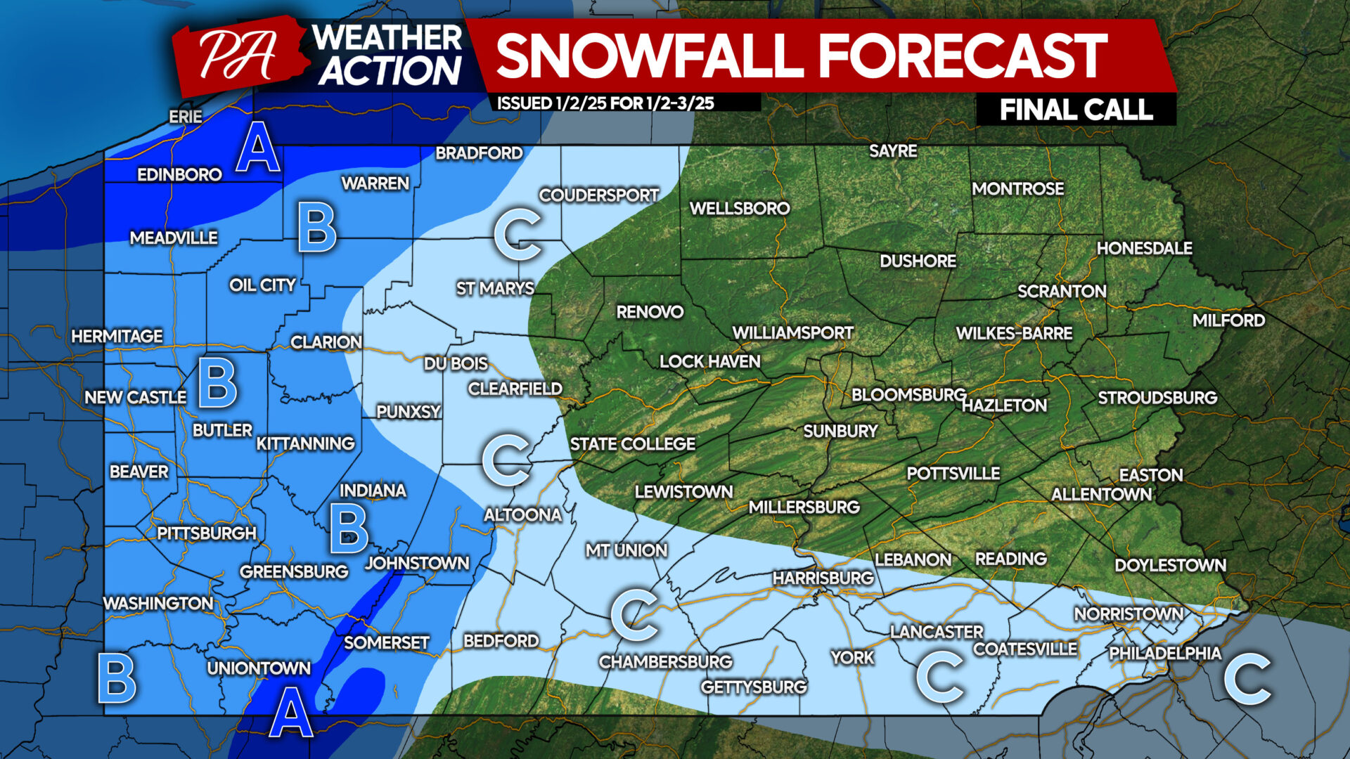
FINAL CALL SNOWFALL FORECAST THRU FRIDAY
Area A: Snowfall accumulation of 4 – 7″ expected. Road conditions will be deteriorated during times of heavier snow.
Area B: Snowfall accumulation of 2 – 4″ anticipated. Snow-covered roads likely Friday morning.
Area C: Snowfall accumulation of 1 – 2″ expected. Slippery travel possible during periods of moderate snow.
Monday’s Potential Snowstorm in PA
Over the last 24 hours, models have trended north with the axis of heaviest snow for Monday’s potential. We are now to the point of expecting significant snowfall in Pennsylvania. The question that remains is where heaviest snow will be, and how sharp the northern cutoff will be.
We have two new scenario maps for you, as we cannot yet determine precise snowfall ranges. We are not looking at a major snowstorm, so below when you read 6″+, realize that the ceiling for this storm looks to be around 10″. And only a few locations will reach that.
If you have plans on Monday in Southern PA that require driving, we would recommend rescheduling them.
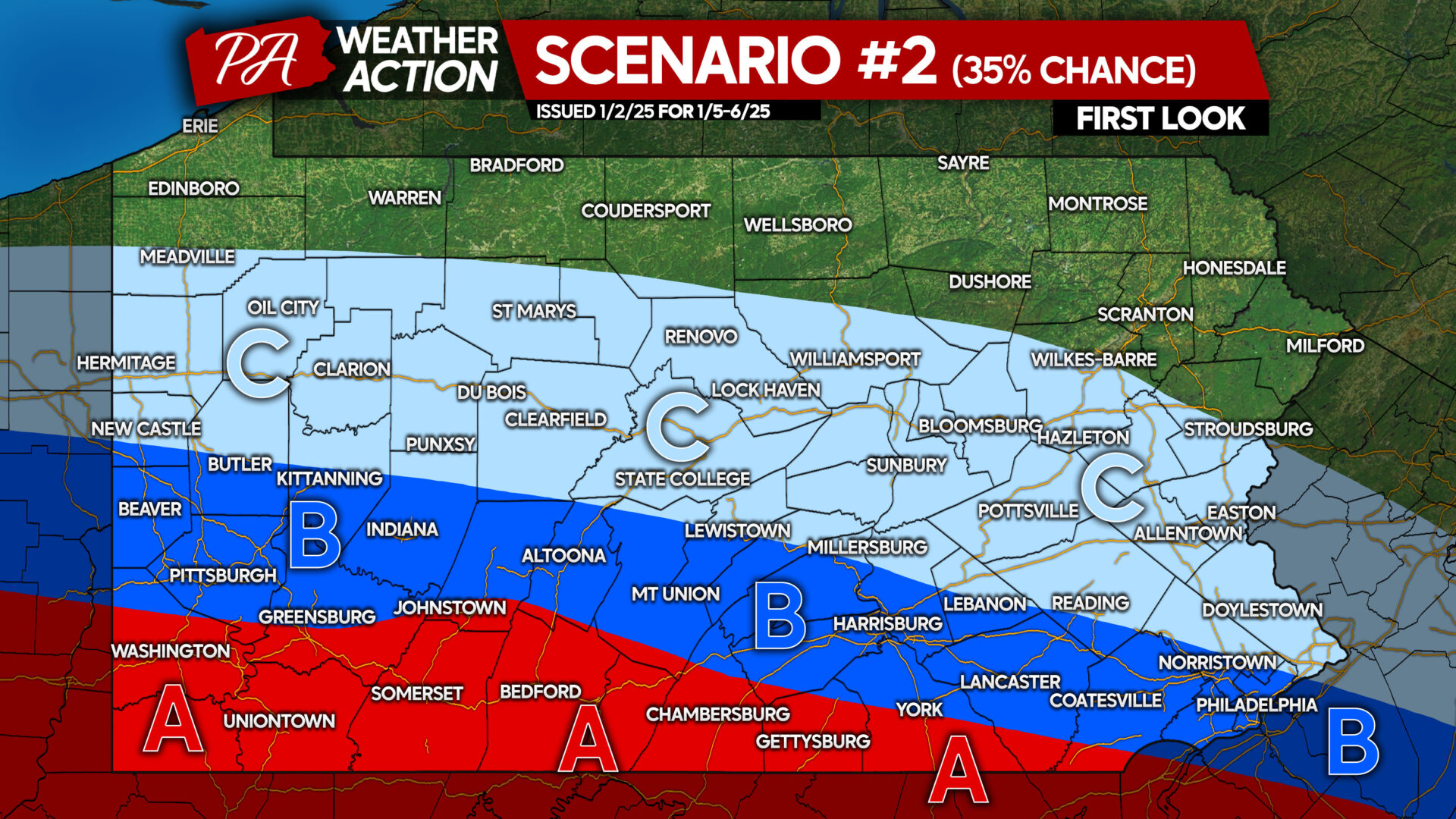
SCENARIO #2 FOR SUNDAY – MONDAY SNOWSTORM: 35% CHANCE
This scenario would include greater suppression from the north, and more weakening of the storm on approach. You may notice this looks similar to our optimistic scenario from yesterday, signaling the northern trends we have seen over the last day.
When considering changing plans, we would advise doing that ASAP if you’re in Area A or B of the Scenario #2 map.
Area A: Significant snowfall accumulation of 6″ or greater possible.
Area B: Moderate snowfall accumulation of 3″ or greater possible.
Area C: Light snowfall accumulation of 1″ or greater possible.
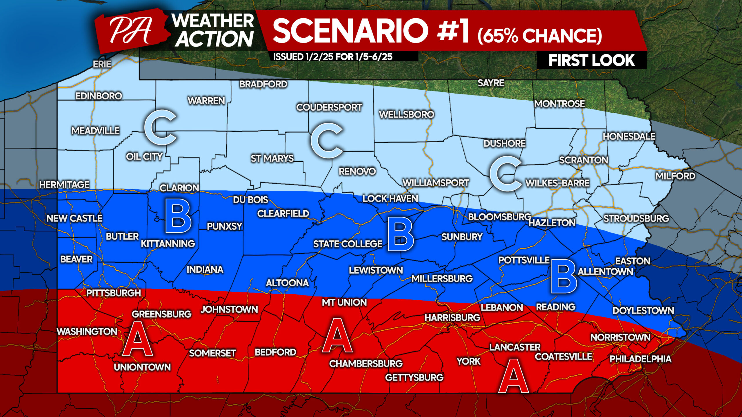
SCENARIO #1 FOR SUNDAY – MONDAY SNOWSTORM: 65% CHANCE
This scenario factors in continued north trends on the models in the coming days. Some guidance has reached this point, but we are largely going on experience here along with existing trends.
Being a bit more than three days out, it’s important to not latch onto the fine details here.
This scenario would result in widespread school and business closings on Monday. Snow will be relatively fluffy, so it shouldn’t be too bad to clean up.
We are watching the chance of some mixing with sleet and freezing rain in far Southwest PA with Scenario #1, but these snowfall amounts represent what would fall before any changeover.
Area A: Significant snowfall accumulation of 6″ or greater possible.
Area B: Moderate snowfall accumulation of 3″ or greater possible.
Area C: Light snowfall accumulation of 1″ or greater possible.
We will have our First Call Snowfall Forecast for Monday’s Snowstorm out Friday afternoon, so keep an eye out for that!
Don’t forget to share this info with family and friends who may have upcoming plans.


You must be logged in to post a comment.