
It’s been a while since our last good chance of seeing the aurora borealis, at least on camera. The solar maximum that gave us relatively frequent opportunities will begin to dissipate as we descend towards our next solar minimum in 2030.
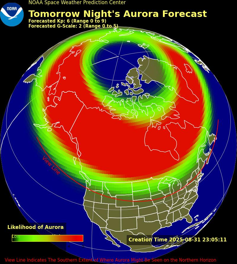
A G3 Geomagnetic Storm is expected to send Earth-bound CMEs arriving late Monday night into Tuesday morning. Forecast timing currently indicates a maximum KP of 6.67 will occur between around 2-5 AM Tuesday morning, with a KP of 5.67 possible starting around sunset Monday.
This graphic from NOAA shows where aurora is projected to be visible with the naked eye on the northern horizon. Here in PA, we really need a KP above 7 to have a chance of seeing the northern lights with our eyes, rather than through a camera lens.
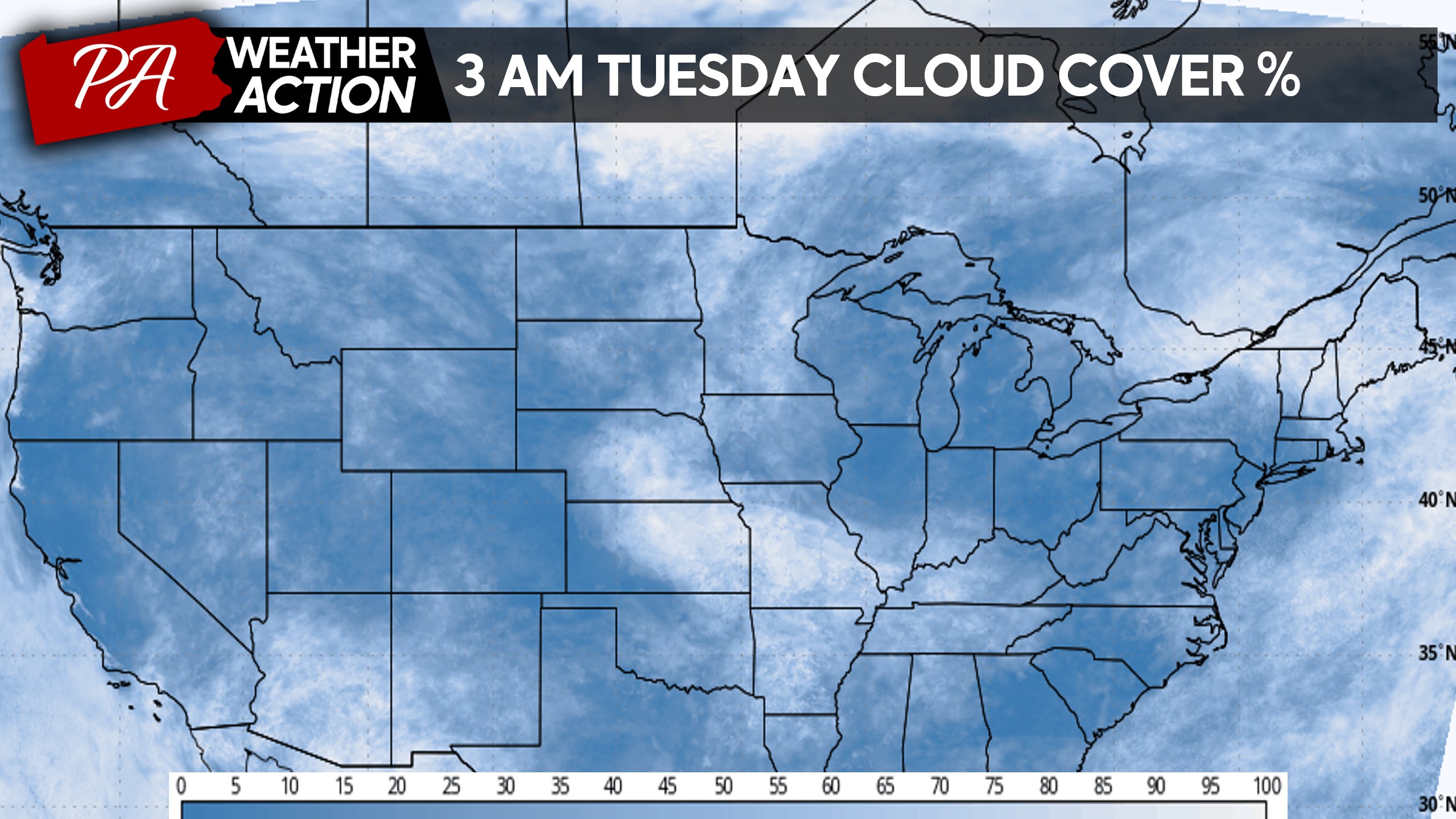
This will still be a fantastic chance for aurora chasers to photograph the colors, as cloud cover should be relatively sparse.
Skies are anticipated to be mainly clear with just a few clouds Monday evening into Tuesday morning, and this trend continues for most of the Northern US as shown below.
As always, light pollution will be a significant factor especially here in PA as opposed to much of the less populated Northern US. The map below factors in light pollution, cloud cover, and expected KP.
FIRST CALL AURORA VIEWING FORECAST FOR MONDAY NIGHT – TUESDAY MORNING
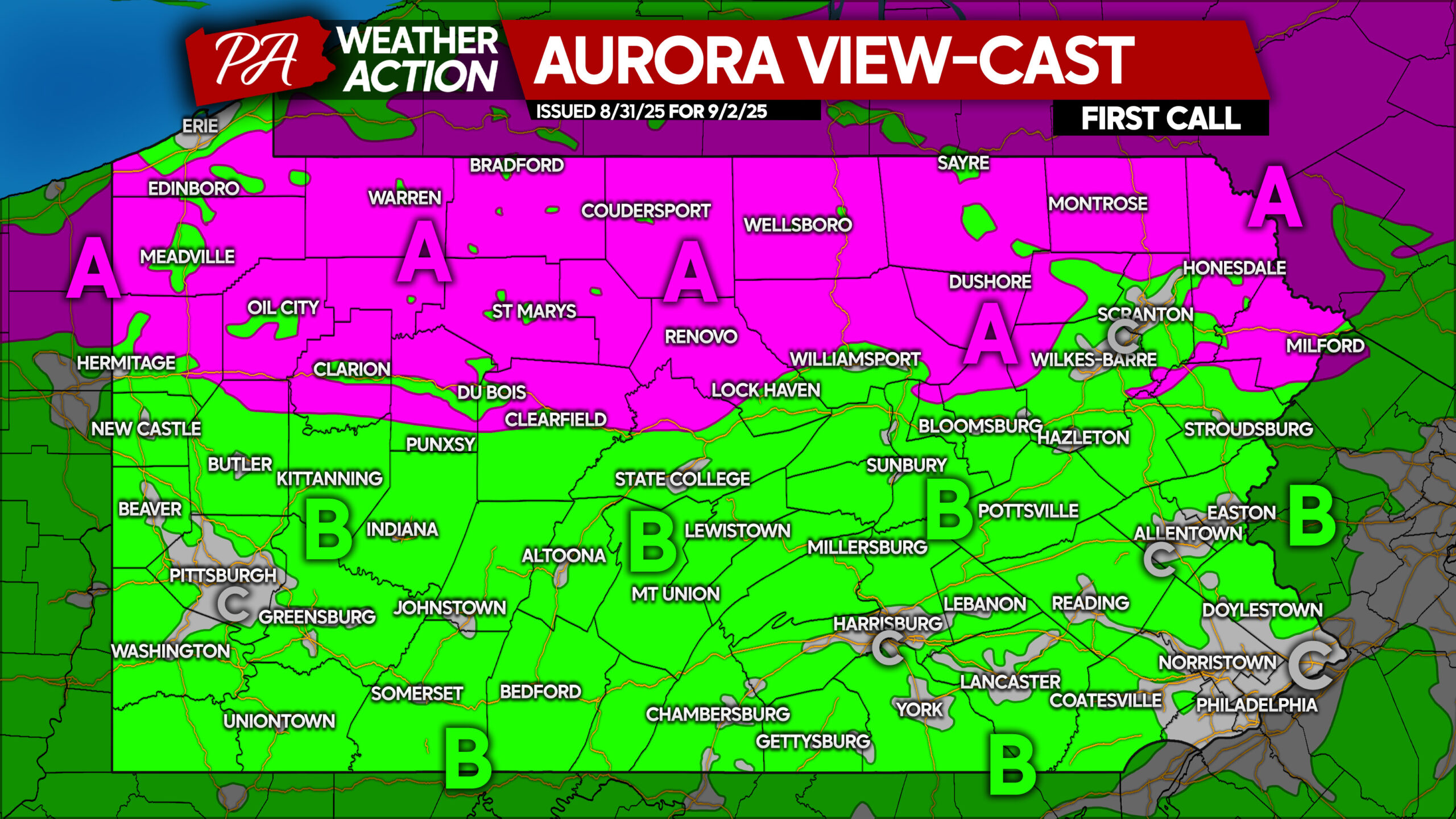
This key is written with the assumption the CMEs will impact Earth with their currently projected strength and timing. Space weather is difficult to predict!
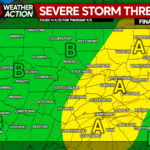
Area A: These rural, northern areas will have the best chance to photograph the aurora. A stronger G4 storm will likely be necessary for viewing with the naked eye, which is possible but currently not projected.
Area B: These suburban to rural areas should be able to capture vibrant aurora on the northern horizon through the camera lens.
Area C: If you’re in one of these urban corridors, it’s best to seek out a more rural area especially to your north for the best chance of aurora viewing!
Don’t forget to pass this forecast on to any friends and family who may be interested!
You must be logged in to post a comment.