The weekend’s Canadian air offered a refreshing reprieve from last weeks oppressive heat and humidity. Temperatures fell into the 40s in some locations! The slight haze in the sky over the weekend was courtesy of smoke from Canadian wildfires. There was even a heavy burst of snow shortly after sunset Sunday evening in Stroudsburg at the annual Mady’s Snow Day festival!

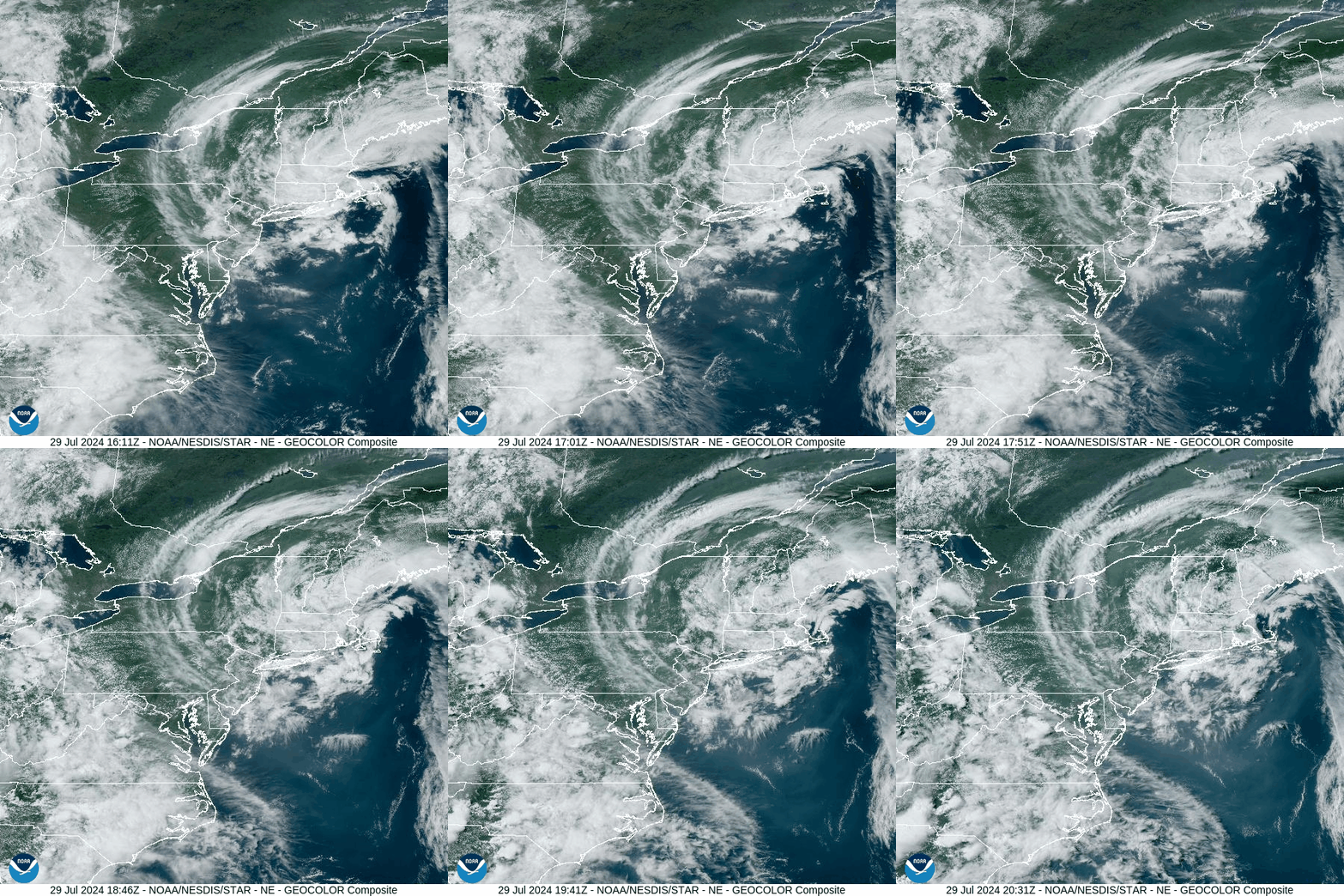
A cut-off upper-level low wobbling off the Northeast Coast spiraled clouds southward into our area today, along with some isolated showers. It also managed to keep humidity somewhat low today. This system will wobble eastward into the north Atlantic tonight. Heat and humidity will return, along with multiple upper-level disturbances that will provide several opportunities for thunderstorms. Enjoy today’s visible satellite loop:
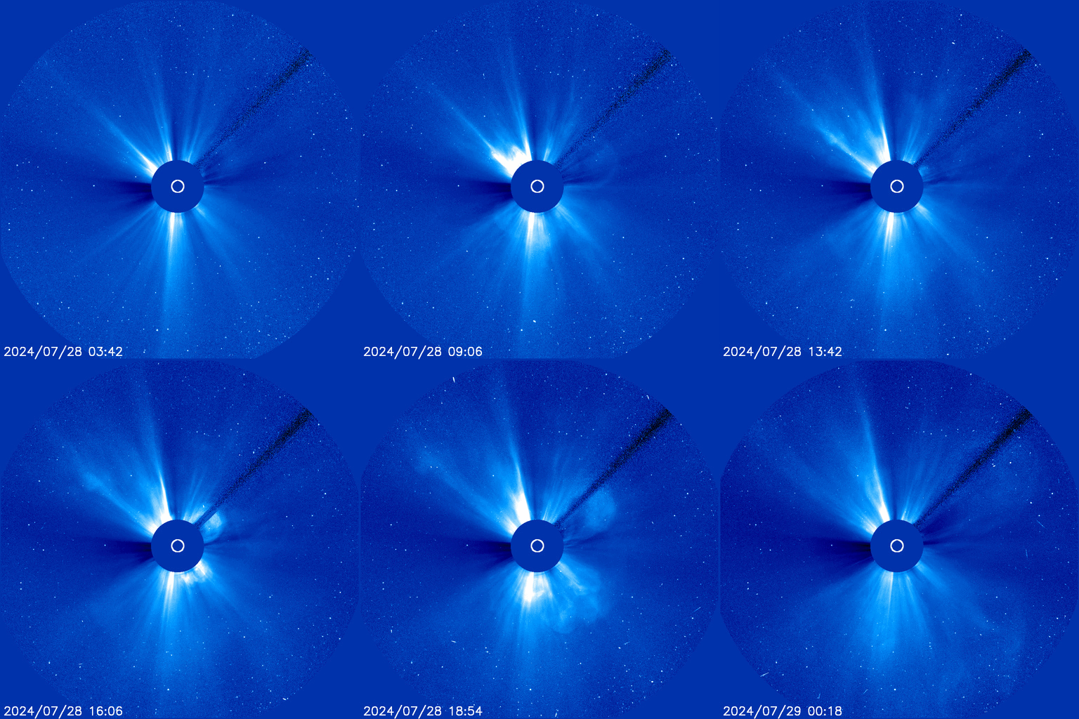
Meanwhile, the sun has been quite active the last couple of days, and several CMEs (Coronal Mass Ejections) were hurled toward Earth. Thus there is a Geomagnetic Storm Watch through Wednesday, possibly offering an opportunity to see the northern lights. As usual, clouds and our ‘southerly’ latitude will hinder that opportunity, but it is always worth paying attention.
The CME from this weekend’s flares are expected to reach Earth shortly after sunrise Tuesday, so the timing is also not optimal. However, if they arrive earlier than predicted, there could be something visible just before sunrise. Also, last night there was another, more-powerful flare that could impact Earth sometime later Tuesday into Wednesday.
You can see the solar particles blasted from the weekend’s flares hurling toward Earth in this loop from the Solar and Heliospheric Observatory (SOHO) Satellite. As with the visible satellite loop, the date-time stamp is in Universal Coordinated Time, which is 4 hours ahead of our local time. It ends before Sunday night’s X-class flare.
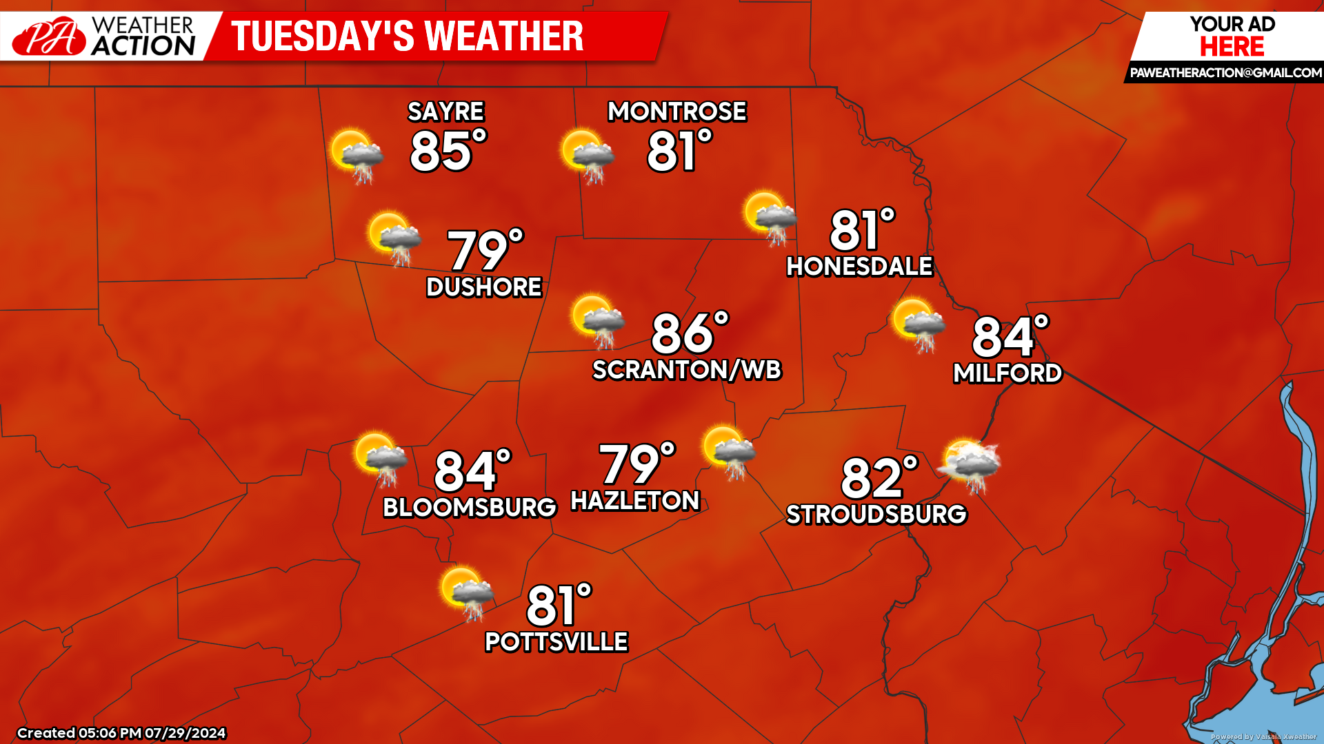
TUESDAY
An upper-level disturbance will approach our area from the west during the afternoon. Scattered thunderstorms could ignite by mid afternoon, with more-widespread showers and thunderstorms possible during the evening and overnight hours as that disturbance moves over our area. While some unlucky people will miss out, those who do get thunderstorms could enjoy locally heavy rain of 1-2″.
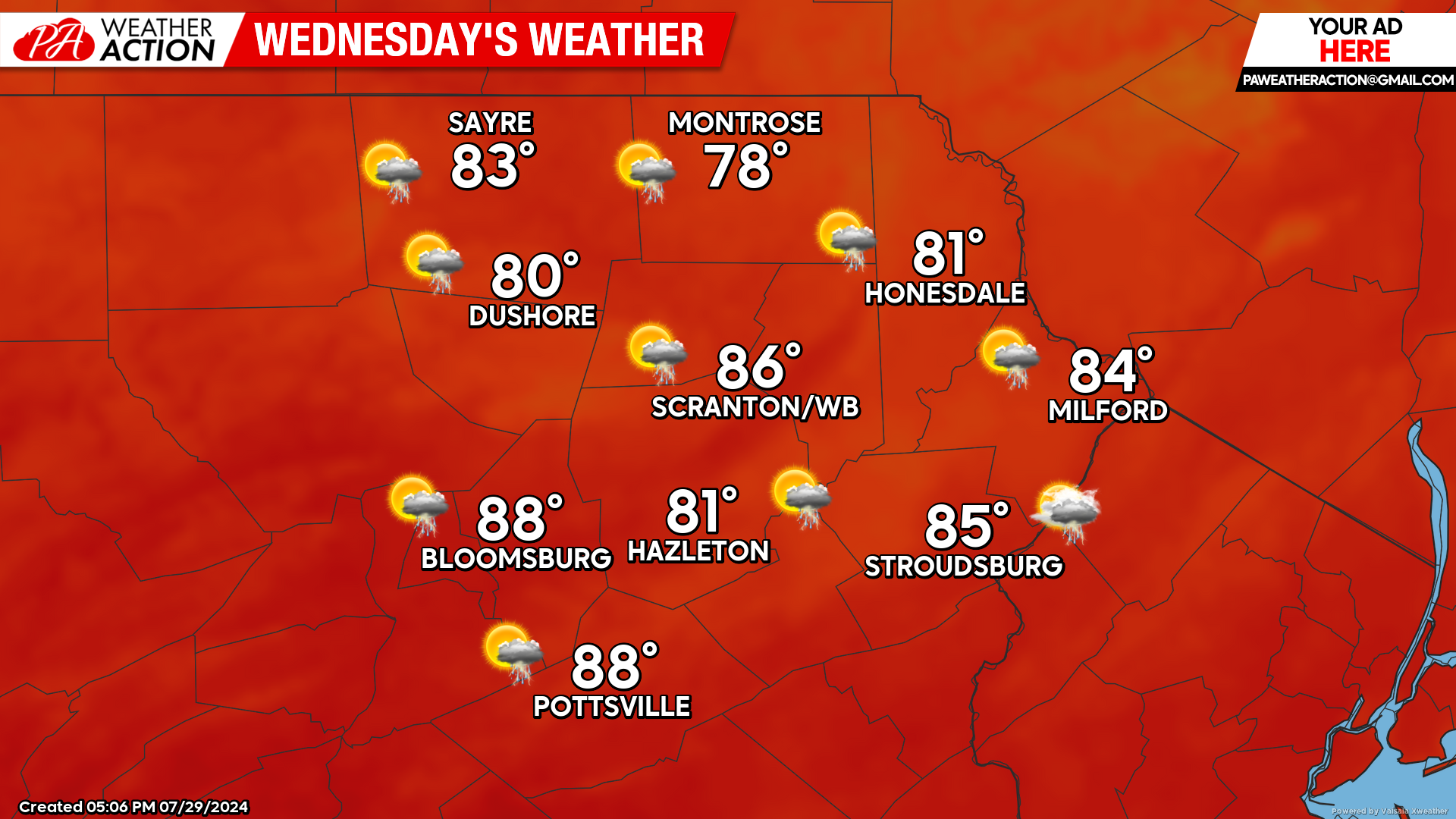
WEDNESDAY
While the morning hours might be dry, scattered thunderstorms with locally heavy rain will develop during the afternoon. It will be humid with widespread high temperatures in the 80s.
THURSDAY
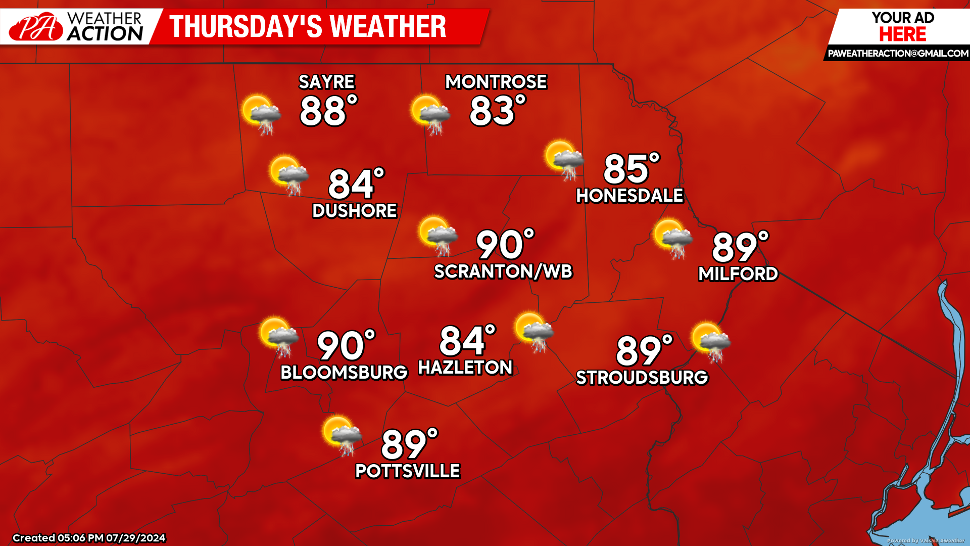
The upper-level disturbance responsible for the Tuesday-Wednesday thunderstorm opportunity will lift to our northeast by Thursday, allowing an upper-level ridge to build into our area. This will result in hot and humid conditions. There will still be a few thunderstorms, but they should be much less widespread than Tuesday-Wednesday.
BEYOND THURSDAY (Friday-Sunday Aug 2-4)
Humid conditions and above-normal temperatures will continue through the weekend. Another upper-level disturbance will provide decent opportunity for thunderstorms Friday-Saturday, subsiding for Sunday.

You must be logged in to post a comment.