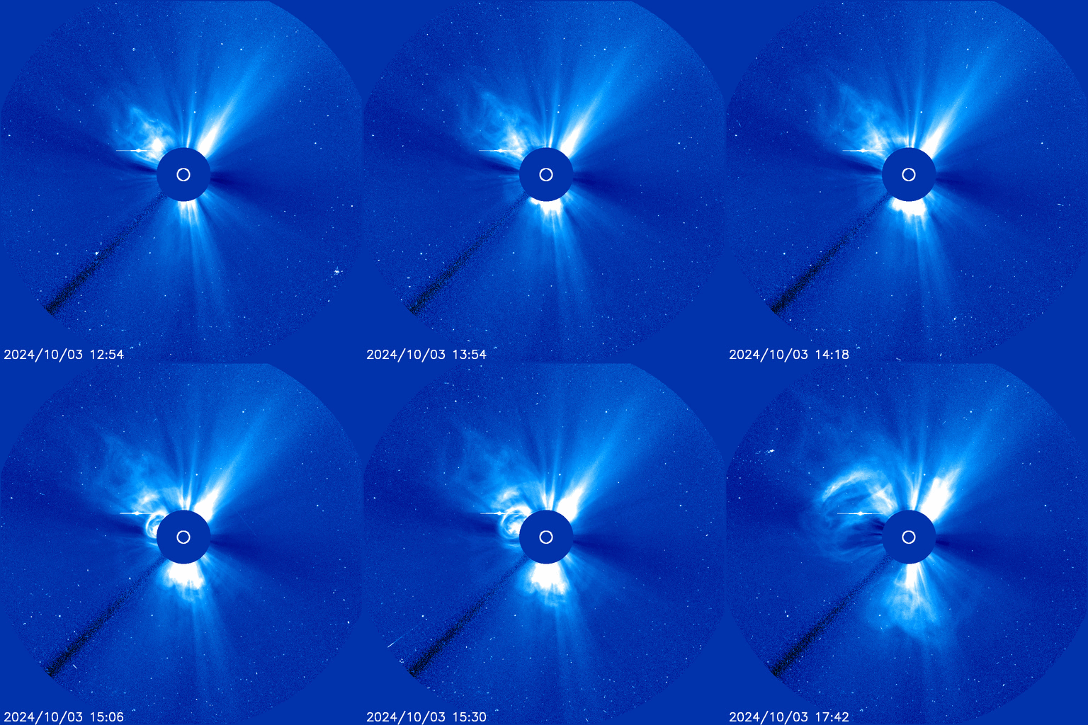
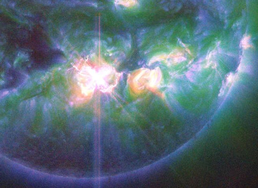
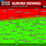
A powerful solar flare on Tuesday sent a weak coronal mass ejection our way which could spark auroras this evening. The good news is that the skies will be clear if the auroras manifest tonight. Another extremely powerful X 9.1 flare erupted Thursday morning and hurling a full-halo coronal-mass ejection toward Earth. This was the most-powerful flare of the current solar cycle and could spark widespread auroras Saturday night.
Also keep in mind the approach of comet Tsuchinshan-ATLAS, which at this time is visible in the southern latitudes just before sunrise, and will become visible in our area in the evening in about a week. It will be visible in the evening for about an hour or so after sunset starting around October 10th, possibly bright-enough to be seen before the sky darkens! The comet will be closest to Earth on October 12th. Don’t miss the opportunity!
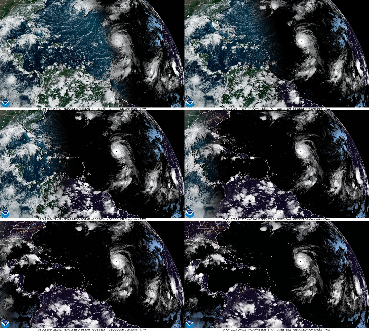
Meanwhile, for the followers of hurricanes, Kirk managed to achieve major hurricane status. Kirk is now a Cat 4 hurricane with 130 mph wind and is expected to continue strengthening with 145mph winds expected by Friday morning! Dangerous swells and rip currents could reach the east coast by Sunday. Kirk will remain out to see and other than the swells, will not affect the United States. He will move northward this weekend then be pulled rapidly eastward toward the English Channel by the latter half of next week.
FRIDAY
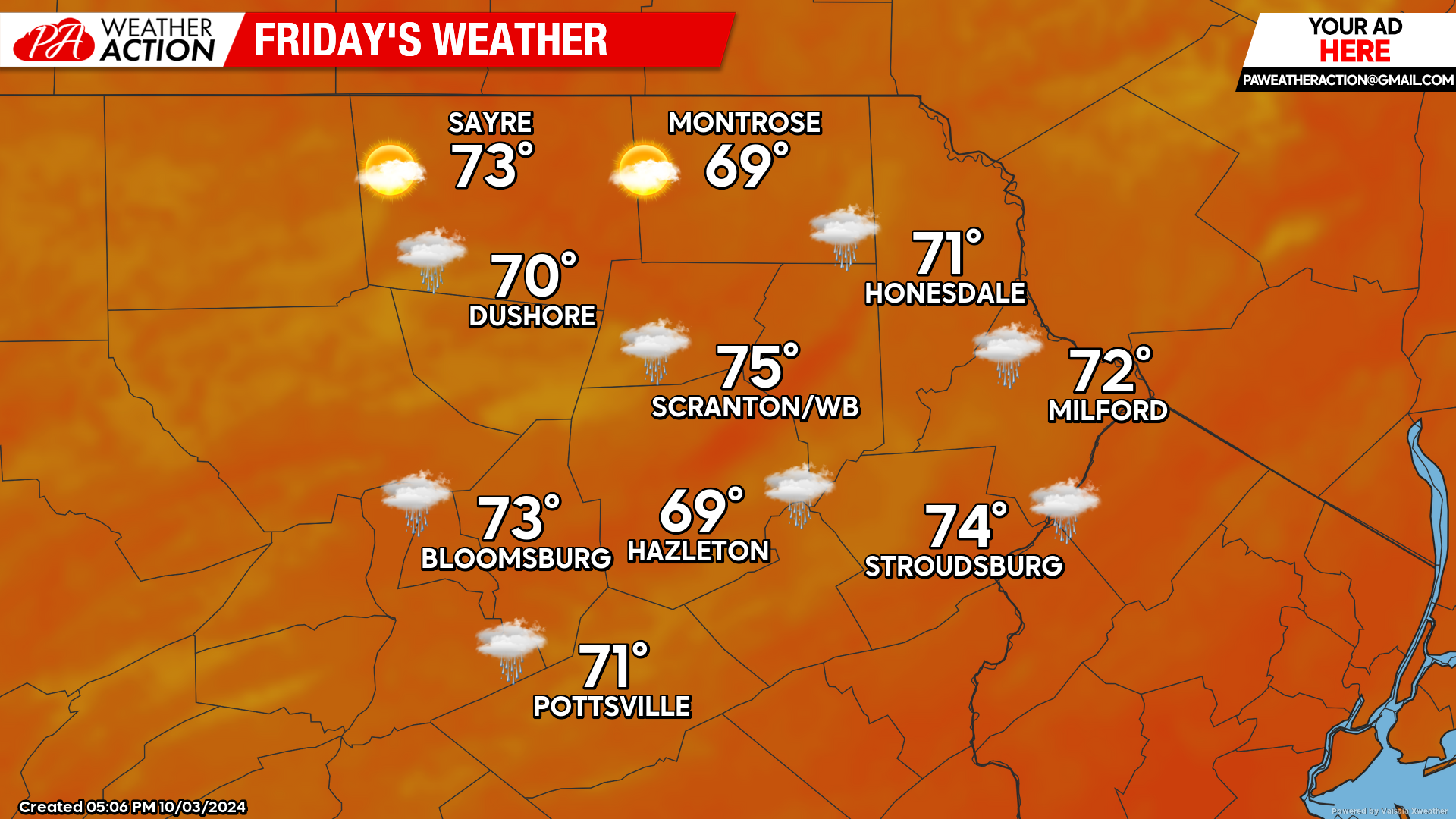
An approaching cold front will draw clouds into our area and the chance of some showers during the afternoon and overnight hours, although again the amounts should be light and most of the day should be dry. Temperatures will be rather mild with many places enjoying highs in the 70s.
SATURDAY
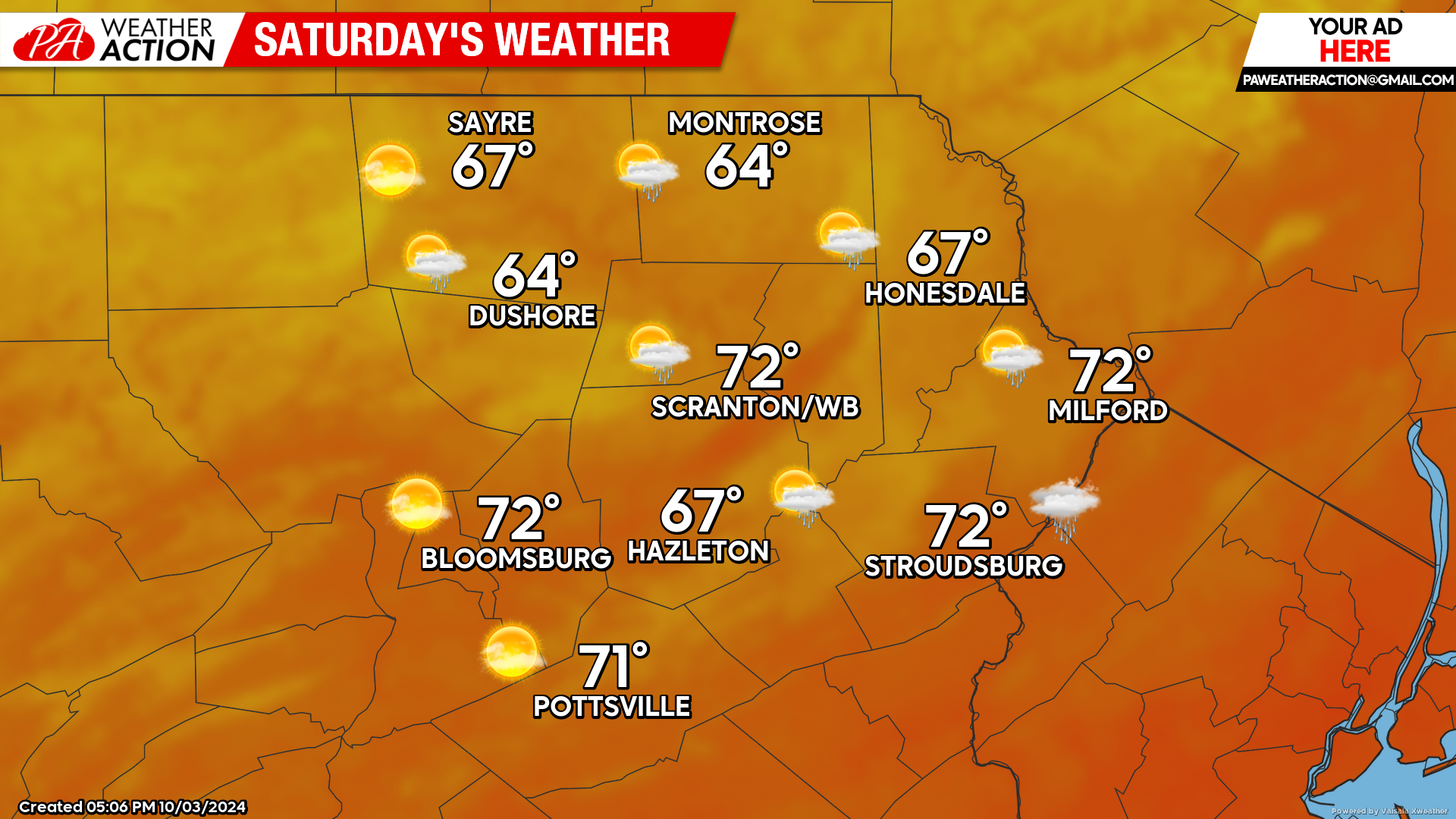
While there could be some light showers Friday night into the morning hours, Saturday will be remembered as a dry spectacular autumn day. Enjoy!
SUNDAY
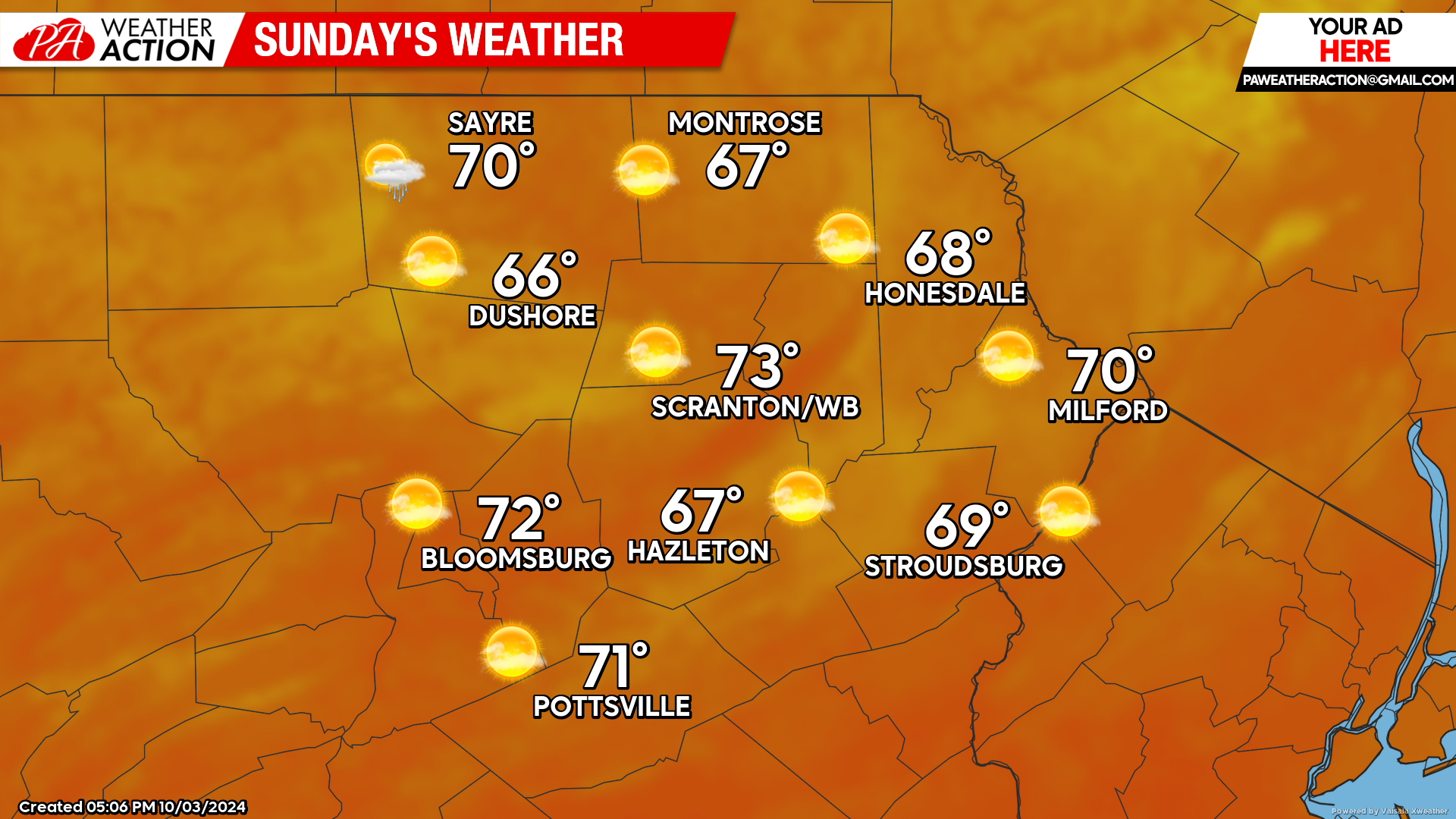
Sunday will be a mostly dry day with sunshine and mild temperatures. Another approaching frontal system could deliver showers Sunday night into Monday morning.


You must be logged in to post a comment.