
Canadian wildfire smoke imparted a hazy pall to the atmosphere this week, turning the sun into a cold red orb earlier this week. Meanwhile, a cold front is attempting to move toward our area today, inspiring some thunderstorms to ignite this afternoon. Ahead of that front, we got to enjoy the first true summerlike weather. High temperatures soared into the 80s along with high humidity today. Temperatures will remain in the 60s tonight, and once again reach into the 80s on Friday. With the proximity of the cold front, Friday will bring a good chance of showers and thunderstorms across the region as well.
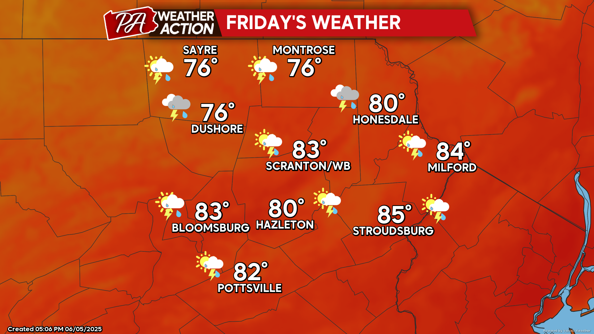
FRIDAY
Friday will be another warm and humid day with numerous showers and thunderstorms igniting ahead of that slow-moving cold front. Localized heavy downpours are possible.
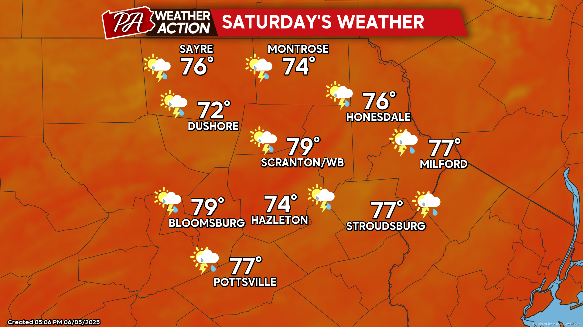
SATURDAY
The cold front will finally swing through our area midday Saturday. This will bring additional showers and thunderstorms to the area. The showers could abate during the afternoon behind the cold front. Humidity levels will drop later Saturday afternoon and evening, allowing for a cooler night Saturday night.
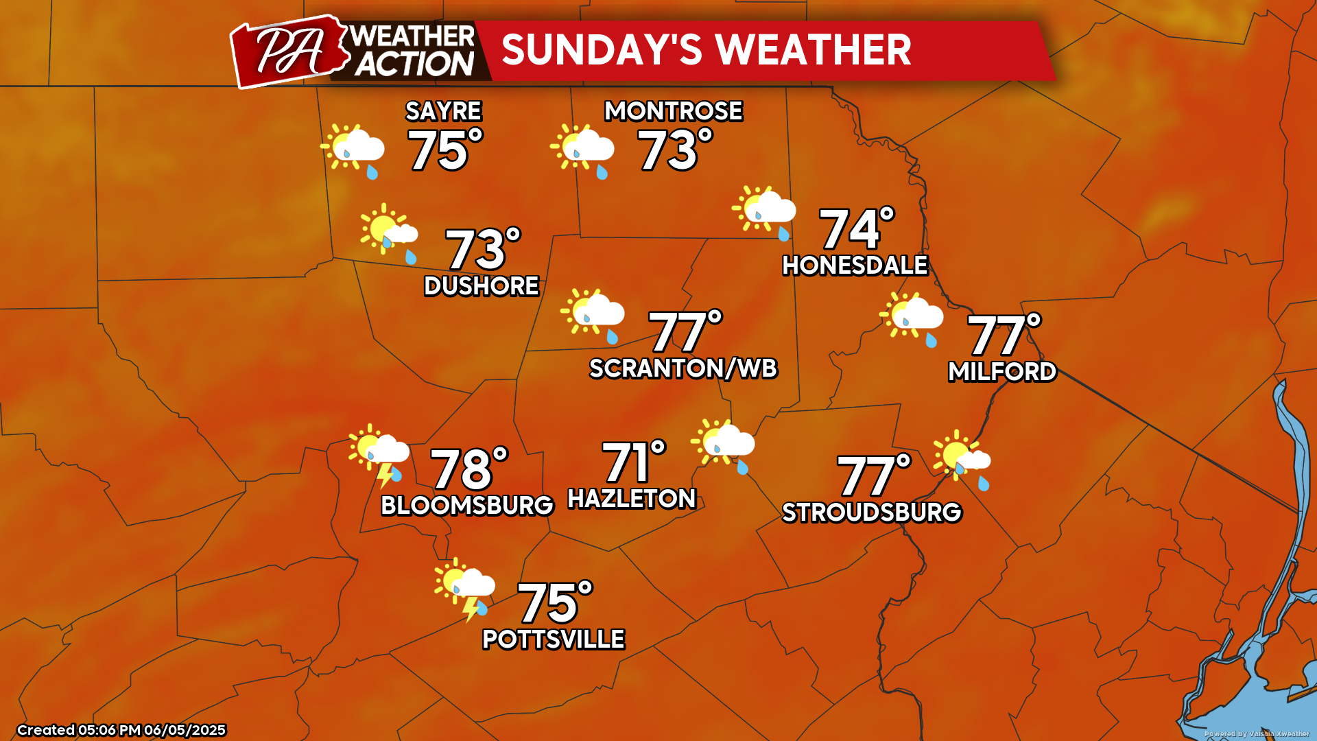
SUNDAY
Sunday will be a cooler and less humid day. A weak upper-level disturbance approaching from the west will deliver showers, mainly during the afternoon and evening.

You must be logged in to post a comment.