


Halloween is over, Thanksgiving is in less than three weeks, and stores think it’s December 24th. Most areas are well past their fall foliage peak as well. Yet temperatures are in the mid 50s to near 70?
So far, this Fall for the most part has been on the warmer side of things. Lately you may have heard about a pattern flip. While that is generally accurate, latest data suggests more of a gradual pattern change.
The next five days will just be a continuation of what we’ve been dealing with for the past several weeks. Highs in the 50s and 60s with Tuesday coming close to 70 degrees in parts of the state. However, this weekend (12th & 13th), a cold shot from Canada will deliver much colder air.
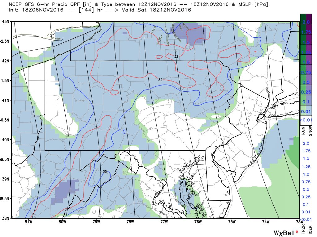
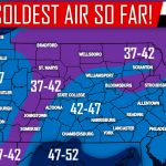
Highs could be in the mid 30s to mid 40s state-wide. In addition, lake effect snow showers could be relatively far reaching. There is a good chance many areas north of Allentown, Harrisburg, and Chambersburg will receive their first flakes of the season. Areas in Western PA could even see light snowfall accumulation Saturday. Below is the GFS for Saturday (Nov 12th).
By Monday (Nov 14th), the cold shot exits the region. What’s next, warmth as usual? Around this point, things get interesting. There is a good amount of model support that a system will move west-to-east above the Great Lakes Region. Behind that there is some uncertainty of what comes next.
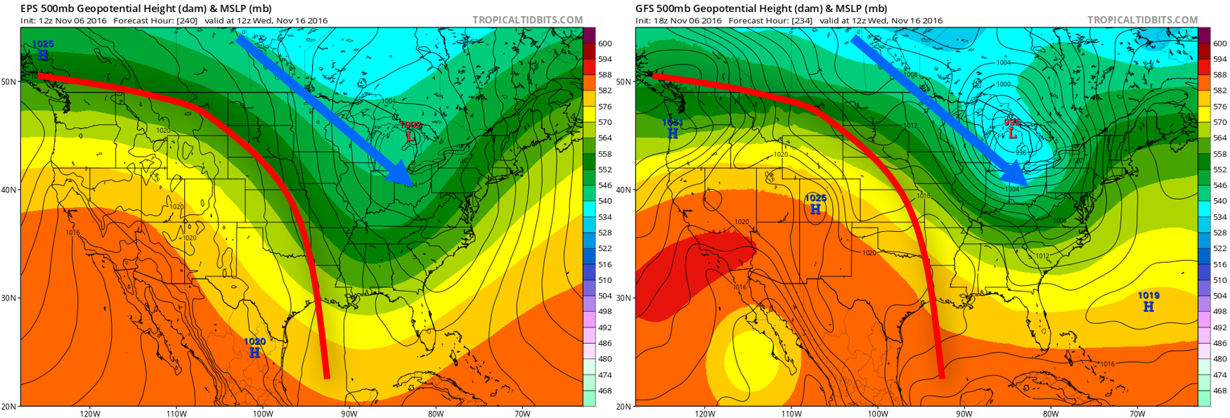
Above are two different models, the Euro EPS on the left and the GFS on the right. The low pressure just referred to can be seen in Northern Michigan on both models. Also on both models is a strong Southwestern US Ridge.
The real question is whether or not cold air flows into the Northern Plains and makes its way down into our area or if ridging wins out. There is strong disagreement within the models in regards to the answer of that question.
The lack of Central Canadian Snow Cover suggests ridging will once again win out. Another variable we look to is the EPO.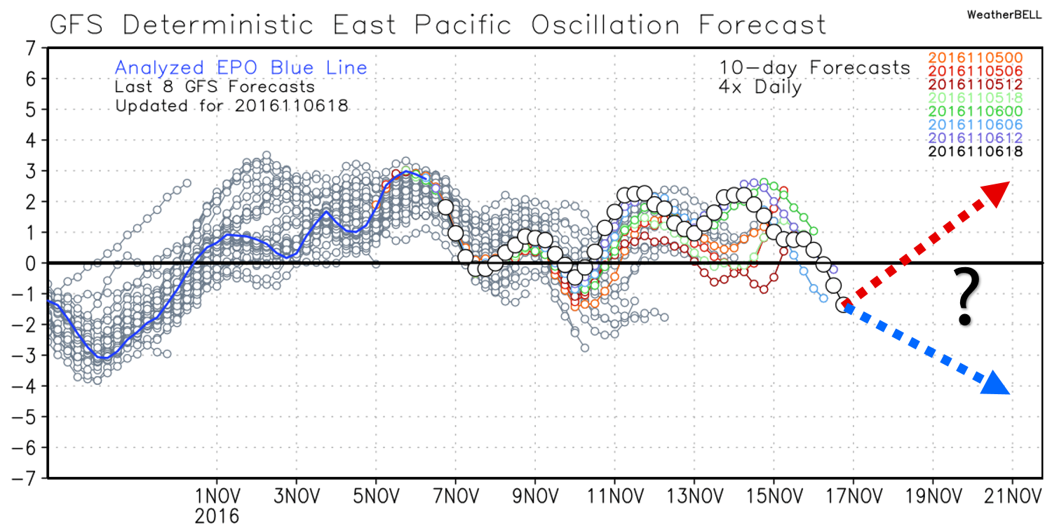
A Negative EPO often translates to below normal temperatures in the Central and Eastern US while a Positive EPO can cause above average temperatures in the stated regions. As you can see on the chart above, the EPO will fluctuate for the next ten days before potentially heading negative.
To wrap it all up, another warm week is ahead before a very chilly weekend arrives potentially bringing many first flakes to many areas. After that, either troughing will setup over the Eastern US or ridging will expand back into the area.
If the EPO does drop into a negative phase, there is an increased chance the Thanksgiving Time-frame could be chilly and possibly stormy. This is one reason why we are predicting a gradual pattern change as we head into the second half of the month.
Some interesting weather may be in store later this month, so be sure to like Pennsylvania Weather Action on Facebook. Don’t forget to share this update below with your family and friends. Stay safe!
You must be logged in to post a comment.