
Showers and thunderstorms delivered up to an inch of rainfall to our southern counties over the weekend. Hot and humid air returned for the first half of this week. A cold front will deliver refreshing Canadian air for the end of this week.
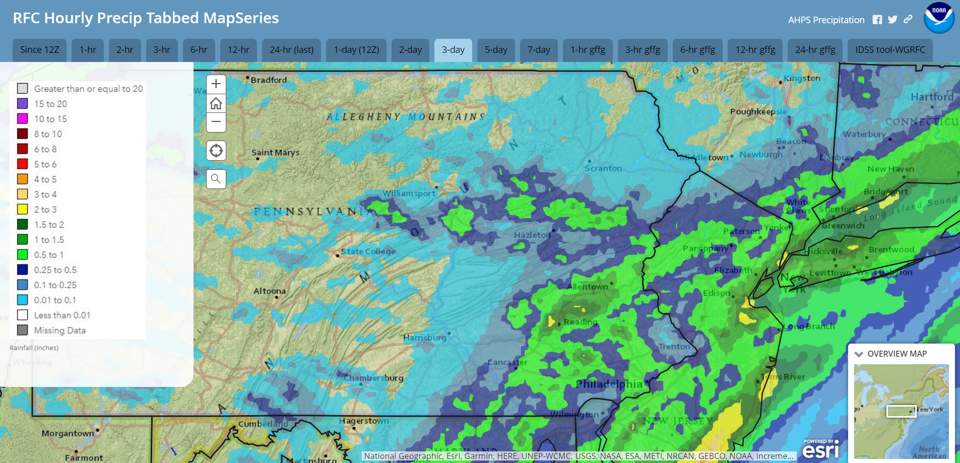
Radar-estimated rainfall for Friday-Sunday July 12-14:
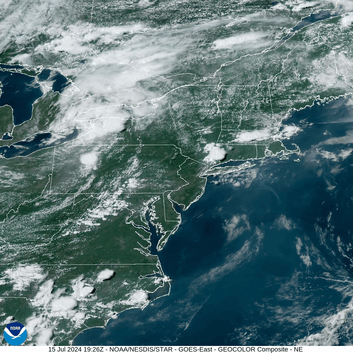
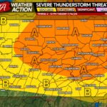
Strong and severe thunderstorms are likely this evening (Monday evening), courtesy of the high heat and humidity along with a disturbance approaching from the west. These storms could bring frequent lighting and strong wind gusts. You can see a north-south oriented line of severe thunderstorms explode into existence and push eastward into our area on this visible satellite loop (loop starts at 3:26pm and ends at 6:41pm Monday July 15):
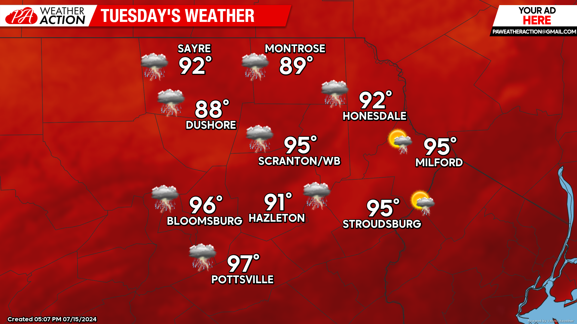
TUESDAY
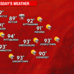
Tuesday will likely be the most-oppressive day of the week, as temperatures soar into the mid 90s in our southern valleys. With heat indices projected to be near 100, the National Weather Service has issued a heat advisory. The high heat and humidity will destabilize the atmosphere, and another round of strong thunderstorms could form during the afternoon and evening.
Tuesday night will be another muggy night, and temperatures will struggle to fall much below 70.
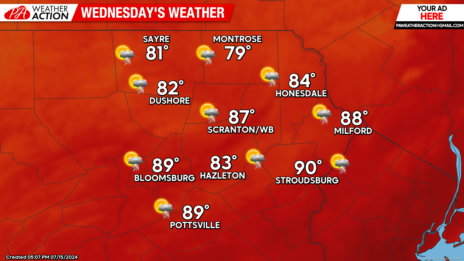
WEDNESDAY
Wednesday will feature another day of heat and humidity. The approaching cold front will result in a cloudier day, holding temperatures down slightly compared to Tuesday.
An approaching cold front will spark thunderstorms during the afternoon. The opportunity for thunderstorms will continue until the cold front crosses overnight.
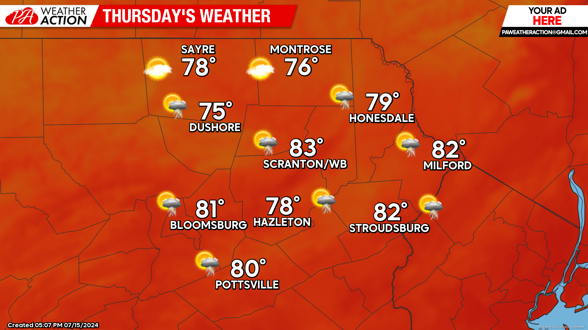
THURSDAY
The cold front will deliver refreshing Canadian air. Max temperatures will range from the mid 70s to the low 80s, with low humidity. Depending on how quickly the influence of the front can exit our area, there could be a few lingering showers in the southern and eastern counties. Most of the day should be dry, however.
BEYOND THURSDAY (Friday-Sunday July 19-21)
The cold front will likely stall east-west just south of the Mason-Dixon line, taunting the southern Pennsylvania border with the chance of unsettled weather. Our area should be far-enough north to have a dry weekend with seasonal temperatures and low humidity. Normal high temperatures this time of year range from the upper 70s in the higher elevations to the low-mid 80s in the valleys. Normal low temperatures are in the mid-upper 50s.
You must be logged in to post a comment.