
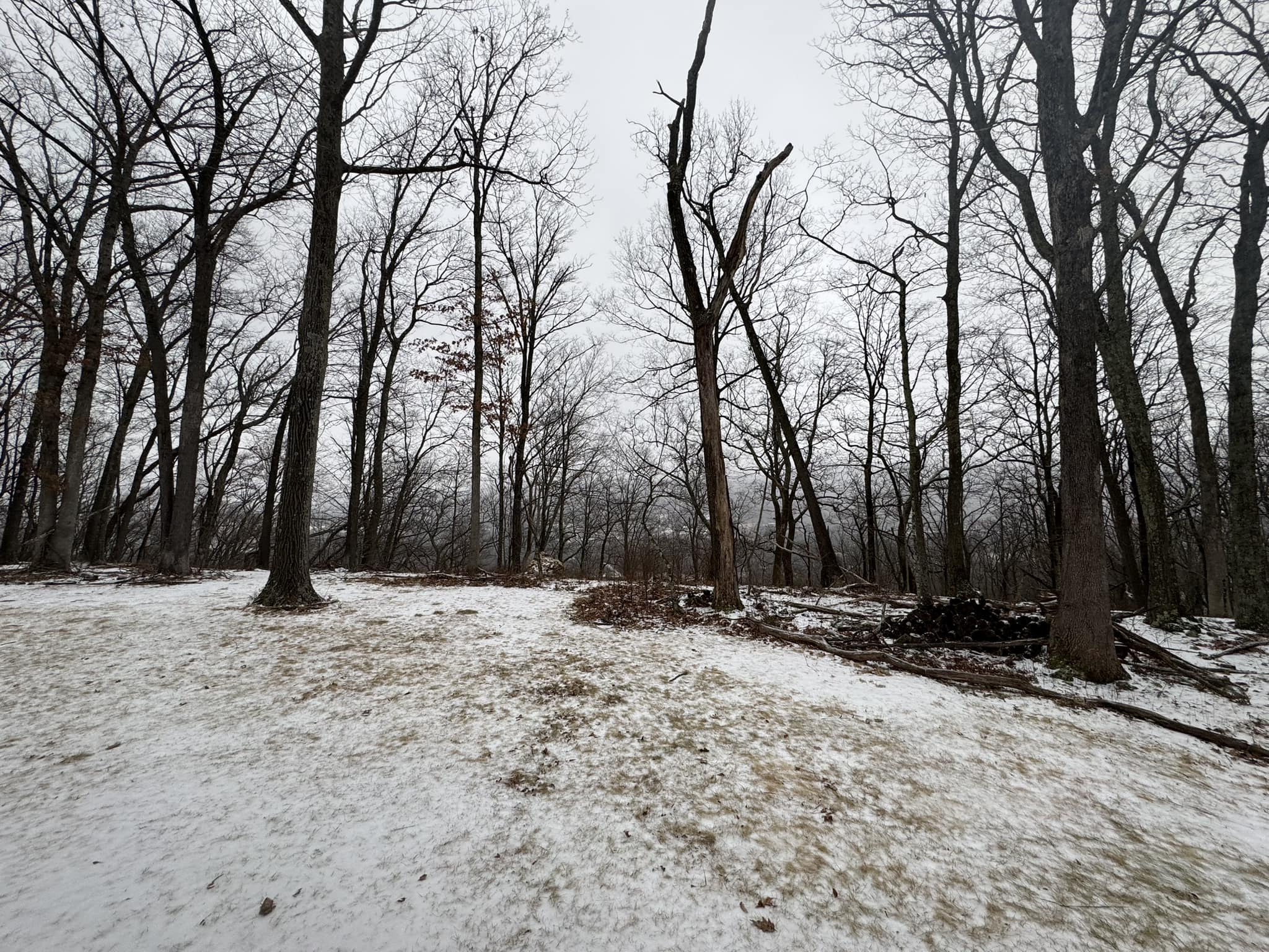
This morning’s system delivered a general half inch to inch of ice-sleet concrete. Wind blowing from the west-southwest is blowing warmer air into our region and attempting to melt this morning’s accumulation. However, that warm breeze will overrun the more-dense cold air at the surface and struggle to erode that colder air, and the sleet-ice concrete on the ground also contains the same amount of frozen material as a half foot of snow. And that delivery of warm air will be cut off by a cold front after midnight, driving temperatures below freezing by sunrise. Thus, complete melting of the icy concrete is unlikely.
We are now entering an active winter pattern. There will be a moderate winter event this weekend, with a couple more anticipated for next week. Phil warned you! Enjoy!
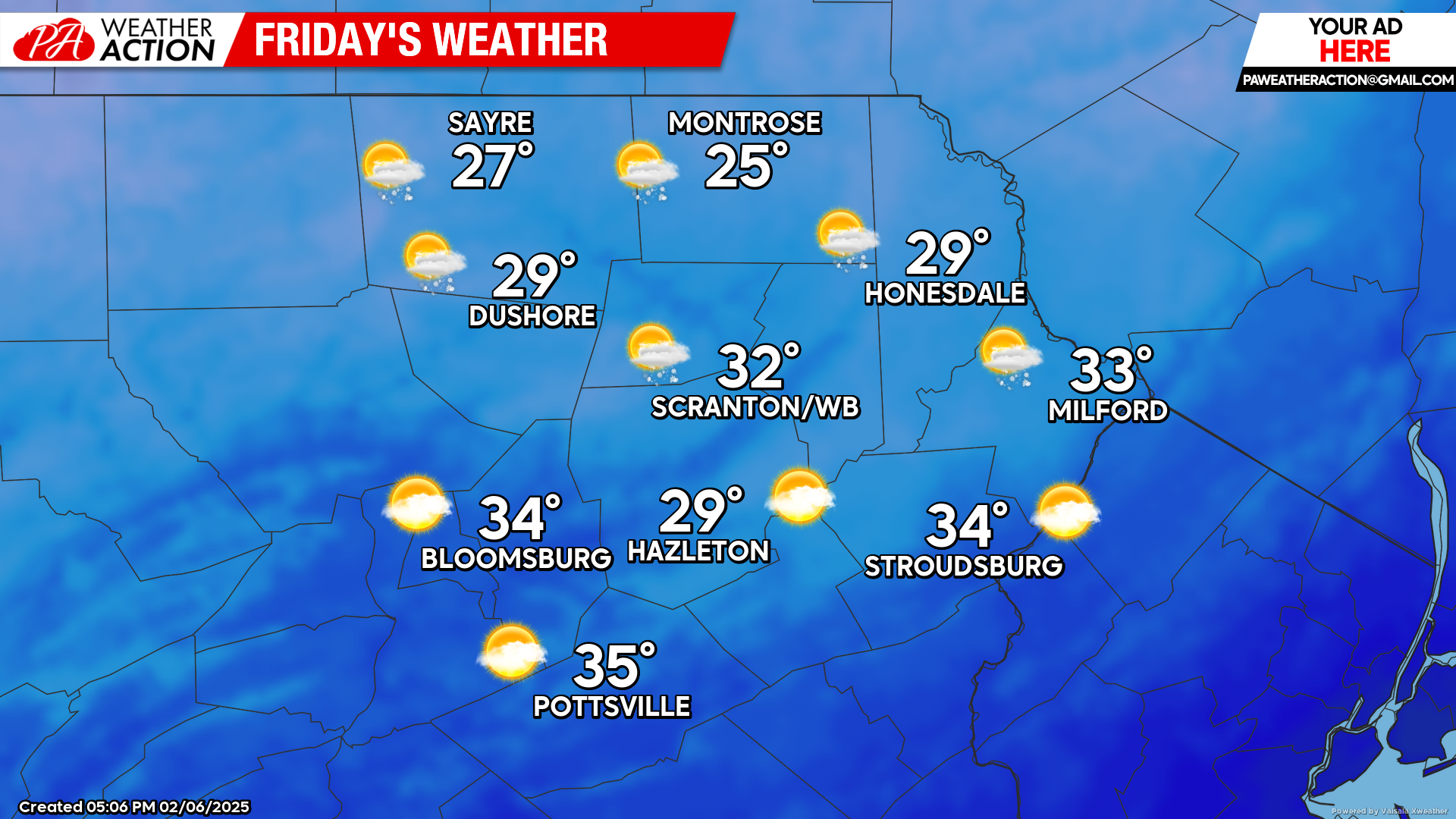
FRIDAY
Colder air will blow into our area on wind from the northwest gusting over 40 mph, driving the frontal zone to our south. Temperatures will slowly fall from their sunrise highs, along with scattered snow showers.
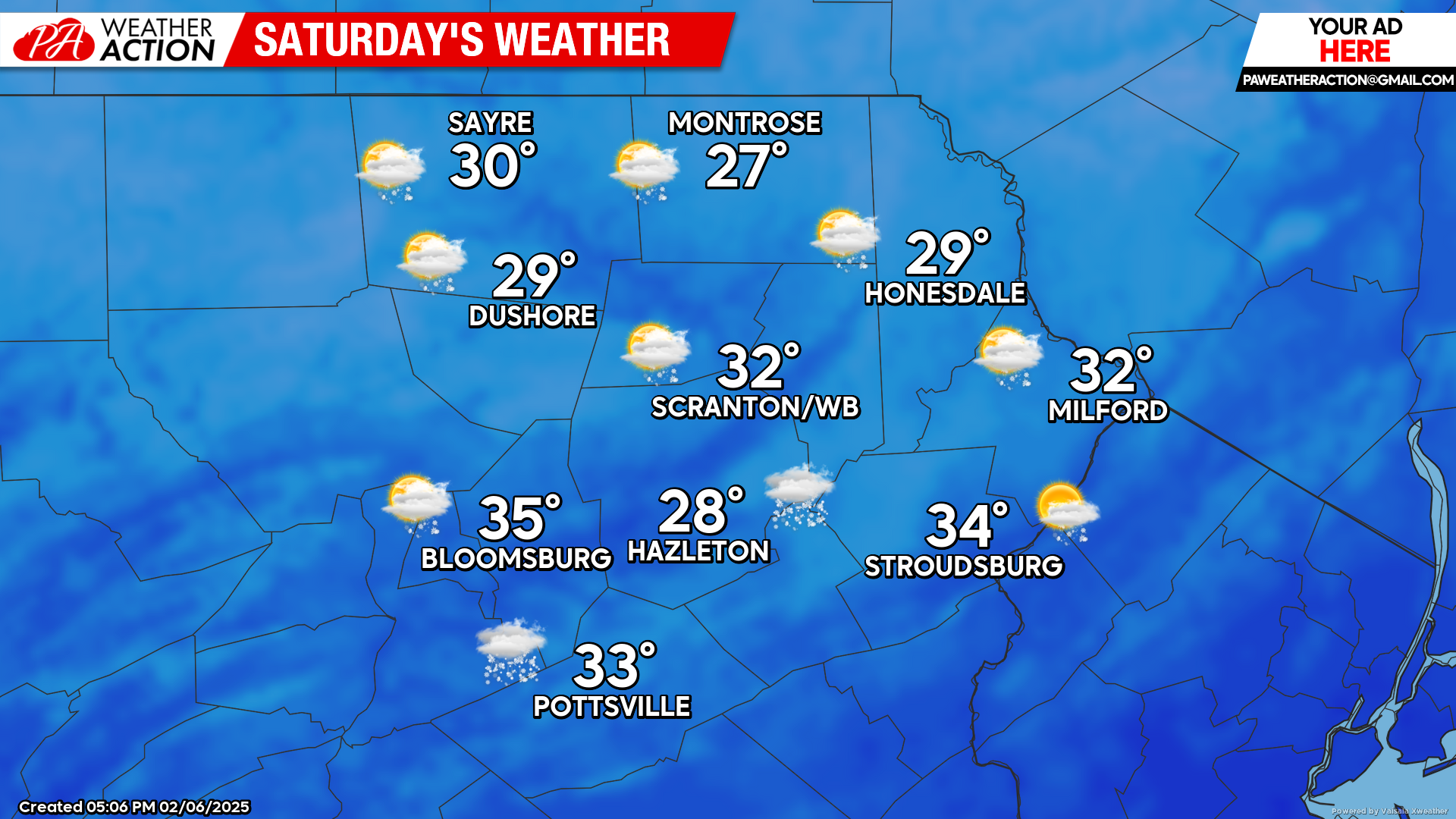
SATURDAY
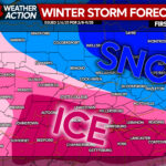
Another storm system will strengthen along the frontal zone, bringing increasing clouds. Snow will spread into our region around and overnight into early Sunday. There could be changeover issues in our southern counties, but a few inches of snow will be possible with this system.
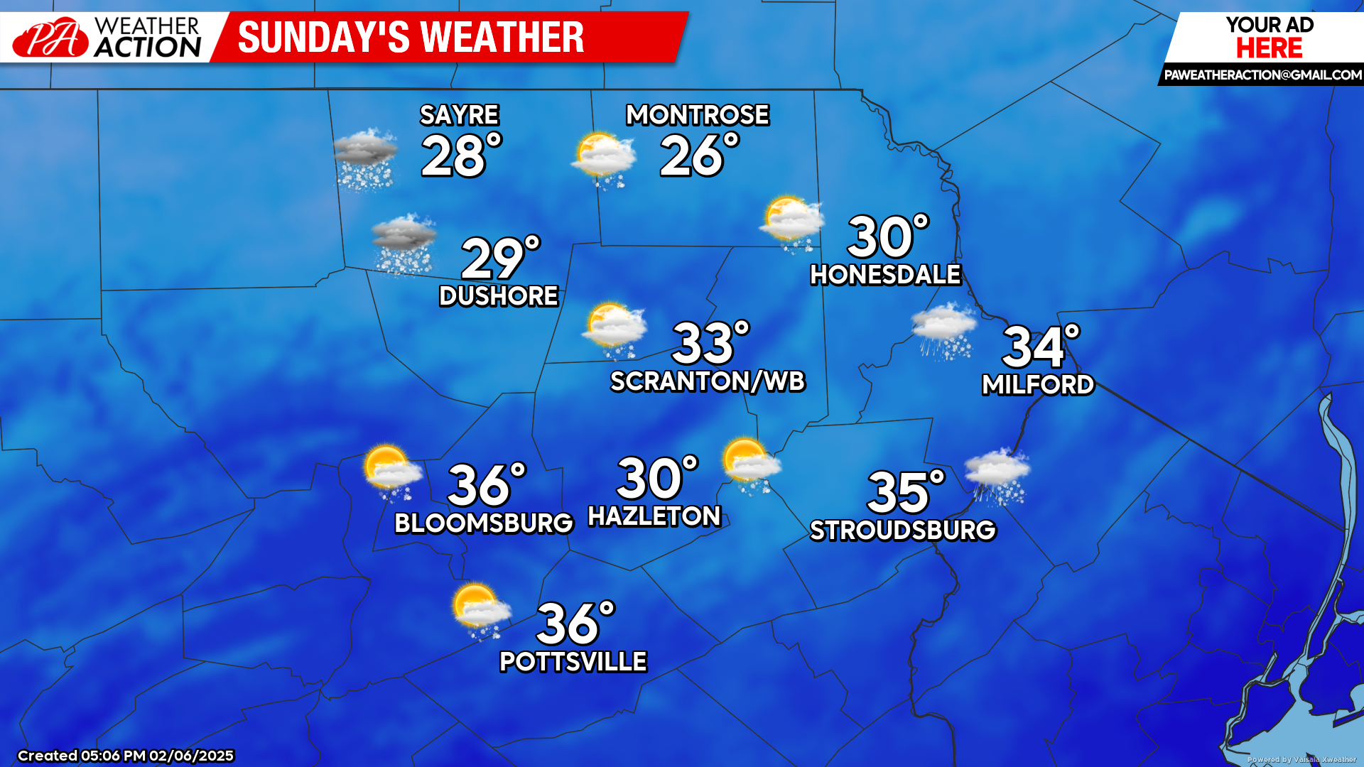
SUNDAY
Snow and mixed precipitation will end around sunrise. Gusty winds will bring colder air into our region, with temperatures remaining steady or slowly falling throughout the day.
You must be logged in to post a comment.