
SECOND CALL FORECAST POSTED:
Just as we thought it may be weeks before the snow-starved in Southeast PA see their first plowable snowfall, one last system before a pattern change will deliver. A clipper coming across the Midwest will crash into the Appalachian mountains, but not before dropping moderate snow in Western PA.
A coastal low pressure will then develop, producing fluffy snow in Southeast PA. In the middle, Central PA will downslope off the Alleghenies and see very little. This is a common occurrence in clipper systems.
There is still significant disagreement among the models, and this forecast is based on many other factors as well. We don’t see a scenario where the coastal low really blows up and drops lots of snow. Highest confidence for snowfall amounts is in Western PA.
Future Radar Timing
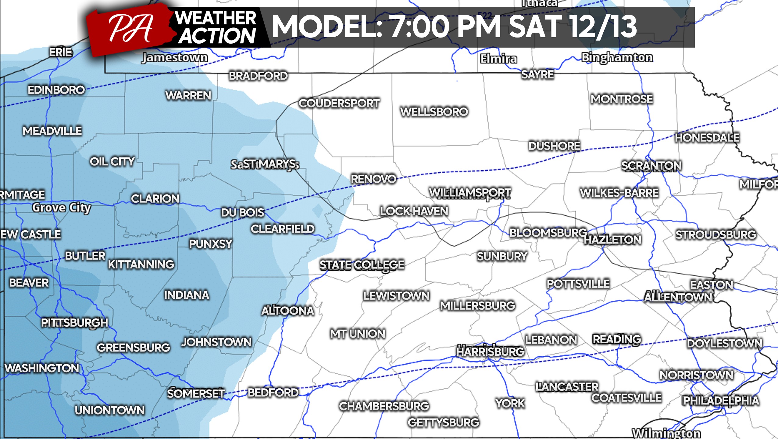
Light snow will push into Western PA early Saturday evening, turning moderate especially in Southwest PA. There may be some lake effect enhancement near Erie as well.
Temperatures will be in the 20s, so there’s zero concerns about mixing. This will be a fluffy snow you can use the broom to clear off. Below is the NAM model for 7:00 PM Saturday.
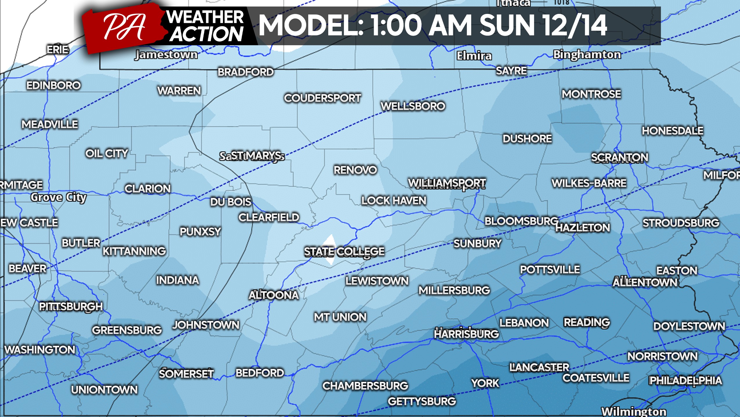
Late Saturday evening into early Sunday morning, we expect the coastal low to get going. The NAM is pretty aggressive with snow in Eastern PA, but overall we’re looking at moderate snow in SEPA, and light snow near I-81.
By sunrise Sunday, snow will be over in Western and Central PA. Meanwhile in Southeast PA, the coastal low should still be producing moderate snow especially around the Philadelphia Metro. This will be a rare scenario where the closer you are to the Delaware River, the more snow you’ll get.
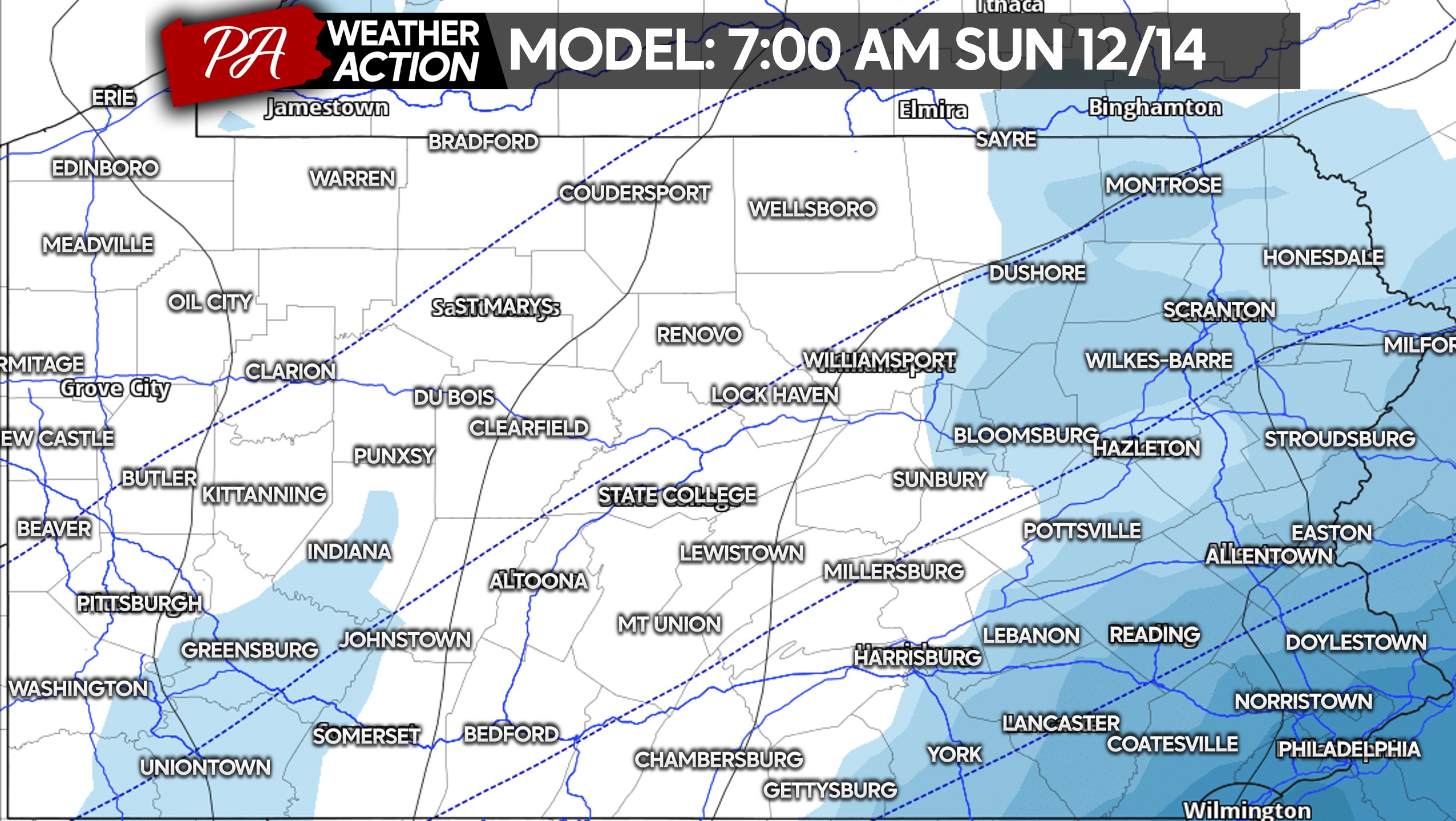
Snow will then exit Southeast PA between 7-9 AM Sunday. Even in Eastern PA, the snow will be light and fluffy unless we see major north trends that would bring the sleet/snow mix line nearby. That’s not currently expected though.
FIRST CALL SNOWFALL FORECAST FOR SAT PM – SUN AM
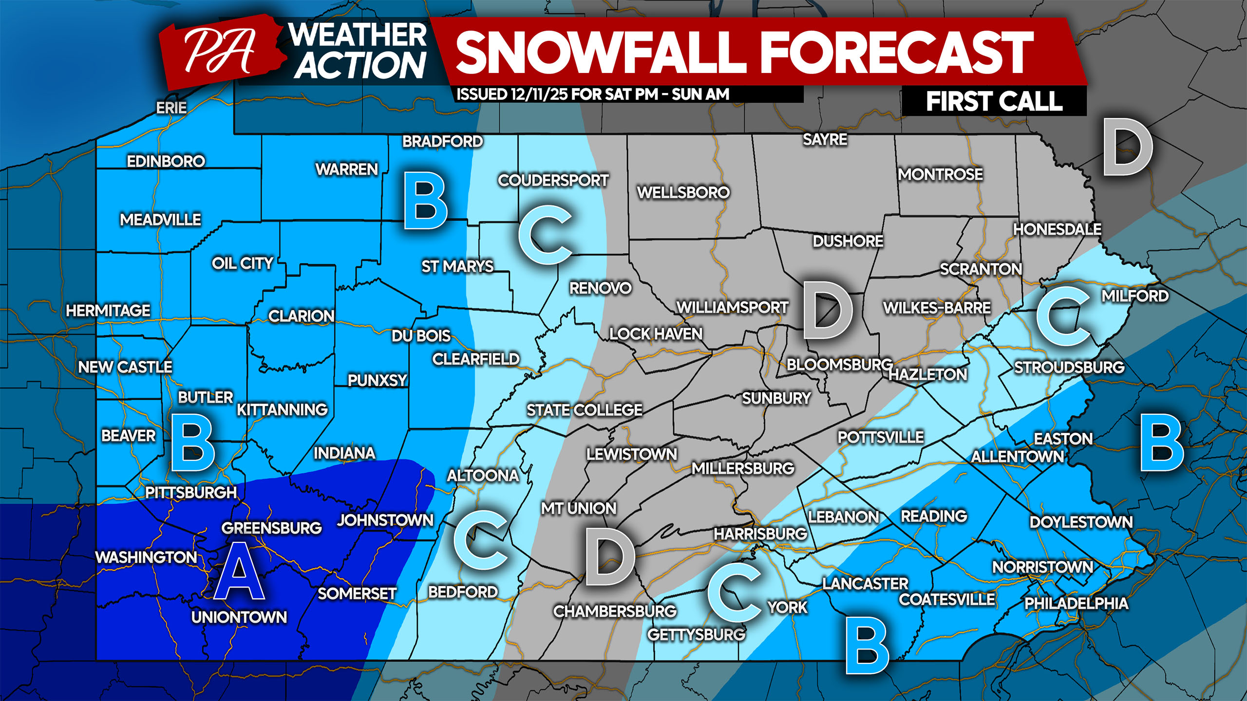
Area A: Snowfall accumulation of 4 – 6″ expected. Roads will be snow-covered.
Area B: Snowfall accumulation of 2 – 4″ anticipated. Roads will be snow-covered.
Area C: Snowfall accumulation of 1 – 2″ expected. Untreated roads will become snow-covered.
Area D: Snowfall accumulation of less than 1″ anticipated. Roads may be slippery.
Be sure to share this forecast with friends and family especially if your area hasn’t seen much snow yet this season!
You must be logged in to post a comment.