
There is no better time of year to see snow than the holiday season, and the pattern is loading up! Snow in December has been a rarity these last several years, with the last major December storm in 2020. The last white Christmas in Philadelphia was in 2009, and 2022 in Pittsburgh.
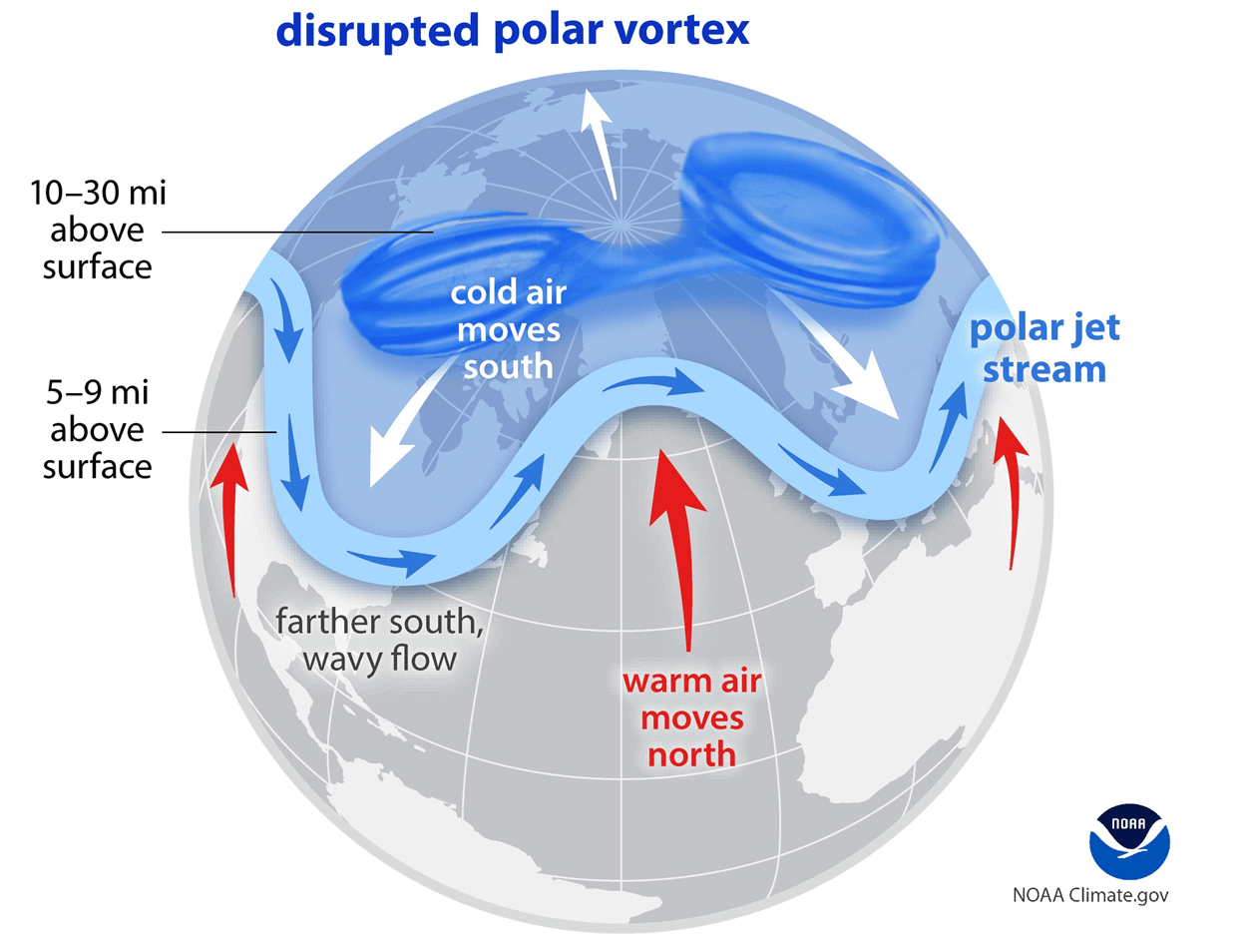
The polar vortex is a term that’s often floated around, but rarely makes an appearance. January 2025 featured a short-lived event, but even that caused frigid temperatures as we all remember.
Here is an illustration of what happens, even under a stretched polar vortex like we’re expecting in the next 10 days. The downstream of that disruption may not reach the troposphere, where are we live, until mid – late December.
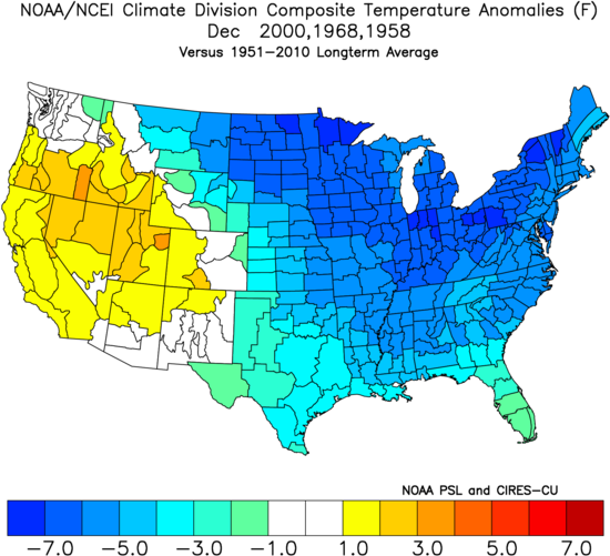
This would be a historically-early appearance, only happening in late November a few times in the last 75 years. When it has occurred, this was the outcome. One of those years, 2000, is a top analog for this upcoming Weak La Niña winter.
The catch is that we won’t have to rely on the stratospheric warming event for a cold and potentially snowy December. The NAO/AO/EPO look favorable for slightly below average temperatures, with the PNA trying to balance out the jet stream and prevent a large western ridge.
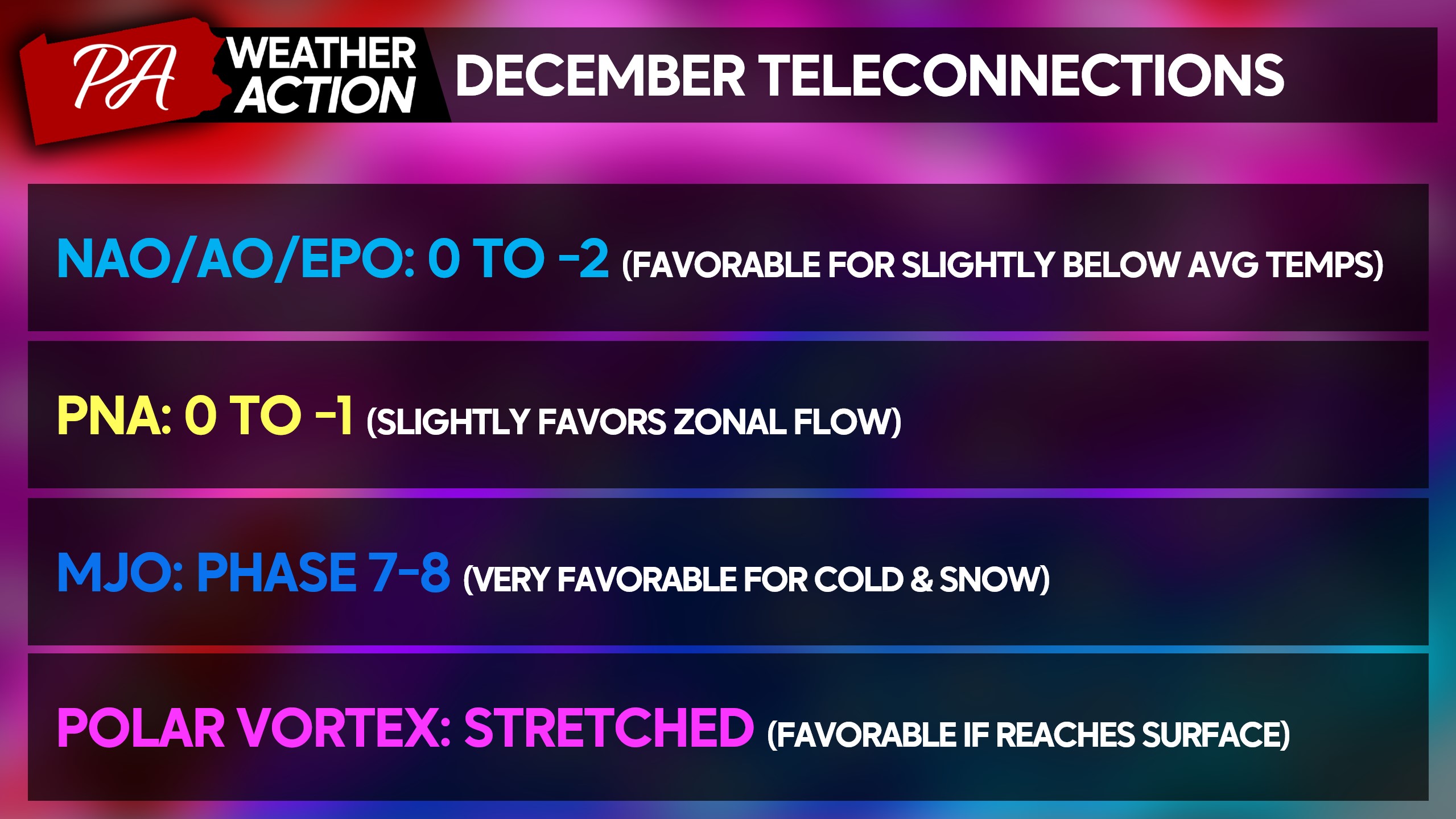
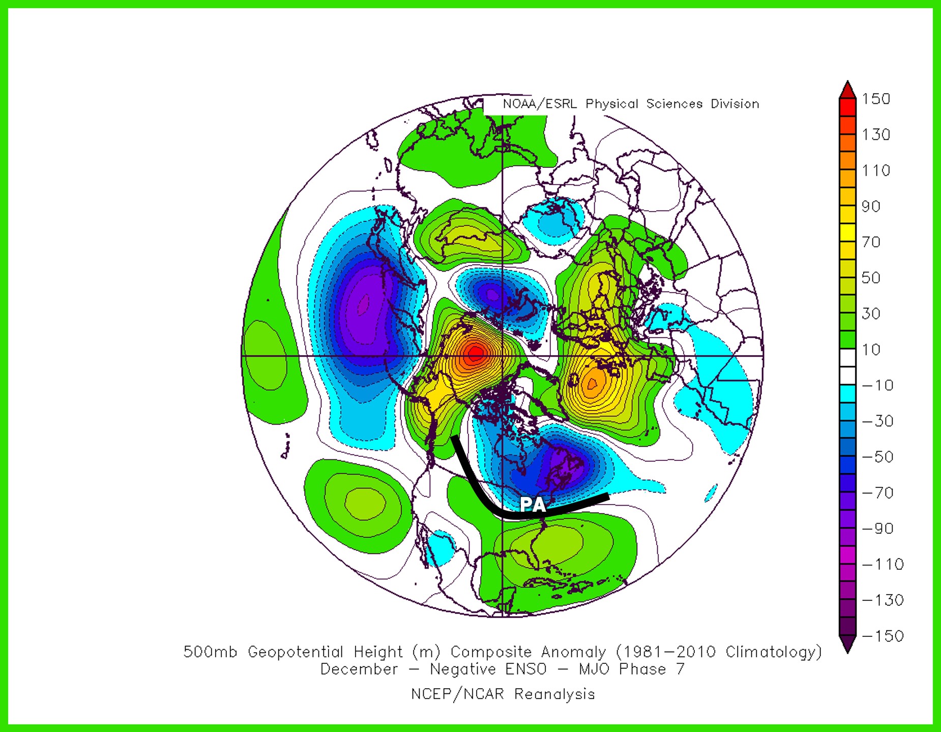
The MJO will be heading into phase 7 by Thanksgiving, migrating towards phase 8 in mid-December. In the meantime, the phase 7 pattern is optimal for trofing in the Great Lakes and Northeast.
The big question head into December especially in a Weak La Niña will always be the southeast ridge. The SE ridge is an infamous dome of high pressure known to setup on the East Coast, which forces the storm tracking to our west and gives us rainstorms. This phase 7 MJO look keeps the SE ridge somewhat suppressed.
We will likely see a few systems cut to our west between Thanksgiving and the first week of December before the pattern becomes most supportive of eastern cold.
Weekly models are on board for a cold and potentially snowy December, with below average temperatures shown across the board. The middle to later portions of December look most favorable for early season snow events in the Northeast and Upper-Mid Atlantic.
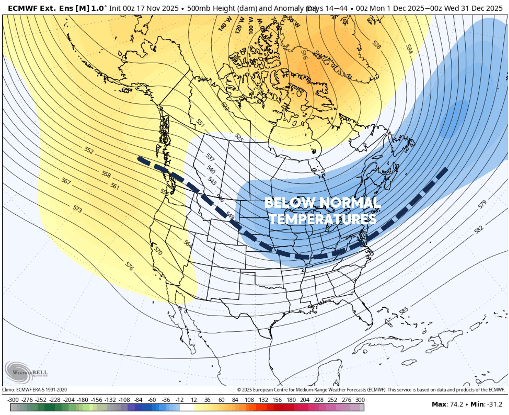
Below is the European model’s projection for month of December, showing a trough setting up from the Northern Plains into the Northeast.
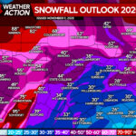
You will likely see the image below floated around on social media, as it’s entertaining to look at potential snow amounts for December. But we use it more for snowfall anomalies and to get an idea of where the storm track may set up.
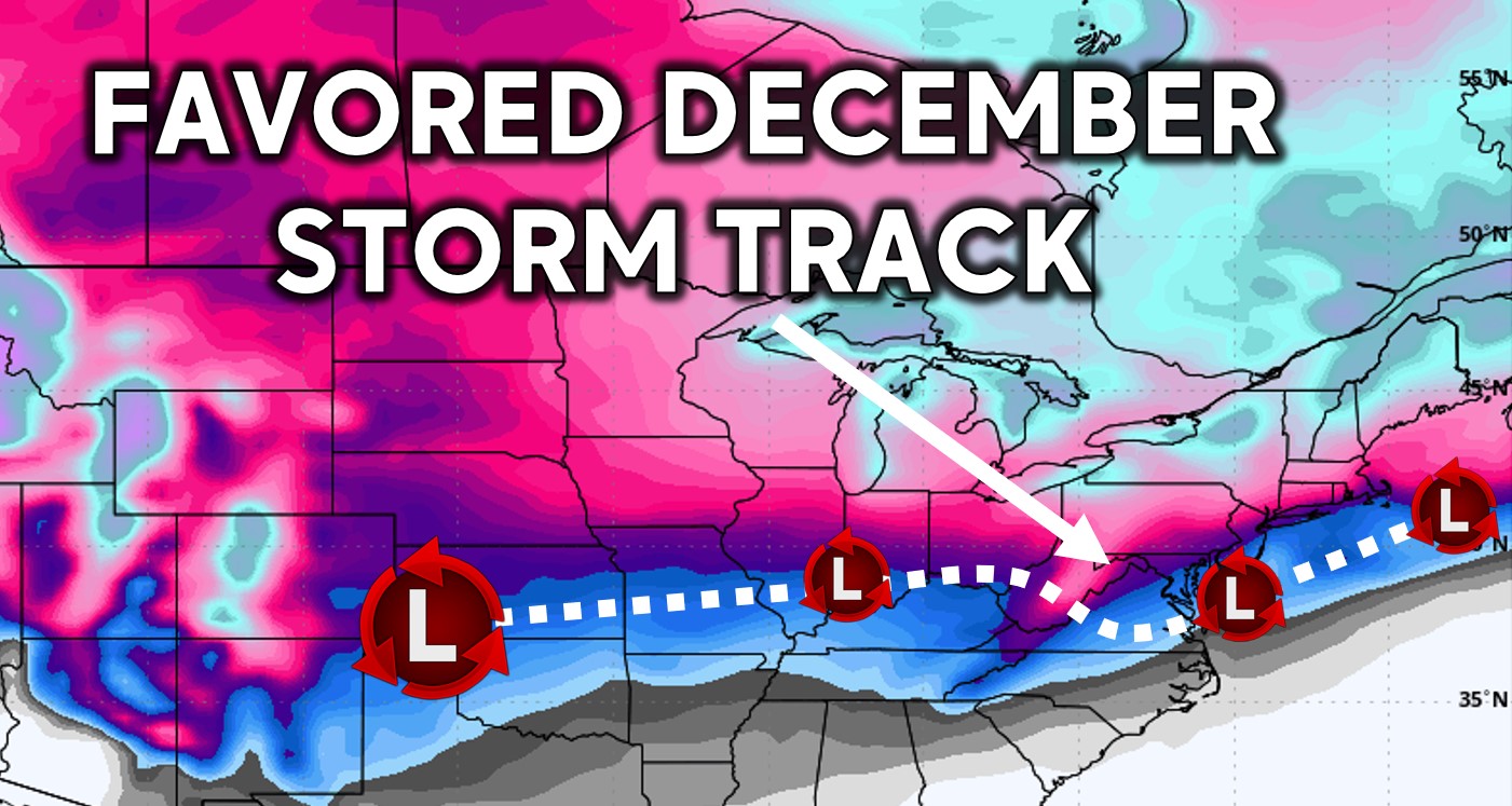
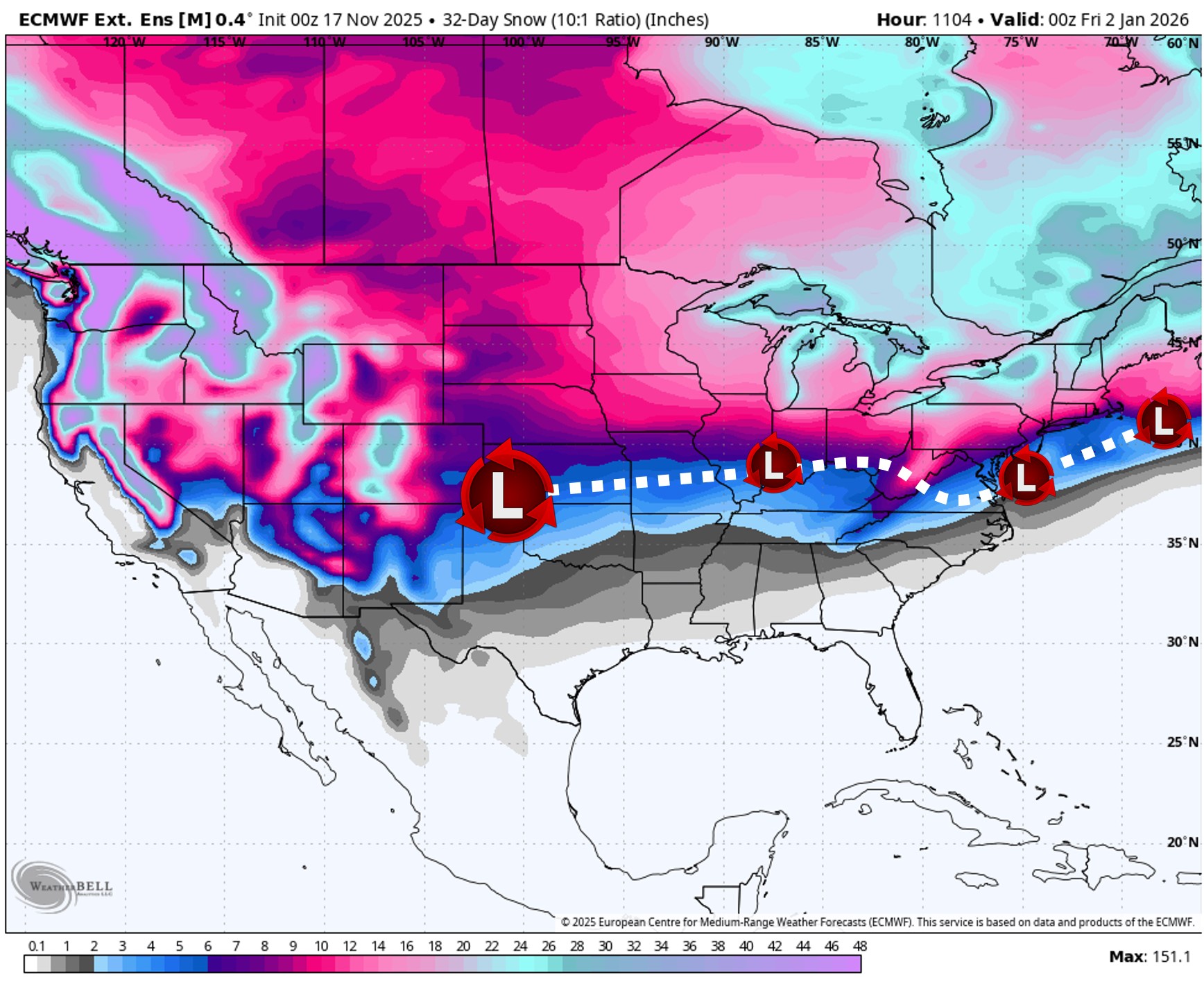
La Niña amplifies the northern jet stream, meaning most of our storms will come from the Great Plains, rather than the Gulf Coast. We expect Miller B storms to be common in December and this winter as a whole.
This is where a low pressure tracks through the Ohio Valley before transferring to a coastal low. Sometimes the coastal low can be near I-95, which results in mixed events over Pennsylvania.
Overall, weekly models are projecting above average snowfall during the month of December. The actual amounts will be much different than what’s shown below, as each storm will have its own complexities.
We will have the latest winter storm forecasts, which will likely be starting shortly after Thanksgiving! Share this forecast with friends and family hoping for a snowy holiday season!
You must be logged in to post a comment.