
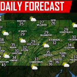
Without a doubt, our state has dealt with its fair share of cold weather this winter so far. Unfortunately this week, the coldest air of the winter season arrives Wednesday and lasts through Friday. For many areas, especially across Northern Pennsylvania and locations in higher elevations, low temperatures will drop below zero degrees with wind chill temperatures even colder.
There will be many school delays and even cancellations this week between Tuesday’s snow and these near record cold temperatures. Of the three mornings between Wednesday through Friday, Thursday morning will be coldest. So while Wednesday and Friday our wind chill temperatures will be below zero at times, our forecast map truly reflects Thursday morning the most, as some areas could get as cold as negative 40 degrees. Incredible for the state of Pennsylvania.
To demonstrate exactly how much colder it will be compared to normal, take a look at the latest GFS for Thursday morning:
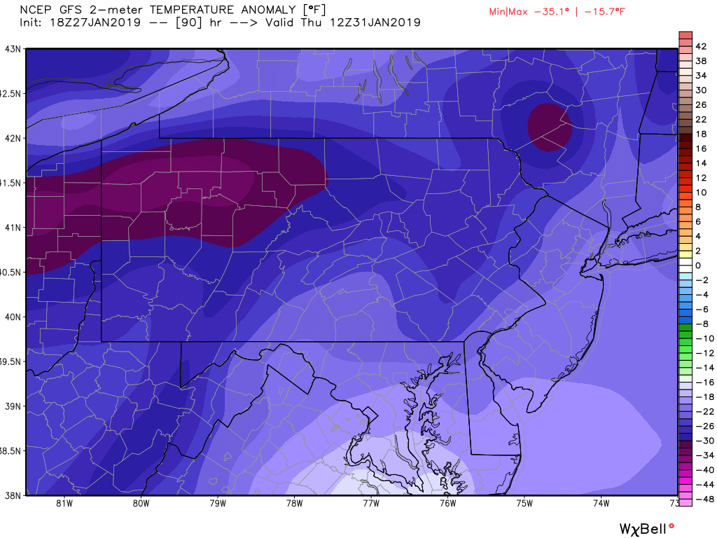
The GFS is showing that temperatures will range from 20 to 40 degrees below normal for this time of year. This is the type of cold that can be very dangerous if your skin is exposed to it for too long. Take a look at the Wind Chill chart produced by the National Weather Service: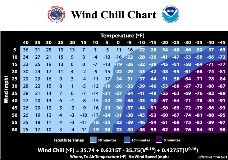
For most locations, it will take 10 to 30 minutes of being exposed to the cold weather for frostbite to occur. Please check on your elderly family members and friends often. Do not leave your pets outside.
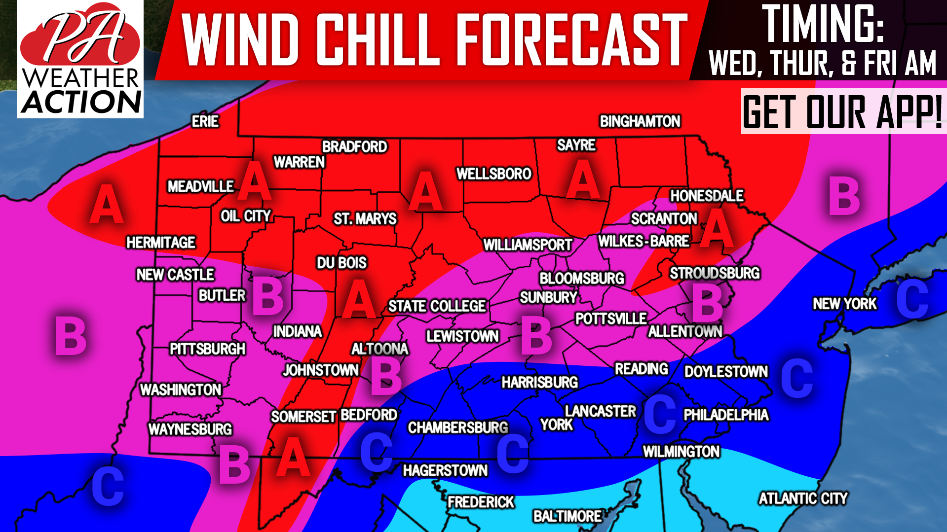
WIND CHILL FORECAST WEDNESDAY THROUGH FRIDAY:
Area A: Wind chill temperatures will range from negative 30 to negative 40 degrees at times. It will take as little as 10 minutes of exposed skin to develop frostbite. Once again, the coldest part of this time period will be Thursday morning. School delays and cancellations will be a common occurrence.
Area B: Wind chill temperatures will range from negative 20 to negative 30 degrees at times. It will take 10-30 minutes of exposed skin to develop frostbite. Once again, the coldest part of this time period will be Thursday morning. School delays and cancellations will be a common occurrence.
Area C: Wind chill temperatures will range from negative 10 to negative 20 degrees at times. It will take as little as 30 minutes of exposed skin to develop frostbite. Once again, the coldest part of this time period will be Thursday morning. School delays and cancellations will be a common occurrence.
Like our Facebook page for the latest on Tuesday’s snow and the frigid temperatures to follow, click here: Pennsylvania Weather Action’s Facebook Page
Download our free app today to keep you ahead of the latest weather alerts and traffic conditions, click here: Pennsylvania Weather Action’s App
Share the article with your family and friends using our icon below, stay warm!
You must be logged in to post a comment.