

It has become clear that 99% of us are about done with this Seattle-inspired weather pattern, which is soon to take another weekend victim. However, it won’t be a complete washout – far from it. The weekend has trended drier especially in the eastern half of Pennsylvania.
Watch for foggy conditions in the valley this morning. Above the fog, there are only clouds in Western PA that will dissipate this morning. View current satellite below!

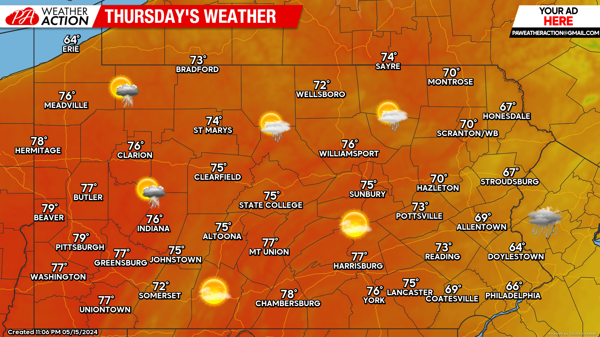
Today’s Weather Forecast: 6-8/10 Rating
A pesky low pressure system just off the coast of New Jersey will keep far Eastern PA socked in the clouds and contained to the 60s. Everywhere else in the state should bask in the mostly sunny skies and high temperatures in the 70s.
We could use a few more days like today in May before it heats up and every day is 85 and sweat city. A rare day we don’t need to break out future radar just yet.
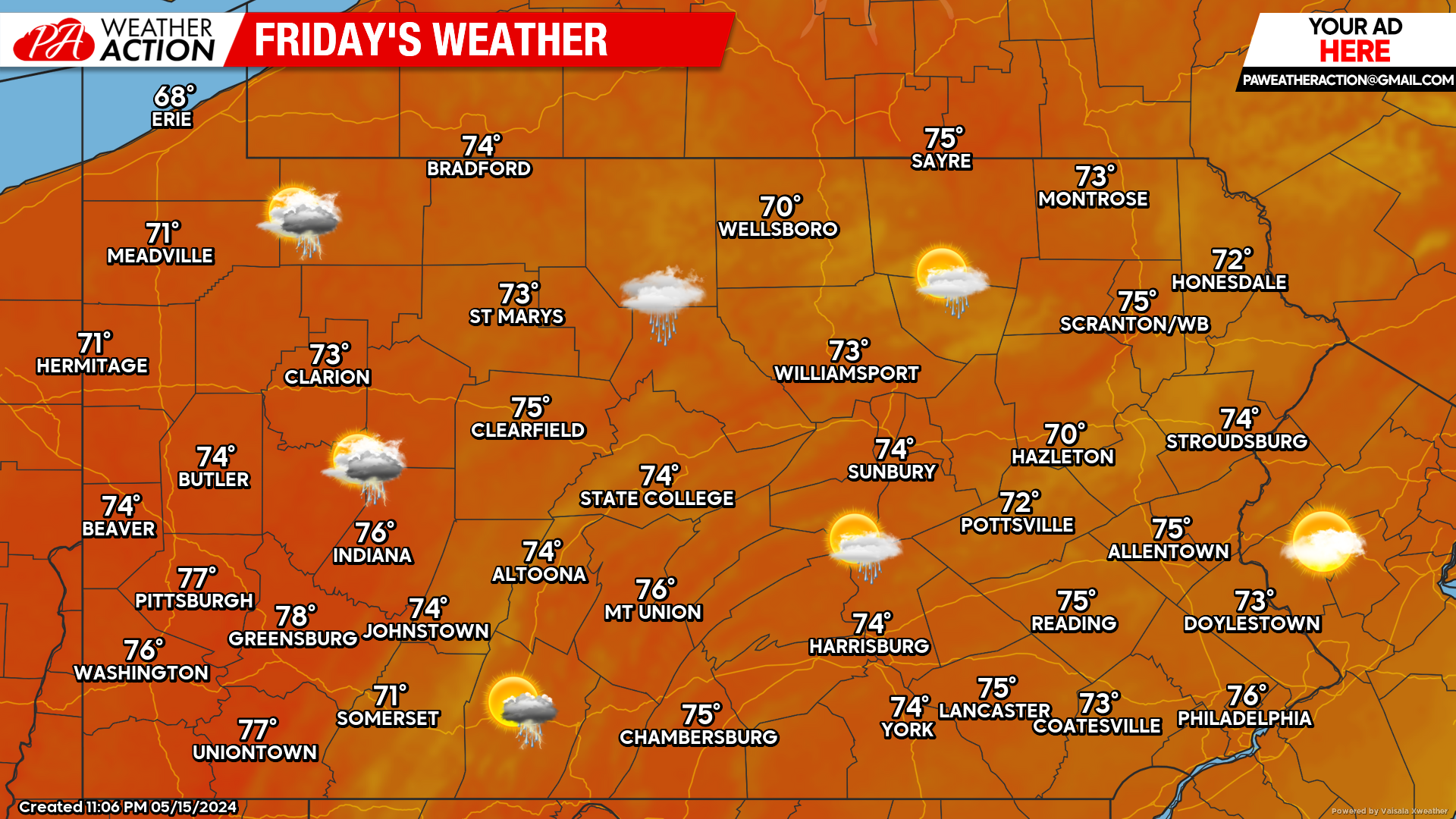
Friday’s Weather Forecast: 6-9 Rating
Western PA’s luck will run out tomorrow, as showers will move into the western half of the state by lunchtime or just after. However, a high pressure to our northeast will cause those showers to hit a wall near Route 15 in Central PA Friday evening. As a result, Friday evening should be dry across Eastern PA for any festivities.
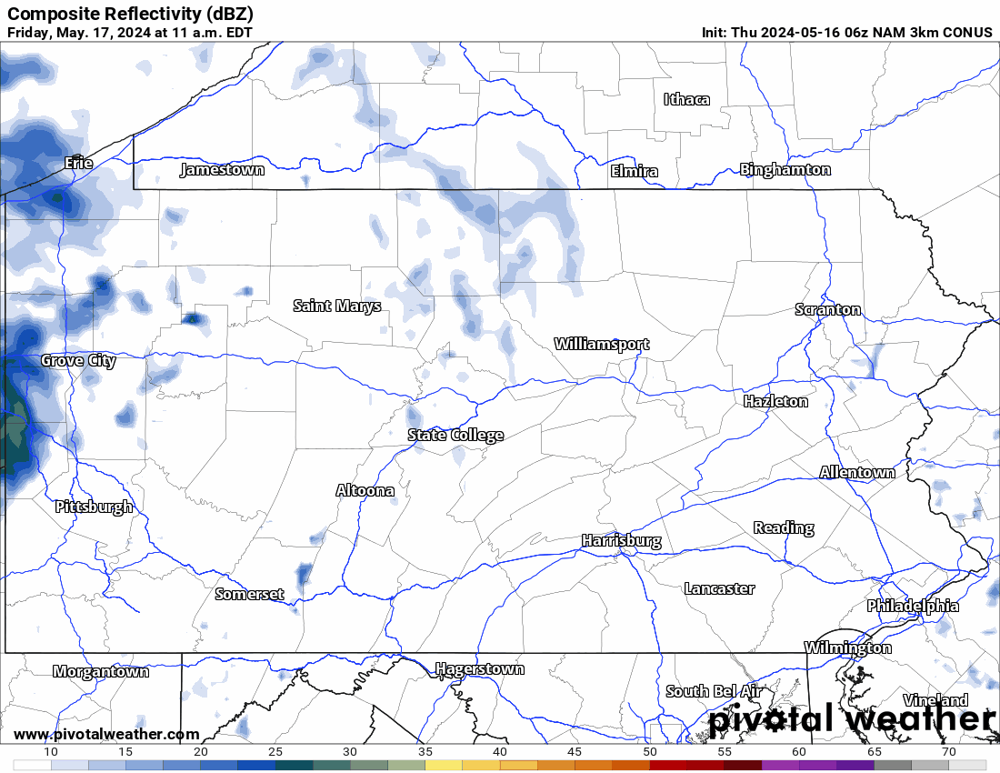
Friday – Saturday AM Future Radar
We managed to make it this far in the forecast before having to pull the future radar out which is a step in the right direction. As mentioned, rain showers will push into the western half of PA during the daytime on Friday. Those showers will move into Eastern PA Saturday morning.
By Saturday afternoon, we expect showers to be confined to places near the Maryland border. There is still a chance this rain trends farther south, as it has been doing lately. Regardless, latest Hi-Res NAM Future Radar is below with the timestamp in the top left.
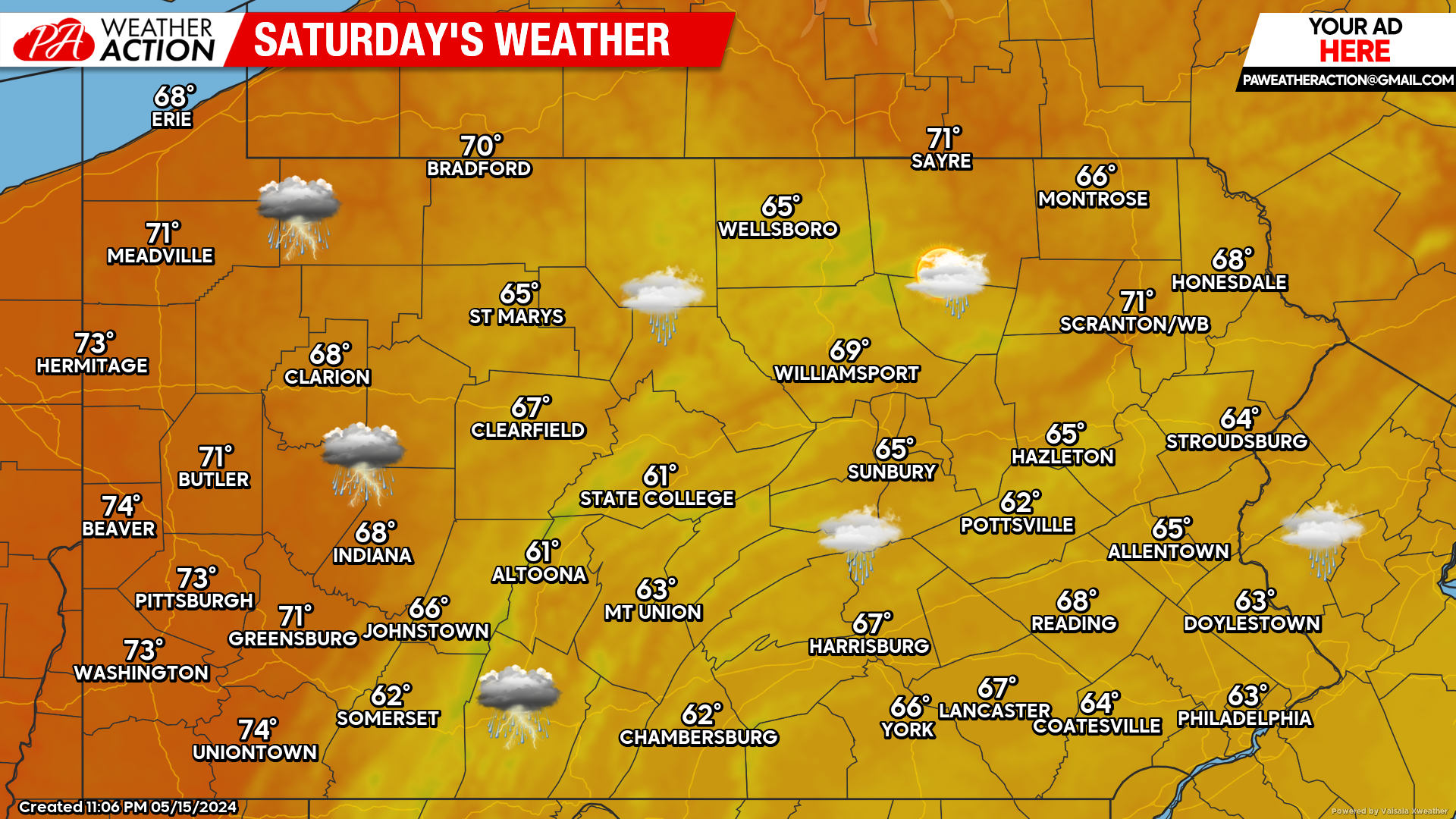
Saturday’s Weather Forecast: 4/10 Rating
Well, I suppose it could be 42 and rain instead of 62 and rain. But in all seriousness, there is a good chance much of the rain will clear up Saturday afternoon everywhere except South Central & Southeast PA. And even in those areas, showers will become sparse after lunchtime.
Under cloudy skies and perhaps misty conditions, temperatures will still be held in the 50s and 60s in and east of the Appalachians. West of the mountains will likely break into the 70s under clearing skies.
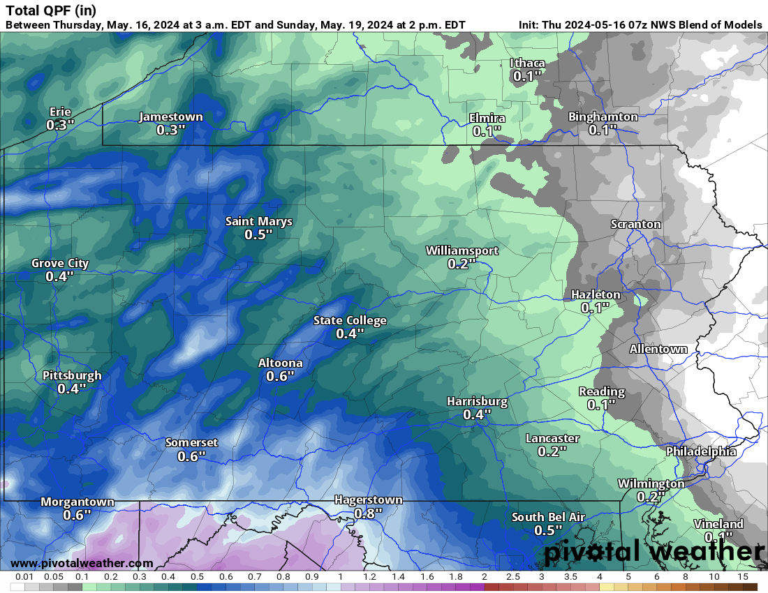
Friday – Sunday AM Rainfall Forecast
Due to locally heavier showers in western and central parts of the state Friday and Saturday, rainfall amounts between 0.5 – 1.0″ are expected there. But thanks to the New England high pressure, most of Eastern PA probably won’t even pick up a quarter-inch of rain.
A Look At Sunday & Beyond
The pattern has trended a bit drier in the mid-term, thank goodness! Sunday to next Wednesday are now looking mostly dry and very comfortable! The details of Memorial Day Weekend remain fuzzy, but right now it looks mainly dry with perhaps some showers parts of that Saturday.

You must be logged in to post a comment.