
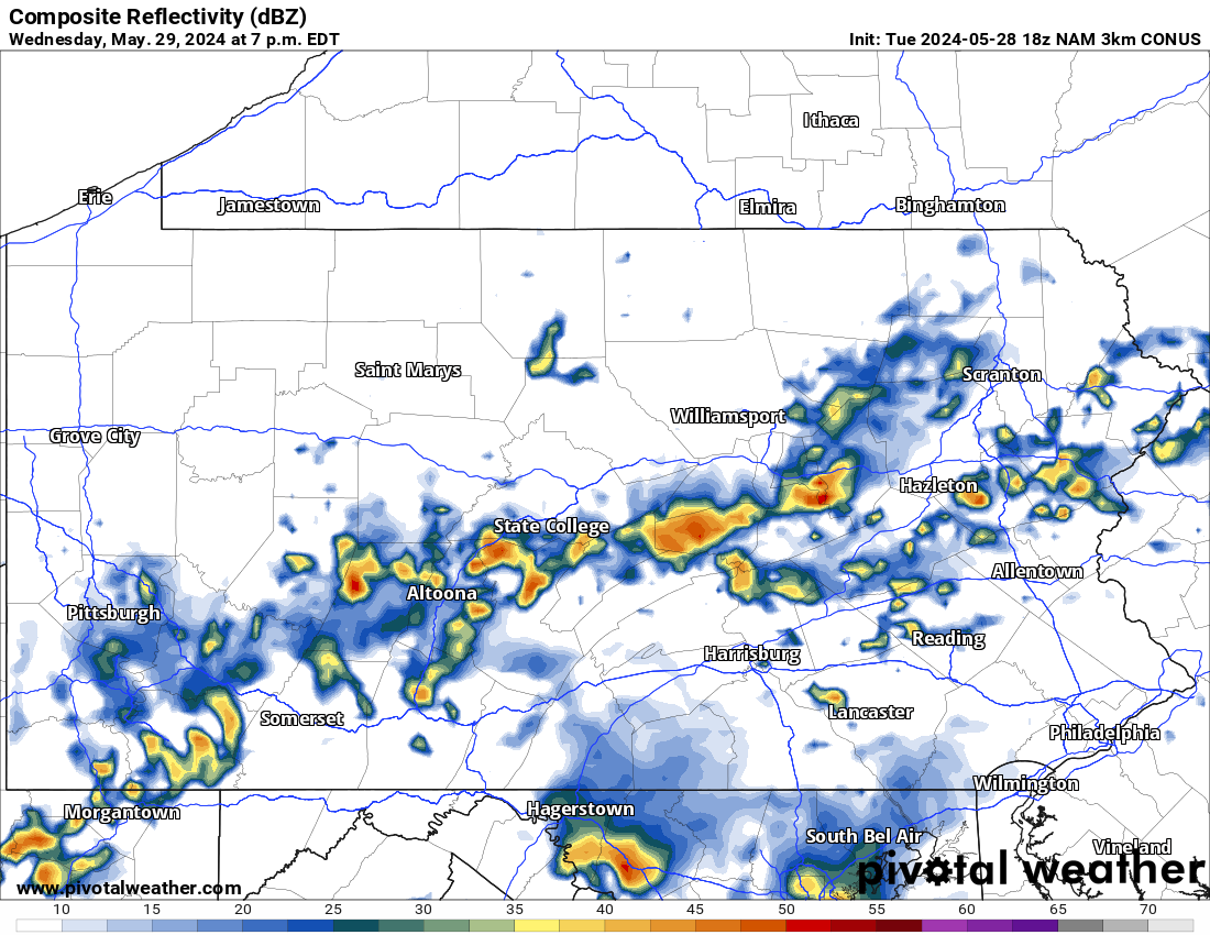
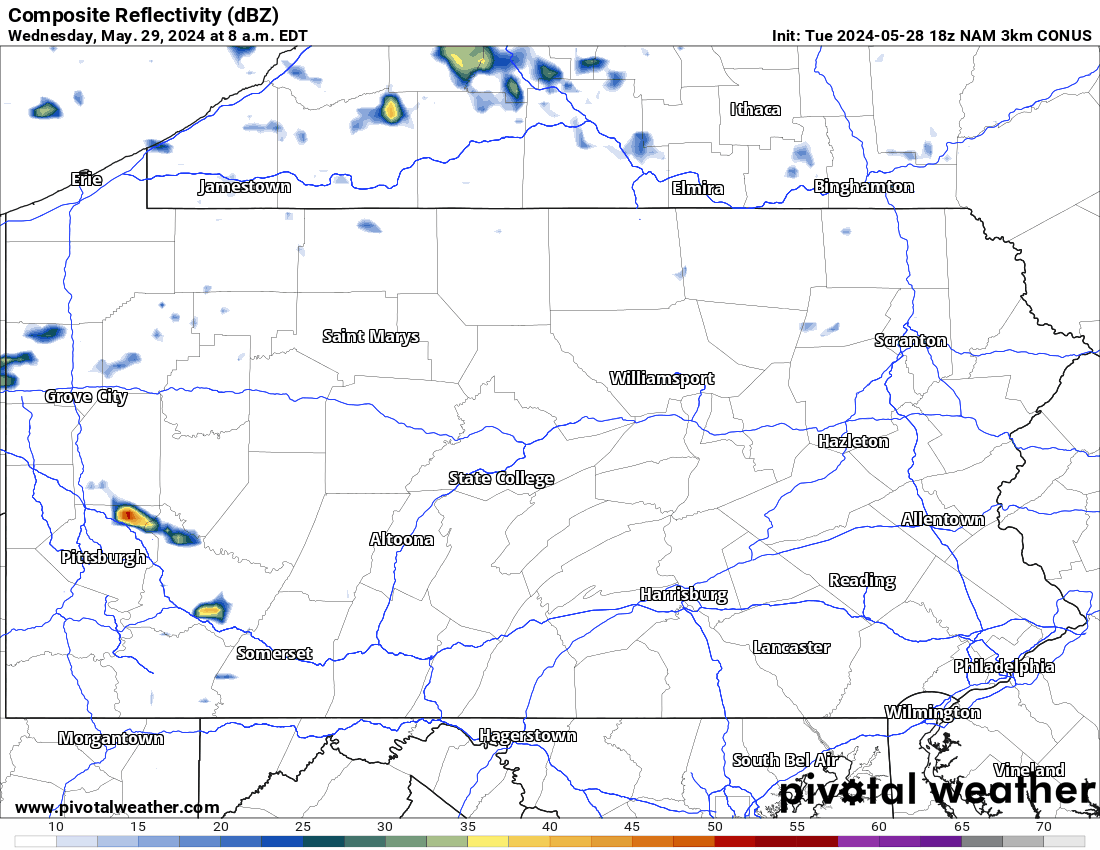
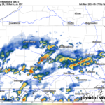
Without a doubt, yesterday was more active with thunderstorms than we originally expected. Today we can expect much of the same. Looking at this morning’s radar, it is relatively calm before more widespread thunderstorm is expected later in the day:
Today’s Weather Forecast: 6/10
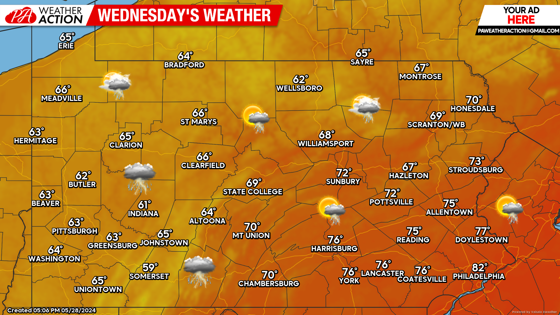
Cooler temperatures have arrived and with it, more widespread showers and thunderstorms are likely today. Most of the activity should hold off until the afternoon hours.
Hi-Res NAM Future Radar Through Early Thursday AM:
Looking at the future radar below, again the bulk of the shower and thunderstorm activity hold off until this afternoon. Lingering showers and storms are possible during the overnight and early Thursday morning hours across eastern areas. For reference the time stamp is in the top left of the graphic below.
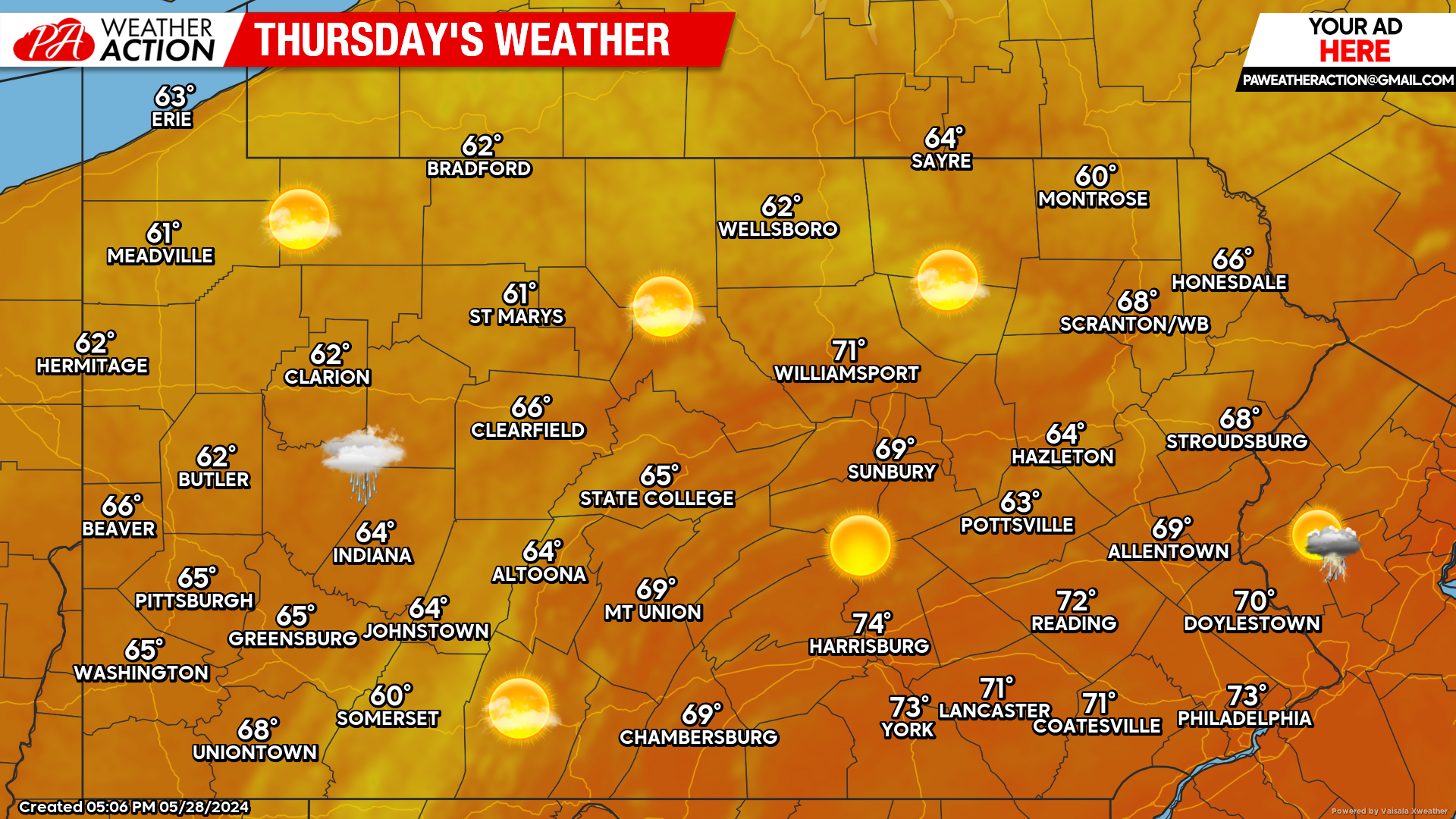
Thursday’s Weather Forecast: 9/10
Thursday will be gorgeous, temperatures in the 60s and 70s across the state with low humidity.
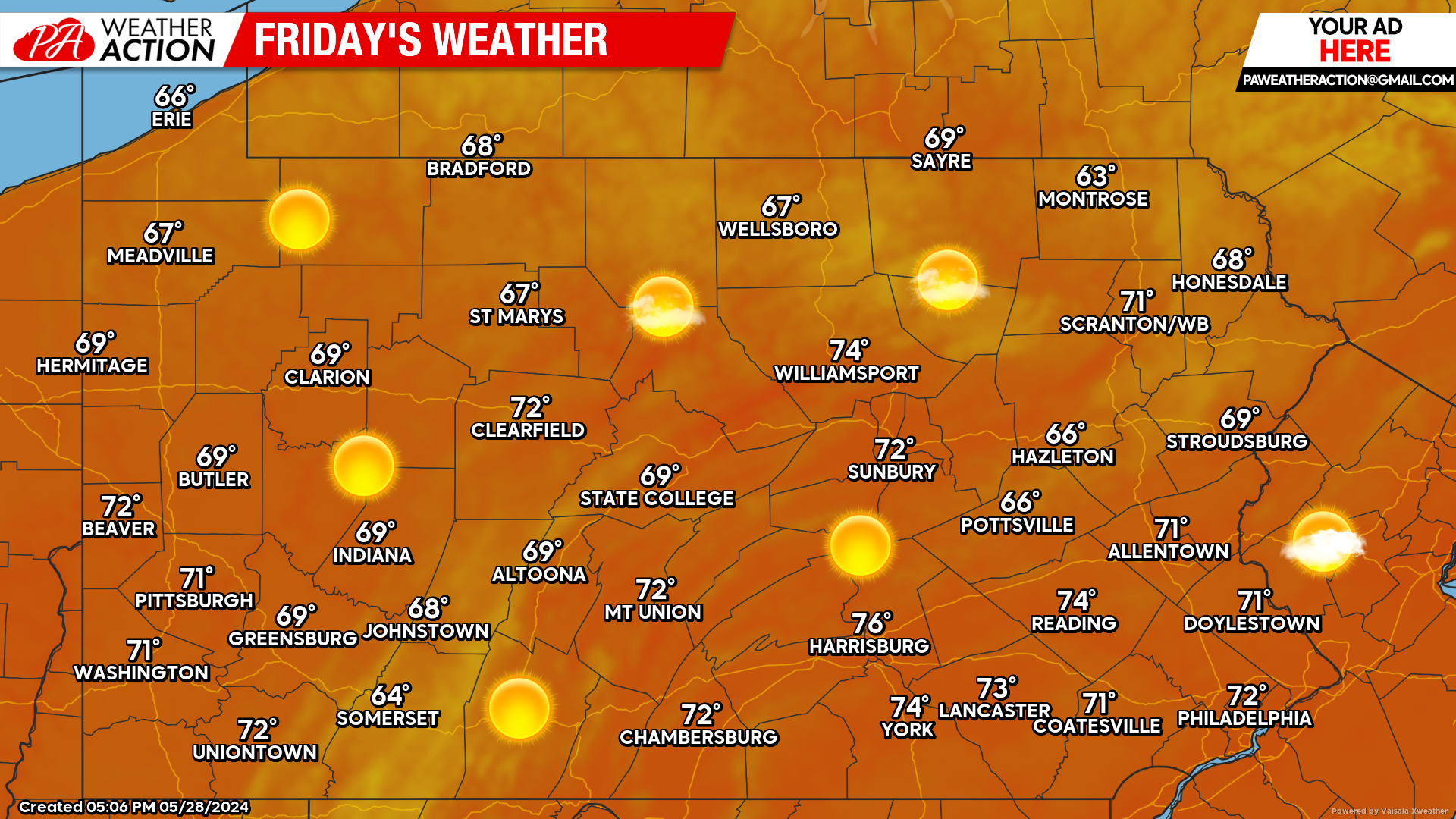
Friday’s Weather Forecast: 9/10
The only factor keeping Friday from being a perfect 10/10 kind of day is the cooler temperatures.
Weekend Update:
Model guidance continues to suggest Saturday will be beautiful, similar to Friday, with slightly warmer temperatures. Sunday is a bit more questionable. Guidance is beginning to hint at some showers, but nothing that should cancel outdoor plans.
You must be logged in to post a comment.