
Three scenarios are on the table for this weekend’s potential snowstorm. You will not find snow amounts in this article, as it is too much too early.
A weak low pressure system will form in Texas Friday evening. It will then move east into the northern gulf coast states Saturday. Where it goes from there depends on how soon the northern and southern streams interact and to what extent they interact. We are not putting all of our trust in one model, and the following scenarios are composed with a blend of solutions in mind.
We will make this as easy to understand as we can. As mentioned, there are three scenarios.
Scenario one involves little interaction between streams, keeping the system a weak, flat wave of energy as it moves east.
Scenario two, our most likely scenario, involves some interaction between the streams, and early enough to “benefit” parts of Southern PA.
Scenario three requires the northern stream energy to “catch” the southern stream energy. This would allow for a stronger storm, likely farther up the coast.
SCENARIO MAPS FOR WEEKEND STORM
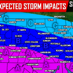
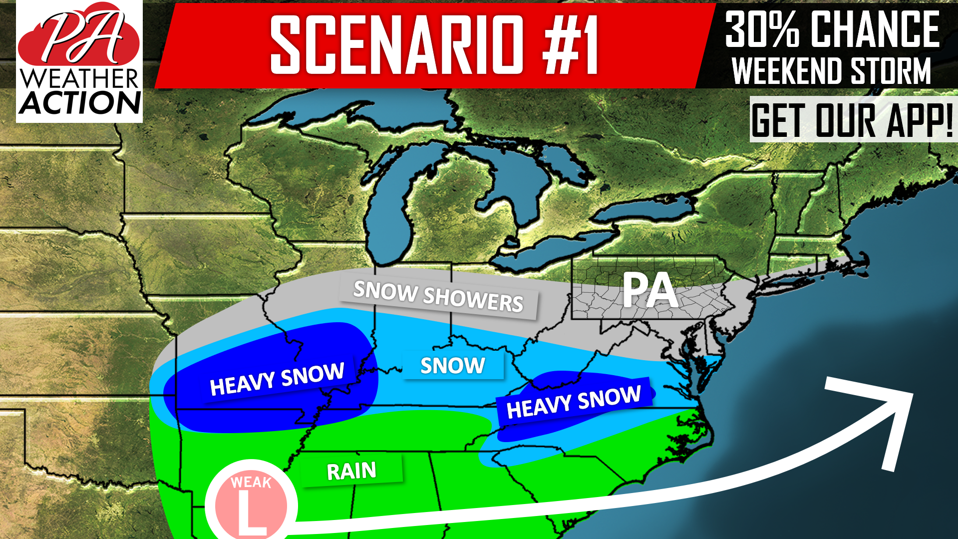 Above is scenario one, in which we give about a 30% chance of occurring. This is the least snowy scenario for us due to the storm staying weak and suppressed to the south thanks to little stream interaction. Snow showers with little to no accumulation would occur if this scenario unfolds.
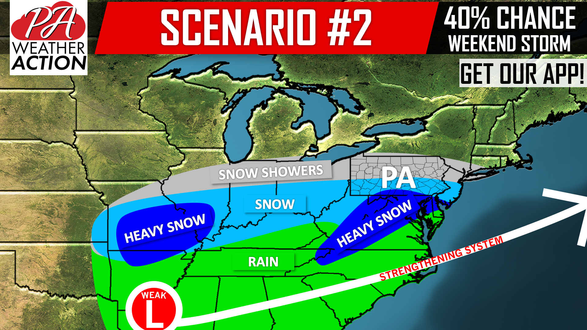 At a 40% chance, this is our most likely scenario. As you can tell, uncertainty remains as we are still four days out from the potential storm. This scenario will play out if the northern stream energy hangs back far enough south to at least partially interact with the southern stream energy. The low pressure system would then come somewhat farther up the coast, giving south of i-80 an accumulating snowfall.
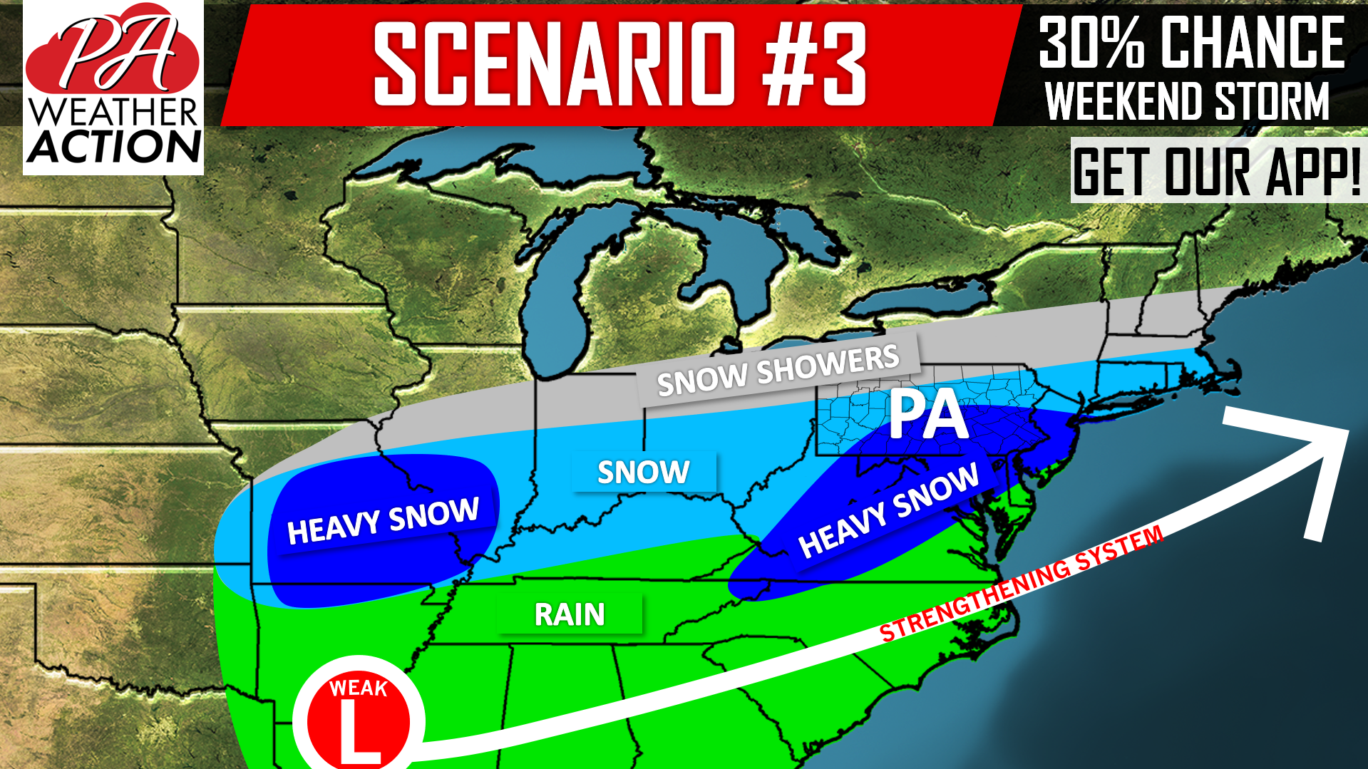 This final scenario has an equal probability as scenario #1, but a much different story. Scenario #3 may occur, but only if northern stream energy is more potent, and extends far enough southwest to catch the southern southern energy and bring it farther up the east coast. If this does occur, much of the state could be looking at a plowable snowfall.
Many details surrounding this potential snowstorm still need to be worked out in the coming days. Be sure to like us on facebook >>> PA Weather Action Facebook Page Link
Receive future updates and forecasts on this potential snowstorm with our free app >>> PA Weather App Link
Don’t forget to share this update with some of your snow-loving friends and family using the blue button below!
You must be logged in to post a comment.