
The first major snowstorm in a few years may be on the way late this weekend with surprising consistency from the models. Not only models, but various meteorological indices around the globe favor a high ceiling for this storm. This storm will be different than almost every storm we’ve seen since the Blizzard of 2016.
It has seemingly been impossible to not involve sleet or freezing rain in a major storm for us here in PA as of late, which has managed to derail what otherwise could’ve been memorable snowstorms. What will make this storm different is the temperatures not only at the surface but in the upper levels as well. As snow is falling, temperatures will range from 5-15° across the state.
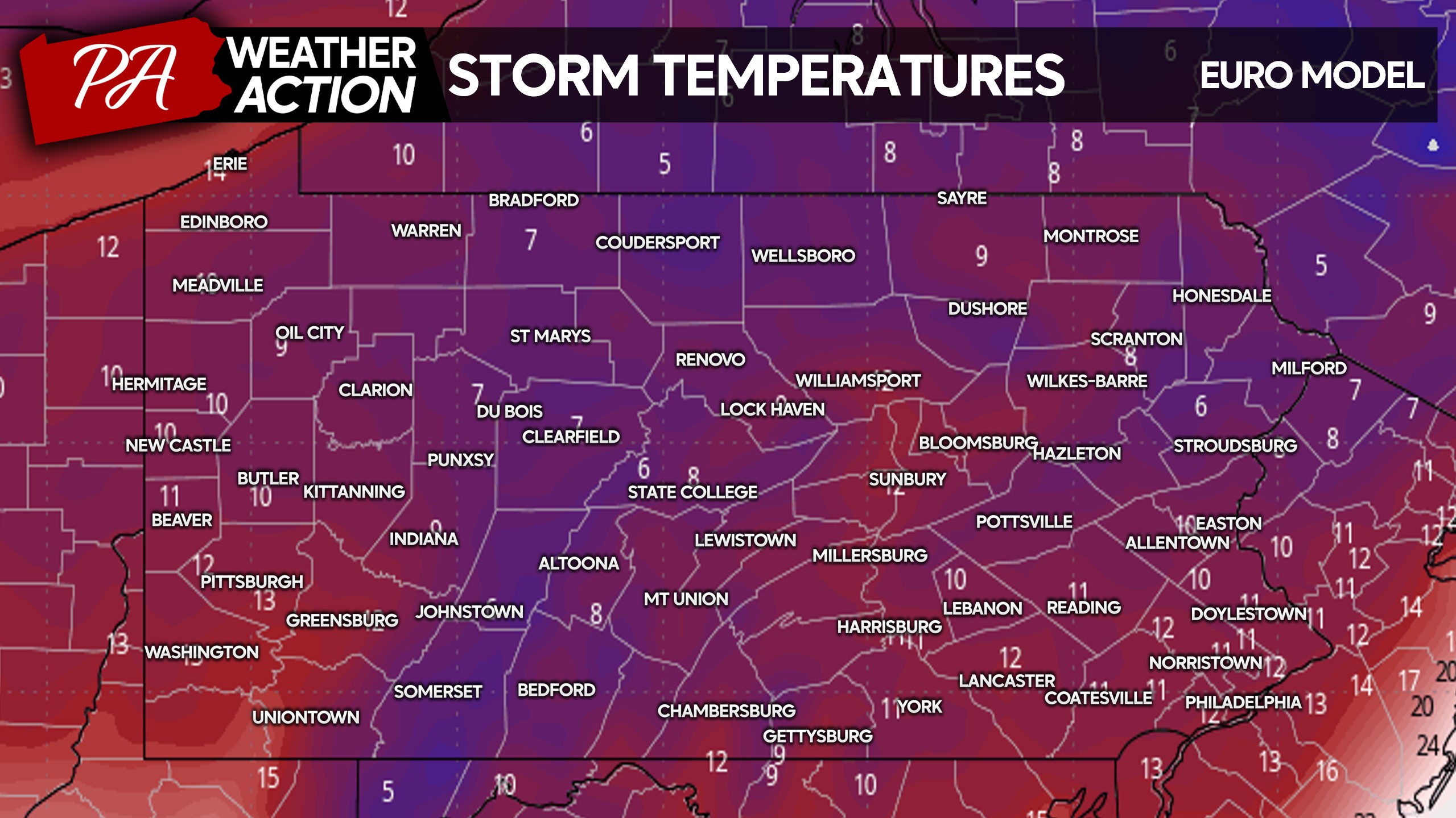
There is very little chance of mixing with rain or sleet, and snowfall ratios will be doubled what they normally are. For example, the typical snowfall ratio is 10:1 (10″ of snow for every 1″ of precipitation). With this storm, we will see snowfall ratios of 20:1, or higher! This snow will be very fluffy and accumulate rapidly.
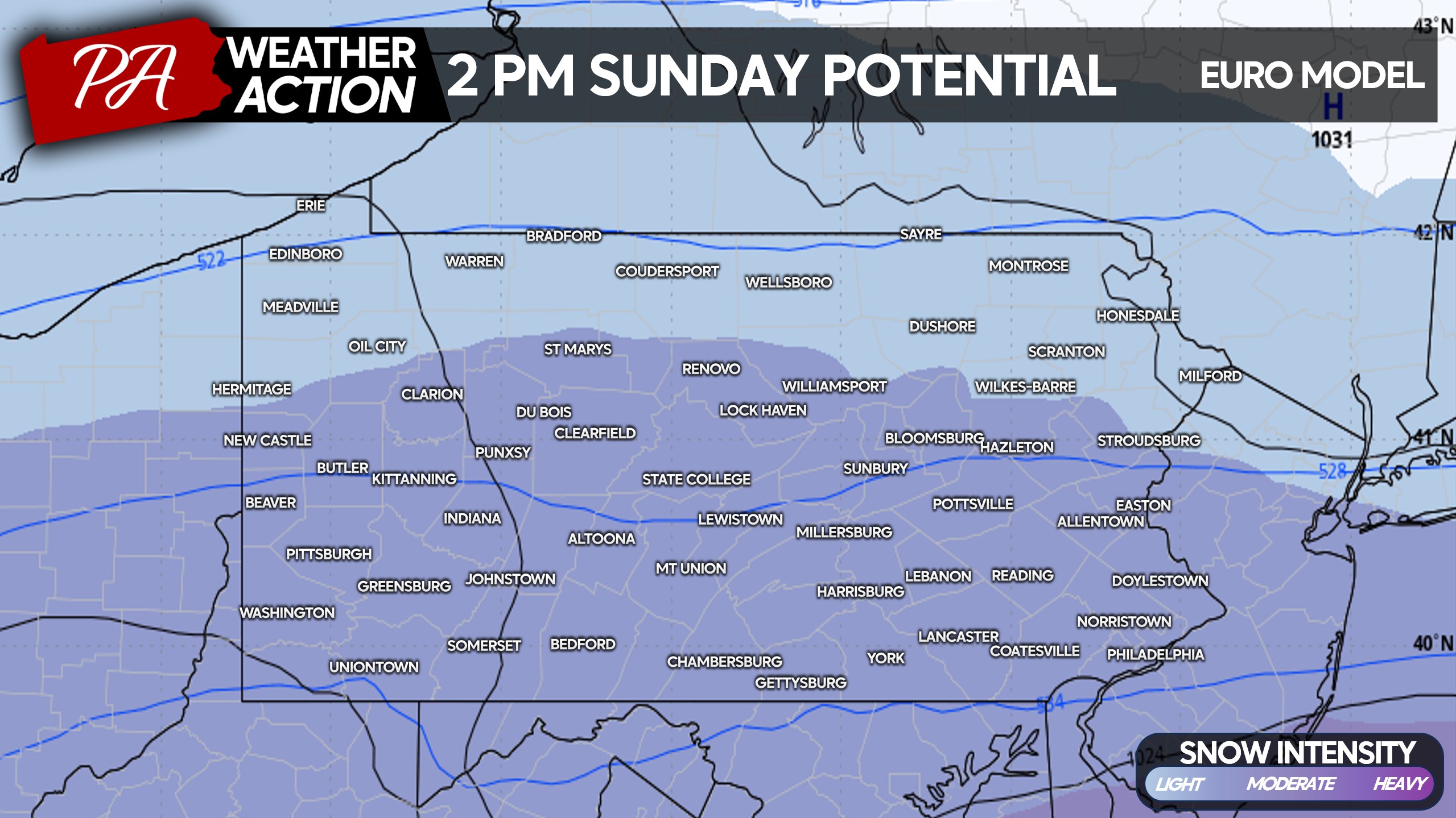
While difficult to lock in timing this far in advance, we are looking at snow moving into Southern PA Sunday morning, overspread most of the state south of I-80 by early Sunday afternoon. Below is the European model for around 2 PM Sunday.
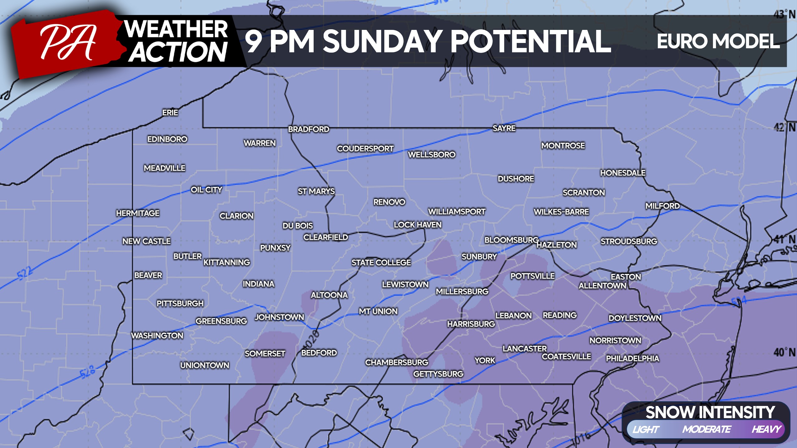
Moderate to locally heavy snow is modeled to push into Southern PA on Sunday evening. And remember, with snowfall ratios so high, the snow will pile up much faster than what we’re used to seeing.
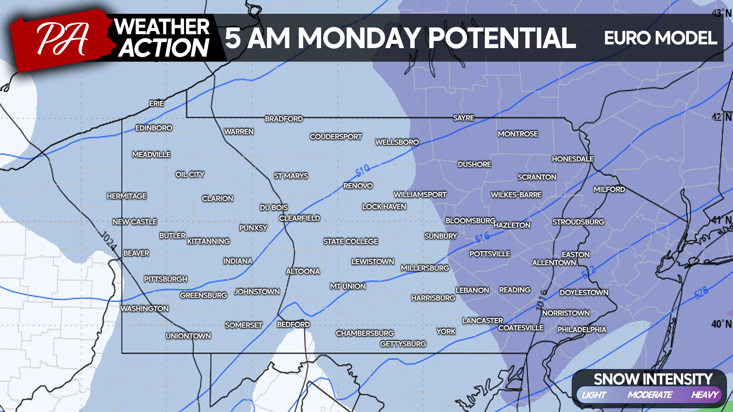
Assuming we have a coastal low that’s decently far enough north, snow will likely exit from west to east Monday morning. This is shown on the European model projection for 5 AM Monday below.
All in all, we are very confident Pennsylvania will feel at least significant impacts from this storm. Being five days out, it’s too early to determine exact snowfall ranges.
In regard to the percentages shown on the scenario maps below, the % chance indicates the likelihood of that scenario versus the other two. It does not indicate the likelihood of that scenario versus no storm at all.
SCENARIO #3 MAP – 25% CHANCE
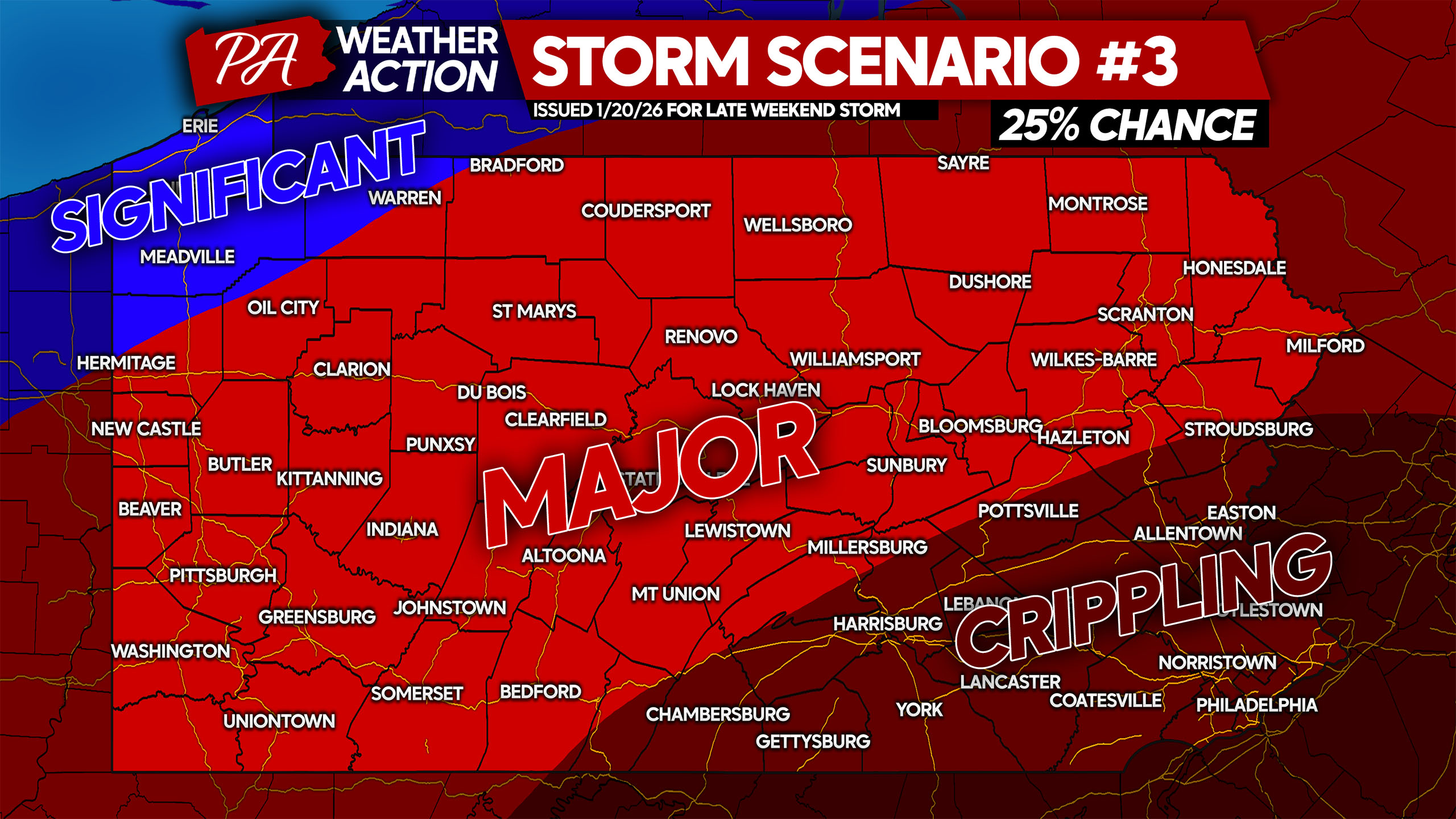
Above is Scenario #3, one of the two less likely solutions. Under this scenario, we would see a classic Miller A coastal storm that would include a full phase of the energy from the northern and southern stream down south.
This would generate a strong low pressure near the Gulf Coast that would gather gulf moisture and head up the coast, before running into high pressure to our north. As a result, we would see a 18-28 hour storm with crippling snowfall totals (15″+) in parts of Pennsylvania.
This solution is not currently most favored by most models, but is within the realm of possibilities.
SCENARIO #2 MAP – 25% CHANCE
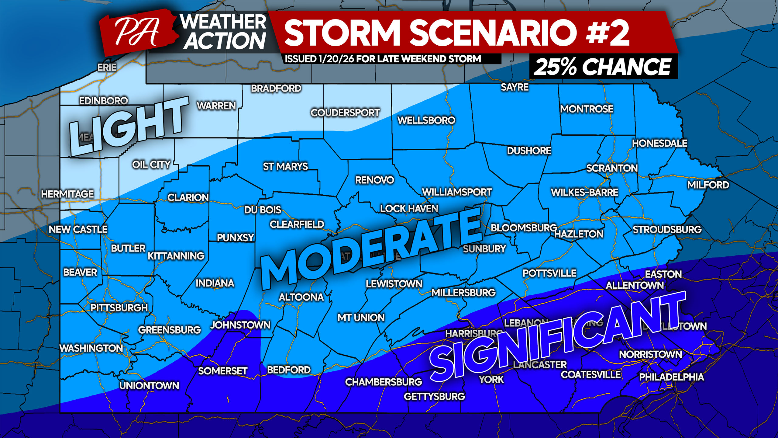
Above is Scenario #2, the second of the less likely solutions. This scenario would entail a weaker storm that misses a phase within northern energy, resulting in a flatter storm that gradually pushes east-northeast off the Mid-Atlantic coastline. Because snowfall ratios will be so high, even a third of an inch of precipitation will result in 6″ of snow.
Significant snowfall amounts would likely still occur along the Southern PA border, as far north as roughly I-78 in Eastern PA. With that said, the potential for double-digit snowfall amounts would be low.
SCENARIO #1 MAP – 50% CHANCE

Above is Scenario #1, our most likely scenario at this point. With that said, confidence remains medium, although if you’re in the ‘significant’ area on Scenario #2, it may be a good idea to begin rescheduling events and preparing a bit. Scenario #1 is most favored by models, and includes a near-miss in the phasing of energy along the Gulf Coast.
As a result, we would get a dominant coastal low off the Carolinas and a second, weaker low pressure near Alabama. Because the coastal low is the primary, we would see a slightly shorter duration storm (12-18 hours) that wouldn’t ride up the coast any farther north than Virginia Beach before pulling away.
And despite a near-miss for a full fledged coastal storm, Southern and much of Eastern PA would still see major snowfall amounts (10″+) due to high snowfall ratio of 20:1.
Begin planning for an impactful winter storm late weekend if you’re in Southern or Eastern PA. Salt will likely fail to melt this snow due to temperatures being below 15°. But it will be an easier snow to shovel due to being very light and fluffy.
We will have a first look at potential snowfall amounts at 5:00 PM Wednesday, stay tuned for that update!
Don’t forget to share this news of a potential major winter storm with friends and family!

You must be logged in to post a comment.