Our First Call Snowfall Forecast has been posted, as of 5:00 PM Friday. View the article linked below.
First Call Snowfall Forecast for Sunday’s Significant Snowstorm in Pennsylvania
We are heading into the belly of winter, with a rapidly uptrending snowstorm potential late this weekend followed by a visit from the polar vortex. We have been monitoring this potential for a few days, and in the last 24 hours it has gained steam with support from nearly every weather model.
As for timing, snow looks to move in from southwest to northeast Sunday morning, and exit in that orientation Sunday evening.
Three days out from start time, the question that remains is how amplified the storm will be. Some guidance suggests not so much, and for only moderate snow in Southeast PA. Other models drop significant snow across most of PA with mixing issues near Philadelphia. Based on how models have performed this year, anything could happen.
We will be coming off a very brief warm period, so there’s no suppression from the north like last storm that just missed us to the south. This will allow the storm to move northeast up the coast. The ceiling with this storm will be around 10″, as we don’t have a Greenland block to slow it down.
Highest confidence for snow is east of the I-81 corridor, including most of Eastern PA and South Central PA. As you go west, that’s where a lot is still to be determined. Let’s get into the scenarios!
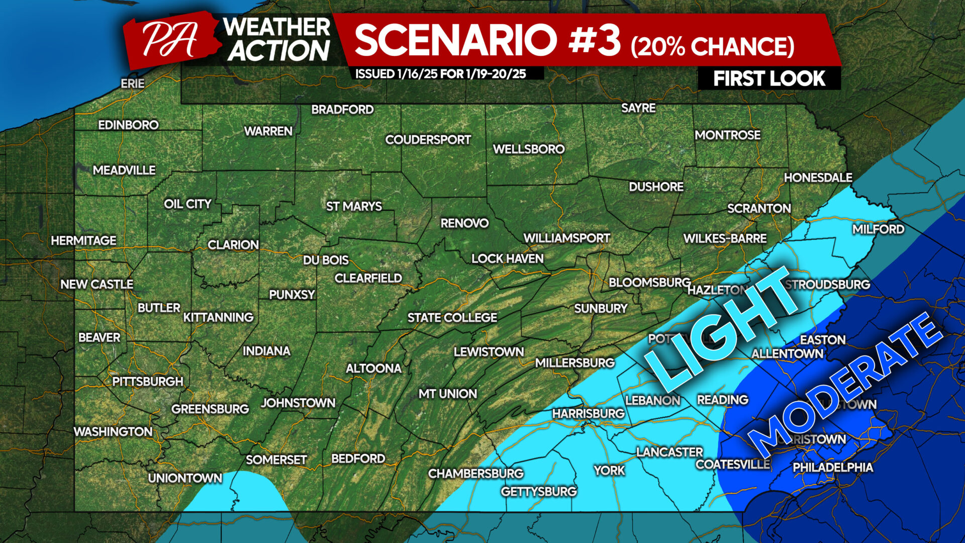
SCENARIO MAP #3: 20% CHANCE
This scenario has the lowest chance of coming to fruition. It represents a weak storm that stays a bit farther off the coast. Moderate snow would be concentrated in Southeast PA, with light snow farther northwest across South Central PA to the Coal Region and Poconos.
This scenario is quickly losing support from models, but still has the support of the European model as of 5 PM Thursday. However, the European AI model is more amplified. But while unlikely, this outcome still remains a possibility.
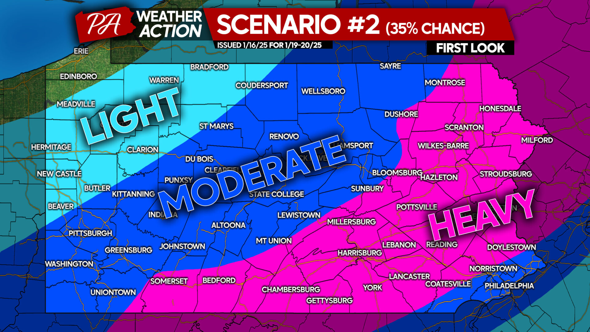
SCENARIO MAP #2: 35% CHANCE
This scenario represents the complete opposite outcome of what we just discussed above. The Canadian, German, and UK models support this outcome. And while those models are middle of the pack in terms of accuracy, the Canadian model has done well recently.
With this scenario, low pressure would scoot along the coast, producing heavy snow accumulations just northwest of I-95 all the way to the I-81 corridor and beyond. Moderate accumulations would occur in the Pittsburgh Metro and up into the Allegheny Plateau of Northern PA.
This scenario actually has the most momentum, meaning it seems more and more guidance is trending this direction. However, this outcome is missing support from the statistically most accurate European model, so we cannot put it at #1.
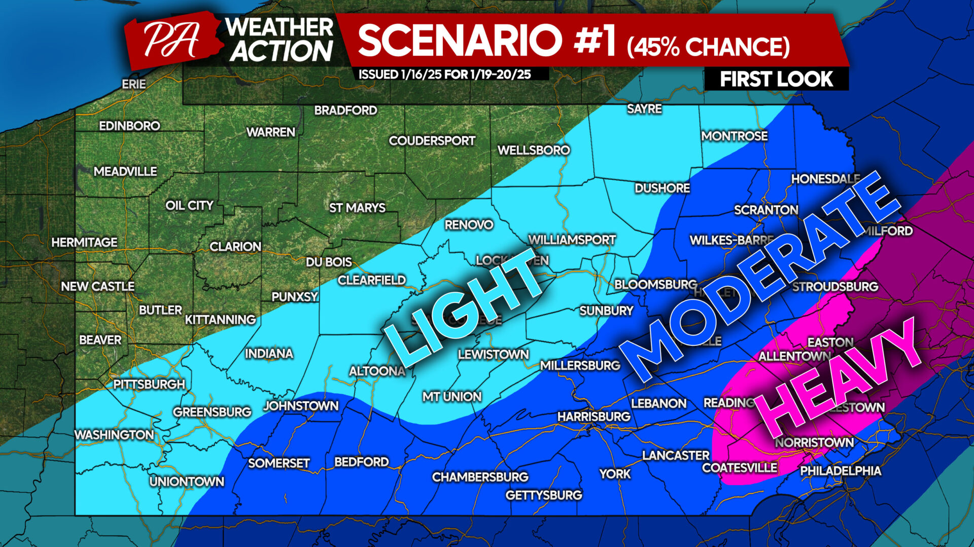
SCENARIO MAP #1: 45% CHANCE
Finally, the middle ground scenario, which is our most probable scenario. We don’t want to say a given scenario is likely yet. But Scenario #1 suggests a low pressure that stays off the coast and a bit weaker, throwing heavy snow back to a small area near the I-95 corridor. Right now, we think this would include most of Southeast PA.
Moderate snow accumulation would occur in locales near I-81, with lighter accumulations northwest in places like Pittsburgh to State College and Williamsport.
We should have more clarity by Friday evening, when our First Call Snowfall Forecast will be posted. As for now, we encourage those in the moderate and heavy areas of Scenario #1 to get the shovels ready and check on the snow blower, if anyone in Southeast PA still actually has one.
This storm popped up quick, and most people are unaware. Share this article with family and friends below, and stay tuned!


You must be logged in to post a comment.