
An update with new scenarios for Monday’s snowstorm has been posted. Please tap the article link below.
It’s a new year and a new weather pattern for Pennsylvania. After ending 2024 with heavy rain and the occasional lightning strike, it’s safe to say we are on to a much more wintry pattern. The cold air is the easy part, as we know that’s coming in the next few days and will be here to stay. The not so easy part is the snow.
This article will cover the lake effect snow, along with Friday’s light snow event in parts of Southern PA, and finally the storm that has been getting lots of attention this upcoming Sunday into Monday. With such a cold pattern coming, the winners and losers with regard to snow will be flipped compared to what we’ve seen so far this season.
Lake Effect Snow & Friday’s Light Snow in PA
Lake effect snow showers and squalls will be very consistent over parts of Northwest PA like Erie County from this evening through Friday. As you move away from the lake, snow amounts will decrease.
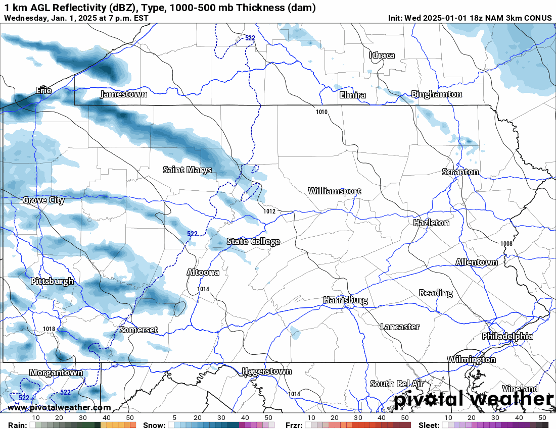
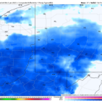
We also have a quick snow event likely Friday morning mainly in Southwest PA, but South Central PA may also see some snow showers Friday afternoon and evening. Below is Hi-Res NAM Future Radar for Wednesday night through Friday.
FIRST CALL SNOWFALL FORECAST THROUGH FRIDAY (1/1 – 1/3)
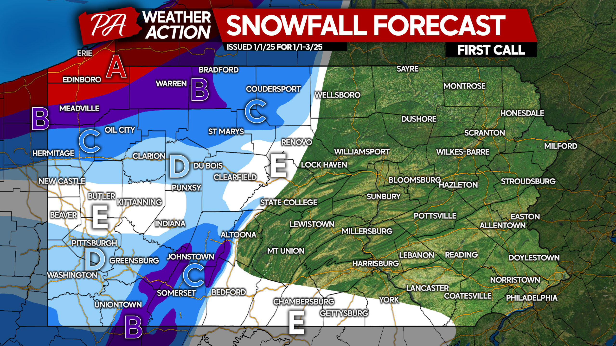
Area A: Snowfall accumulation of 10 – 15″ expected.
Area B: Snowfall accumulation of 6 – 10″ anticipated.
Area C: Snowfall accumulation of 3 – 6″ expected.
Area D: Snowfall accumulation of 2 – 3″ anticipated.
Area E: Snowfall accumulation of 1 – 2″ expected.
As a reminder, these amounts are through Friday of this week.
Sunday – Monday Winter Storm Potential
And then comes the talk of the town! Perhaps not yet, but certainly in areas to our south and west. Our forecast will be a tricky one, because the amount of snow we see all comes down to a small piece of energy in the upper levels of the atmosphere that will be swinging through the Great Lakes.
If that energy stays southwest, our snowstorm will be pushed southwest. If it eases up and is farther north, then so is our storm. Models have a tendency of trending things north in the coming days, which would result in Pennsylvania seeing more snow. For now, there are two scenarios. Let’s start with the less likely scenario.
Timing for this storm will be Sunday evening through early Monday afternoon, with snow moving west to east. More precise timing will be ironed out soon.
SCENARIO #2 FOR SUNDAY – MONDAY SNOWSTORM: 40% CHANCE
Scenario #2 is aligned with the current output of some models, and does not account for any north trend in the coming days. While there is a very small chance models may trend south instead, we think it’s highly unlikely. This scenario would keep impacts contained to locales closest to the Southern PA line.

Area A: Moderate snowfall accumulation (3″ or greater) possible. Confidence is increasing that these locales will see a plowable snow with poor travel conditions.
Area B: Light snowfall accumulation (1″ or greater) possible.
SCENARIO #1 FOR SUNDAY – MONDAY SNOWSTORM: 60% CHANCE
Scenario #1 is currently the northern solution on models, and it also takes into consideration the usual northward trends that may occur soon. It relies on the confluence being farther north, allowing the storm to push farther north in the Ohio Valley and Upper Mid-Atlantic.
This would make for a plowable snowfall in much of Southern PA, with lighter amounts north.
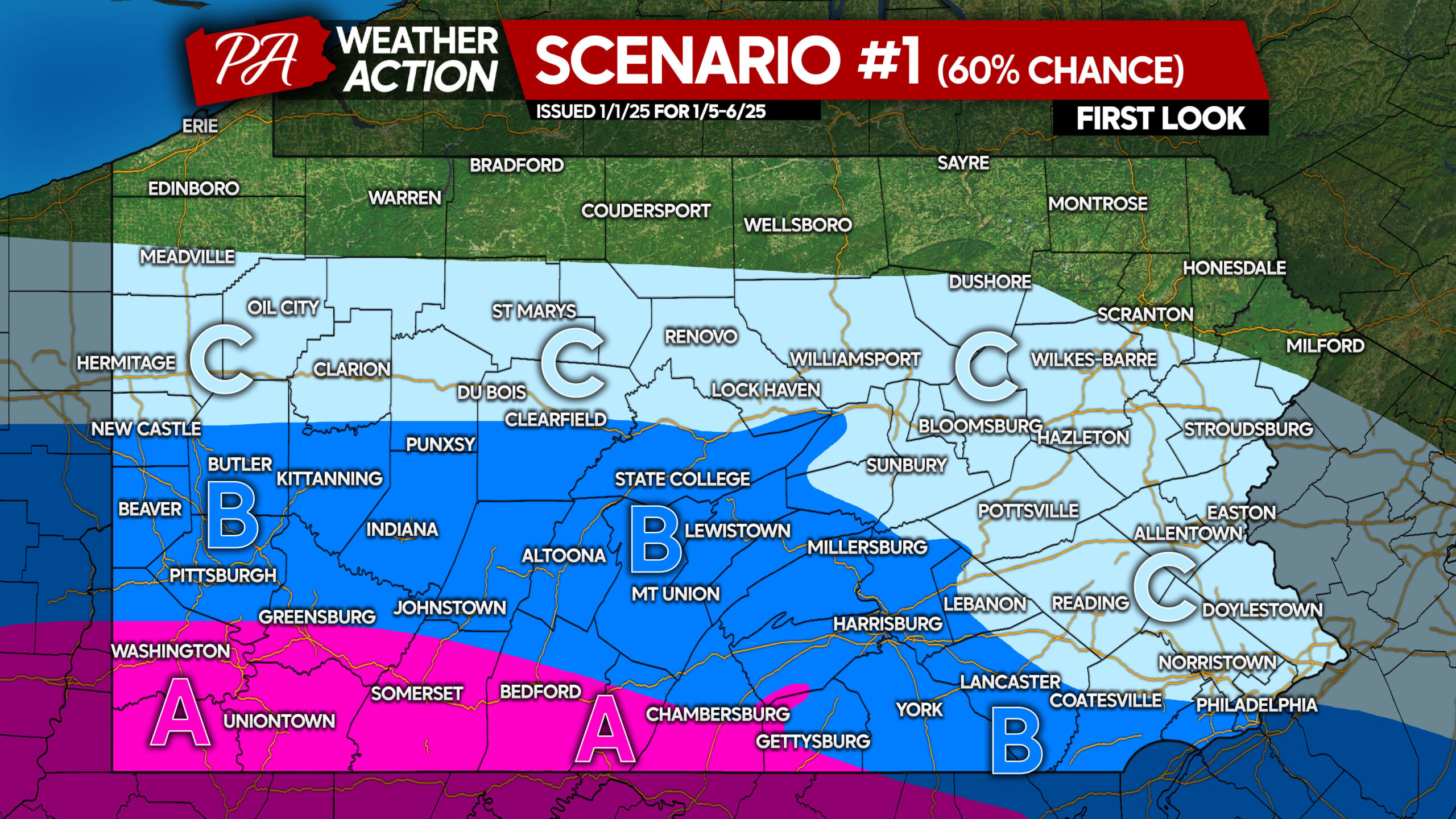
Area A: Significant snowfall accumulation (6″ or greater) possible, but uncertainty remains.
Area B: Moderate snowfall accumulation (3″ or greater) possible, though uncertainty remains. Also, the sharpness of the northern cutoff is still to be determined.
Area C: Light snowfall accumulation (1″ or greater) possible. Locations closest to Area B have the highest chance of seeing a plowable snow.
Could the storm move even farther north than this? Yes, so we advise that you stay tuned.
We will have more details in the coming days! There is still plenty of time for changes.
Don’t forget to share this update with friends and family who will find it useful!
You must be logged in to post a comment.