
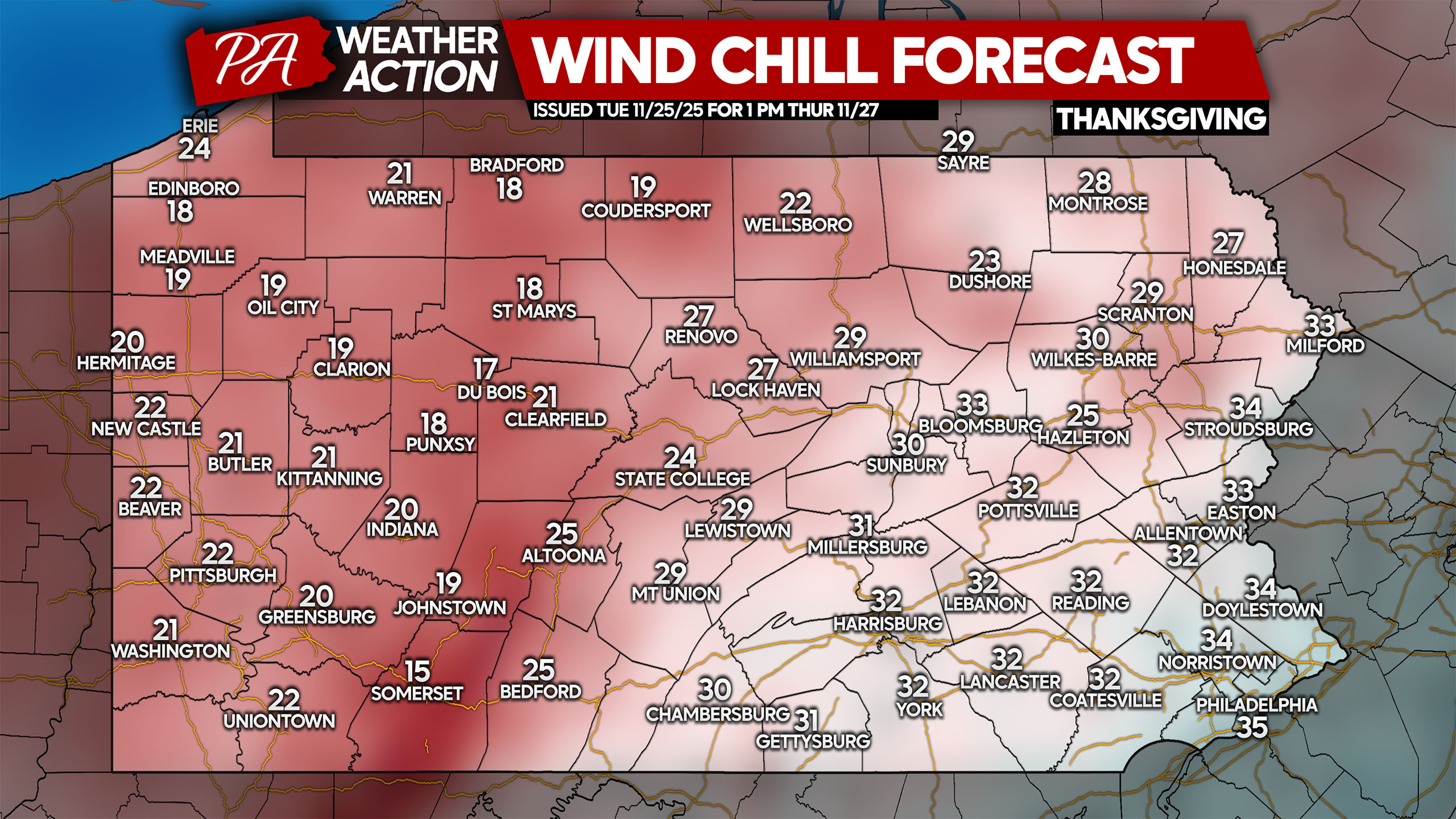
After a brief warmup, cold air will come rushing in just in time for Thanksgiving. Wind chills will top out in the upper teens to low 30s amidst cold and blustery conditions.
And as usual for this time of year, breezy westerly winds means the potential for significant lake effect snow across Northwest PA. This will be the first significant event of the season, with well over a foot of snow likely in the usual jackpot areas like Edinboro.
Moderate to heavy lake effect snow looks to start Thursday morning, mainly north of Meadville. As the day goes on and winds shift to the WNW, places like Warren and Bradford will get involved.
The Canadian short-range model, the RGEM, has a solid handle on this event. Below is it’s latest projection for 10:00 AM Thursday.
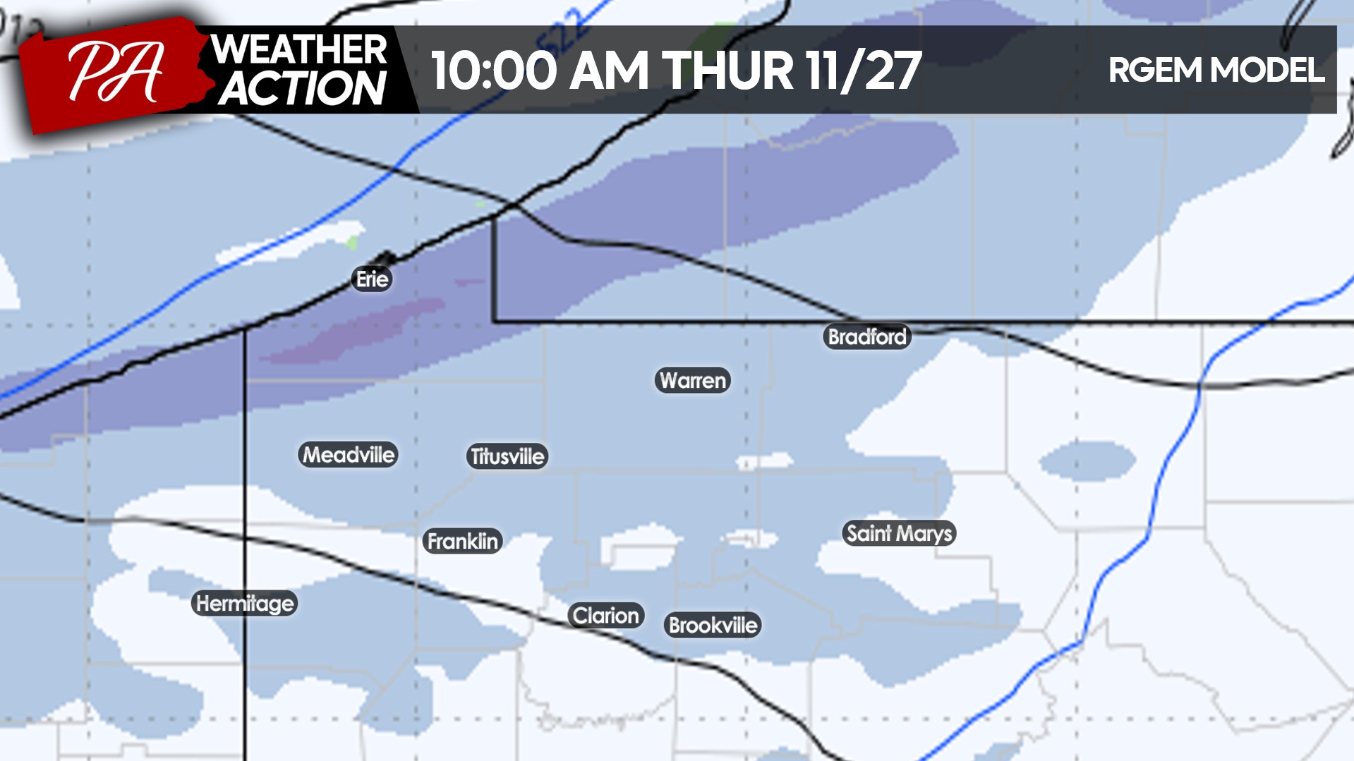
By Thursday evening I-79 in Erie and Crawford counties will be a tough go, especially considering it’ll be Thanksgiving and there may be less road crews.
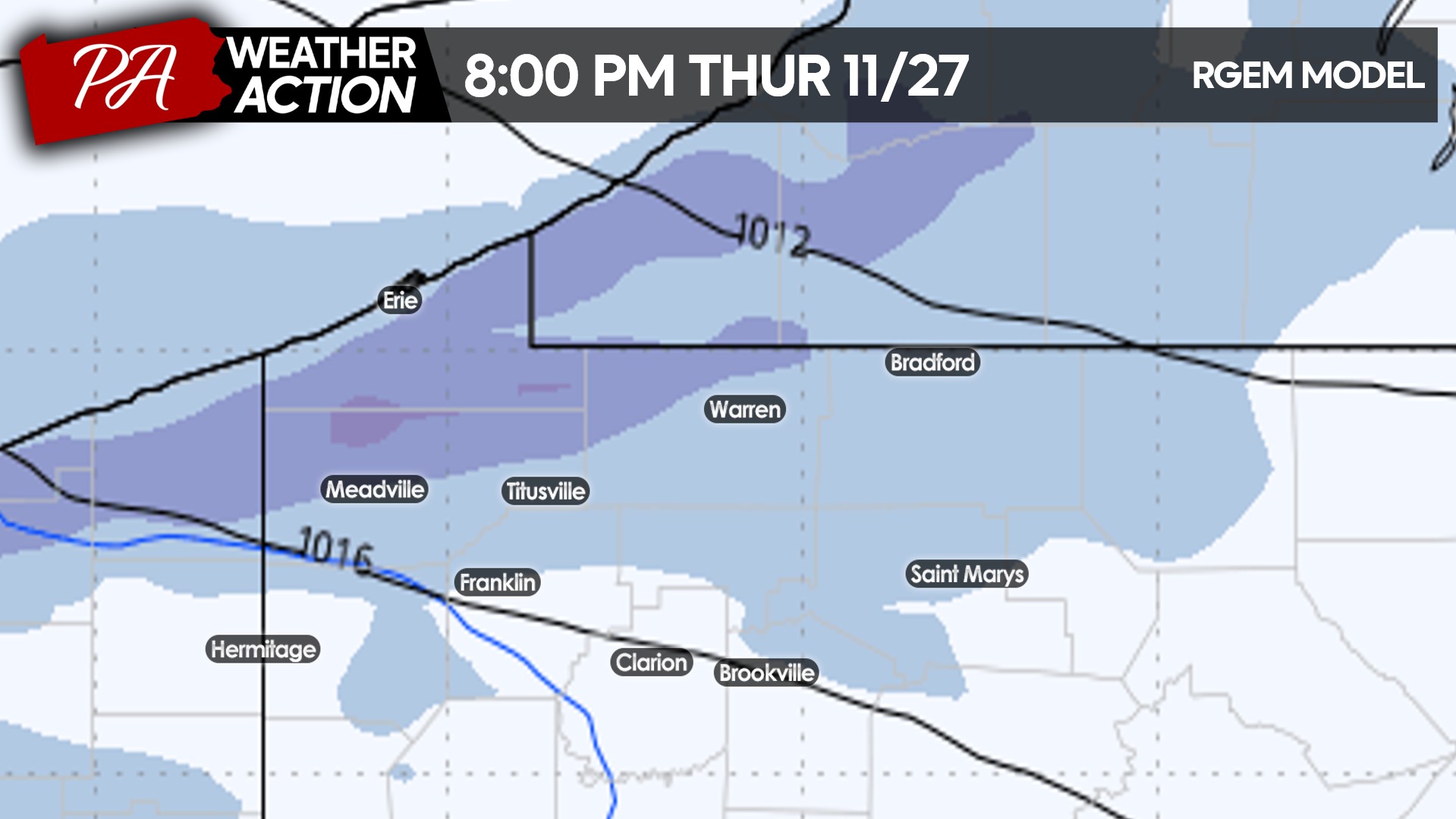
Lake effect streamers will continue coming in Thursday night, reaching more interior locations like Hermitage, Clarion, St. Marys, and Coudersport.
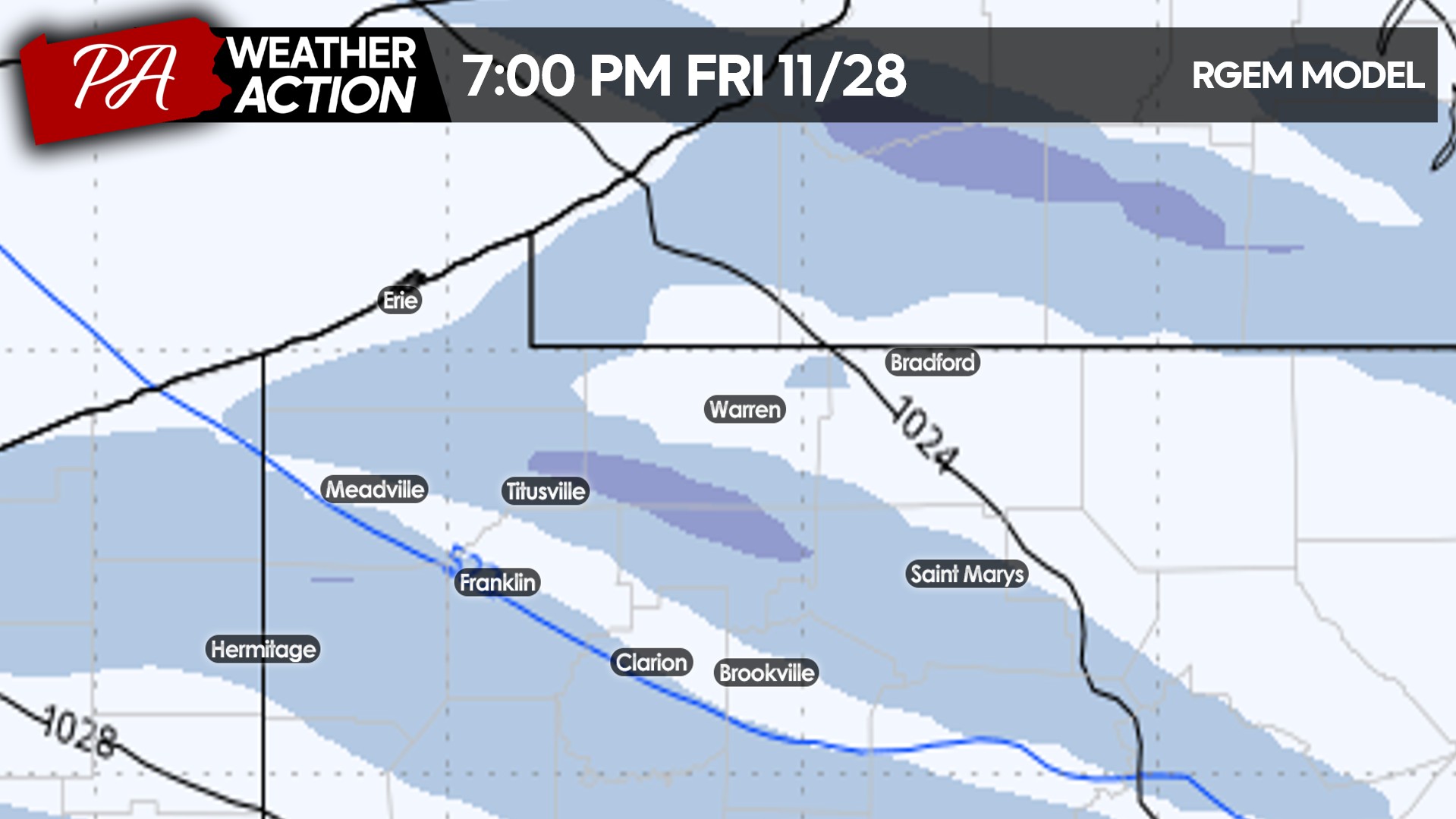
As you go farther away from the lake, bands will become scattered. In most places, snow will be light throughout Friday morning outside of the isolated heavy banding. Here’s a look at the radar simulation for 10:00 AM Friday.
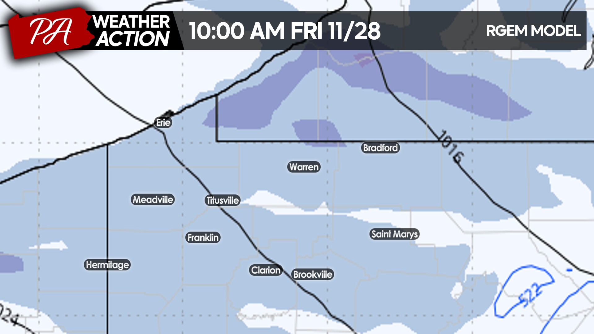
Lake effect will wind down as Friday goes on, with scattered snow showers and a few isolated moderate snow bands leftover Friday evening before ending.
If you’re reading on Google or NewsBreak and don’t follow us on Facebook, you can find us by searching PA Weather Action or tapping here!
SECOND CALL SNOWFALL FORECAST FOR THURSDAY – FRIDAY
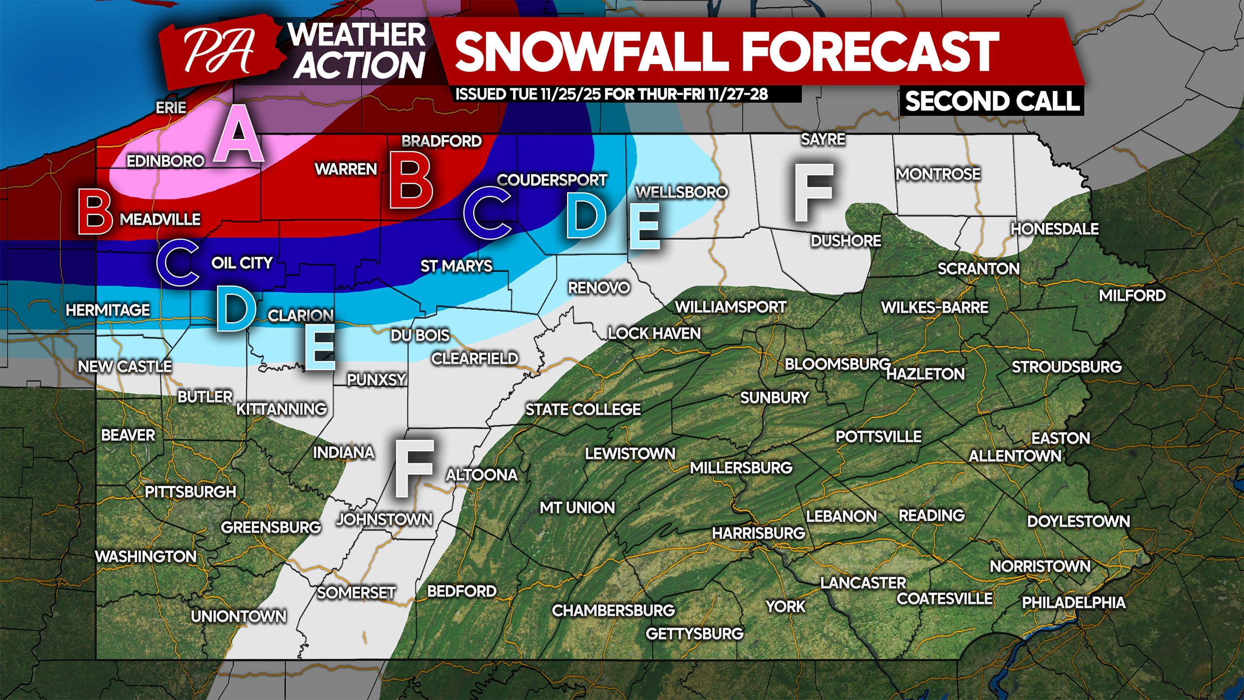
Area A: Snowfall accumulation of 12 – 18″ expected. Most roads will be snow-covered Thanksgiving into Black Friday.
Area B: Snowfall accumulation of 8 – 12″ anticipated. Snow-covered roads will lead to hazardous travel.
Area C: Snowfall accumulation of 5 – 8″ expected. Snow-covered roads likely during and after snow squalls.
Area D: Snowfall accumulation of 3 – 5″ anticipated. Roads will become snow-covered during and briefly after snow squalls.
Area E: Snowfall accumulation of 1-3″ expected. Roads will be mostly clear except during and briefly after snow squalls.
Area F: Snowfall accumulation of less than 1″ anticipated. Roads should stay clear.
Share this forecast with family and friends in affected areas, especially since it’s the first big lake effect event of the year and falling on the holiday!
You must be logged in to post a comment.