
The final call snowfall forecast has been posted, as of 5:30 PM Friday. Please follow the article linked below to view the new update.
Final Call Snowfall Forecast for Tonight’s Light Accumulating Snow in PA
A winter storm will bring parts of the Southern US to a standstill in the next 24 hours, with Little Rock to Nashville on tap for 6 – 10″ of snow. Winter Storm Warnings are up from Texas to the Virginia Coast, extending into the Ohio Valley.
Unfortunately for snow-lovers in PA, this storm will once again slide right off the coast instead of coming up. Don’t worry, we have a lot of potential left this January and even into early February.
That means we are just in store for light snow accumulations. Nonetheless, an inch or two of snow can be impactful especially if roads aren’t treated. This is a pretty straightforward forecast, considering the boom or bust potential is very narrow.
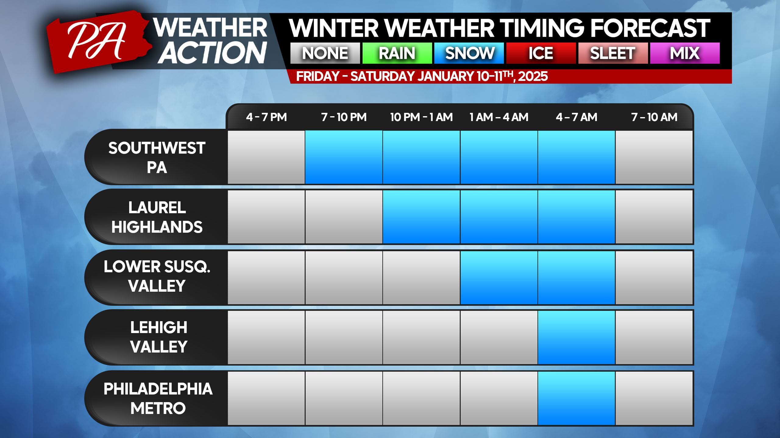
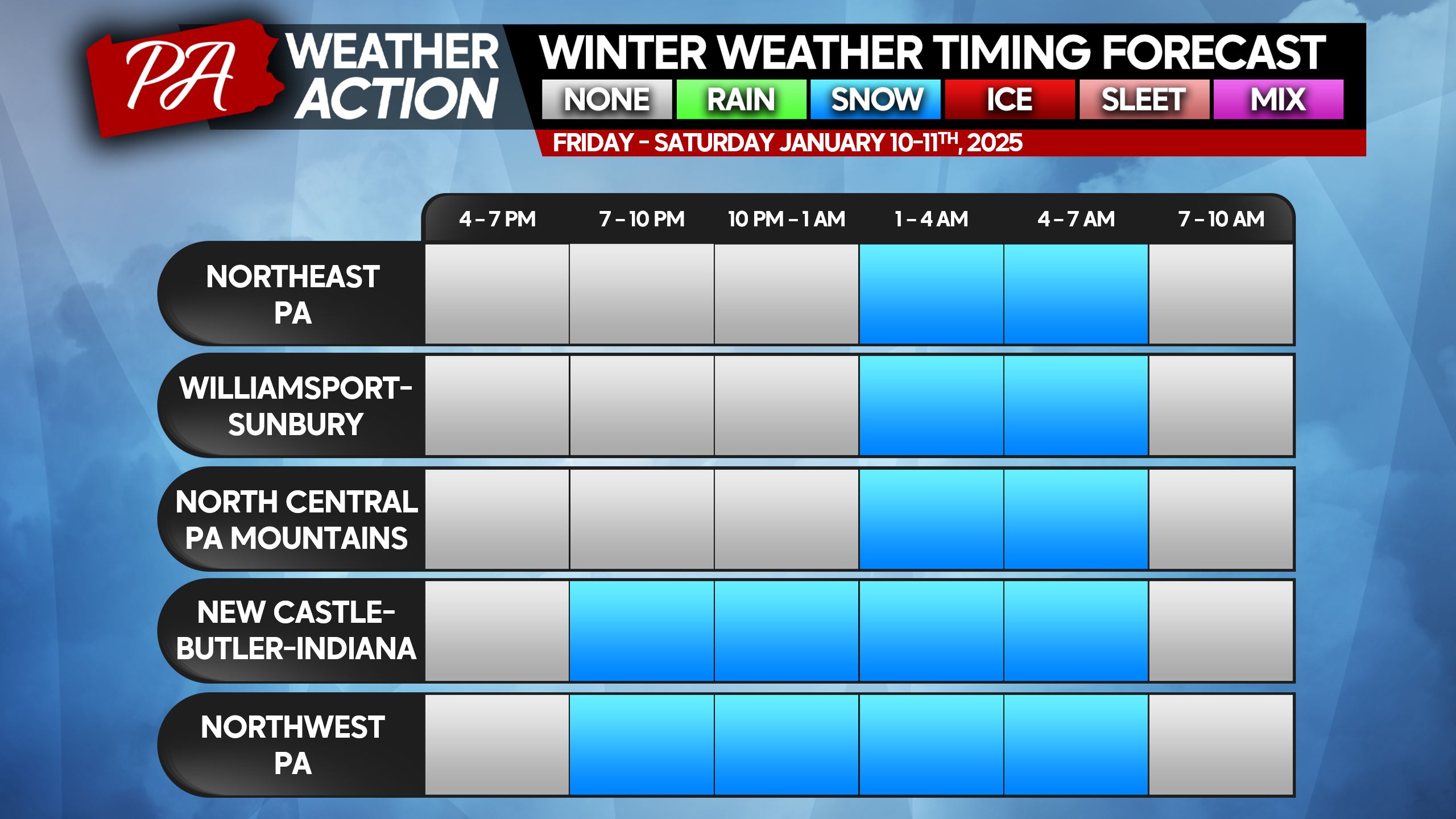
Winter Weather Timing
Snow will move in from southwest to northeast. Western PA may see the onset of light snow late Friday evening, but this will be a Saturday morning exclusive everywhere else.
Snow will be light and fluffy, meaning a push broom will do a great job clearing it off your driveway. Snow will be out of here by sunrise Saturday in most places.
Below are timing charts for all regions of PA. If you don’t see your town, please reference the column with the nearest town/area.
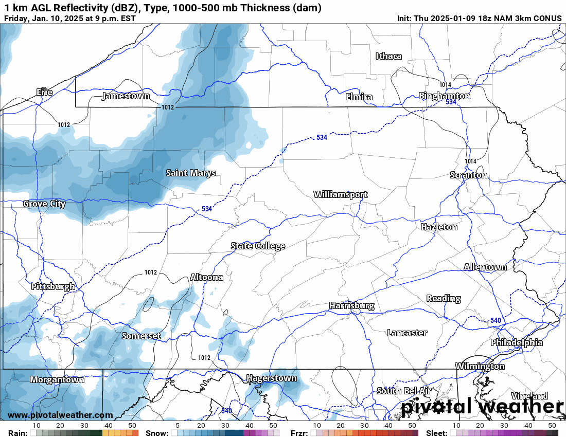
Below is the latest Hi-Res NAM Future Radar for the duration of this event. The timestamp is in the top left.
SECOND CALL SNOWFALL FORECAST FOR SATURDAY MORNING
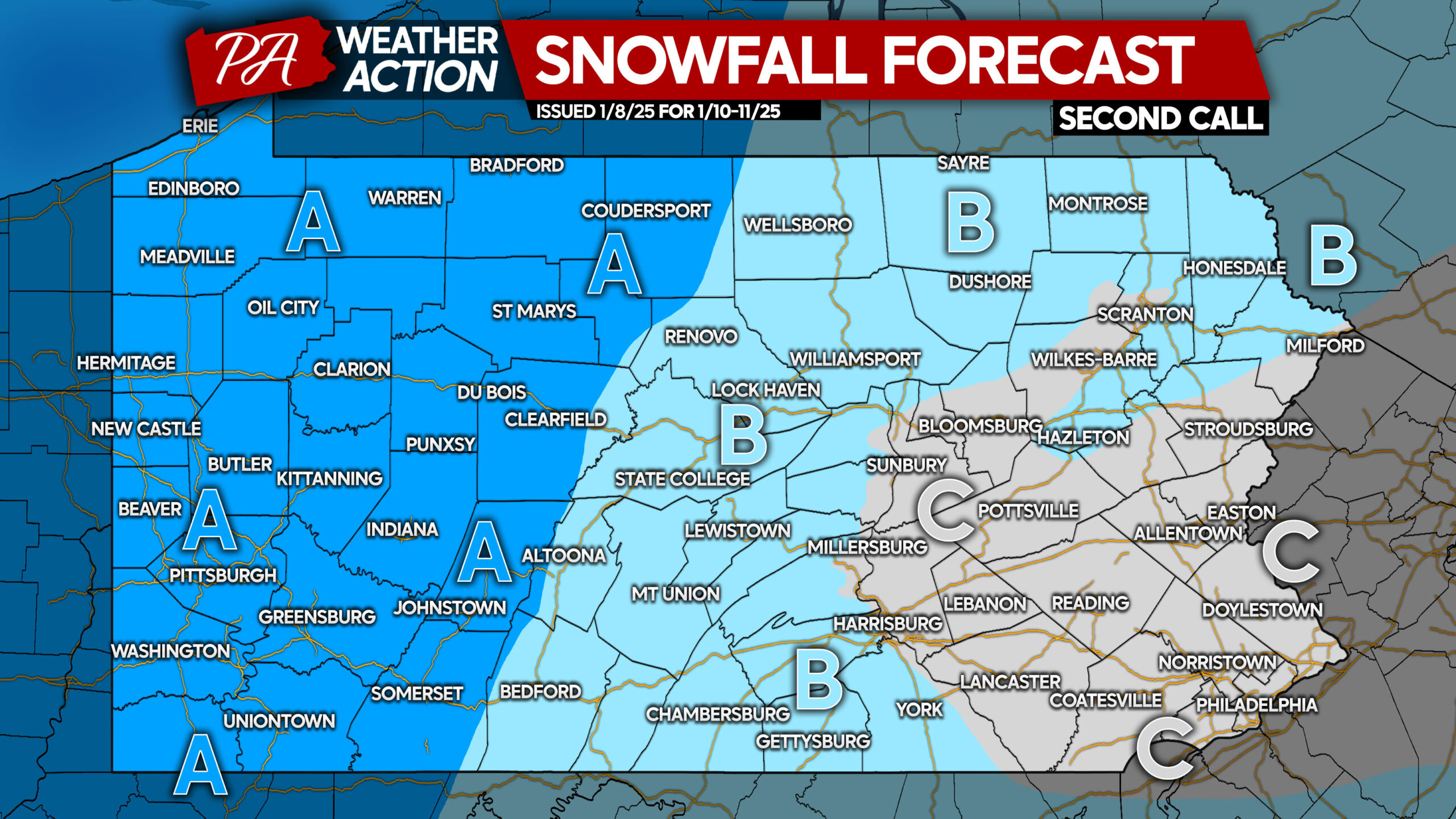
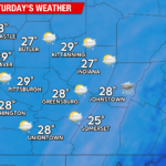
Area A: Snowfall accumulation of 2 – 3″ expected. Up to 4″ possible in the Laurel Highlands. Slippery driving conditions are likely.
Area B: Snowfall accumulation of 1 – 2″ anticipated. Slippery driving conditions are likely.
Area C: Snowfall accumulation of less than 1″ expected. Untreated roads may be slippery.

You must be logged in to post a comment.