
There was not much of a transition between the cold and snow of winter and severe storm season this year. An organized line of strong to severe storms is likely Sunday Evening ahead of a cold front sweeping through.
Here is the SPC Severe Storm Outlook: 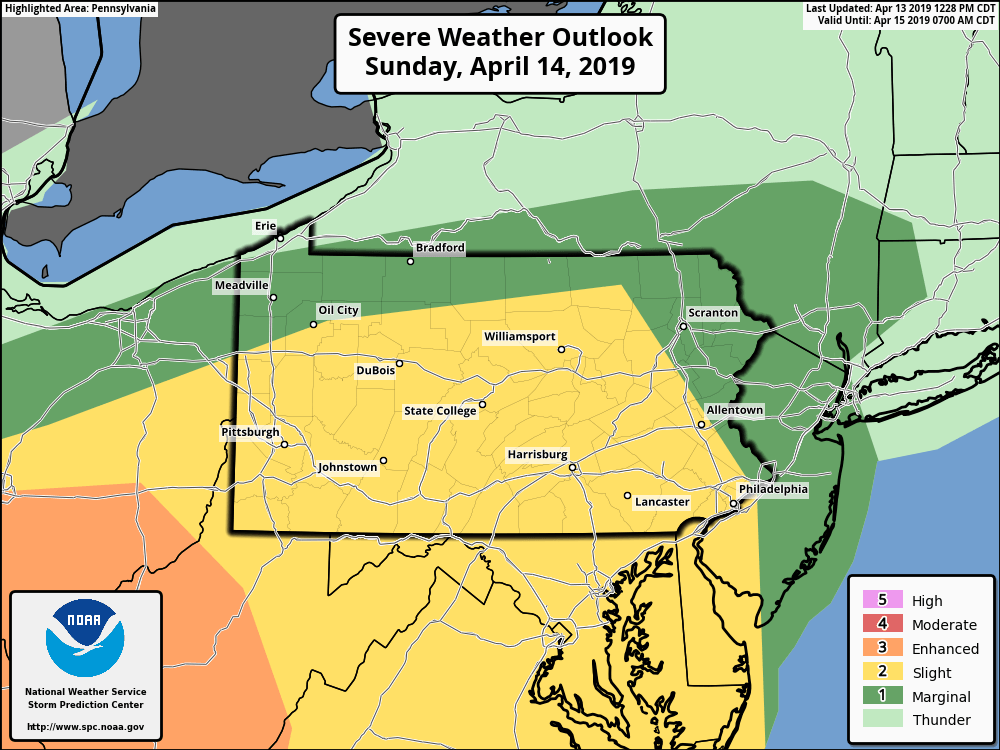
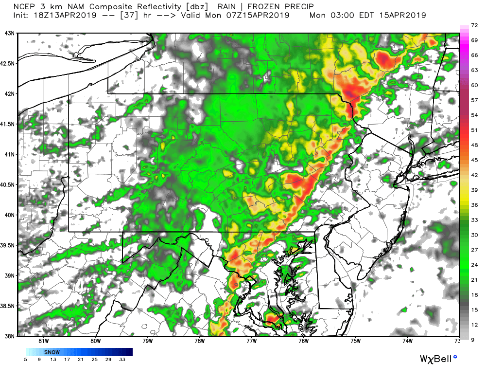
This event is modeled to take place mainly after sunset, however guidance suggests the line of storms will stay organized until early morning Monday.
Models tend to be an hour or two behind as far as timing of storms. Below is a look at the Hi-Res NAM model for 7 PM Sunday.
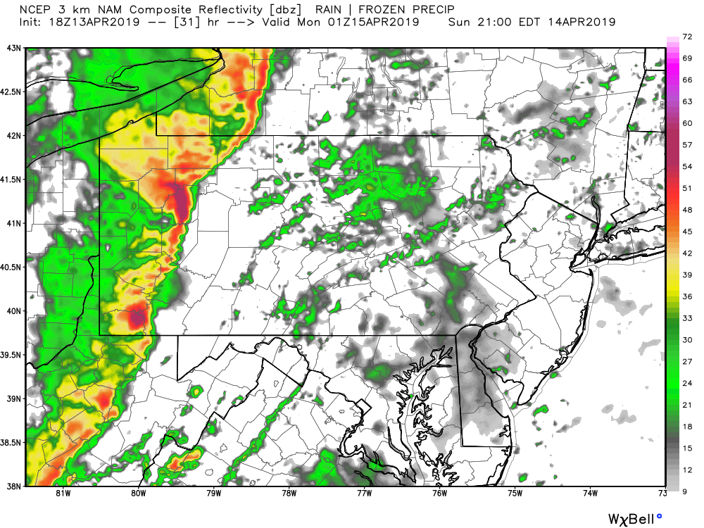
Not all areas will experience the same impacts, as sections of the line will be of varying intensity. By 10 PM, the line will reach parts of Central PA.
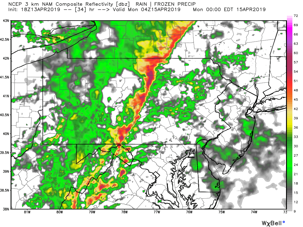
As daytime heating and associated instability decreases, we anticipate the line to weaken. The line of strong storms will make it’s way into Eastern PA by just after midnight. Below is future radar for 1 AM Monday.
Scattered damaging winds will be the main risk with this threat. Download our app for your latest hourly forecast and interactive radar >>> PA Weather App Link
Share this forecast with your friends and family using the blue button below!
You must be logged in to post a comment.