Severe Thunderstorm Outlooks for Thursday, March 31, 2022 (Damaging Winds, Hail, Tornado Risk Maps)

Severe Thunderstorm Outlooks for Thursday, March 31, 2022 (Damaging Winds, Hail, Tornado Risk Maps)

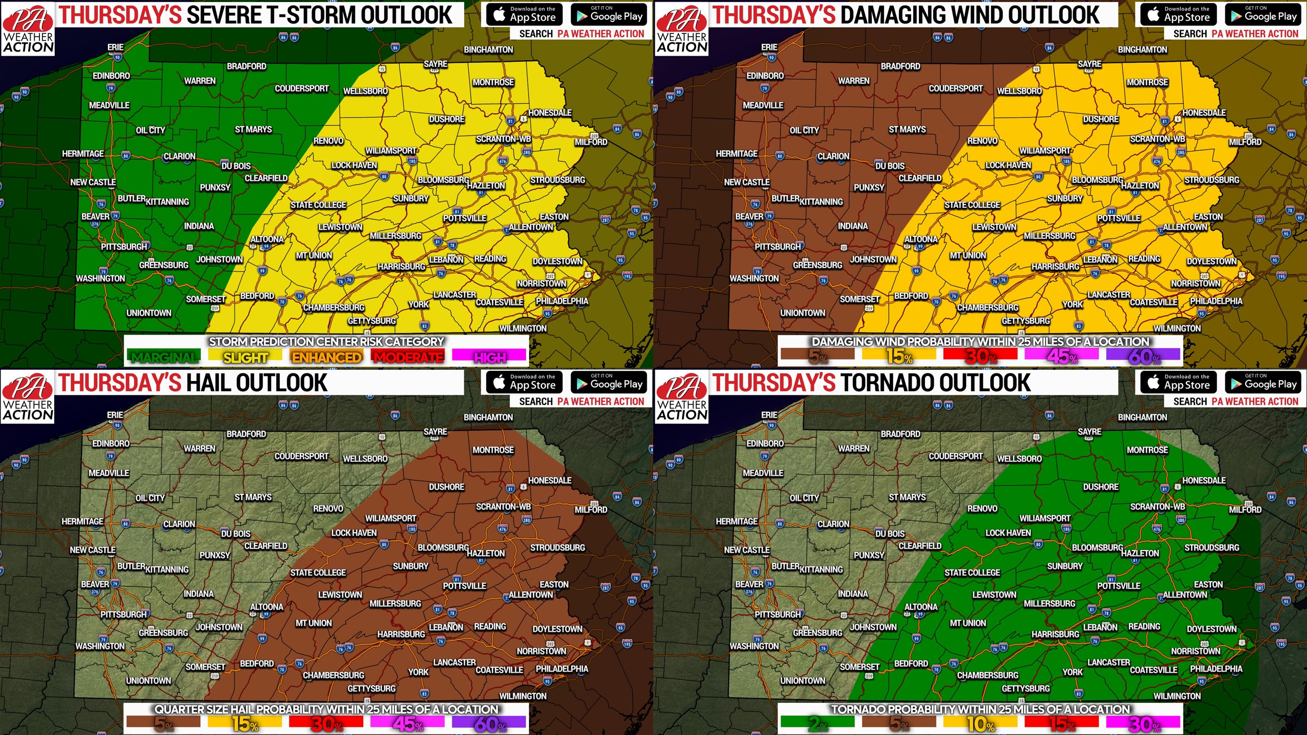
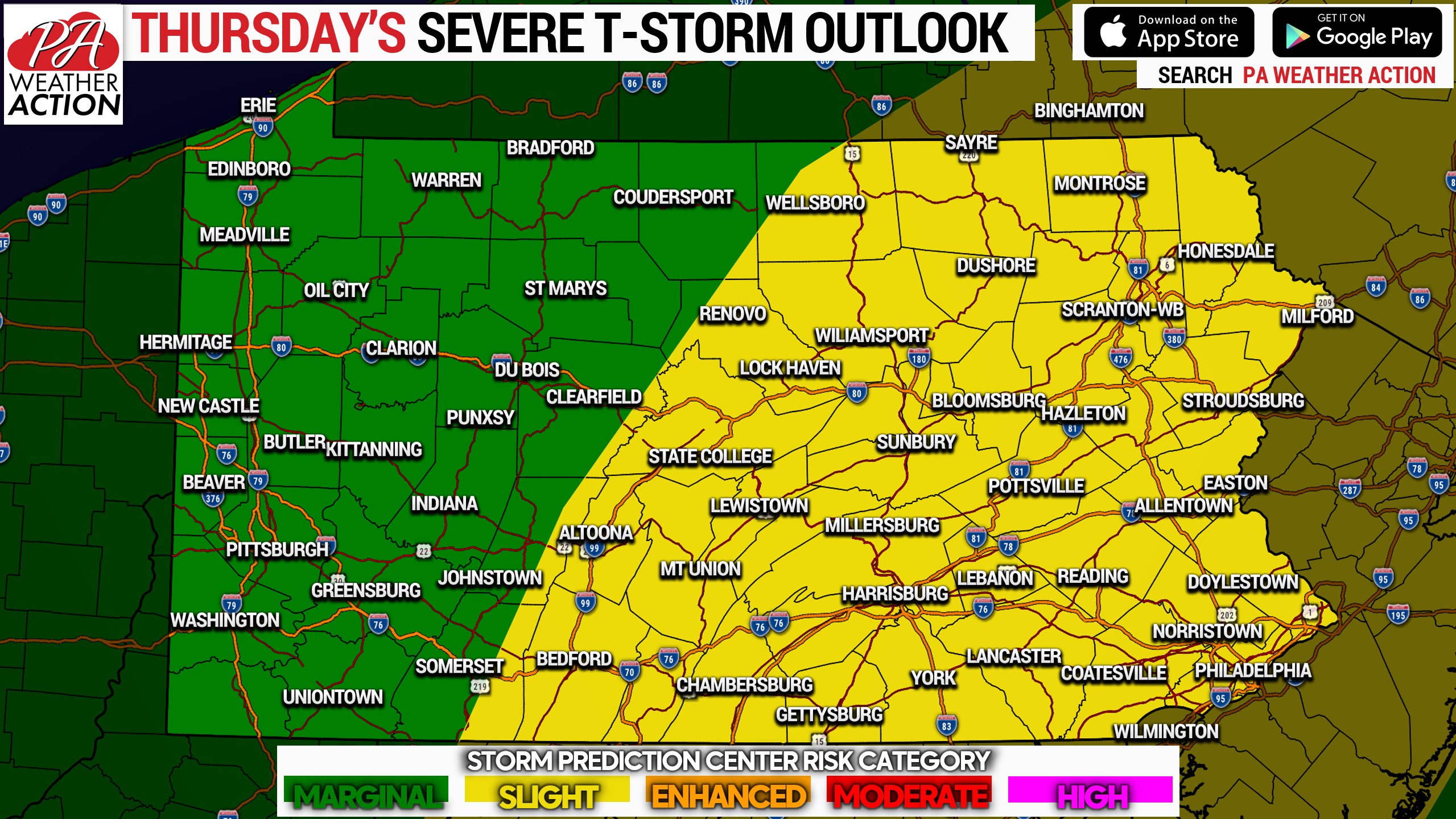
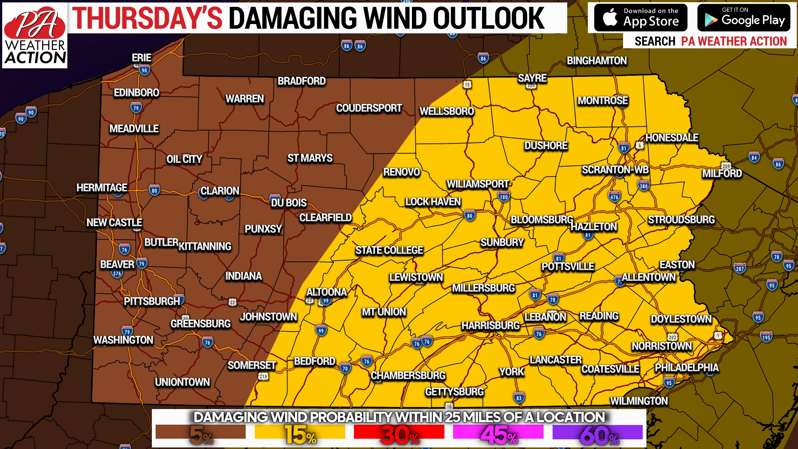
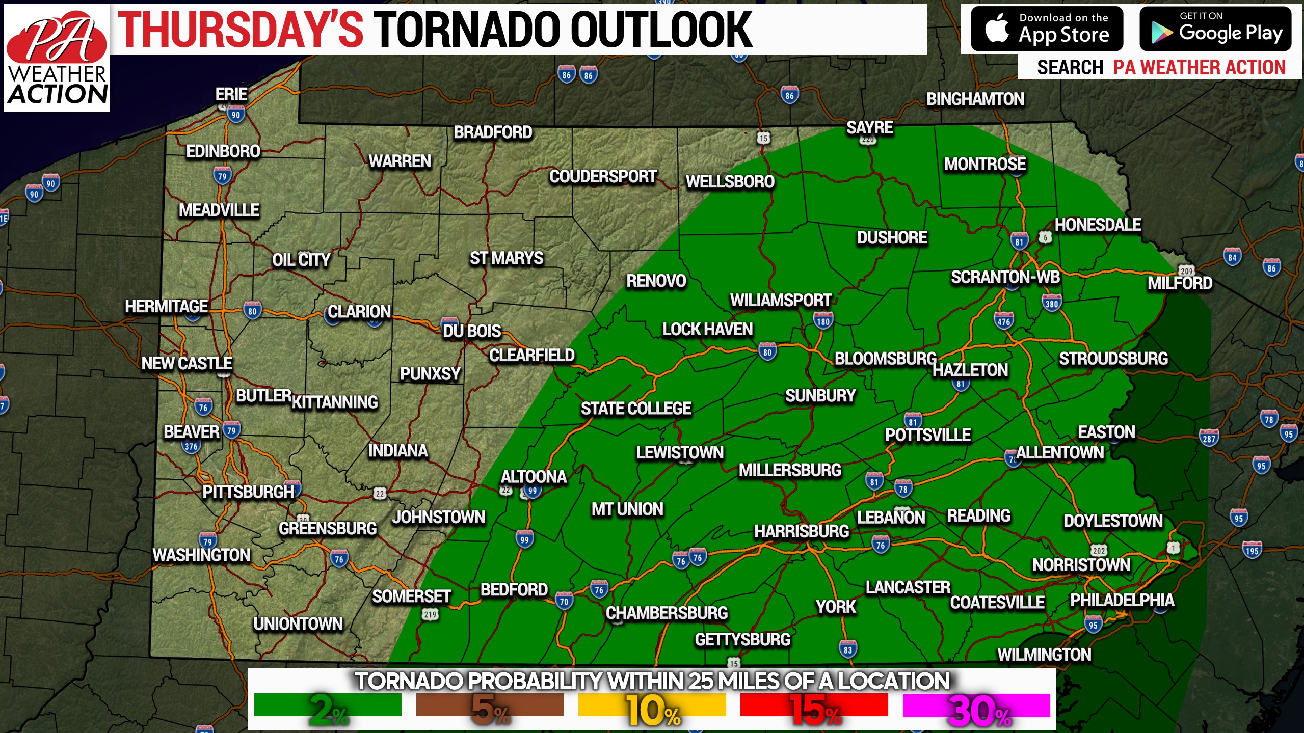
The Storm Prediction Center has issued a Slight Risk (level 2 out of 5) for the eastern two-thirds of Pennsylvania. Damaging winds are the primary threat, with gusts commonly in the 40-55mph range, isolated higher. A very low hail threat and low tornado threat risk exist as well.

Timing for strong to severe thunderstorms will be 1-6pm in Central PA, and 4-8pm in Eastern PA. This will not be a solid line of storms, making timing almost impossible to nail down to the hour in each locality. Stay tuned to radar and alerts today!

Josh Adams is the founder and lead forecaster of Pennsylvania Weather Action, a regional forecasting site he launched in 2015. With over a decade of experience analyzing weather patterns across Pennsylvania, his forecasts have reached millions of readers throughout the state. Josh specializes in Pennsylvania’s complex microclimates and terrain-driven weather patterns, providing detailed coverage of severe thunderstorms, winter storms, and flooding events. His forecasting focuses on delivering precise, timely information to help Pennsylvanians stay informed and prepared during impactful weather. Last Updated: March 10, 2026