
An area of heavy rain potentially with embedded thunderstorms will move through western and central PA Thursday morning and early afternoon. This may work to limit convection and instability, which would reduce the severe threat.
A few hours of clearing is almost always required to destabilize the atmosphere, and where the destabilization occurs in the late afternoon and evening will be where the highest threat of severe thunderstorms is. Currently, southwestern and south-central Pennsylvania looks to be the area of concern late Thursday afternoon until just after sunset.
FUTURE RADAR TIMING
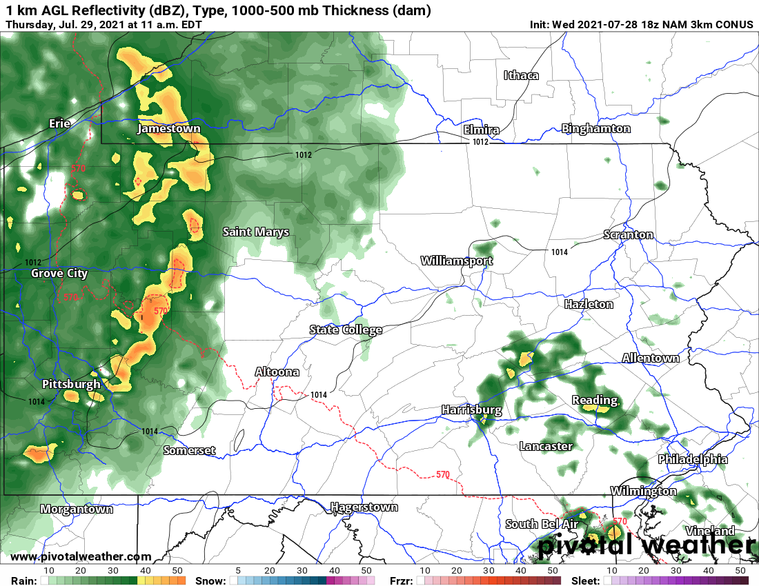
A swath of rain, potentially with an embedded line of thunderstorms, will push through western PA in the mid to late morning. Embedded strong winds are possible near the line of storms. Below is future radar for 11:00 AM Thursday.
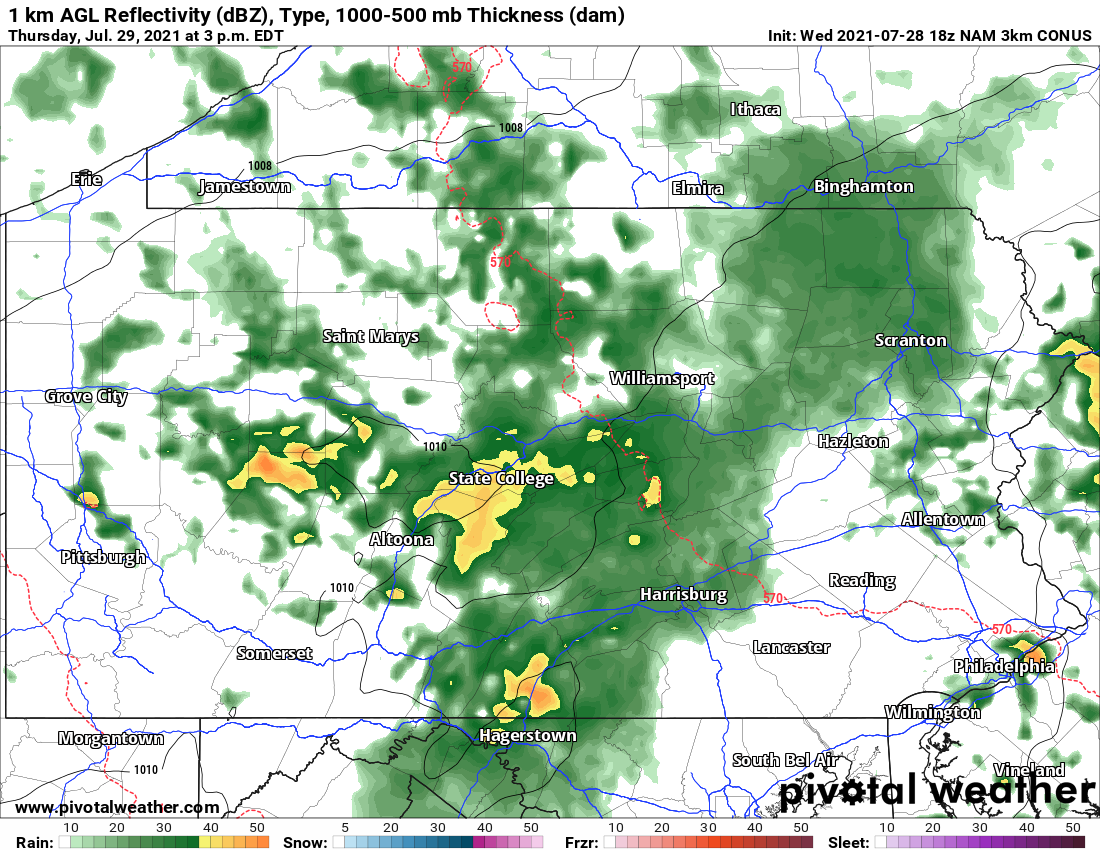
The area of moderate rain begin to weaken as it pushes east into central and eastern PA in the afternoon. Meanwhile, some destabilization is likely in western PA, causing scattered thunderstorms to develop soon after. Future radar for 3:00 PM Thursday is below.
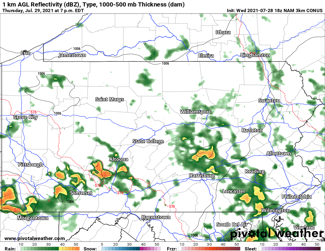
Scattered thunderstorms will push southeast as the evening progresses, and will reach the southern PA border by 8-9 PM. This is when the highest damaging wind and tornado threat will exist. Here is future radar for 7:00 PM Thursday.
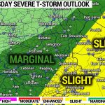
Below is the SPC Severe Thunderstorm Outlook for Thursday, showing Enhanced Risk across South Central and Southeast Pennsylvania, and Slight Risk covering most of the state.

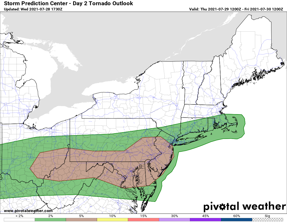
Finally, shown below is the tornado risk for Thursday, showing that 5% risk in southern PA.
We will not have live radar on Facebook due to being on vacation. Remember to keep an eye on the radar and the latest weather alerts Thursday, especially in Southern PA!
You must be logged in to post a comment.